

Curated by Vorarlberg Tourismus
Krumbach
A village of gentle hills at 730 m where seven architects from around the world each designed a bus shelter.
- 1Highlights
- 6Routes
Highlights
14 from neighbouring places
 Natural feature Feel free to use my photos, but please mention me as the author and if you want send me a message. or (rufre@lenz-nenning.at) · CC BY-SA 3.0 at
Roßbad
A nature reserve of 103 hectares at about 660 m in the west of the municipality.
PeakVisor / OpenStreetMapUnser KleinWien
2.6 km away, in Doren
A disused bakery in the middle of the village, bought by the municipality and given a new use.
Sulzberg | Moorbad Oberköhler
2.7 km away, in Sulzberg
A moor bath on the belt of bog with its rare flora that runs for kilometres along the ridge north of the village.
Gasthof Alpenblick
3 km away, in Sulzberg
An inn on the plateau half a kilometre south-west of the village square, looking out over the Bregenzerwald.
PeakVisor / OpenStreetMapFinkenbühl
3 km away, in Langenegg
A rise of 748 m immediately north of the village centre, on the edge of the Nord nature reserve.
Baukultur in Sulzberg
3.1 km away, in Sulzberg
The building heritage of Sulzberg and Thal, from the Empire-style church designed by Alois Negrelli onwards.
Juppenwerkstatt Riefensberg
4 km away, in Riefensberg
The workshop where the Bregenzerwald Juppe is made; making and wearing it entered Austria's intangible heritage list in 2021.
Rotenberg
4.2 km away, in Hittisau
A 994 m hill north-east of the village, covered by the selection forest the local theme trail explains.
Kojenstein
4.3 km away, in Riefensberg
The village's own mountain at 1,300 m, a little over a kilometre south-east of the centre.
Riefensberg – 3D Bogenparcours
4.5 km away, in Riefensberg
A 3D archery course laid out through the woods, shot at animal targets along a walking circuit.
Freibad Hittisau
4.7 km away, in Hittisau
The open-air swimming pool of Hittisau in the Bregenzerwald, open through the summer months.
Marienkapelle
5.1 km away, in Riefensberg
A wayside chapel a kilometre and a half east of the village, on the path towards the Steinernes Tor.
PeakVisor / OpenStreetMapSteinernes Tor
5.2 km away, in Riefensberg
A rock arch on the way up from the village to the Kojenstein, and a lookout in its own right.
PeakVisor / OpenStreetMapCLARISSAKORK
5.4 km away, in Hittisau
A workshop making rugs, homeware and children's things out of cork.
Alpsennereimuseum Hittisau
5.4 km away, in Hittisau
A historic alp dairy kitchen with its cheese-making and milk-working equipment, shown with a tasting.

 Historic site

 Mountain hut


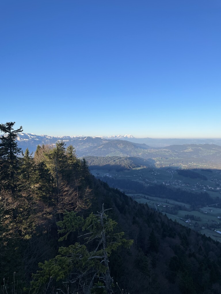


 Viewpoint

Nothing of this kind in Krumbach.
Routes
14 from neighbouring places
Krumbach | Moore Krumbach
A round past five of the fourteen Krumbach moor seats, ending at the Moorraum lookout over the Salgenreuten bog.
- 5.2 km
- Distance
- 91 m
- Ascent
- 1 h 27 min
- Duration
Open route Vorarlberg TourismusArchitekturweg Bregenzerwald | Krumbach – Lingenau (Etappe 1)
The opening stage of the architecture trail, which runs in five days from Krumbach by Schwarzenberg to Au.
- 14.0 km
- Distance
- 347 m
- Ascent
- 4 h 12 min
- Duration
Open route Vorarlberg TourismusMellau l Rennrad Mellau – Vorderwald
A long road round out of Mellau taking in most of the villages of the outer Bregenzerwald.
- 51.4 km
- Distance
- 894 m
- Ascent
- 5 h 24 min
- Duration
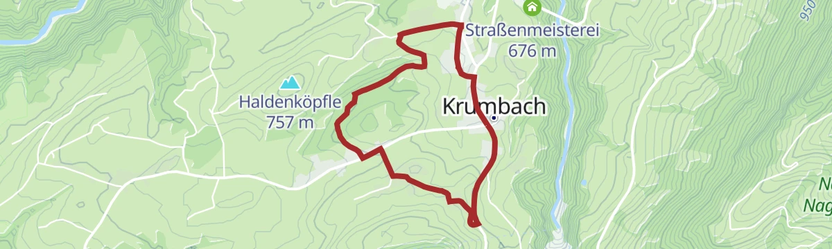
Open route Vorarlberg TourismusUmgang Krumbach
A village circuit through the place known for its moor, which yields fruit, herbs and pasture for old livestock breeds.
- 3.8 km
- Distance
- 84 m
- Ascent
- 1 h 6 min
- Duration
Open route Vorarlberg TourismusKrumbach | Rundweg von Krumbach nach Langenegg
A varied round through the scattered settlement country of the outer Bregenzerwald, from Krumbach to Langenegg.
- 10.5 km
- Distance
- 212 m
- Ascent
- 2 h 58 min
- Duration
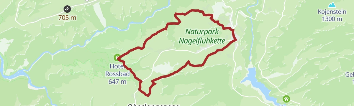
Open route Vorarlberg TourismusKrumbach | Zum Heilbädle Rossbad
An easy winter round through the scattered farms of Krumbach to the old Rossbad healing bath.
- 10.2 km
- Distance
- 134 m
- Ascent
- 2 h 43 min
- Duration
Open route Vorarlberg TourismusHittisau | über Schetteregg nach Großdorf
5.3 km away, in Hittisau
From Hittisau up to the hamlet of Stöcken at the foot of the Hittisberg, then over the Hinterberg alps to Großdorf.
- 20.0 km
- Distance
- 716 m
- Ascent
- 6 h 34 min
- Duration
Open route Vorarlberg TourismusBolgenach - Hochhädrich
5.9 km away, in Hittisau
Hochhädrich from Bolgenach: 730 m of climbing in 4.3 km, topping out at 1,549 m.
- 3.7 km
- Distance
- 0 m
- Ascent
- 0 m
- Descent
- 54 min
- Duration
Open route PeakVisor tTRL (OpenStreetMap piste_type=skitour)Egg | Skitour Winterstaude
10.1 km away, in Egg
A much-used ski tour close to Egg; steep grass beneath, but north-facing descent slopes that hold snow well.
- 4.4 km
- Distance
- 839 m
- Ascent
- 35 m
- Descent
- 2 h 21 min
- Duration
Open route Vorarlberg TourismusLeiblachtal Route
12.6 km away, in Bregenz
From the lakeside promenade along the Pipeline and the Leiblach as far as Hohenweiler, 133 m of climbing.
- 13.5 km
- Distance
- 104 m
- Ascent
- 1 h 16 min
- Duration
Open route Vorarlberg TourismusVon Bregenz zum Jannersee in Lauterach
12.7 km away, in Bregenz
An easy 7 km to the Jannersee with a stop at Dietrichs Kostbarkeiten on the way.
- 6.2 km
- Distance
- 0 m
- Ascent
- 34 min
- Duration
Open route Vorarlberg TourismusHandwerk und Innovation
4 km away, in Riefensberg
A ride through the Bregenzerwald along its craft tradition, from timber building to fair-faced concrete.
- 38.7 km
- Distance
- 622 m
- Ascent
- 4 h 4 min
- Duration
Open route Vorarlberg TourismusDoren | Lesewanderweg StandWOrtWeg
2.6 km away, in Doren
A family round behind the village hall through shaded forest ways, playing with perspective and puzzles.
- 4.9 km
- Distance
- 193 m
- Ascent
- 1 h 38 min
- Duration
Open route Vorarlberg TourismusDoren | Weissachbrücke – Egg
2.5 km away, in Doren
Down from the village to where the Weißach meets the Bregenzerache, then level along the river to Egg.
- 12.0 km
- Distance
- 164 m
- Ascent
- 3 h 22 min
- Duration
Open route Vorarlberg TourismusHittisau | von Hittisau nach Sulzberg
5.3 km away, in Hittisau
Down to the Bolgenach and up the far side through mixed woodland to the plateau village of Sulzberg.
- 16.5 km
- Distance
- 1 101 m
- Ascent
- 6 h 60 min
- Duration
Open route Vorarlberg TourismusBolgenach - Westlicher Koppachstein
7.5 km away, in Hittisau
A ski tour from Bolgenach to Westlicher Koppachstein, 666 m of climbing in 5.6 km to a high point of 1,529 m.
- 4.4 km
- Distance
- 0 m
- Ascent
- 0 m
- Descent
- 1 h 5 min
- Duration
Open route PeakVisor tTRL (OpenStreetMap piste_type=skitour)Bödele - Guntenspitze
11.1 km away, in Schwarzenberg
From Bödele at 1,101 m, 858 m of ascent over 8.5 km to Guntenspitze.
- 8.4 km
- Distance
- 0 m
- Ascent
- 0 m
- Descent
- 2 h 3 min
- Duration
Open route PeakVisor tTRL (OpenStreetMap piste_type=skitour)Hittisau | Von Hittisau nach Balderschwang
5.3 km away, in Hittisau
A cross-border ride from Hittisau into the Allgäu at Balderschwang and back.
- 42.5 km
- Distance
- 1 231 m
- Ascent
- 4 h 56 min
- Duration
Open route Vorarlberg TourismusSulzberg | Panoramarundweg Hochsträss
3 km away, in Sulzberg
An unhurried panorama round above 1,000 m into the soft hill country of the outer Bregenzerwald, returning through wood.
- 5.5 km
- Distance
- 81 m
- Ascent
- 1 h 29 min
- Duration
Open route Vorarlberg TourismusSulzberg | Rundweg Eibelesmühle
2.9 km away, in Sulzberg
A round from the village centre by Lindengschwend and the Gullenbach to the Eibelesee and the Hermannsberg.
- 10.1 km
- Distance
- 370 m
- Ascent
- 3 h 17 min
- Duration
Open route Vorarlberg Tourismus




No routes of this kind in Krumbach yet.
Planning a trip to Krumbach?
Everything else Vorarlberg has, in one place


Take Krumbach with you into the mountains
Every route on this page with 3D terrain, GPX navigation and offline maps — including the valleys with no signal.
Data sources
- Official website: bregenzerwald.at ↗
- Routes and highlights: Vorarlberg Tourismus, PeakVisor / OpenStreetMap, Bregenzerwald Tourismus, PeakVisor tTRL (OpenStreetMap piste_type=skitour), Bodensee-Vorarlberg Tourismus
- Published as open data by the tourist boards named above.
