
Scan the QR code and open PeakVisor on your phone
While the southeast Asian city-state of Singapore might be most known for its metropolitan shine and eternal bustle, it is nevertheless home to all sorts of natural riches and lush green hills. There are 58 named peaks in the country, the highest and most prominent of which is Bukit Timah Hill (175 m/574 ft).
Singapore is one of the smallest countries in Asia. It consists of one main island and 63 satellite islands for a total land area of 724.2 sq. km (279.6 sq. mi).
The main island, known as Singapore Island or Mainland Singapore, contains the bulk of Singapore’s land area, at around 710 sq. km (270 sq mi) in size. It is also home to the vast majority of Singapore’s 5.7 million person population.
Only 3 of Singapore’s 63 satellite islands are even inhabited, including Pulau Ubin, a 10.19 sq. km (3.9 sq mi) island with only a couple dozen residents off the northeastern coast of the mainland.
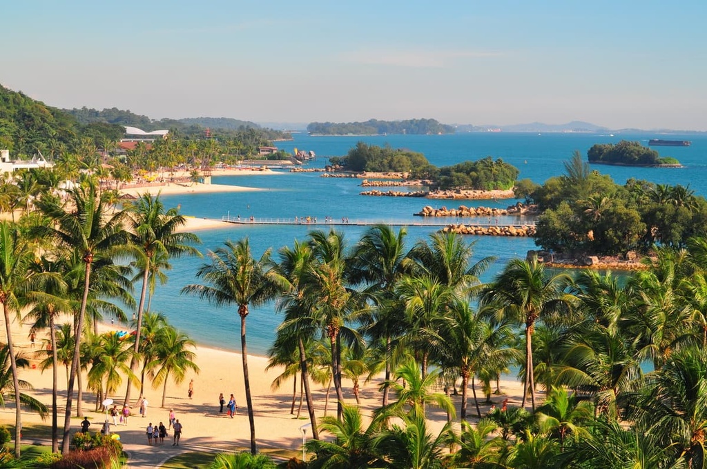
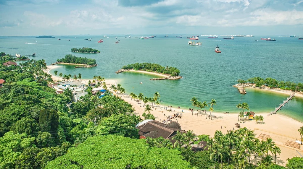
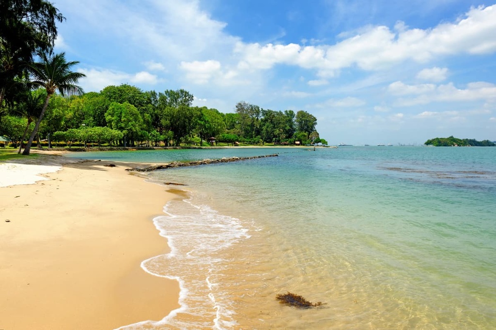
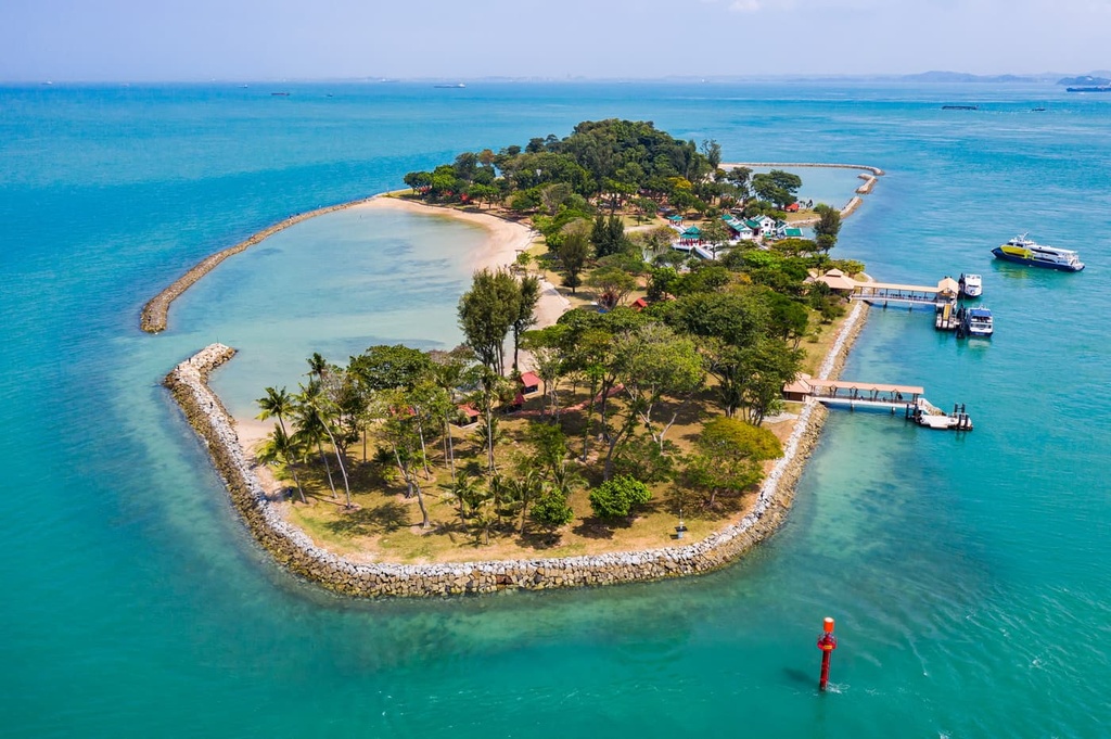
Some islands, like Sentosa, which is separated off the southern coast of the mainland by the Keppel Harbour, are primarily used as resort or nature destinations for tourists. Others still are primarily used by the Singapore Armed Forces, and many more of these islands are simply uninhabited land.
Singapore has about a dozen artificial islands that were formed through the country’s land reclamation efforts. Most of these islands are designated for tourism or industrial use. There is also a single outlying island owned by the country, a small outcrop of granite known as Pedra Branca near the South China Sea, which is the country’s easternmost point.
Singapore is located off the southern tip of the Malay Peninsula, about 137 km (85 mi) from the equator. Though it shares no land borders with any other country, it is incredibly close to Malaysia to the north, and it is separated from the Malaysian state of Johor by the Johor Strait. There are two bridges that link the two countries together.
Singapore is also not far from Indonesia, as the Singapore Strait separates the country from the Riau Islands of Indonesia. Moving directly east from Singapore is the South China Sea, and moving west are smaller Indonesian islands off the coast of Sumatra, particularly the province of Riau.
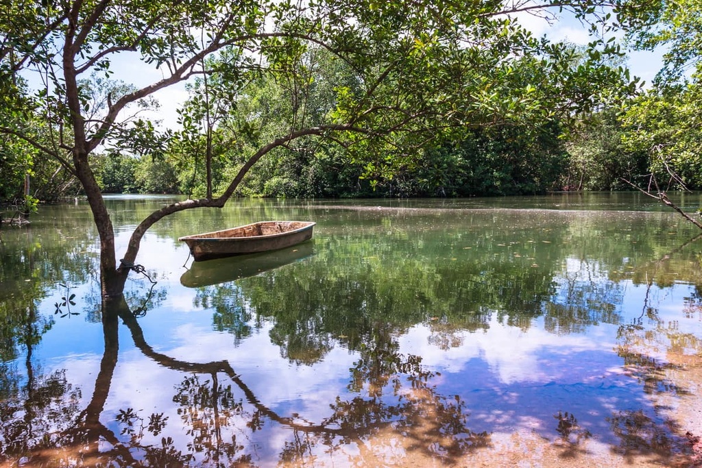
The main island consists of small round hills in the center and north, with low ridges and valleys in the west and southwest, and flat plains in the east and southeast. The small country of Singapore contains no notable lakes or rivers, but there are water reservoirs, narrow streams, estuaries, and mangrove swamps.
Though once the island consisted of thick swaths of rainforest and farmland, most of the land in Singapore has since been urbanized and developed. The only non-developed areas of Singapore are the country's parks and more rural areas like Lim Chu Kang.
That said, there are now over 300 parks and 4 nature parks in Singapore. The country has also had a long history of intentional tree and flower planting in its urban areas. As a result, approximately 50 percent of Singapore is covered in greenery—a true feat for such a densely populated island nation.
Administratively, Singapore divides itself into five districts, which are further divided into town councils and political constituencies. However, these boundaries tend to fluctuate and vary, and are often geographically arbitrary.
The climate of Singapore is designated as tropical and the landscape of the island was traditionally dominated by rainforests.
As a result, the weather in Singapore is similar throughout the year with no great seasonal variation (except in November, December, and January, when the monsoon occurs). Humidity levels and temperatures are almost perfectly constant throughout the year in Singapore, with fairly negligible fluctuations from month to month.
Generally, the weather in Singapore is warm or hot, ranging from 23º to 32ºC (73 to 90ºF), with high humidity and plenty of rain throughout the year, even when the monsoon season isn’t in effect.
Every month tends to see between 10 and 20 days of rainfall, with non-monsoon months typically seeing 100 mm to 170 mm (3.9 to 6.7 in) in rainfall and monsoon months seeing over 200 or 300 mm (7.9 or 11.8 in).
September to December see the fewest hours of sunshine in Singapore while the rest of the year may see around 170 to 190 hours of sun per month. There are also some variations based on location, as the eastern side of the country is typically drier and hotter than the western side.
The geology of Singapore’s mainland can be split into 10 geological formations, most of which take place on the mainland.
In the southwestern part of the mainland is the Jurong Formation, which consists of sedimentary rocks like siltstones, sandstones, conglomerates, limestones, mudstones, and shales, most of which are rich in fossils.
To the north of the Jurong Formation is the Huat Choe Formation, which consists of white mineral-rich kaolin clay. Hills and valleys can be found around the northern and northeastern parts of the country.
Just a little further to the east of the Huat Choe Formation is the Gombak norite, which consists of norite and gabbro. This is followed by the much larger Bukit Timah Granite formation, in which one can fittingly find Singapore’s tallest peak, Bukit Timah Hill, among other hills of granite, diorite, adamellite, and granodiorite.
To the south of that along the country’s coastline is the Fort Canning Boulder Bed, which consists of sandy and silty clay dotted by sandstone boulders. Next to that is the Kallang Formation, which is made of soft clay, peaty clay, muddy sand, and loose white sand.
Then, occupying much of northeastern Singapore, is the Old Alluvium formation, which is dominated by flat expanses of muddy sand and gravel.
The Singaporean islands to the northeast of the mainland are in some parts similar to the mainland geologically. But they also contain other formations, like the quartzite and argillite Sajahat Formation, the tuff rocks of the Paleozoic Volcanic formation, and the pebbly sand of the Tekong Formation.
Chronologically, some of Singapore’s oldest formations, like the Sajahat and Gombak Norite, came about in the Early Paleozoic, followed Bukit Timah in the Triassic and Jurong in the late Triassic to early Jurassic.
These formations were created in part through the rising of magma in the region during the Paleozoic. This magma then solidified into the igneous rocks that comprise much of central Singapore. In particular, this magma helped to create the Jurong forming in a shallow basin of the granite after much uplift.
A little later on, formations like the Fort Canning Boulder Bed were created in the late Cretaceous. The Old Alluvium was formed during the late Tertiary to Middle Pleistocene, and the Kallang was created in the late Pleistocene.
Not much uplift occurred from the Jurassic onward in what is now Singapore, as marine sediments in the region had long been settled. However, still some sediments continue to be deposited or were deposited only several thousand years ago, such as those of the Tekong Formation.
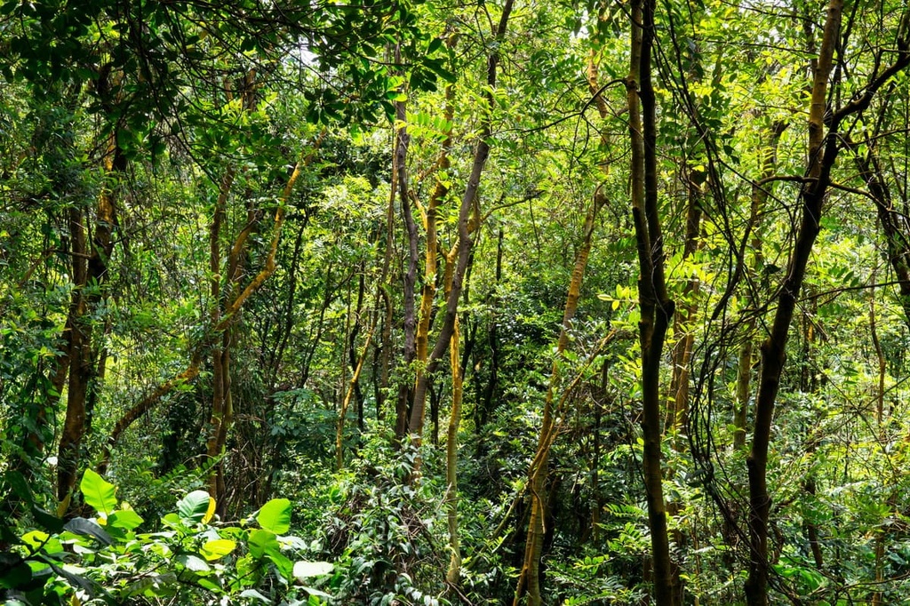
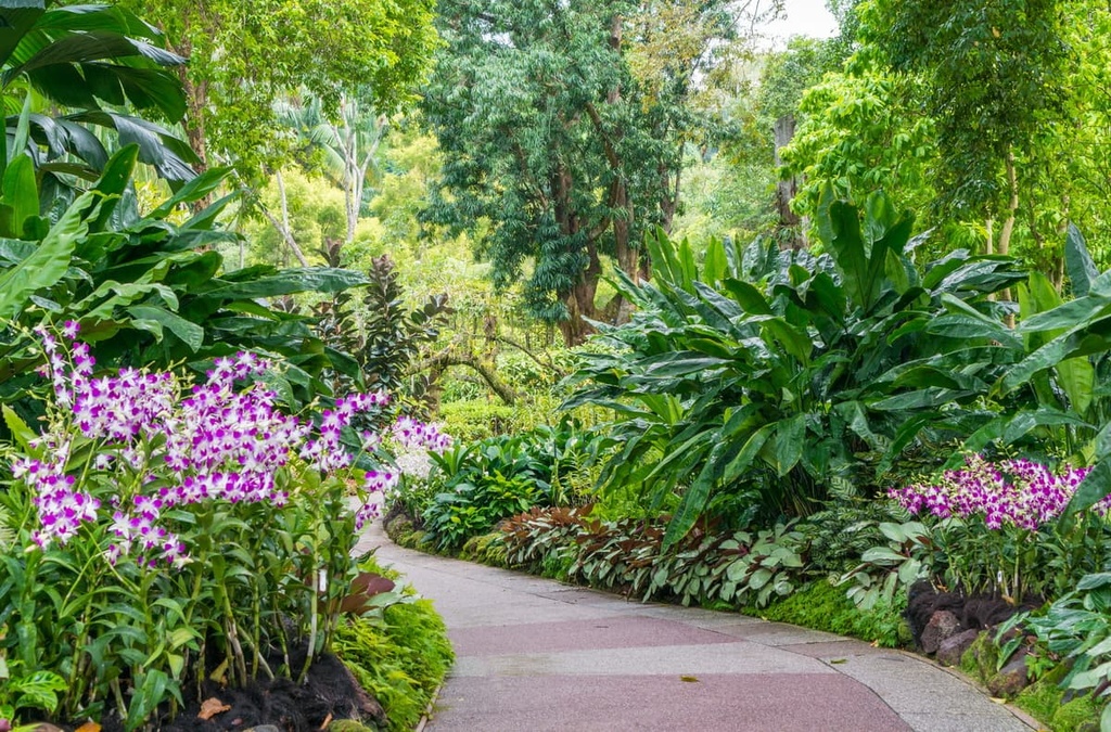
The wildlife of Singapore is concentrated mainly in its many nature reserves and botanical gardens. As a warm and humid tropical rainforest, the biodiversity of flora in Singapore is rich and extensive, similar to that of neighboring Malaysia, with over 1,300 native plant species.
The tree canopies of Singapore consist of a variety of large tropical trees from many different families, like the seraya of the lowland rainforest Dipterocarpaceae family, the flowering Apocynaceae family, the legume family, and the mallow family.
The canopy is also characterized by a variety of palm trees, like the rattan tree, fan palm and mangrove palm, the latter of which is one of many examples of mangrove vegetation that can be found in the country.
Black mangroves, milky mangroves, looking glass mangroves, and spurred mangroves line Singapore’s mangrove coasts as well, with other parts of the coast home to all sorts of sedges, grasses, and trees.
Other notable plants include figs, macarangas, and joint firs. Leaf litter plants, bird’s nest and staghorn ferns, orchids, and lichens and fungi are all part of the rich and diverse forest understory in Singapore.
The country is also home to about 80 species of mammals, with over half of these being types of bats, such as the lesser dog-faced fruit bat and cave nectar bat, both of which are abundant in population.
Many of these animals are unfortunately greatly endangered in the country. Endangered species in Singapore include the Raffles’ banded langur, the Malaysian porcupine, and the greater mousedeer, most of which are mainly found in more remote parts of the country.
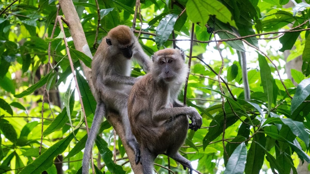
More common mammals in Singapore include the long-tailed macaque, plantain squirrel, colugo, and the wild boar, which is the largest terrestrial mammal in the country. The waters around Singapore contain even larger creatures, like the common dolphin, Irrawaddy dolphin, humpback dolphin, finless porpoise, and dugong.
Different types of civet, squirrel, mouse, and shrew otherwise contribute to Singapore’s mammalian community, as do smooth-coated otters, leopard cats, shrews, Sunda pangolins, slow lorises, long-tailed macaques.
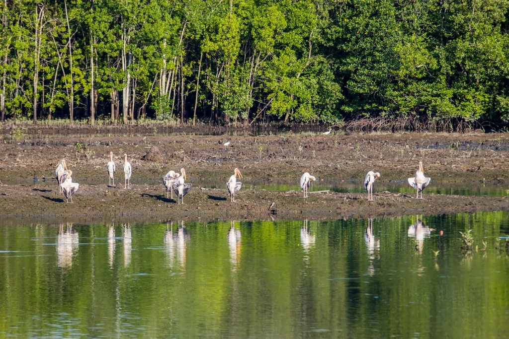
As for birds, over 400 species have been found in Singapore. Around the Bukit Timah Nature Reserve, one may find greater racket-tailed drongos, red-crowned barbets, Asian fairy bluebirds, straw-headed bulbuls, and brown-chested jungle flycatchers.
Elsewhere, such as the Labroad Nature Reserve, you can find birds like the rufous woodpecker, blue-crowned hanging parrot, and Abbott’s babbler. And in the wetlands of Sungei Buloh Wetland Reserve, there are Eurasian whimbrels, Mongolian plovers, curlew sandpipers, yellow bitterns, and common greenshanks, among many others.
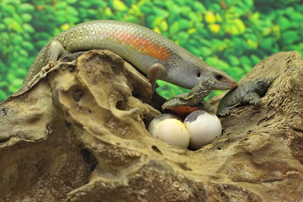
Singapore boasts over 100 species of reptiles, ranging from small lizards to fearsome reticulated pythons, Asian water monitors, and saltwater crocodiles. Also found in Singapore are clouded monitors, common sun skinks, geckos, lizards, anoles, iguanas, sunbeam snakes, keelbacks, reed snakes, whip snakes, water and mud snakes, pit-vipers, and turtles, among numerous others.
Then there is Singapore’s amphibious population, which consists of about 30 different species. Some common amphibians in the country include the Asian toad, four-ridged toad, banded bullfrog, four-lined tree frog, and black-eyed litter frog.
Outside of the aforementioned domains, Singapore is home to all sorts of butterflies and, along the coasts, many types of coral, sea grass, molluscs, and crabs, including common hairy crabs and horseshoe crabs.
References toward and tales about the existence of some sort of settlement or human occupation off the tip of the Malay Peninsula date back almost two thousand years, primarily to Greco-Roman and Chinese sources.
For several hundred years, Singapore Island fell under the reign of the Srivijayan Empire, a Buddhist empire based in Sumatra, though various other empires attacked this region of southeast Asia and may have taken control of the land.
Records and documentation about society on the island pick up later on, when Singapore was known as “Temasek,” an urban settlement that likely had its own city wall and moat. Temasek is referenced in Javanese epics, recorded by Chinese travelers, and was possibly part of a large aquatic trade route, as suggested by the presence of imported goods and contemporary references to trade.
Temasek’s name was eventually changed to the more familiar “Singapura,” which means “Lion City” in Sanskrit. However, the origin of this is unclear.
The Kingdom of Singapura only lasted from 1299 to 1398. After the decline of the Srivijaya Empire, the region became independent. But the island became greatly contested, as the Majapahit and Ayutthaya Kingdoms both laid claim to it, and both attacked the otherwise successful trade port on numerous occasions throughout this period,
Eventually, Singapura was taken under the authority of the Malacca Sultanate, though the island was largely in tatters when the Portuguese captured Malacca in the early 1500s. When the Malacca Sultanate fled, Singapore became a trading hub of the Johor Sultanate instead, though the conflicts between Johor and the Portuguese proved disastrous for Singapore, as the Portuguese destroyed its trading post.
Singapore came to global relevance again in 1819, after a few hundred years of the gradual encroachment of European colonial powers, namely, in Singapore’s case, the Portuguese and the Dutch, across southeast Asia.
This changed with the arrival of British governor Stamford Raffles in Singapore in 1819. Raffles decided Singapore could be an integral port for expanding British power across the islands.
The land was officially signed over to the British by the Sultanate of Johor. It began as a rather small settlement, though it quickly grew in population, with diverse demographics of immigrants from around southern and southeast Asia. By 1871, Singapore had over 100,000 residents and was a prosperous hub of trade for the British Empire.
Though part of the British Empire, Singapore was untouched during World War I. However, the island did witness conflict in the form of the 1915 Singapore Mutiny, when Muslim sepoys from British India rebelled after hearing that they may be sent to go fight the Ottoman Empire. The mutiny was eventually quashed.
The British did build a huge naval base after the war, but were too occupied by European matters to station a fleet there. In World War II, Japan took this opportunity to capture Singapore as part of their Malayan campaign.
The Battle of Singapore saw a victory for the Japanese and a resounding defeat for the British, and Japan continued to occupy Singapore from that battle in 1942 until Japan’s surrender in the war in 1945.
After the war, Singapore faced many issues, as the archipelago’s infrastructure was greatly decimated by the years of battles and conflicts. Its relationship with Britain was also particularly strained. Once the British Military Administration ended, Singapore became its own Crown Colony and began to bolster its own governmental systems, though conflict continued to persist.
Singapore became a state of Malaysia in the 1960s, but political and ideological differences led to a quick dissolution. As a result, Singapore became the Republic of Singapore, as it is known now, in 1965. It has since seen an extended period of rapid economic growth that has ended up shaping the country into the modern metropolis it is seen as today.
If you’re interested in hiking in Singapore’s reserves and parks, keep in mind that some parks require that you apply for a hiking permit beforehand. Additionally, some parks have areas that are only accessible through guided tours, not independent hikers.
With that in mind, here\s a quick look at some of the best hiking areas in Singapore to check out during your next visit.
Known as the site of the tallest point in Singapore, Bukit Timah Nature Reserve is a lush park of diverse plant species, thick forests, and unique animals that’s located only 12 km (7.5 mi) from city center. The reserve has a complex of well-organized and well-maintained trails for both hiking and biking.
The Red Trail is a casual hike that takes you 1.3 km (0.8 mi) up to the tallest peak in the country, Bukit Timah Hill. The moderate Green Trail and difficult Yellow Trail also provide other opportunities for reaching the summit. The Green Trail is 1.8 km (1.1 mi) long and the Yellow Trail is 2 km (1.2 mi) long.
The reserve can also be reached on foot from a trail extending from Central Catchment Nature Reserve through the Eco-Link@BKE, for those wishing to take a longer trek around the island’s parks.
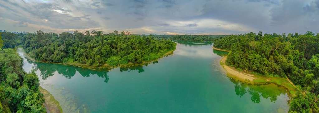
The heart of Singapore is a place of natural splendor and green forests that’s enclosed by the Central Catchment Nature Reserve.
The reserve contains Singapore’s four main reservoirs, MacRitchie, Lower Peirce, Upper Peirce, and Seletar, as well as buffer parks and reserves along its perimeter. About 20 km (12.4 mi) of trails, known as the MacRitchie Trails, wind through the reserve.
Trails in the reserve, which are organized by their color-coded difficulty levels, range from easy to difficult and from 3 km (1.9 mi) to 11 km (6.8 mi) in length.
Some of the longer trails in the reserve include the 7 km (10.6 mi) Orange Trail by the northern limits of the park, the difficult 9.5 km (5.9 mi) Pink Trail that cuts through the heart of the park from east to west, the 10.3 km (6.4 mi) Blue Trail, and the 11 km (6.8 mi) Yellow Trail from MacRitchie Reservoir Park that offers the best experience of the reservoir itself.
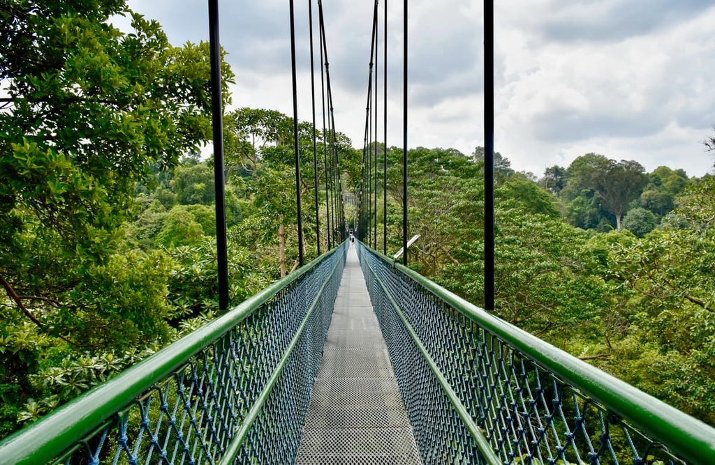
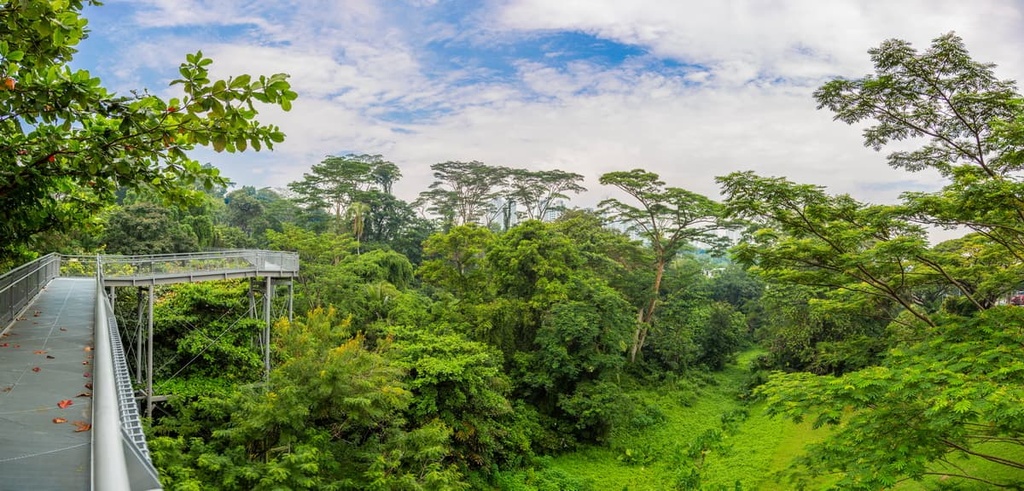
One of the highlights of the reserve, which can be accessed through the trail system, is the TreeTop Walk, a 250 m (820 ft) suspension bridge that connects the two highest points of the MacRitchie Reservoir, Bukit Pierce and Bukit Kalang.
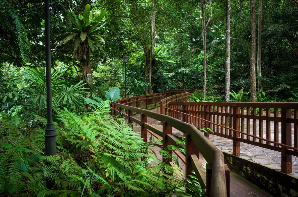
At Labrador Nature Reserve, one can experience Singapore’s coastline and coastal ecosystems alongside left-behind relics of World War II.
The Berlayer Creek Mangrove Trail is a casual 2.1 km (1.3 mi) trail in the reserve that takes you through a thick mangrove forest, one of very few remaining in southern Singapore. Here, the sounds of the cicadas and overwhelming greenery make it hard to remember that there’s a sprawling metropolis located right outside the reserve.
There are also trails in the interior of the park that take you through even thicker forests. Many of these trails also pass by historical relics from the second World War.
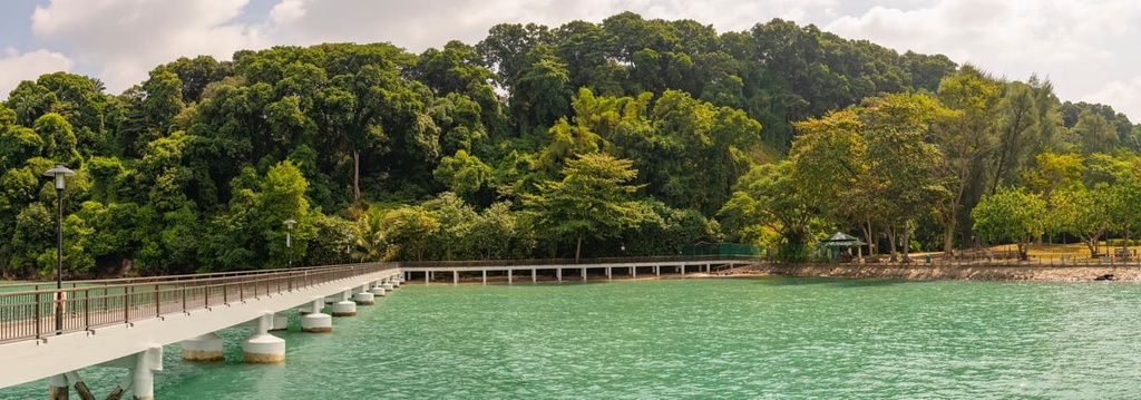
Pulau Ubin, one of Singapore’s more notable islands, is about a 15-minute boat ride away from the mainland, and it offers numerous great locations for hiking. The island itself, barring its specifically designated boardwalks and walking trails, is incredibly remote and walkable, making it a great place for anyone searching for a serene escape from the city.
Some hiking options include the Chek Jawa wetlands, which contain six different and rich ecosystems and a 1 km (0.6 mi) boardwalk from which to observe them.
There’s also Puaka Hill, the island’s tallest peak. It is about a 1.8 km (1.1 mi) hike from the ferry terminal to the hill. On this trail, you’ll make a 74 m (243 ft) ascent that takes you to the summit, which overlooks the nearby granite quarry and features views of the surrounding islands.
Located in northwestern Singapore is the Sungei Buloh Wetland Reserve, a prominent expanse of wetlands and mangroves replete with animals and plants of all sorts. In other words, it is one of the premiere locations for spotting Singapore’s many diverse bird species.
As far as hiking within the park goes, a small network of trails make for a great experience through both thick forests and marshy wetlands.
While each of the individual trails are relatively short, with the longest hikes are the 1,300 m (4,265 ft) Coastal Trail and the 1,950 m (6,398 ft) Migratory Bird Trail. They are all connected well enough to form one longer hike around the park for a solid half-day journey.
Not only does Singapore have parks for hiking and outdoor adventure, but it’s also home to the island-wide Park Connector Network, which provides a way to trek between parks and all across the island. This Park Connector Network contains over 300 km (186.4 mi) of trails that wind in and out of reserves, connecting them with one another.
These trails can be divided into several specific routes for exploring specific parts of the island, such as the 36 km (22.4 mi) Coast to Central Central Trail from the Jurong Lake Gardens to Coney Island Park or the 150 km (93.2 mi) Round Island Route that runs mostly around the island’s coastal perimeter.
If you’re looking for additional trekking opportunities during your trip, there are plenty of other hiking areas to check out in Singapore. Other notable hiking areas in Singapore include:
As Singapore is a city-state, there are no major “cities” that reside within it, as the country is in and of itself, a major city. The closest to a city-within-the-city is Singapore’s Central Area, which is sometimes referred to by the synecdoche of “The City,” and functions as the island’s city center.
For transport to and in Singapore, the country’s major airport is Changi Airport, which is located on the northeastern side of the island about 24 km (15 mi) from the Downtown Core.
The airport is connected to Singapore’s Mass Rapid Transit network, which is a very comprehensive system that spans the entire island. Additionally, the country is serviced by several bus stations, making it incredibly easy to get from the airport to anywhere else on the island.
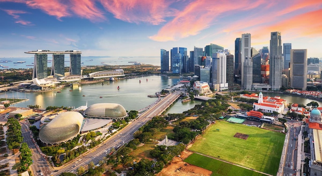
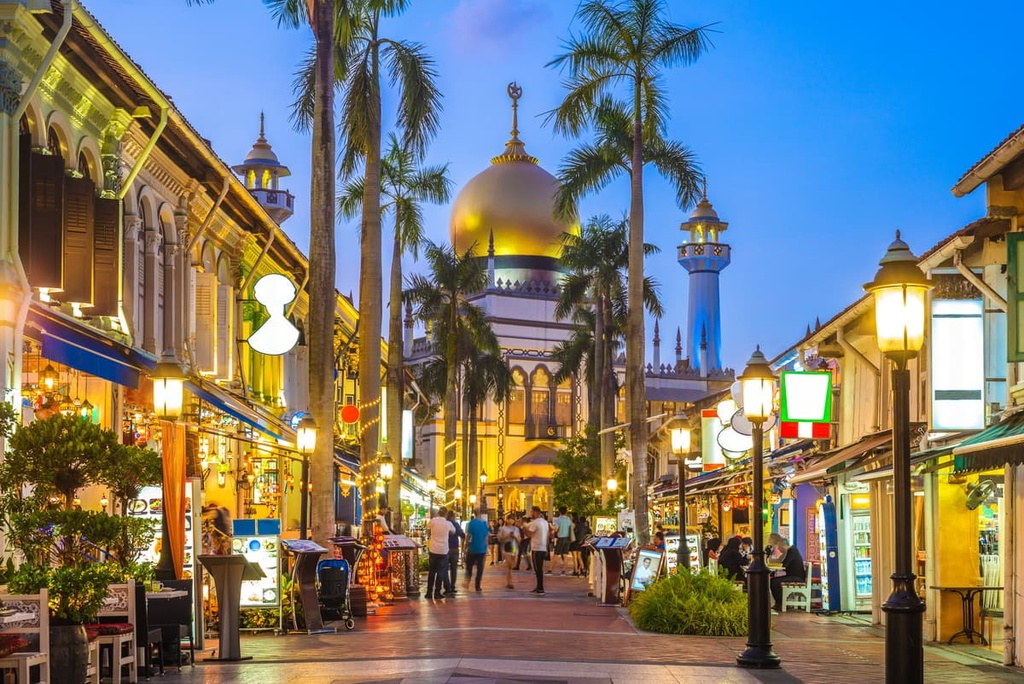
The Central Area, as mentioned, is Singapore’s city center, where many of the country’s most famous sites are located. As a densely-developed region with a long history, the area is an amazing mix of old and new, with buildings like the Thian Hock Keng Temple, Nagore Durgha Shrine, Masjid Sultan Mosque, and the National Museum alongside modern wonders like skyscrapers, the Helix Bridge, and the Marina Bay Sands.
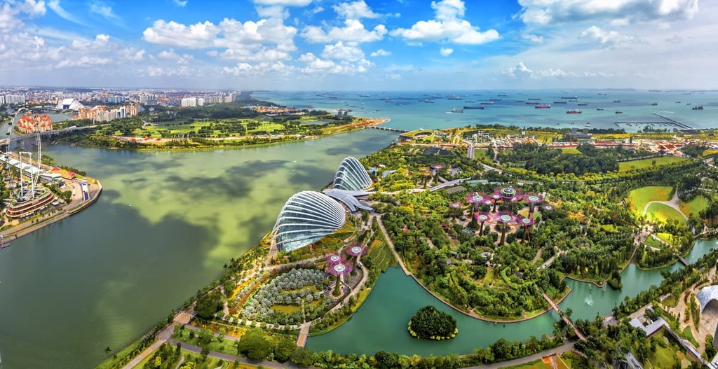
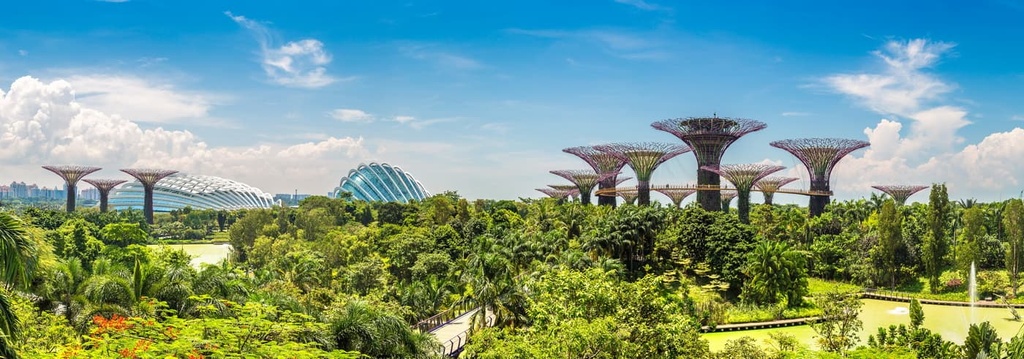
The modern and the natural also collide in the Central Area in the forms of the Gardens by the Bay, which is a pristinely manicured garden famous for its futuristic glow.
As for city life, Singapore’s Chinatown is located in the Central Area, too. It features a collection of Chinese and European-inspired architecture, boutique hotels, temples, food markets, and holiday festivities that occur throughout the year.
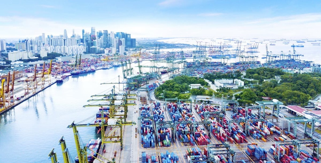
And there is the Downtown Core, the main commercial area of Singapore’s mainland, which is known for its skyscrapers, promenades, massive ferris wheel, casinos and resorts, the Sands Skypark Observation Deck, Merlion Park, food centers, and museums like the National Gallery and Asian Civilizations Museum.
In all, the Central Area is home to a multitude of options for sightseeing, dining, shopping, and lodging, and it features something totally unique around every corner.


