
Scan the QR code and open PeakVisor on your phone
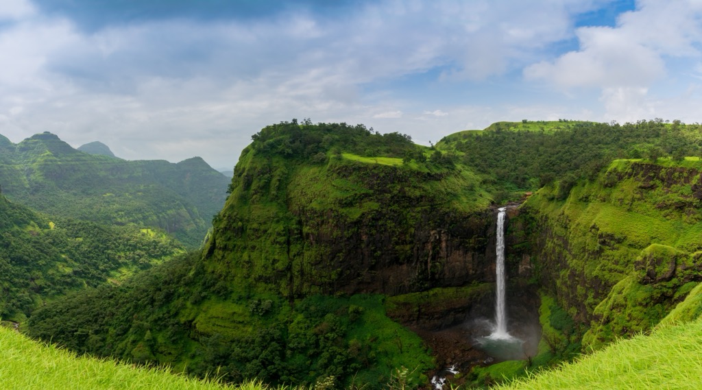
Maharashtra is a state in India ranking third in size and second in population, just behind Uttar Pradesh. Its capital, Mumbai, is the most potent economic force in India. The state's west coast is very densely populated, while the broad plains to the east are rural. The main mountain range in Maharashtra is the Western Ghats, a chain of peaks that runs along India’s west coast to the southern tip of the Indian peninsula. These are the highest mountains in India aside from the Himalayas, though, in size, they hardly compare; nevertheless, they are gorgeous and worth a visit in their own right. There are 583 named peaks in Maharashtra. The highest point in the state is Kalsubai (5,400 ft / 1,076 m), a popular destination for trekking.
Maharashtra borders Madhya Pradesh and Gujarat to the north, Goa and Karnataka to the south, and Telangana and Chhattisgarh to the east.
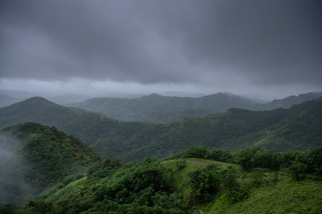
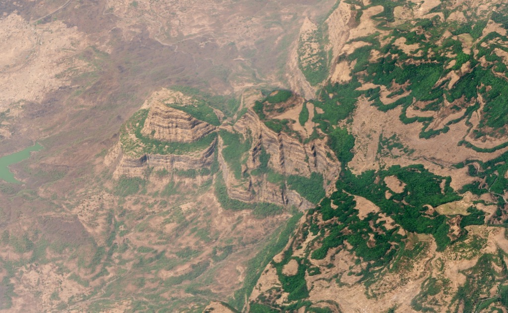
A topographical map of Maharashtra (the “Gateway of India”) shows two prominent geographic zones. The first is the lush area from the coast to the highlands of the Western Ghats. This region is mostly tropical and subtropical forest and agricultural land.
The second is the east slope of the Western Ghats, which descends into a long rolling plain called the Deccan Plateau, an expanse of hot, dry forest and farmland. The Satpura Range, a minor chain of rolling peaks, sits to the north along the border with Madhya Pradesh.
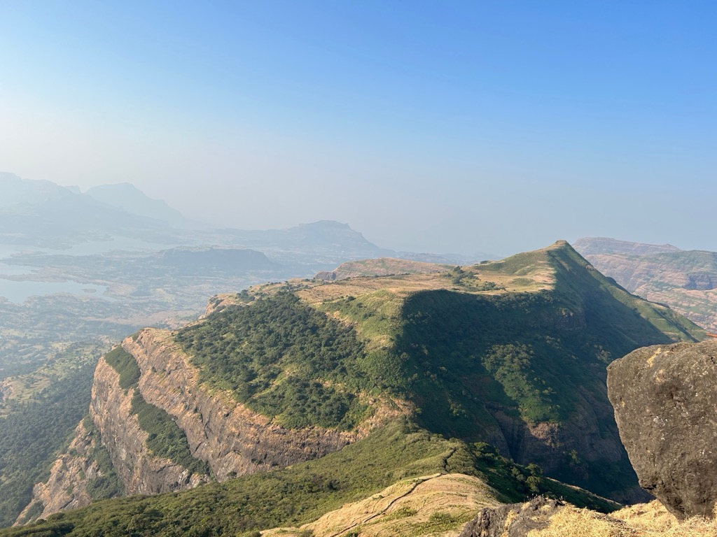
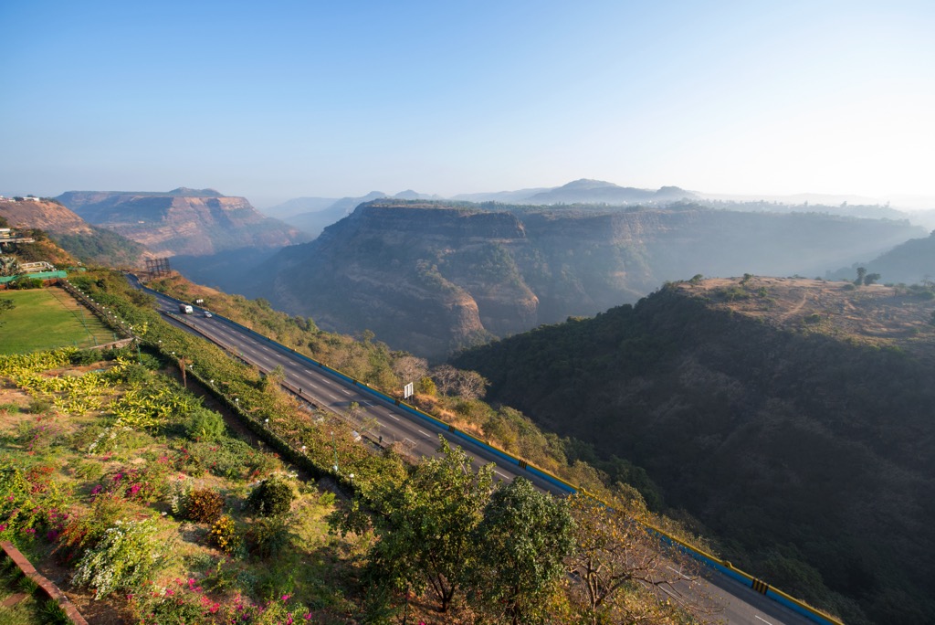
The defining feature of Maharashtra is the Western Ghats, which stretch over 1,600 km along the coast of the Arabian Sea. These are the highest mountains in India aside from the Himalayas, but the tallest peaks in the Western Ghats are much further south in Kerala. The highest peak in the range is Anamudi (2,695 m / 8,842 ft), while the highest point in Maharashtra is Kalsubai (5,400 ft / 1,076 m). The northern portion of the Western Ghats is part of a larger volcanic formation called the Deccan Traps.
The Western Ghats define both the topography and climate of Maharashtra. They collect moisture from the ocean, making the western slope wetter and more tropical and the expansive Deccan Plateau hotter and drier due to a rain shadow effect.
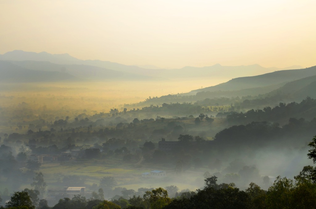
The majority of the population in Maharashtra lives along the coast, and population centers get smaller as you travel further inland. Mumbai has a population of almost 12.5 million. Pune, on the east side of the Ghats, has about half that. And Nagpur, further east, is home to 3 million people.
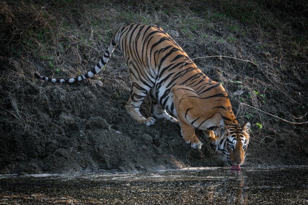
Maharashtra has a handful of national parks, including Tadoba National Park, the largest in India. Tadoba, south of Nagpur, has one of the country’s largest tiger populations. Other parks include Sanjay Gandhi National Park along the coast in Mumbai, Pench National Park north of Nagpur, and Gugamal National Park in the Satpura Mountains.
The main attraction of national parks in India is wildlife. Most of the protected areas in the country primarily serve as wildlife reserves, especially for tigers.
The Western Ghats are the most apparent geological feature in Maharashtra. But they are just one part of a vast geological formation called the Deccan Traps.
The Traps (from the Swedish word for “staircase”) are a vast region of basaltic plateaus created by ancient lava flows on the seafloor. They formed about 66 million years ago during one of the largest volcanic eruptions ever, which created layers of basalt over a kilometer (.62 mi) thick in some places, covering about half the Indian landmass. Some paleontologists partially credit the eruptions with the extinction of the dinosaurs, although it seems like a meteor impact in the Gulf of Mexico was far more consequential.
The Deccan Traps cover 500,000 square kilometers (310,686 sq mi) in west-central India. For scale, that is an area roughly the size of Yemen. The Deccan Traps are full of short, steep, free-standing peaks more similar to a chain of volcanoes than a classic mountain range of branching canyons. Most of the rock in this area is basalt, although there are some areas of gneiss, soft marble, and granite in the northern part of the Western Ghats.
The variation in rainfall and elevation around the Western Ghats fosters a highly biodiverse ecosystem. People primarily focus on big charismatic mammals like elephants and tigers, and there are wildlife reserves around Maharashtra to help preserve their populations.
But dozens of unique habitats in Maharashtra support all kinds of other wildlife. The tropical forests around the coast include jungle areas with multi-level forest canopies. Higher up in the Western Ghats, the forest type changes to the mixed conifer forest more typical of a temperate mountain range. The highest reaches of the peaks can reach freezing temperatures during the cold season.
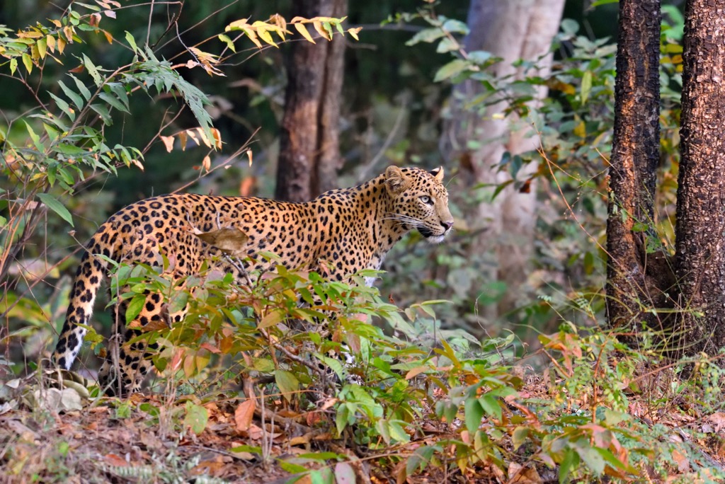
The lower plain east of the Western Ghats was historically covered in tropical dry forests. These ecosystems support herd animals and large predators like leopards and tigers. But today, they are heavily degraded due to centuries of agriculture and development. The most pristine ecosystems in the state are found in reserves and parks, most of which are in the mountains along the coast or closer to Nagpul.
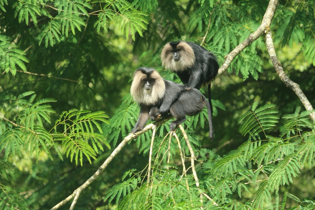
These places support a very fragile and diverse ecosystem. In particular, the tropical forests in the lower elevations of the Western Ghats are irreplaceable. 78% of these amphibians and 62% of the reptiles found here are endemic. The range also supports at least 325 threatened or endangered species.

Many of these are insects, but the list also includes mammals like the lion-tailed macaque, Nilgiri tahr, leopards, dhole, mongooses, martens, and gaur. The Western Ghats have a tiger population of almost 1,000 and the largest wild Indian elephant population on earth, around 11,000 individuals. Over 500 species of birds are native to the range, and another 200 fish.
The best way to see Maharashtra’s wildlife is to go on a safari to places like Tadoba and Pench National Parks. Sanjay Gandhi National Park in Mumbai has the distinction of being inside the city.
Based on archaeological sites, humans have inhabited India for tens or even hundreds of thousands of years. During the South Asian Stone Age, modern humans on the Deccan Plateau lived in caves and quickly developed technology and culture.
Around 3,300 BCE, the Indus River Valley Civilization was the largest in the world, extending from modern-day Himachal Pradesh almost to Maharashtra. The Indus Civilization overlapped with the Jorwe Culture, which was local to Maharashtra and dates back to around 1,400 BCE.
The Maurya Empire was the first major kingdom in Maharashtra, founded by Chandragupta. The Mauryas effectively took over all of India and most of Pakistan during their reign, which lasted until 230 BCE when the Satavahana dynasty took over. The Satavahanas would rule Maharashtra for the next 400 years.
From roughly 200 CE until the British arrived in the 1700s, dozens of empires and dynasties rose and fell in Maharashtra. Rulers like Gupta and Amoghavarsha came and went.
In 1535, Europe started influencing the area’s politics when Portugal captured Mumbai. At that time, the Mughals ruled most of the surrounding area and were continuously at war with the Maratha Empire into the 1700s. Portugal would control Mumbai until the 1660s.
At the same time, the British East India Company was gaining a foothold in the region. The company, which employed soldiers and functioned as a sort of autonomous government, would expand and take over a massive area of South Asia. The Mughals welcomed the East India Company, but they would end up overthrowing the Maratha Empire in the earliest example of a corporate hostile takeover.
This was the defining period of India’s history in terms of what it would become. The British spread the English language to India and built infrastructure like railroads to connect the country. Still, they also expected the locals to be subservient to them, providing both labor and natural resources.
The arm of the British Empire in control of Maharashtra was called the Bombay Presidency, which spanned from Karachi in Pakistan to the Deccan Plateau. The Indian people would work for two centuries to gain their independence. In 1947, India finally became a united country under a single flag. Maharashtra attained statehood in 1960 and continues to be an economic superpower today.
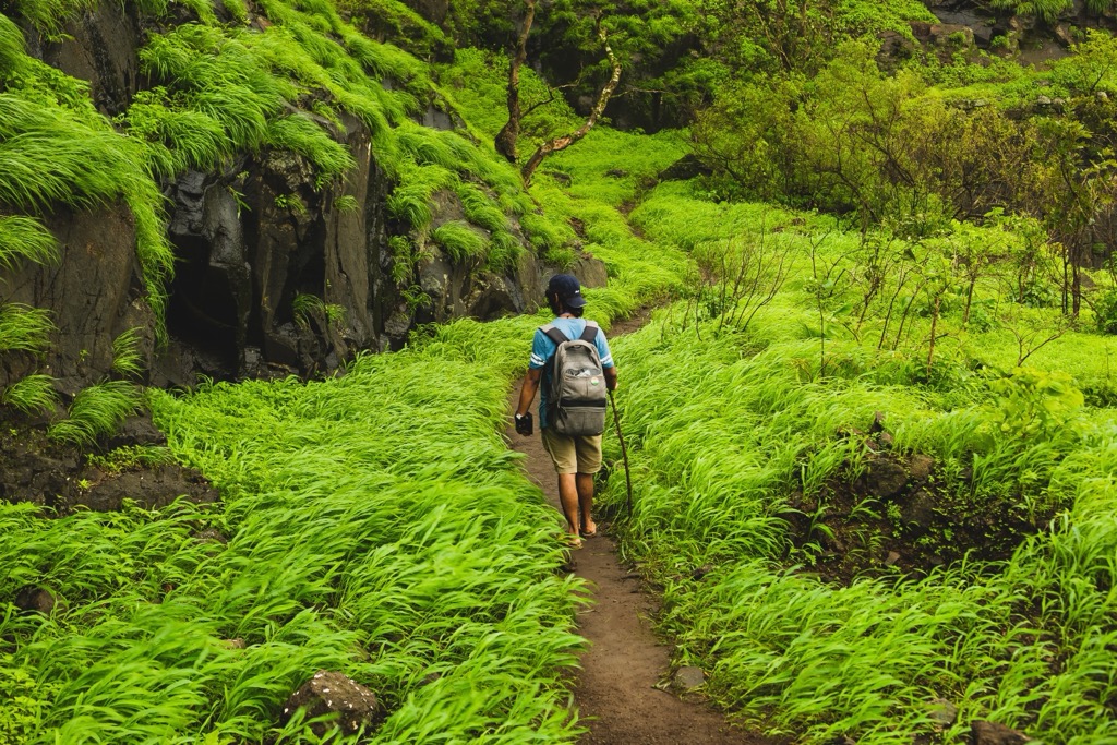
Maharashtra is full of short hikes through the peaks and valleys of the Western Ghats. Most of the national parks in the state are full of dangerous wildlife, so there aren’t as many trails in the parks. These are some of the more popular trails in and around the Western Ghats.
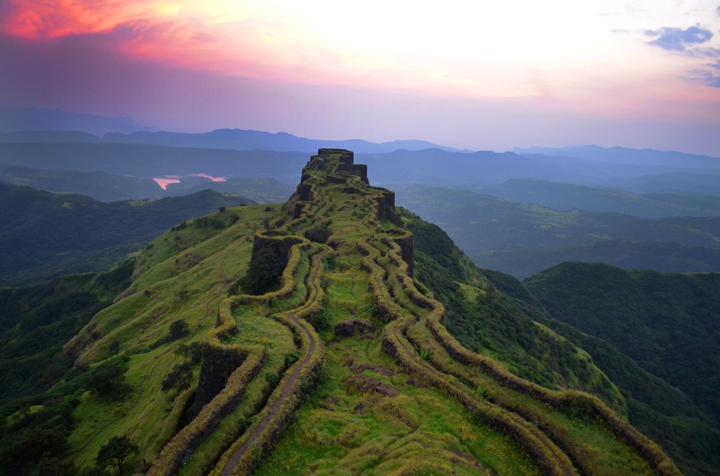
As the highest peak in the state, Kalsubai is the most popular hiking destination in Maharashtra. Kalsubai has over 1,000m (3,281 ft) of prominence and is unquestionably the most adventurous of the area’s summits.
There are three routes to the summit of Kalsubai. The shortest and most popular approach is from the east, starting in Bari at 816 m (2,677 ft). This route climbs steeply up 853 m (2,800 ft) of elevation over just 3.5 km (2.2 mi). The trail passes Kalsubai Temple near the summit.
The other approaches are from the north and south, both of which are longer and more gradual. The south approach begins at Udadavne on the shore of Pravara Lake. There is a campsite just outside of town, perfect if you want to camp and get an early start for the summit. This trail traverses along cliff faces back and forth up Kalsubai’s most jagged face. The north approach is more direct and involves less exposure.
Pune sits in the eastern foothills of the Western Ghats. There are half a dozen lakes to the east, and the surrounding hills are full of temples and forts.
The Katraj to Sinhagad Fort Trek starts south of Pune along NH 48. From there, the trail follows a ridgeline over 14.3 km (8.9 mi) to Sinhagad Fort. The fort, which is now ruined, has existed for at least 600 years and has been involved in several battles over the centuries. From the fort, you could either go back the way you came or continue southwest toward Winjhar.
The out-and-back option totals 28.8 km (17.9 mi) and covers 1,840 m (6,036 ft) of elevation in total, which is a hearty overnight trek. The one-way option to Winjhar is more feasible as a day hike but would require a shuttle to the trailhead.
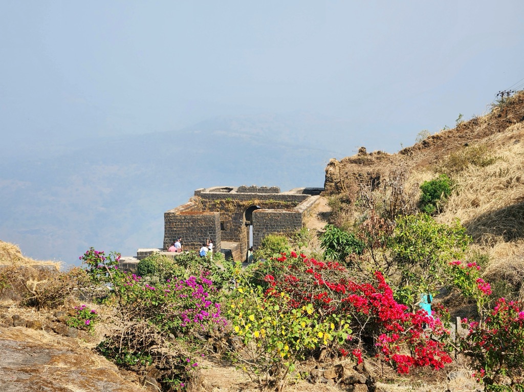
The Rajgad Fort trek is a shorter and more manageable option that could be done in a day. The trail starts at Darewadi, south of Pune, and climbs a ridgeline to the fort, a spectacular payoff. Rajgad Fort was the first capital of the Maratha Empire in the mid-1600s and was built on a precarious ridge. It’s ruined now, but it is just as impressive. The trek to the fort covers 7.7 km (4.8 mi) out and back and climbs 642 m (2,106 ft) to the high point.
There is a short trail over the top of Baner and Pashan Hill on the west side of Pune. This is a great half-day, covering 6.1 km (3.8 mi) out and back and 194 m (636 ft) of elevation. There are views of the city to the east and the Ghats to the west along the way.
Mumbai has good access to the Western Ghats but also has its own national park right inside the city. The Mumbai area is a tropical forest full of caves, ruins, and many short single-day hikes.
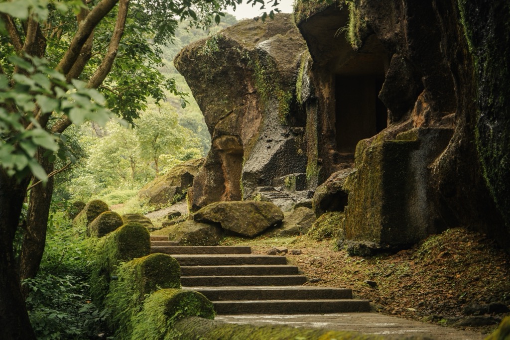
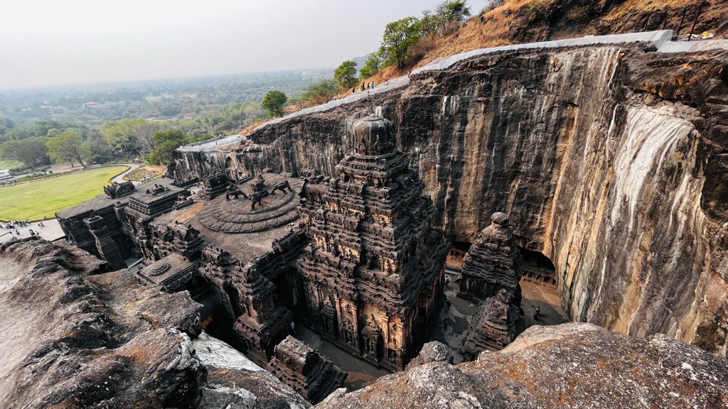
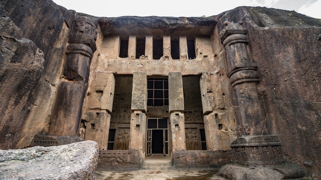
One of the most popular routes in Sanjay Gandhi National Park ascends 296 m (971 ft) over 6.9 km (4.3 mi) to Kanheri Caves. This collection of over 100 caves, partly natural and human-made, dates back to the first century CE. They have primarily served as Buddhist temples, and they are full of inscriptions, stupas, reliefs, and paintings. This trail perfectly combines outdoor recreation and cultural learning without even leaving Mumbai.
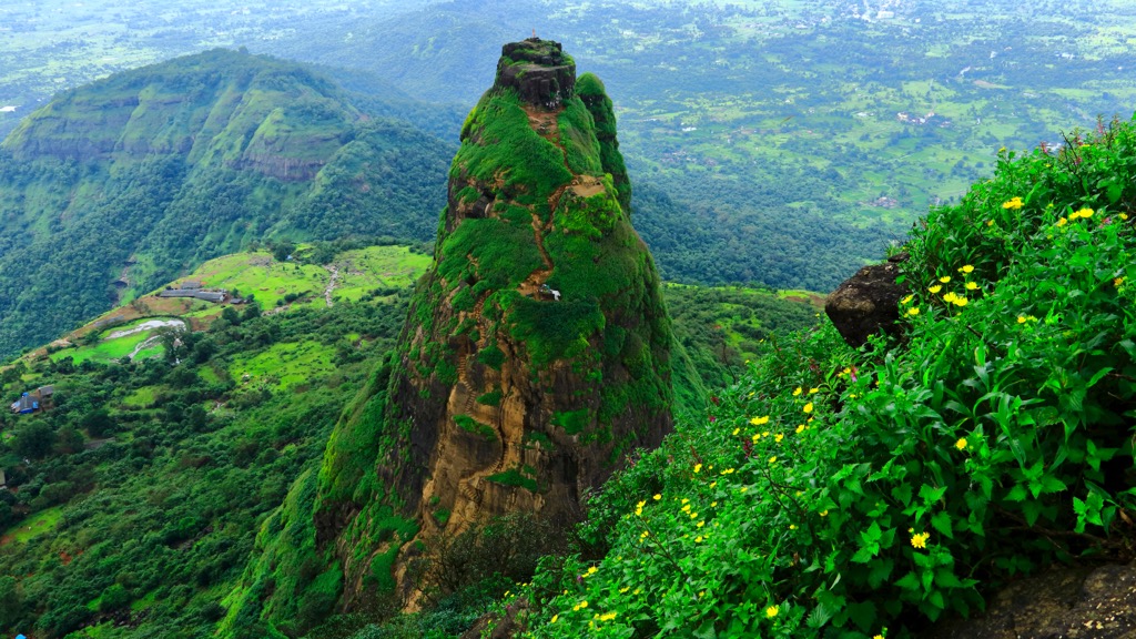
The Kalavantin Durg (pinnacle) 662 m (2,172 ft) and Prabalgad Fort trail is a full and very fulfilling day. The route starts in Thakurwadi, west of Mumbai, and climbs 1,045 m (3,428 ft) over 5.5 km (3.4 mi). First, the trail leads to the top of Kalavantin Durg, a scenic freestanding pillar. After returning, the route traverses up the sloping edge of a cliff to Prabalgad Fort. The fort is at least 500 years old and is ruined, but it gives excellent views of the nearby pinnacle.
The Karnala Trail is much shorter, totaling 5.8 km (3.6 mi) out and back and 352 m (1,154 ft) of elevation. The trail starts just off NH 66, south of Navi Mumbai, and ascends the most prominent hill in the Karnala Bird Sanctuary. This is a prime spot to watch for wildlife and enjoy the ecology of the Western Ghats.
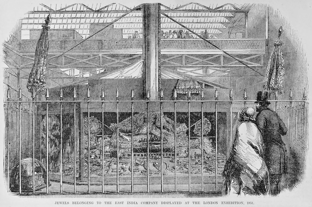
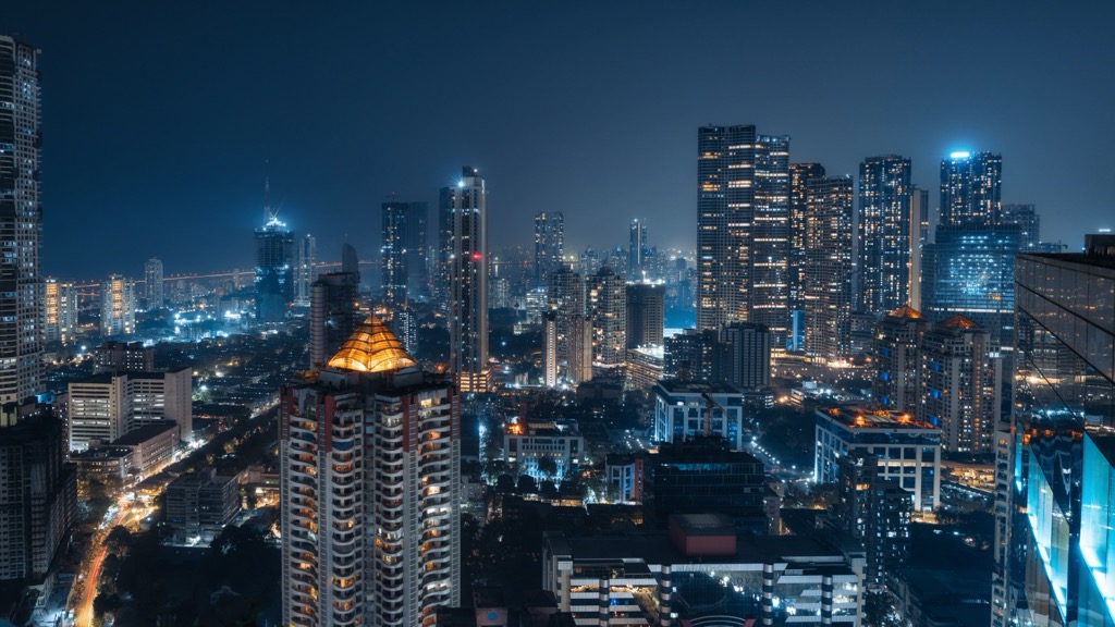
Mumbai is India’s economic powerhouse, a megacity on the coast that has seen empires rise and fall over almost 2,000 years. The city is considered very safe, especially given its size, and is tourist-friendly.
The city is full of fantastic architecture (new and old), shopping districts, religious monuments, and delightful food. Be sure to see the Gateway of India monument, the Shree Siddhivinayak temple, and the Chhatrapati Shivaji Terminus rail station. Sanjay Gandhi National Park, on the city's north end, is well worth exploring.


