
Scan the QR code and open PeakVisor on your phone
Hebei is home to 493 named mountains. The highest is Dōng Tái at 2,882 m.
Hebei Province is an administrative region located in northern China that’s home to jagged mountains, plains, coastline, and some of the country’s most important historical sites, including sections of the Great Wall. There are 493 named mountains in Hebei, the highest of which is Dōng Tái at 2,882 m (9,455 ft) in elevation, and the most prominent of which is Wuling Mountain (2,292 m/7,520 ft).
Hebei Province (河北, Héběi) lies within the northern part of the Chinese heartland. It is situated along the historical border between the Chinese Empire to the south and nomadic tribes like the Mongols and Huns who inhabited the plains to the north.
The area that is now Hebei Province area has been central to Chinese history for thousands of years, both as the seat of the imperial government and the scene of many pivotal battles. As such, Hebei is full of high-caliber historic sites, including imperial palaces, mausoleums, and the Great Wall. There are five UNESCO World Heritage Sites in the province alone.
In addition to thousands of years of history, Hebei is also home to jagged, imposing mountains, massive cities, wide plains, and some of the best stretches of coastline in northern China. It’s one of the most varied and diverse provinces in the country, which, given the size of China as a whole, is really saying something.
Geographically, Hebei forms an irregular “U” shape. It extends to the northwest from the Bohai Sea (渤海, Bóhǎi) to the east. The province also shares its borders with a number of other provinces, such as Shandong (山东, Shāndōng), Henan (河南, Hénán), Shanxi (山西, Shānxī), Inner Mongolia (内蒙古, Nèi Měnggǔ), and Liaoning (辽宁省, Liáoníng).
The province of Hebei encircles Beijing (北京, Běijīng) and Tianjin (天津, Tiānjīn), two of China’s largest cities. However, the two megacities are governed independently and are not technically part of Hebei.
Together, Beijing, Tianjin, and Hebei from the JingjinJi Metropolitan Region (京津冀城市群, Jīng jīn jì chéngshì qún), which is home to over 110 million people. The region accounts for about 8 percent of China’s total GDP, covers an area roughly the size of Great Britain, and has a population equivalent to the Philippines.
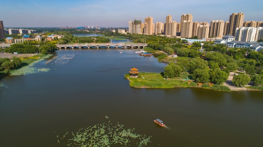
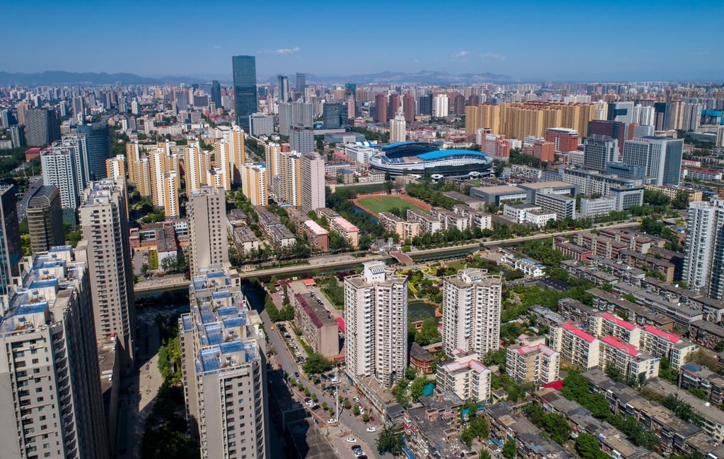
On its own, Hebei province has over 75 million residents. The largest cities in the province are Chengde (承德, Chéngdé), Zhangjiakou ( 张家口, Zhāngjiākǒu), Baoding (保定, Bǎodìng), and Shijiazhuang (石家庄, Shíjiāzhuāng), the latter of which is the provincial capital.
Hebei is an industrial powerhouse, with a GDP of almost 3 trillion RMB. Manufacturing and agriculture are the largest industries in the province. Hebei is also one of China’s leading producers of steel, which has made the region economically powerful but also caused problems with air pollution.
While the province’s major cities and heavy industry make Hebei important to modern China, its deep history and slow-paced rural areas are what make it a major destination for tourists.
The province’s rustic countryside and historical sites are readily accessible from Beijing, so it’s a great place to venture to if you want to escape the megacity. Whether you’re searching for fresh air in the mountains or you want to visit a centuries-old palace, there’s something in Hebei for everyone to enjoy.
The dominant geographical features in Hebei are the Yellow River plain, which covers most of the southern and central areas of the province, and the mountain ranges that separate it from the Mongolian plateau to the north. In fact, the name Hebei literally means ‘north of the river.’
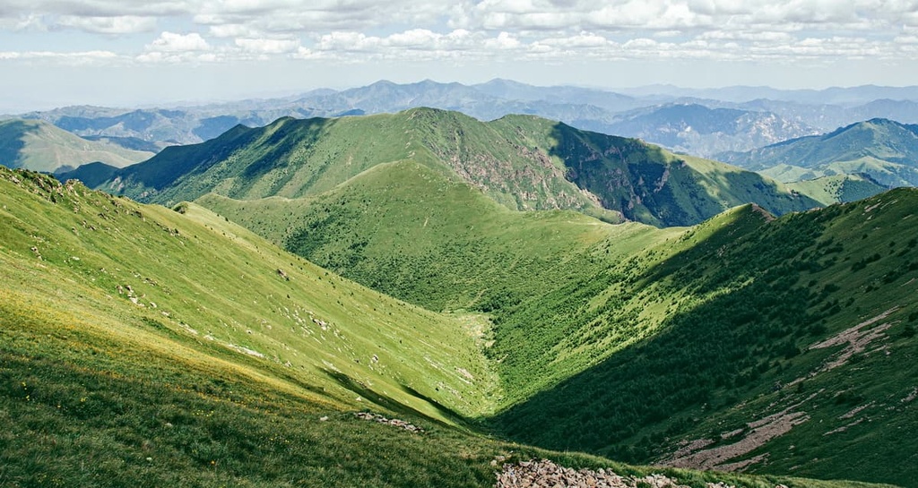
The Yan Mountains (燕山, Yànshān) run through the northern end of the province, creating the natural defensive barrier that China relied on for thousands of years. Peaks in the range reach between 400 and 1,000 m (1,300 and 3,300 ft) in elevation, and the range’s highest mountain is Wuling Mountain (雾灵山, Wùlíng Shān). The Yan mountains are mostly composed of limestone, granite, and basalt.
The highest point in Hebei province is Mount Xiaowutai (2,882 m/9,455 feet) in the Taihang Mountains in the northwestern end of the province. Dōng Tái, the easternmost peak of Xiaowutai’s five-peak ridge, is the massif’s highest point. The Taihang Mountains reach an average of 1,500 to 2,000 meters (4,900 to 6,600 feet) in elevation.
Hebei also has a wealth of natural resources, which have made it a center for mining and heavy industry in recent centuries. There are major iron mines at both Handan and Qian’an. The province is also home to the Kailun coal mine, which produces over 20 million tonnes of coal per year.
Hebei is known for its rich, fertile soils. Loess-rich streams running down from the Taihang Mountains and the Shanxi Plateau flood annually and replenish the soils in the province. Hebei can see severe flooding at times and serious efforts have been underway in the province for the past several decades to control the region's rivers and streams for this very reason.
Hebei has served as northern China’s breadbasket since dynastic times, but thousands of years of intensive farming and cultivation have left little of the original vegetation in place on the plains. The only real forests left in the province are found in the mountains and upland areas, where elm, poplar, and willow trees are common.
Hebei has four distinct seasons, with cold dry winters and hot summers. June, July, and August are the rainy season, so spring and fall are the best times to visit Hebei if you’re looking for mild temperatures and more pleasant weather.
Hebei plays a leading role in Chinese history, from the prehistoric period and the mythical foundations of the first dynasty to the Chinese civil war in the twentieth century.
Some of the earliest evidence of human and pre-human habitation in China comes from Hebei. In particular, the Zhoukoudian Cave on the outskirts of Beijing has produced hundreds of artifacts tied to the Peking Man (Homo erectus pekinensis), a human ancestor who likely lived during the middle Pleistocene. The tools and human remains that have been found in the cave date back between 200,000 and 800,000 years.
While the events from the earliest records of Chinese civilization are considered mythical, they’re nonetheless important to Chinese history and identity. More importantly for our purposes here, many of these legends took place in Hebei.
Fuxi, who is considered to be the first human in Chinese mythology, supposedly lived in Xingtai city in southern Hebei. Xingtai is one of the oldest cities in northern China, and its history stretches back over 3,500 years to the Shang Dynasty. Another Hebei city, Zhangjiakou, claims to be the site of a major battle that brought to power China’s mythical first leader, the Yellow Emperor (黃帝, Huángdì).
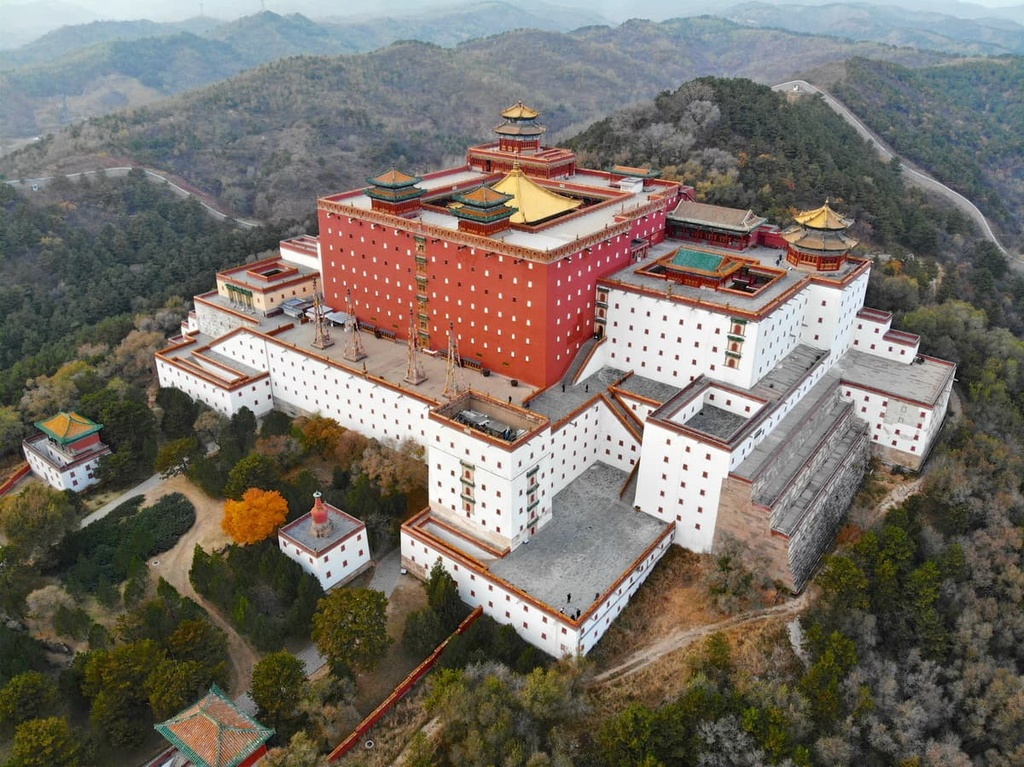
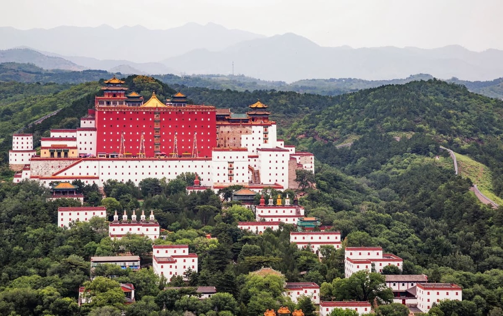
In more recent millennia, Hebei has historically been an important region in China due to its proximity to Beijing. The emperors of the Qing Dynasty actually built a massive summer retreat in the city of Chengde that is now a designated World Heritage site.
During the Yuan, Ming, and Qing dynasties, the area was so important that it was controlled directly by the imperial government in Beijing. During these times, the province was called Zhili, which literally translates to “directly ruled.”
When the Kuomintang brought the northern regions under the control of the Republic of China in 1926, the city of Nanjing in southern China was made the capital. As a result, Hebei once again reverted to provincial status.
After the Communist Revolution in 1949, Hebei’s traditional borders were extended northward, creating the present-day borders of the province. In 1976, over 240,00 people were killed in Hebei Province in the Tangshan earthquake, the deadliest earthquake in modern Chinese history.
Today, Hebei is a major industrial center and the sixth-largest province by population in China. Together with Beijing and Tianjin, it’s part of the JingJinJi Metropolitan Region, which accounts for about 8 percent of China’s total GDP.
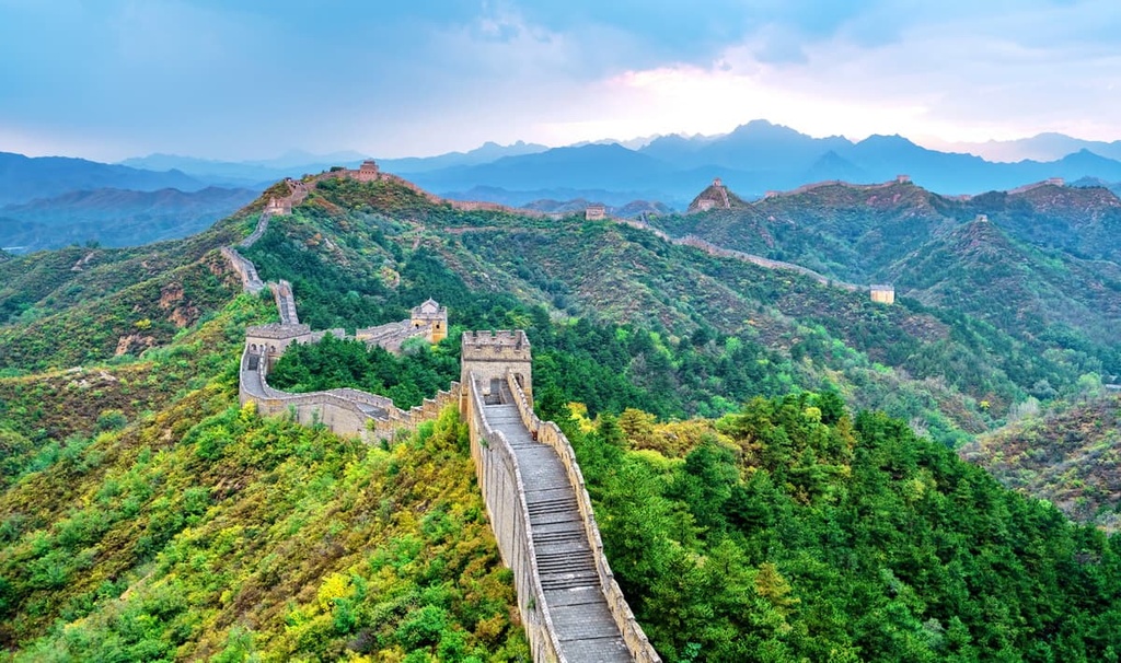
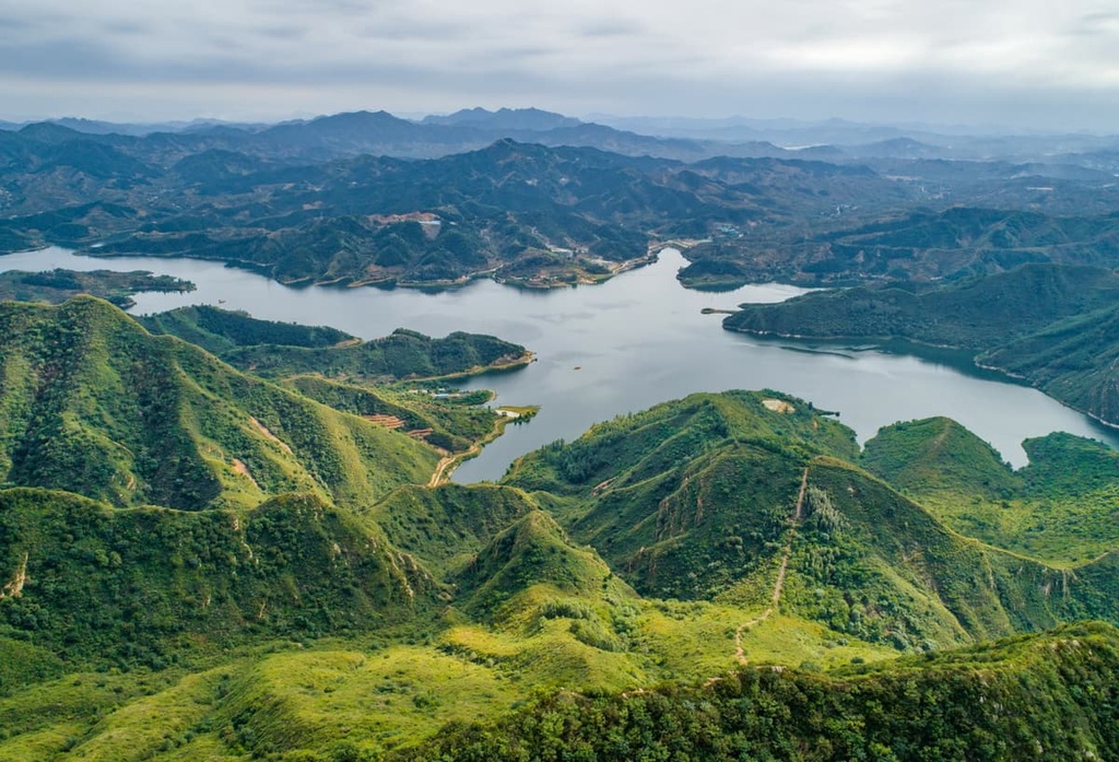
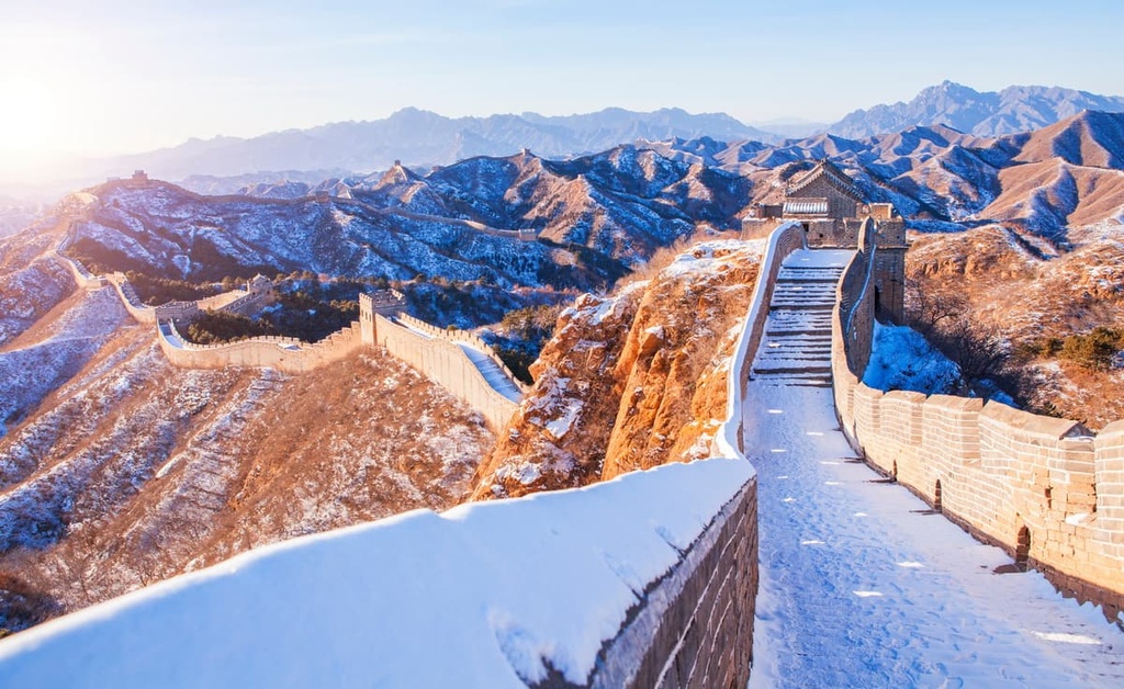
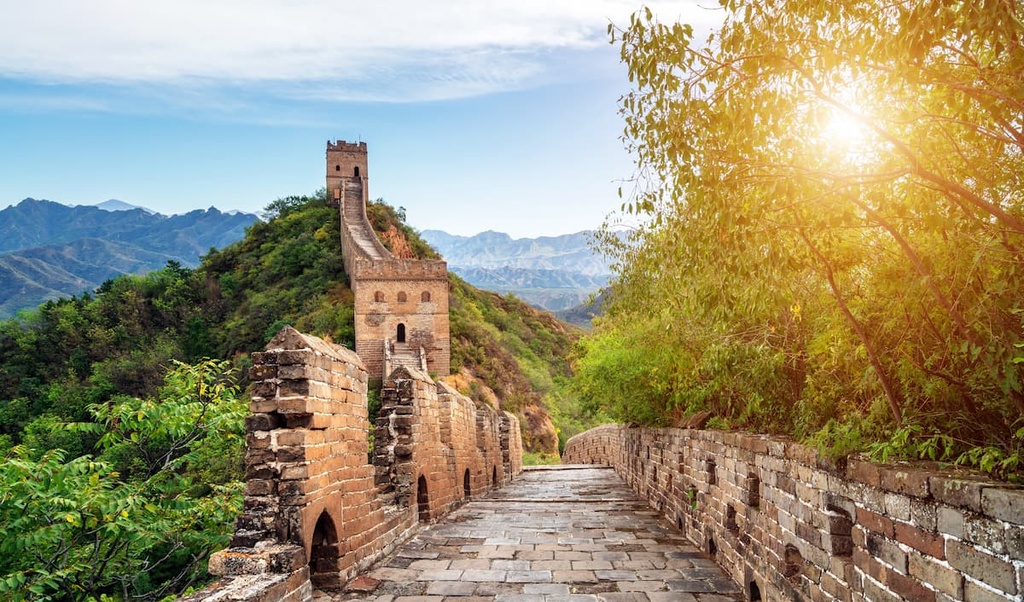
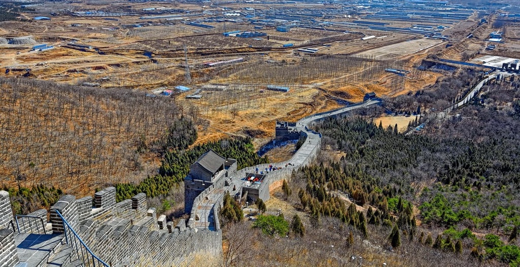
There are plenty of mountains and hiking areas in Hebei for visitors to enjoy, from the sea coast to the grasslands on the fringes of Inner Mongolia. However, the Great Wall is undoubtedly the top destination in the province.
There are many places you can visit the Great Wall in Hebei, from ticketed tourist parks with cable cars and restaurants to crumbling, unrestored sections where you’ll have to hike (and sometimes blaze your own trail).
Camping on the Great Wall is a fantastic way to experience the landmark without the crowds. You can camp on the Great Wall as a solo hiker, or join a tour group, which makes traveling in China without Chinese language skills significantly easier. Hotels and hostels in Beijing frequently arrange day and overnight trips to the Great Wall, which can be good places to start your search if you’re looking to join a tour group.
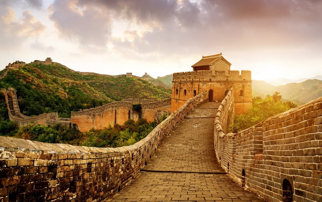
The Mutianyu section of the Great Wall is fully restored, and it features a plethora of tourist amenities, such as a cable car and even a roller coaster. It’s a great destination for families or those who want to experience the wall without having to hike any more than they please.
While Mutianyu is popular and busy, you can get away from the crowds by simply walking along the wall (most people stay near the entrance). While the Mutianyu section is crowded, it’s not quite as crowded as the Badaling section, which is located even closer to Beijing.
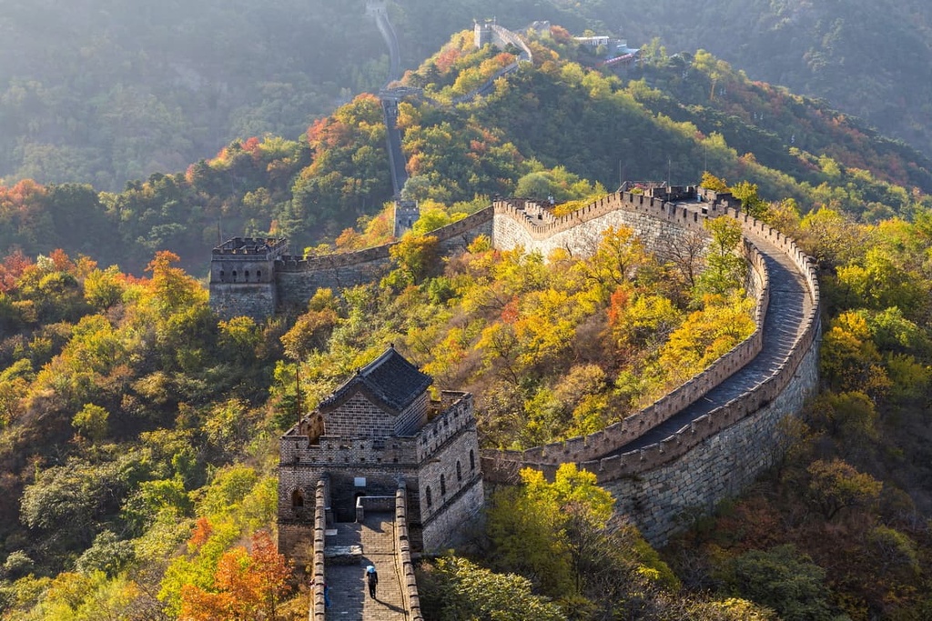
The “Wild Wall” refers to unrestored sections of the Great Wall, which haven’t (yet) been turned into tourist attractions. These areas offer incredible hiking and few, if any, crowds, but they can be challenging and dangerous to hike in places.
These sections of the Wild Wall don’t have much signage, so come prepared with maps and be ready to navigate on your own. The wall is hundreds of years old and crumbling in places, so make your own judgments about what’s safe to hike on before you start walking.
Here are some sections of the wild wall located close to Beijing that you can consider hiking during your next visit:
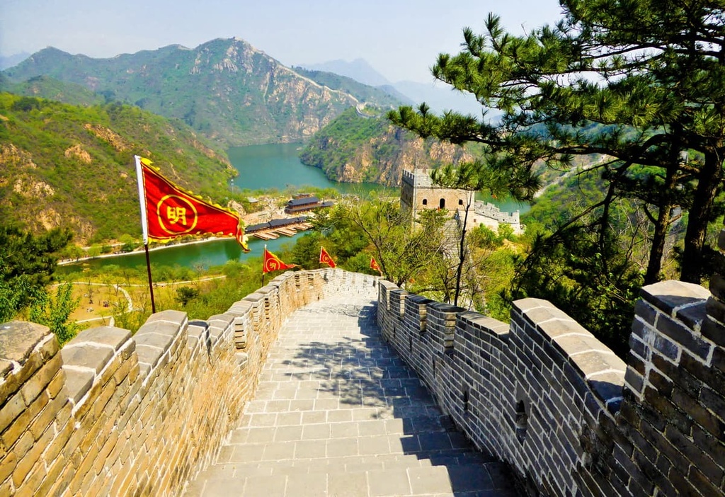
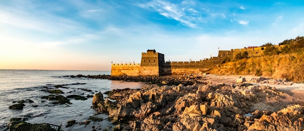
Shanhaiguan is the end of the line— the place where the eastern end of the 21,000 km (13,000 mi) Great Wall meets the sea. The Shanhaiguan (山海关, Shānhǎiguān) section features some of the most interesting fortifications and features still standing along the Great Wall, and it’s only a 3-hour train ride from Beijing.
Shanhaiguan lies within the larger coastal city of Qinhuangdao. It occupies a strategically important point on the narrow strip of flat land between Hebei’s mountains and the sea. One of the Great Wall’s few gates is located in the town center. If you walk along the wall for about 4 km (2.5 mi), you’ll reach the eastern edge where the wall meets the sea.
Hebei’s highest peak is located only a four-hour train ride from Beijing, but it feels a world away from the bustling, industrial areas of north China.
Mt. Xiaowutai (小五台山, Xiǎo wǔtáishān) forms a spectacular ridge that features five peaks above the treeline. It tops out at an elevation of 2,882 m (9,455 ft) on Dōng Tái, the easternmost peak of the massif. The easiest way to climb the mountain is by an out-and-back route from the Jinhekou (金河口) tourist entrance to the park.
This is a challenging hike that gains (6,000 ft) of elevation over about 24 km (15 mi). The trail disappears in places and you’ll need to rely on your map and navigation skills to make it to the ridgeline.
Outside the metropolises of Beijing and Tianjin, Hebei offers a number of pleasant mid-sized cities and quaint villages that are well worth checking out. Here are some of the best places to stay in the province during your next visit to Hebei.
Shijiazhuang is the capital of Hebei province and its largest city. With a total population of over 11 million people, it’s one of the biggest cities in China. Internationally, Shijiazhuang is known as one of the worst cities in China in terms of air quality.
While there’s not much to attract tourists to Shijiazhuang, it’s a good jumping-off point for visiting Mount Cangyan (苍岩山, Cāngyán Shān), a beautiful mountain-top temple in the Taihang Mountains that dates back to the Sui Dynasty.
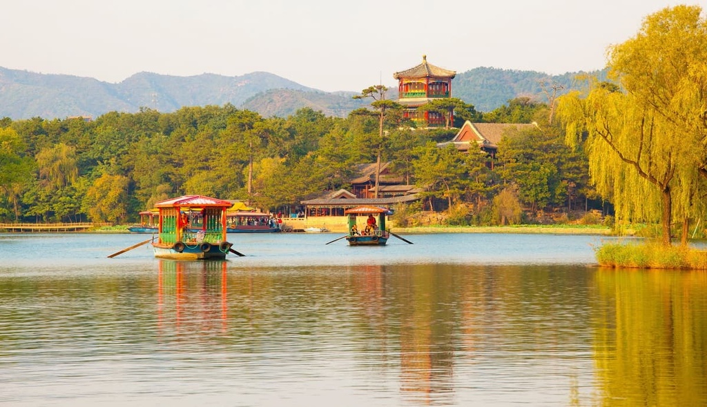
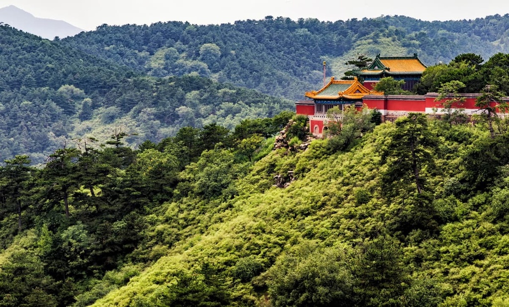
Chengde ((承德, Chéngdé) is famous for the massive imperial summer retreat the Qing emperors built in the city during the 1700s. The resort is a UNESCO World Heritage Site, and it contains the largest surviving royal garden in China.
The Chengde Mountain Resort is the main tourist draw to Chengde, but there are plenty of other historic attractions here, too, including Putuozongcheng Temple, which is a small replica of Potala Palace in Lhasa, Tibet, and the Puning Temple, which houses the tallest wooden Bodhisattva Avalokiteśvara sculpture in the world.
China isn’t known as a beach destination, but if you’re looking for sun and sand near Beijing, Qinhuangdao (秦皇岛; Qínhuángdǎo) is a good choice. You can visit the eastern end of the Great Wall at Shanhaiguan in the northern part of the city, then head to the beaches for some fun in the sun.
Beidaihe (北戴河 běidàihé), which is located to the south of Qinhuangdao’s main port area, is a popular summer beach resort. It’s famous for the annual Communist Party summer retreat that takes place here, but the beach resort has also become popular with other vacationers from around China, too.


Yes. Hebei has 493 named mountains. The highest is Dōng Tái at 2,882 m.
The highest mountain in Hebei is Dōng Tái, at 2,882 m.
Hebei has 493 named mountains.


