
Scan the QR code and open PeakVisor on your phone
Gunma is home to 264 named mountains. The highest is Mt. Nikko-Shirane at 2,578 m.
The Gunma Prefecture of Japan is a prime destination for experiencing some of the country’s most mountainous and volcanic terrain. The prefecture is home to 264 named peaks, with the highest and most prominent being stratovolcano Mount Nikkō-Shirane at 2,578 m (8,458 ft) in elevation and an admirable 1,614 m (5,295 ft) in prominence.
The Gunma Prefecture is an administrative region in central Japan. With an area of around 6,362 km2 (2,456 sq mi), Gunma is home to some 2 million residents, most of whom live in cities in the southeastern part of the prefecture. However, despite having approximately 2 million residents, Gunma is only the 19th most populous prefecture in the country.
There are twelve cities in Gunma, most of which are located within its southeast and central areas. Its capital is Maebashi, a city of around 335,000 people, though its largest is Takasaki with a population just over 372,000. In extreme southern, western, and northern Gunma, settlements tend to take the shape of towns or villages rather than cities.
Interestingly, Gunma is one of only 8 of Japan’s 47 prefectures to be totally landlocked. It is located in the central part of the country’s largest island—Honshu—and it is the northwesternmost of the 7 prefectures in the Kantō region. Its eastern borders are its fellow Kantō prefectures of Tochigi, to the north, and Saitama, to the south.
The Chūbu region borders Gunma to the west, with its prefecture of Nagano to the center and south and Niigata to the north. Next to Niigata, bordering northern Gunma just slightly, is the prefecture of Fukushima in the region of Tōhoku.
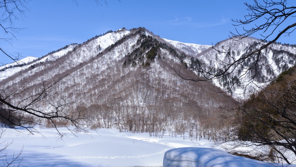
The major geographical feature of note is Gunma’s mountainous terrain, mainly in the north, and to the west and south, and especially along its borders. These mountains are largely part of the Okuchichibu Mountains.
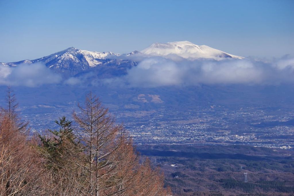
Notable mountains include the aforementioned Nikkō-Shirane, to the north, as well as the mountains of Myōgi, Haruna, and Akagi. Nikkõ-Shirane is actually the tallest peak in all of northeastern Japan. Gunma has many other peaks at over 2,000 m (6,562 ft) in elevation as well, and its second most prominent peak is the 2,568 m (8,425 ft) tall volcano Mount Asama, at 1,262 m (4,140 ft) in prominence.
Many of these mountains are volcanic in nature, generally dormant as in the case Mount Haruna, but occasionally active, as in the case of Asama. Stratovolcanoes, lava domes, calderas, and hot springs can all be seen and experienced as a result of this characteristic volcanism.
Outside of mountains, the Kantō plain, Japan’s largest plain, stretches into the northwestern corner of Gunma prefecture. There are also various wetlands and marshlands dispersed throughout the prefecture, such as the Yoshigadaira wetlands, located in the foothills of Mount Kusatsu-Shirane and Oze marshlands.
Hydrologically, the most notable river to be located entirely within the prefecture is the Agatsuma, responsible for the drainage of northwest Gunma—especially from the Asama and Kusatsu-Shirane mountains—and known for the Agatsuma Canyon found further along its path. Agatsuma is a tributary of the Tone River, which flows down through the Echigo Mountains along the Niigata border; the Karasu River, a branch of the Tone, is also of note.
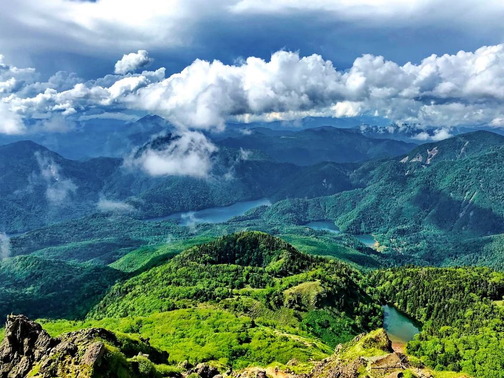
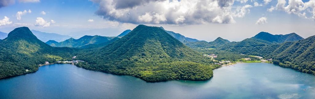
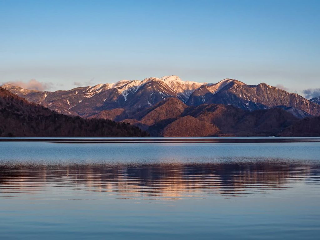
Gunma has many lakes atop mountains or within volcanic craters, such as Lake Haruna atop Mount Haruna and Lake Yugama atop Nikkō-Shirane.
As a landlocked prefecture, Gunma isn’t moderated by the ocean, and thus its winters and summers tend to be more extreme in their respective directions.
In those areas where Gunma is especially overrun by mountains and thus generally at a higher elevation, summers tend to be cool and winters cold and wet, with quite a bit of rain and snowfall. Toward the southern part of the prefecture, where it gets flatter and lower, winters are drier and windier, and summers hotter.

The main rock formations of Gunma are sedimentary in origin, including mudstones, sandstones, and conglomerates. However, there are also many rock formations and systems that are volcanic in nature, largely dating back to the Permian, Jurassic, and Cretaceous.
Nevertheless, many of the overlying formations in Gunma are much younger, with many from the Miocene, Pliocene, and Pleistocene.

Mount Akagi is a good example of typical Gunma volcanic geology, being a stratovolcano of andesite and dacite adorned by a large caldera and several lava domes, at its most active in the Pleistocene Era. There are claims that it last erupted in 1251, but such claims are not well supported. Mount Asama, an active complex volcano, likewise consists of andesite and dacite, built up from volcanic rocks dating back to Late Pleistocene.
Basaltic, andesitic, and rhyolite dykes can also be found in parts throughout the prefecture, as well as formations of ophiolites, pumice beds, and pyroclastic cones.

Gunma also boasts a diverse profile of minerals in all kinds and colors, with quite a few mines spread throughout the region. Aragonite, pyrite, quartz, magnetite, rhodonite, and galena are just a few of the dozens—if not hundreds—of mined or found minerals in the prefecture.
With great variation in elevation tends to come great biodiversity, and Gunma is no exception.
At higher elevations, generally 1,600 m (5,249 ft) above sea level and upward, is a subalpine zone where the forests are mainly made of conifers, like Japanese spruce, Maries’ fir, Veitch’s silver fir, and Japanese hemlock. Japanese beeches and Jolcham oaks can also be found in certain areas at these elevations.

As elevation lowers to around 600 m (1,969 ft) to 1,600 m (5,249 ft), beech and oak forests begin to predominate, though beech forests are generally restricted to a smaller number of areas today. Trees like the Amur maple, Japanese cedar, and acanthopanax sciadophylloides can be found here as well.
And at even lower elevations below 600 m (1,969 ft), typically in the east and central portions of the prefecture, are temperate broad-leaved forests, though urbanization has made them more sparse. Japanese cedars and cypresses, Sawtooth oaks, and Conara oaks can still be found among the foothills and forests.
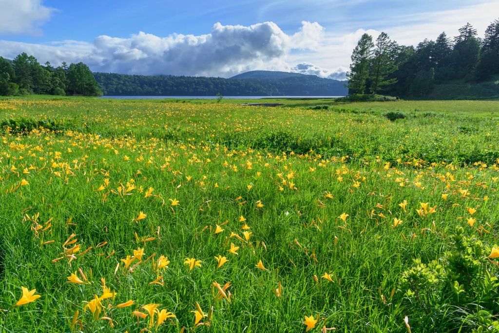
There are also vast plains and plateaus, atop which flowers like the goldenrod and dandelion tend to grow. Species of violet, anemone, and orchid are also fairly common. Lastly, the Oze Marshland is full of terrestrial plants like the Japanese wood poppy, daylily, hare’s-tail cottongrass, and white skunk cabbage, and aquatic plants like the Oze kohone.
The mammals of Gunma are concentrated among its mountain forests, and include Asiatic black bears, Japanese macaques, herbivorous species like the Japanese serow Sika deer, and smaller mammals like the tanuki and Japanese stoat.
Wetlands provide premiere destinations for birdwatchers, with the Yoshigadaira Wetlands home to over 60 bird species. Raptors like ospreys, golden eagles, and mountain hawks can be found around such areas, with Oriental ibises, mallards, and Mandarin ducks common in the Oze marshlands.
Also of note is the forest green tree frog, which breeds in the Yoshigadaira wetlands and can be seen—and heard—best during June.
The area of Gunma has long been known for its fertility and rural nature. In Japan’s Kofun period, specifically around the fourth century CE, Gunma and neighboring Tochigi Prefecture were known as Keno (or Kenu), meaning in Japanese some type of field. This was a reference to the region’s significance as agricultural bastions of the Yamato empire.
A century later, this area would be divided by the Kinugawa River into an Kamitsukeno and Shimotsukeno (as in, Upper and Lower Keno), and in 713 CE, those names were shortened to Kamitsuke and Shimotsuke. Kamitsuke eventually became Kōzuke, and Kōzuke, with its capital in what is now modern Maebashi and its most important Shinto shrine in modern Tomioka, would be the name of Gunma for quite some time afterwards.
In the late fifteenth to early seventeenth centuries, during what was known as the Sengoku Period, three different clans fought over Kōzuke’s lands. With the oncoming Tokugawa Shogunate toward the end of the Sengoku Period, large portions of Kōzuke were taken and split into han estates, a type of Japanese feudal system run by daimyo, powerful feudal lords. Evidently, agriculture was still a prominent business in the region, as was the breeding of horses.
Then, just five years after the 1868 Meiji Restoration, the abolition of the Han system turned these once-feudal estates into individual prefectures, which would be quickly merged into what is now Gunma Prefecture.
With this administrative change also came an economic change, as sericulture—the raising of silkworms to produce silk—and silk-spinning became the new prosperous industries, with a famous industrial site still preserved at the Tomioka Silk Mill.
Gunma prefecture is full of fantastic places to hike and climb. Here are some of the best hiking areas in the region to check out:
Mount Akagi, which is one of the 100 Famous Japanese Mountains, boasts reasons to visit in all seasons, whether it be its snowy peaks in the winter, multicolored foliage in autumn, bright green slopes and cool blue-green lake in the summer, or blooming wildflowers in the spring.

Its most famous summit is its tallest, the 1,828 m (5,997 ft) Mount Kurobi, whose trails contain all the aforementioned features characteristic of the mountain. The Mount Kurobi – Mount Komagatake Loop Trail is a popular way of reaching its peak. This hike takes around 3 to 4 hours to complete.
The simmering crater of the impressive Asama volcano is well worth a visit. However, note that the best trail for accessing Asama’s peak, which is a 6 to 7 hour hike, is located in Nagano rather than Gunma.
Here, rolling hills and green pastures give way to an alien-looking volcanic landscape, marked by deep gorges, ravines, and, at the top, the ever-imposing volcanic crater.
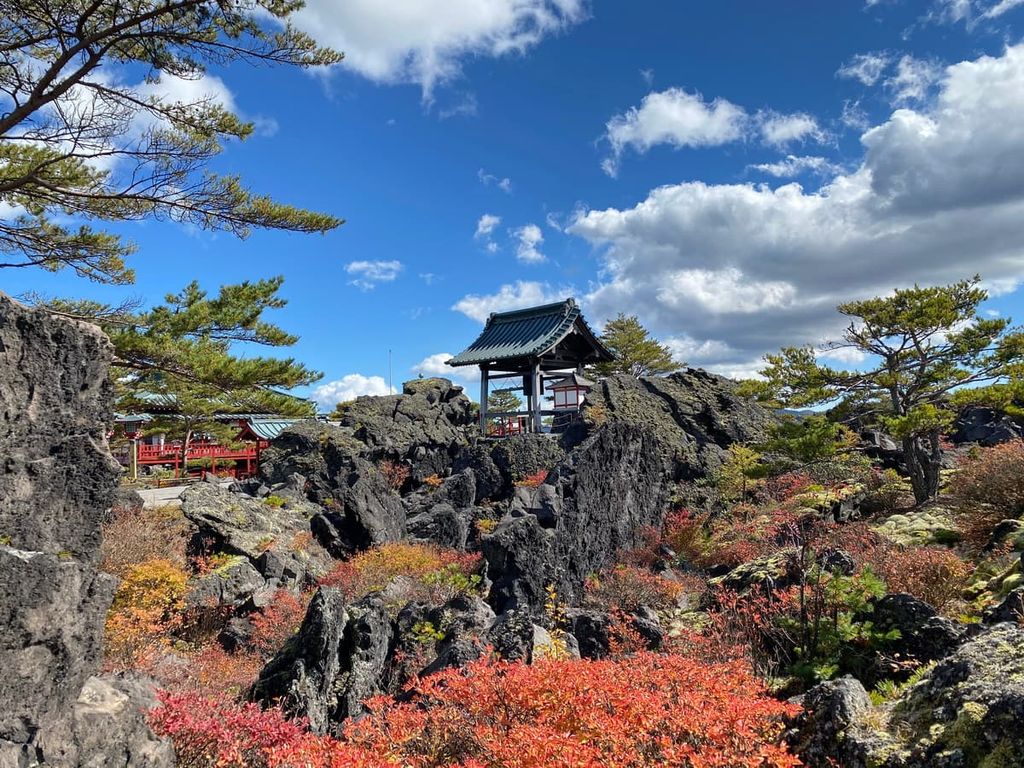
Haruna is another mountain with hidden gems within it, in this case a crater lake known as Lake Haruna and an open caldera. Surrounding these features is a hot spring town with numerous onsens taking advantage of the mountain’s volcanic characteristics.
The 4-hour hike to the summit beholds views of Mount Fuji on clear days. Even on cloudy days, the lush foliage and unique geological features of the mountain make a visit always worthwhile.

The 1,977 m (x ft) summit of Mount Tanigawa is a popular day trip for hikers and climbers, whether it's blanketed in snow or alive with the bright pink of cherry blossoms. Its beautiful rugged peaks have granted it the status as one of the 100 most famous mountains in Japan.
Attempts at rock climbing the mountain should be reserved to those with experience, as they can be rather dangerous. But the mountain’s hiking routes are generally safe, albeit prone to steep lurches and rocky ground. Note that there are two safety huts on the mountain including the Tanigawadake Kata no Koya, which is located right below the summit.

The full hike from the ropeway station to the summit and back can take around 4 to 5 hours.
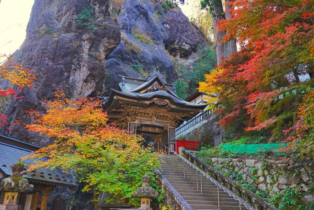
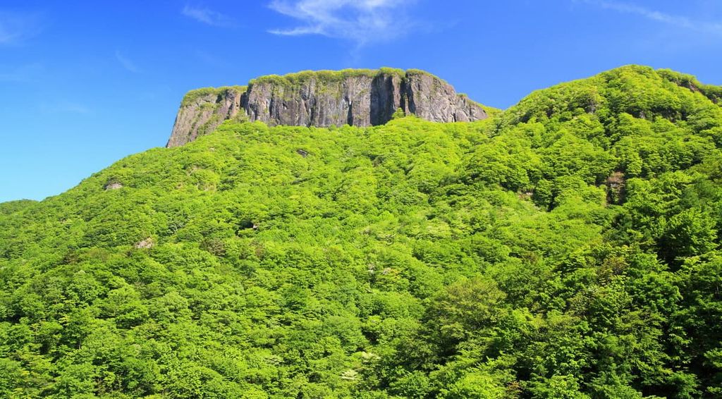
On the border between Gunma and Nagano is the exciting Myōgi-Arafune-Saku Kōgen Quasi-National Park. The park’s two namesake mountains, Myōgi and Arafune, make the park instantly recognizable, with the long, craggy spine of Myōgi forming a great wide arc over the landscape, and the steep, flat table of Arafune jutting out above the trees.
Myōgi has 3 peaks, of which the tallest, Hakuun, stands at 1,104 m (3,622 ft), with the others being Mt. Kindo and Mt. Kintori. There are plenty of trails on the mountain, with some ranging up to 5 hours long, and a popular starting point is the beautiful Myōgi Shrine. It should be noted, however, that the advanced trail up Hakuun and Kindo is considered extremely dangerous and should only be climbed by experienced mountain climbers.
Arafune stands at 1,423 m (4,669 ft) at its summit, and it is popular among climbers for its daunting cliffsides. Paths are well-marked in the region and offer amazing views of the twists and turns of the landscape, especially when the land is flush with greenery.
Nikkō National Park extends over 4 prefectures, including a swath over Gunma’s border with Tochigi that encompasses Gunma’s tallest mountain, Nikkō-Shirane. Alongside its volcanic peaks are thick broadleaf forests, scenic waterfalls and lakes, endemic wildlife, and highly esteemed cultural and religious sites, the most famous being the Nikkō Tōshō-gū Shinto shrine and Rinnō-ji Buddhist temple.
Hiking trails are plentiful here, including up to Nikkō’s many summits. To reach Nikkō-Shirane, you could either take the gondola up to the 2,000 m (6,562 ft) mark and take a quick hike to the peak from there, with a roundtrip totalling at 5 hours, or you could begin at the Lake Suganama trail to experience the entire stunning, forest-lined ascent on foot; however, the panoramic views of the landscape at the top are just the same either way.
The Nasu Mountain Range Traverse is, at its whole, a 12.9 km (8 mi) hike through the three major peaks of the Nasu Mountains, those being Mount Chausu and its volcanic crater, Mount Asahi, and Mount Sanbonyari. However, there are options to abbreviate or ease your journey via gondola along the way.
Furthermore, there is the 6.5 km (4 mi) Ichimanpo-no-Mori Forest Bathing Trail, a more relaxing hike through centenarian red pine forests and droves of hydrangeas and golden lilies.
Once a part of the aforementioned Nikkō National Park, Oze National Park became its own entity in 2007. It is now famous for its expansive and verdant Ozegahara Marshland, the clear blue Ozenuma Pond, and the picturesque cascades of Sanjo Falls. Oze also reaches into Gunma’s prefectural neighbors in the northern corner of Gunma.

There are dozens of hiking trails throughout the park, such as the Hatomachitoge Trailhead, a 6 to 8 hour hike that wanders past both Oegahara and Ozenuma on the way to Oshimizu marsh. Also notable are the higher-difficulty trails lead up the Hiuchigatake and Shibutu mountains, the Numayamatoge trailhead that leads to the 6 km (3.7 mi) path around Ozenuma pond, and the Miike trailhead that leads to Ozegahara Marshland.
The Sanjo waterfalls and other local cascades can also be conveniently accessed from Miike or the trailheads of Kozoudaira or Akatashiro.
For skiing and snowboarding enthusiasts, there are more than 20 ski resorts in Gunma Prefecture, which are located in the north of the region. It is also one of the main areas for skiing in the Japanese mountains.
The largest ski resort in Gunma Prefecture is Ogna Hotaka with more than 15 km (9 mi) of slopes and more than 5 ski lifts. It is also the largest of the nearest ski resorts to Tokyo.
Other major areas for skiing in Gunma Prefecture with more than 10 km (6 mi) of slopes and more than 5 ski lifts each include the following in descending order of size:
These are also the main ski resorts near Maebashi and Takasaki, the two largest cities in Gunma Prefecture.
Check the Gunma Prefecture ski resorts map as well as the larger Japan ski resorts map in the World Mountain Lifts section of the site. It includes information about open ski lifts / slopes in Gunma Prefecture in real-time with opening dates and hours. There are also year-round cable cars, funiculars, cog railways, aerial tramways, and all other types of mountain lifts.

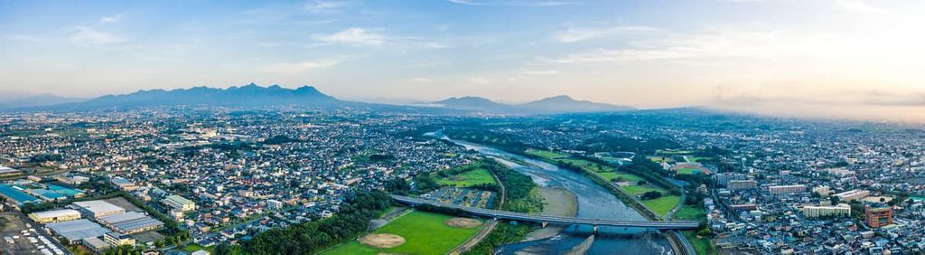
The major cities of Gunma, growing in and around its southwestern corner, may not be the region’s foremost attractions, but are nonetheless beautiful and lively places of culture, history, and recreation well worth a visit.
Owing to Japan’s excellent public transit system, these cities are accessible via Japan’s JR East railways, the easiest way to move about the country without renting a car, with stops at more or less any major city. Most of Gunma’s cities and notable sites can be reached in just a few hours from Tokyo, or even faster, if one opts for the bullet train, instead.
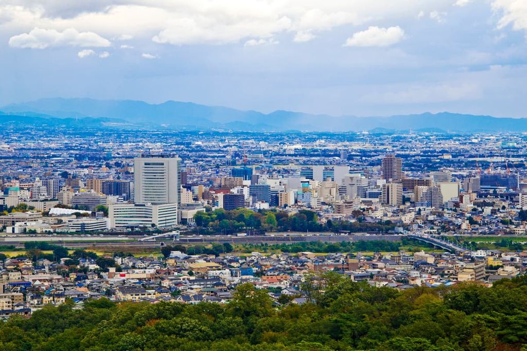
Gunma’s capital is the city of Maebashi, just slightly smaller than its biggest city with a population of around 335,000 people. Known for its intense greenery, riverside strolls along the Hirose and Tone, and rich literary history, Maebashi makes for a great trip for anyone exploring the neighboring mountain of Akagi or the nearby Haruna and Myōgi.
As the City of Greenery, Maebashi is famous for its lush landscaping and natural beauty, including the Shikishima Park with its sprawling rose garden and vast pine forest, the colorful Gunma Flower Park and its pristine pond, and the tree-lined Zelkova Boulevard. Trees and flowers also line the Hirose River, as well as historic and cultural monuments; the bed of the Tone River, meanwhile, is home to a waterpark, fountain, and waterfall.
One notable cultural institution is the Maebashi Museum of Literature, showcasing works of Maebashi’s many famous poets, who were often inspired by the stunning natural scenery of the area. Other sites of note are the Maebashi Castle, the shinto shrine Tōshō-gū, and the ruins of the Kōzuke Kokubun-ji Buddhist temple.
Just south of Maebashi is Gunma’s largest city, Takasaki, with over 370,000 people. Takasaki is located less than an hour away from the scenic shrine, lake, and mountain of Haruna, and all the hot springs that surround it.
Nearby is also the Tomioka Silk Mill, a well-preserved World Heritage Site, and the 42 m tall (138 ft) Byakue Kannon statue, which one can walk up for a great view of the city below. Inside the city, the statues and the green mountains provide a dramatic backdrop that can’t be missed.
En route to Byakue Kannon is Ishiharamachi, a traditional shopping street flanked by stunning older buildings, shops selling traditional handicrafts and Japanese cuisine, and cherry blossom trees that bloom every spring.
Castles like the Takasaki and the stone ruins of Minowa, Buddhist temples like the Shorinzan Daruma, and old shrines offer further opportunities to witness Gunma’s history and culture, while the arts can be seen at the esteemed Museum of Modern Art. Takasaki is particularly known for its red Daruma dolls, with a small museum and a yearly market dedicated to them.


Yes. Gunma has 264 named mountains. The highest is Mt. Nikko-Shirane at 2,578 m.
The highest mountain in Gunma is Mt. Nikko-Shirane, at 2,578 m.
Gunma has 264 named mountains.


