
Scan the QR code and open PeakVisor on your phone
Ghana is a West African nation home to 35 million people. Covering approximately 240,000 square kilometers (93,000 sq mi), Ghana’s territory spans from the Gulf of Guinea in the south to Burkina Faso in the north. A former British colony, Ghana was the first colonial nation in sub-Saharan Africa to achieve independence (1957). There are 516 named mountains in the country, though most of Ghana’s mountains are low elevation. The highest point, Mont Yaouatoutou, is 902 meters (2,959 ft), while the most prominent mountain in Ghana is Atiwiredu (844 m / 2,769 ft).
Ghana sits on the southern coast of West Africa, abutting the Atlantic Ocean, and, more specifically, the Gulf of Guinea. The nation’s capital, Accra, lies on this southern coastline. Ghana is bordered by Côte d'Ivoire (Ivory Coast) to the west, Burkina Faso to the north, and Togo to the east. Ghana is just north of the equator and is crossed by the prime meridian (which passes through the port city of Tema).
Ghana possesses a diverse geography characterized primarily by low plains and plateaus, punctuated by specific highland areas and dominated by a major river system, the Volta. Ghana’s landscape transitions significantly from the coast, moving inland (north). As a whole, the topography is subdued, with elevations largely below 500 meters.
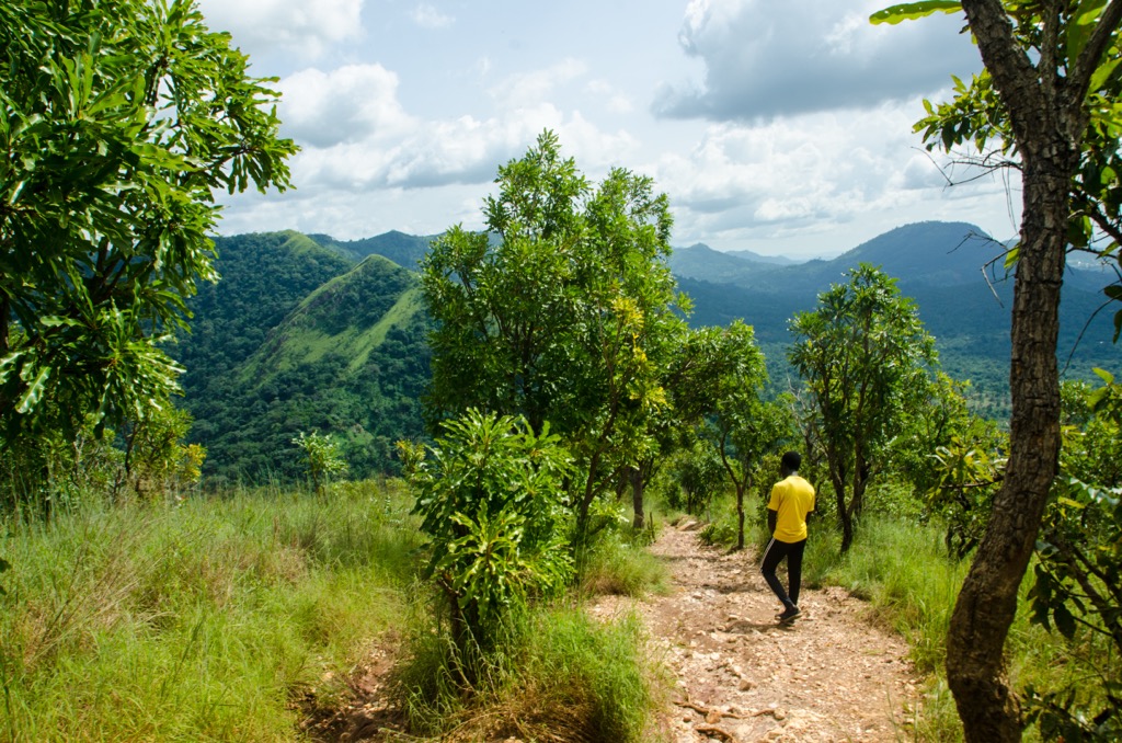
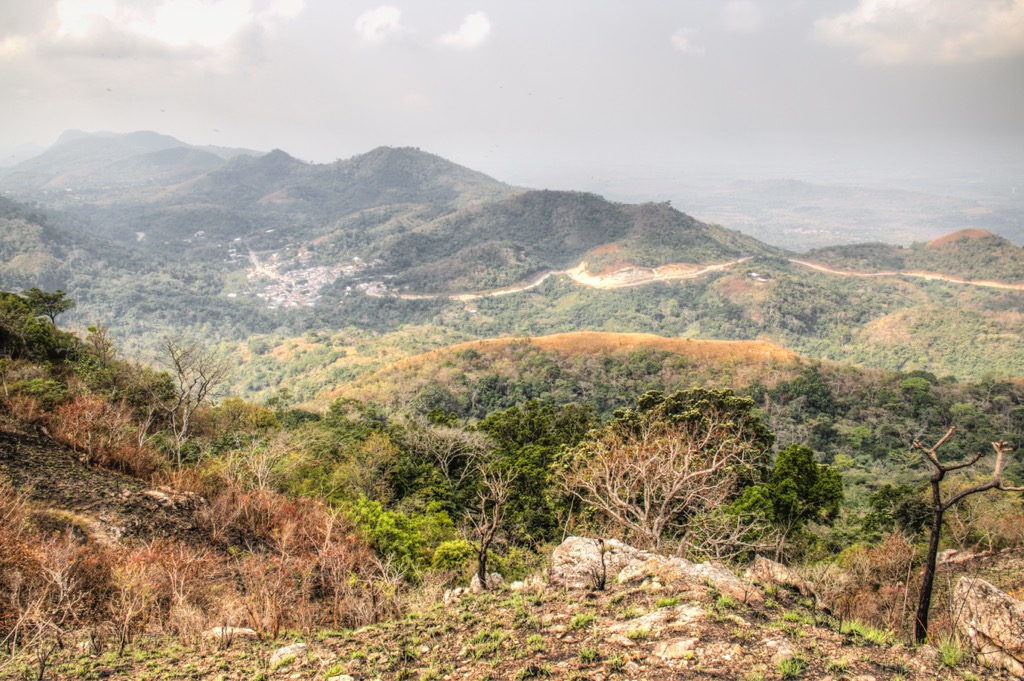
Despite the low elevations, Ghana features several distinct highland zones. The most prominent are the Akwapim-Togo Ranges, which extend northeastward from just north of Accra, the capital, along the border with Togo. Though gentle in nature, these hills, ridges, and valleys form the country's most significant mountainous terrain and highest peaks.
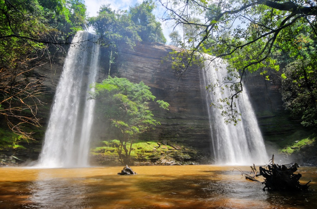
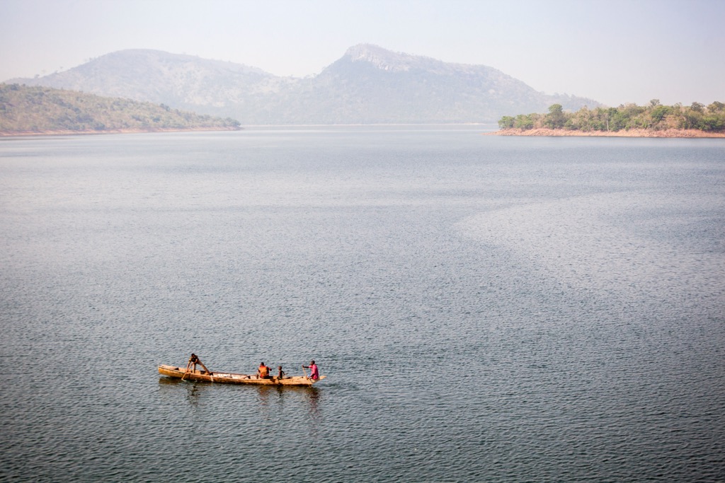
Within this system, near the Togo border, lies one of Ghana's most famous peaks, Mount Afadja (also known as Afadjato), which reaches an elevation of 557 meters (1,893 feet). Afadja is a popular tourist destination and the home of two tall waterfalls, Tagbo and Wli. At 80 meters (26), the latter is West Africa's tallest.
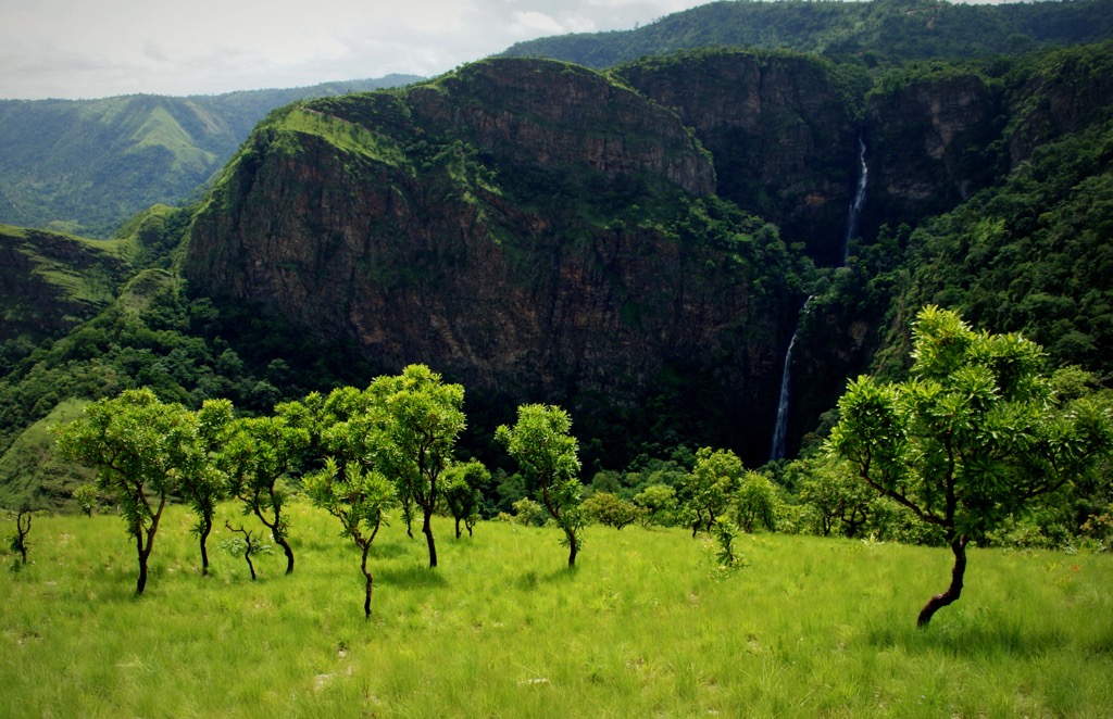
Afadja was formerly believed to be the highest mountain in Ghana, with an elevation of 855 meters (2,904 ft). However, recent exploration has indicated that it is far shorter (557 m) and that the true high point of Ghana lies on the Togo border, where elevations crest 900 meters (2,953 ft).
There are several points along the Ghana-Togo border where elevation may reach a high point. Nevertheless, in our database, based on PeakVisor’s 3D augmented reality of the entire Earth, the highest point in the nation is Mont Yaouatoutou at 902 meters [2,959 ft]. Its summit is shared with neighboring Togo. Togo has higher summits, the highest being Mont Agou [986 m / 3,235 ft], but these are also nearby, in the border region.
Another significant topographical feature in Ghana is the Kwahu Plateau, located in the south-central part of the country. This plateau forms a distinct south-facing escarpment, rising to elevations between approximately 450 and 760 meters (1,476 and 2,493 ft), and acts as a vital watershed, separating the Volta Basin from the southern forested regions and coastal drainage systems. In the far north, the Gambaga Escarpment marks the edge of another upland area extending towards Burkina Faso.
The southern edge of Ghana features a coastal plain, varying in width, characterized by sandy shorelines, coastal lagoons—such as the extensive Keta Lagoon in the far southeast—and estuaries. This plain gradually rises northward.
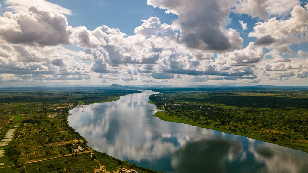
Dominating the central and eastern interior of Ghana is the vast Volta River Basin, a relatively flat or gently undulating lowland area drained by the Volta River and its main tributaries, the Black Volta, White Volta, and Oti River. This basin covers a significant portion of the country's landmass.
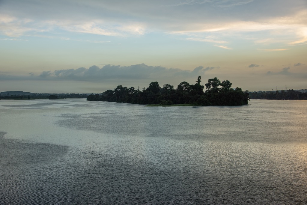
The Volta River system is perhaps Ghana's most notable geographic feature, draining roughly two-thirds of the country. Over a third of Ghana’s electricity is generated along the Volta. The construction of the Akosombo Dam on the river in the 1960s created Lake Volta, the world's largest artificial reservoir by surface area (8,502 sq km / 3,283 sq mi). This immense lake is critically important for hydroelectric power generation, inland transportation, and fisheries.
Several other significant rivers, including the Pra, Tano, Ankobra, and Densu, drain the southern forested regions directly southwards into the Gulf of Guinea.
Ghana’s climate is primarily tropical, varying markedly from south to north. Southern Ghana experiences a tropical monsoon or rainforest climate with high humidity, relatively stable temperatures, and two distinct rainy seasons (typically April-July and September-November).
The northern regions exhibit a tropical savanna climate with higher temperature variations, lower humidity, a single rainy season (usually May-October), and the influence of the dry, dusty Harmattan winds blowing from the Sahara during the dry season (November-March).
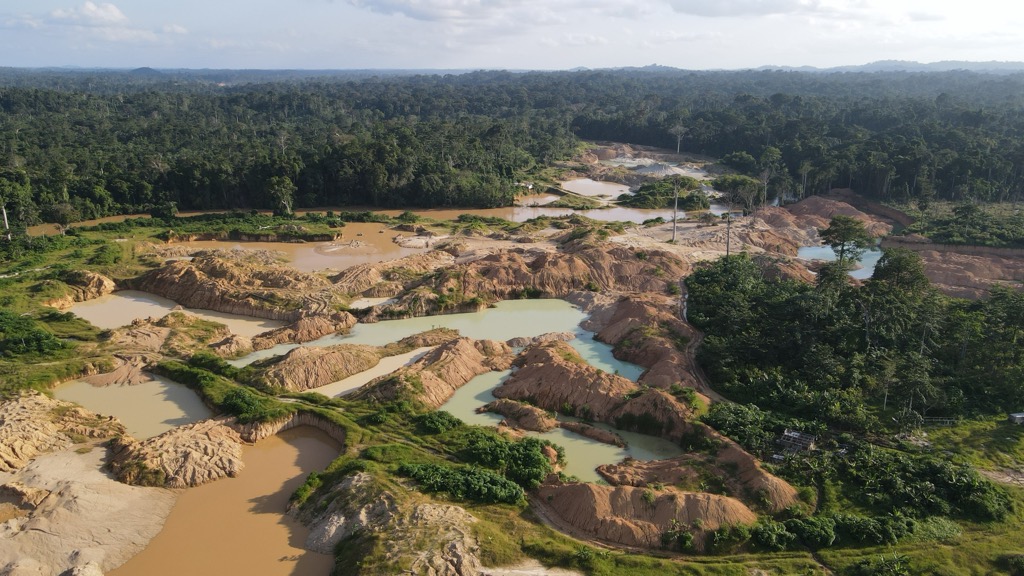
Ghana's geology is founded on ancient Precambrian rocks, primarily the West African Craton in the west and Pan-African mobile belts eastward. The craton features the economically vital Paleoproterozoic Birimian Supergroup (metavolcanics and metasediments), renowned for its extensive gold deposits.
Thus, Ghana is a major gold producer. The small nation mines far more gold than any other African country and is the world’s sixth-largest producer, after the much larger nations of China, Russia, Australia, Canada, and the United States. Ghana mined over 135,000 kilograms (297,850 lb) of gold in 2023, contributing to roughly 7% of GDP.
In the east, the Akwapim-Togo Ranges, Ghana's principal highlands, represent the Neoproterozoic Dahomeyan Belt. These ranges consist of highly deformed metamorphic rocks like gneisses, schists, and resistant quartzites formed during Pan-African continental collisions.
The vast Voltaian Basin dominates central Ghana. The prominent Kwahu Plateau and Gambaga escarpments are topographic features created by the differential erosion of Voltaian sandstones, which cap the older basement rocks. Along the coast, younger Mesozoic-Cenozoic sedimentary basins hold oil and gas deposits.
In summary, Ghana’s geological makeup consists of ancient cratonic blocks and Birimian rocks in the west, folded Pan-African metamorphic belts creating the eastern highlands, and overlying sedimentary deposits forming the extensive central lowlands.
Ghana's distinct vegetation zones can be divided broadly into three biomes—coastal, forest, and savanna. More specifically, vegetation ranges from coastal scrub, mangroves, tropical rainforest, and moist semi-deciduous forest in the south to Guinean and Sudanian savanna grasslands with scattered trees covering the Volta Basin and the northern territories.
The coastal mangrove swamps are dominated by Rhizophora species, lagoons, and patches of grassland and scrub, particularly on the drier Accra Region plains.
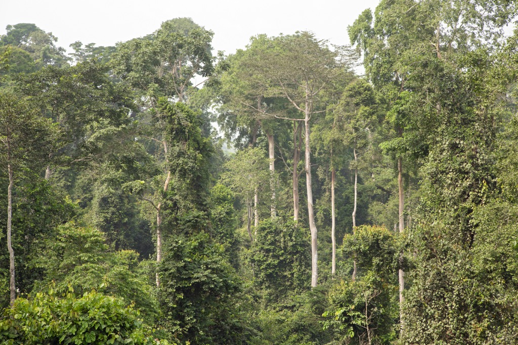
Inland, the southern part of the country falls within the Upper Guinea forest block, historically supporting dense tropical high forest (rainforest) and moist semi-deciduous forest rich in timber species like Odum (Milicia excelsa) and mahogany (Khaya species). This forest zone transitions northward into Guinea and Sudan savanna, characterized by grasslands dotted with fire-resistant trees such as shea (Vitellaria paradoxa) and baobab (Adansonia digitata).
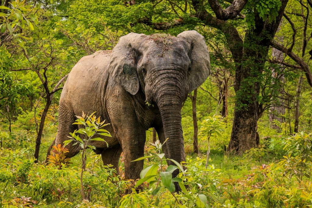
Fauna distribution mirrors these zones. The forests harbor species adapted to dense cover, including African forest elephant (Loxodonta cyclotis), bongo (Tragelaphus eurycerus), numerous duiker species, and a rich primate community including Roloway monkey (Cercopithecus roloway) and western red colobus (Piliocolobus badius).
The northern savannas support grazing herds like roan antelope (Hippotragus equinus), kob (Kobus kob), hartebeest (Alcelaphus buselaphus), and savanna elephant (Loxodonta africana), primarily within protected areas like Mole National Park. Predators such as leopard (Panthera pardus) occur in both habitats. At the same time, the lion (Panthera leo) is now nearly extinct in Ghana, though a small population still persists in the far north around Mole.
Birdlife is abundant, with over 750 species recorded, including forest specialists like hornbills and turacos, as well as savanna dwellers. Ghana is also important for species like the vulnerable yellow-headed Picathartes (Picathartes gymnocephalus).
While Ghana shares most of its species with neighboring West African countries, it holds critical populations for the Upper Guinea forest biodiversity hotspot. Strict endemism among vertebrates is relatively low, but notable examples exist, particularly among amphibians. The most prominent is the critically endangered Giant West African squeaker frog (Arthroleptis krokosua), endemic to a few forest reserves in southwestern Ghana. Conservation efforts in parks like Kakum National Park and Mole National Park protect what’s left of this ecological heritage.
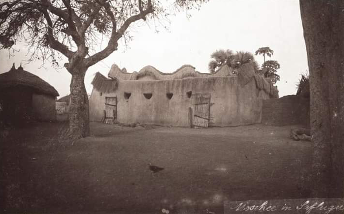
Like much of Africa, Ghana's human history extends back millennia, with archaeological evidence indicating Stone Age occupation and early agricultural settlements, like the Kintampo complex, from around 1500 BCE.
By the end of the first millennia, distinct kingdoms such as Dagbon and Mamprusi began to arise in the northern savanna regions, influenced by trans-Saharan trade. The earliest of these was the Bonoman, which emerged in the 11th century.
In the forested south, Akan-speaking groups formed states like Denkyira and Akwamu, culminating in the rise of the powerful Asante Empire centered at Kumasi from the late 17th century. The Asante controlled significant gold resources and trade routes, playing a major role in regional power dynamics and the trans-Atlantic slave trade.
European engagement began with the Portuguese arrival in 1471, leading to the construction of Elmina Castle (1482) and numerous coastal forts by competing European powers primarily for trade in gold and, later, tragically, enslaved Africans. Britain gradually gained dominance over the region, establishing the Gold Coast Colony in 1874 and extending control over Asante and the Northern Territories by the early 20th century. Colonial rule centered on resource extraction, particularly gold and later cocoa.
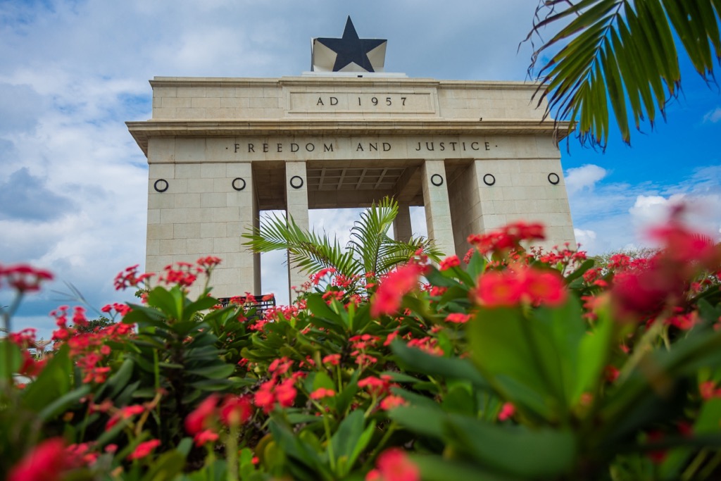
The mid-20th century witnessed a surge in nationalism, spearheaded by figures like Kwame Nkrumah and his socialist Convention People's Party (CPP). This movement culminated in Ghana achieving independence from Britain on March 6, 1957, becoming the first sub-Saharan African nation to do so.
Nkrumah's post-independence government pursued Pan-Africanist ideals but was overthrown in 1966, ushering in a period of political instability marked by several military coups and brief civilian administrations.

Stability began to return under military officer and aviator Jerry John Rawlings, who led coups in 1979 and 1981 and eventually oversaw the transition back to constitutional rule. Since the establishment of the Fourth Republic in 1992, Ghana has gained recognition as a stable multi-party democracy with consistent peaceful transfers of power.
Today, Ghana is divided into 16 administrative regions. These are Ahafo, Ashanti, Bono,
Bono East, Central, Eastern, Greater Accra (home to the nation’s capital, Accra), Northern, Upper East, Upper West, Volta, Western, Savannah, Oti, Western North, and North East.
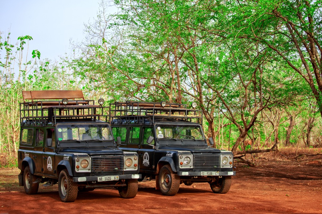
Ghana’s system of protected wilderness includes seven national parks, as well as a number of forest reserves, protected wetlands, and game preserves. The most notable national parks for tourists are Mole National Park, Kakum National Park, and Digya National Park.
Located in the Savannah Region in the north, Mole is Ghana’s largest national park (4,840 sq km / 1,869 sq mi). It primarily consists of Guinea savanna woodland and grassland ecosystems. Mole is Ghana's premier park for wildlife viewing, renowned for its significant population of African elephants (Loxodonta africana), often observable at close range, particularly during the dry season.
Visitors can also encounter buffalo, kob, hartebeest, waterbuck, roan antelope, warthogs, and diverse birdlife through vehicle or walking safaris. Mole’s accessibility and wildlife density make it a key tourist destination for savanna fauna.
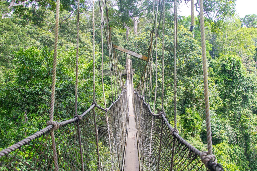
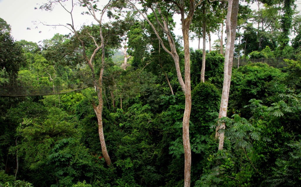
Situated in the Central Region near Cape Coast, Kakum National Park protects a vital area of Upper Guinea tropical rainforest. While the park is home to forest elephants, bongo, various primates, duikers, and rich birdlife, the dense vegetation makes ground-level wildlife sightings challenging.
Kakum is internationally famous for its Canopy Walkway, a series of rope and wire suspension bridges elevated up to 40 meters (131ft) above the forest floor. This structure is roughly 350 meters (1,150 ft) long, connecting seven tree tops and offering visitors a unique perspective of the forest ecosystem, focusing on the canopy environment rather than traditional megafauna viewing found at many other African national parks. It is one of only three such canopy walkways on the African continent.
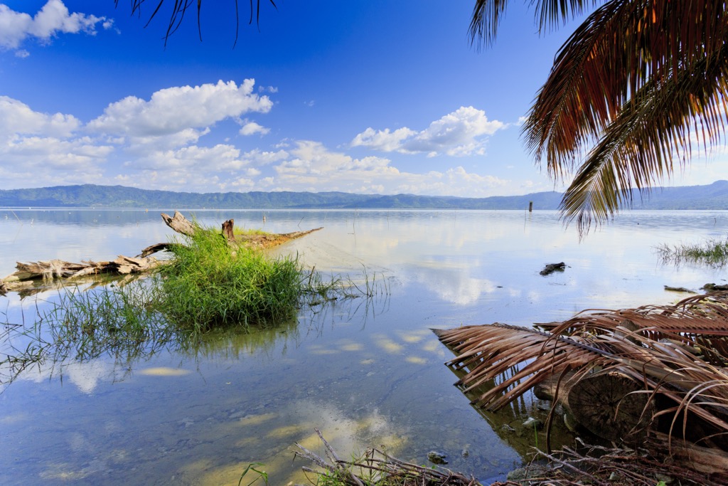
Ghana's second-largest park, Digya, is on the western shores of Lake Volta, spanning the regions of Bono East and Oti. Its landscape is a transition zone featuring Guinea savanna woodland, gallery forests, and an extensive lakefront. Historically rich in wildlife, it holds populations of elephants, buffalo, antelope, primates, and African manatees (Trichechus senegalensis) within Lake Volta.
Digya is significantly less developed for tourism than Mole or Kakum, and faces challenges with accessibility and encroachment. That said, it offers a remote wilderness experience focused on the lakeside setting and woodland habitats.
Ghana’s highest summit is a debated topic. Historically, it was believed to be Mount Afadja (557 m / 1,893 ft), a peak in the Volta Region that was often attached to a severely inflated elevation of 885 meters (2,904 ft). However, not only was this subsequently disproven, but points above 885 meters have also been marked further east and north, directly along the Ghana-Togo border.
PeakVisor’s mapping indicates the highest named point in Ghana is Mont Yaouatoutou (902 m / 2,959 ft) in the Oti Region. There is no known trail to this point. A hike would entail no shortage of bushwhacking and route finding. Bring lots of water, a reliable GPS, and a sturdy pair of legs.
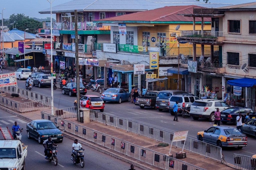
As Ghana's capital and largest city, Accra (pop. 5 million) is a vibrant political, economic, and cultural hub on the Atlantic Ocean. Visitors can explore Ghana's modern history at Independence Square (Black Star Square) and the Kwame Nkrumah Memorial Park.
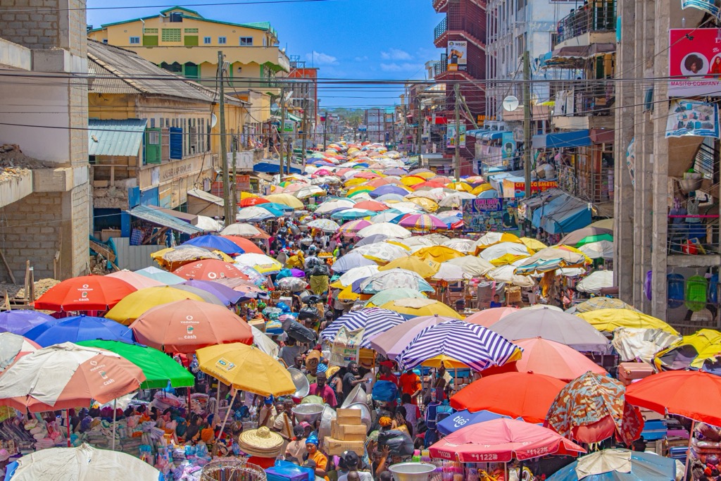
Other key sites include the bustling Makola Market, the historic Jamestown district, the National Museum of Ghana, and the lively Osu neighborhood, known for dining and nightlife. The nearby Labadi Beach offers coastal recreation.
As the capital of the Northern Region and the largest city in northern Ghana, Tamale is a major administrative, economic, and cultural center with an estimated population of around 370,000. It serves as a vital hub connecting southern Ghana with the Sahel region.
Tamale is significant as a center of ethnic Dagomba culture and offers visitors attractions like a bustling market, the impressive Central Mosque, and a cultural center showcasing local crafts. Tamale is roughly 150 kilometers (93 mi) from Mole National Park. There are closer settlements, like Damongo, but Tamale offers more extensive amenities and often serves as a good base for travelers exploring northern Ghana.
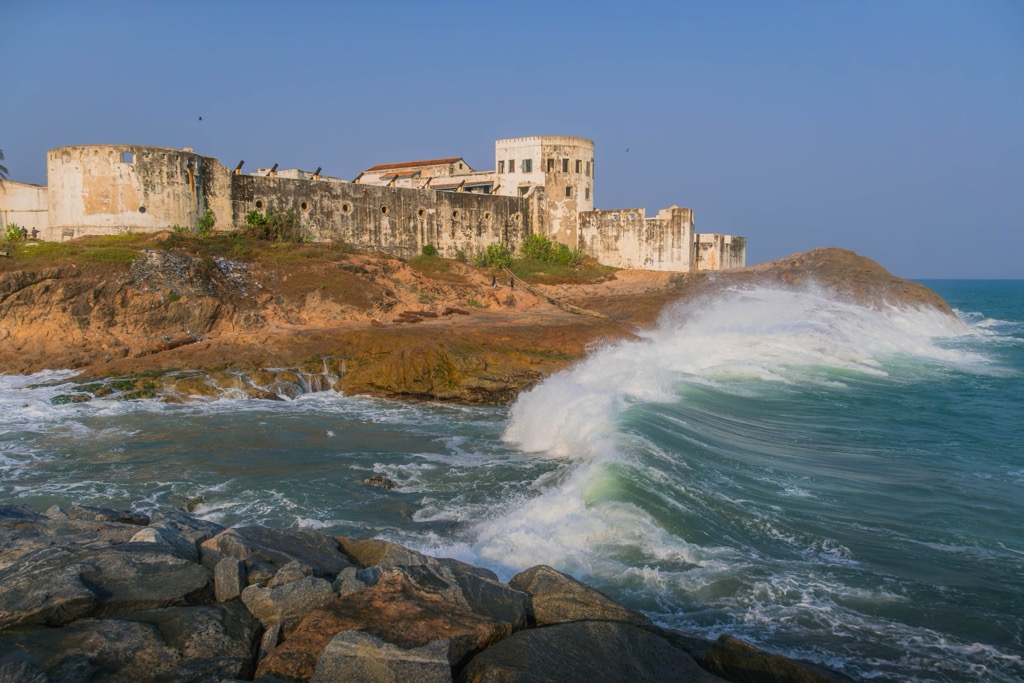
A historic city on the coast and capital of the Central Region, Cape Coast has an estimated population nearing 200,000. It holds profound cultural significance due to its central role during the European colonial era and the trans-Atlantic slave trade. It was an early landing point and hub for Christian missionaries.
The imposing Cape Coast Castle, a UNESCO World Heritage site with a poignant museum detailing the slave trade, is a primary draw. Nearby, visitors can also explore Elmina Castle (another UNESCO site) and experience the rainforest canopy walkway at Kakum National Park.
The historical capital of the Asante Empire and Ghana's second-largest city, Kumasi (pop. 3.6 million), serves as the cultural heartland of the Asante people and the capital of the Ashanti Region.
Tourists should visit the Manhyia Palace Museum (residence of the Asantehene ceremonial monarch and ruler of the Ashanti), explore the vast Kejetia Market, one of West Africa's largest open-air markets, and see traditional crafts at the Kumasi Centre for National Culture. The nearby Komfo Anokye Sword Site is the focus of an Arthurian-esque “sword-in-the-stone” legend.


.png)