
Scan the QR code and open PeakVisor on your phone
Denali is home to 121 named mountains, including 5 fourteeners. The highest is Denali at 6,191 m.
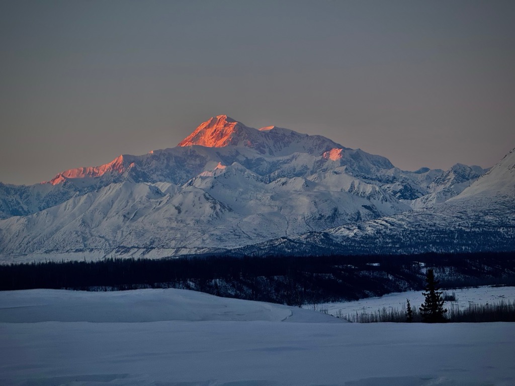
Denali is a borough located in south-central Alaska and is the administrative namesake of one of the most iconic mountains in North America. Denali (20,310 feet / 6,190 meters) is the tallest peak in North America and the largest in the world from base to summit, at 18,000 ft (5,500 m). Denali is protected within the Denali National Park and Preserve, which was established in 1917 and encompasses over six million acres. Denali’s proximity to the Arctic Circle means it sees 22-plus hours of functional daylight around the solstice (June 21st) but just a few hours during the long and cold winters. There are 121 named mountains in Denali. The highest and the most prominent mountain is Denali (20,310 ft / 6,190 m).
Denali Borough encompasses an area of 12,777 sq mi (33,092 ㎢), mostly along the northern half of the Alaska Range, which stretches approximately 400 miles (650 km) across south-central Alaska. It also includes the vast Taiga / boreal forest flatlands north of the Alaska Range. Healy is the largest town, despite having a population of less than 1,000 people.
The borough is mostly protected by—and famous for—the Denali National Park and Preserve, a 9,460 sq. mile (24,500 ㎢) wilderness area. At around 63°N latitude, Denali is well within the Arctic Circle and is among Earth’s coldest places. About 16% of Denali National Park is glacier, but the proportion is much higher on the Denali massif (the park and borough encompass vast, unglaciated taiga north of Denali).
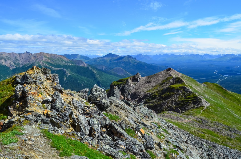
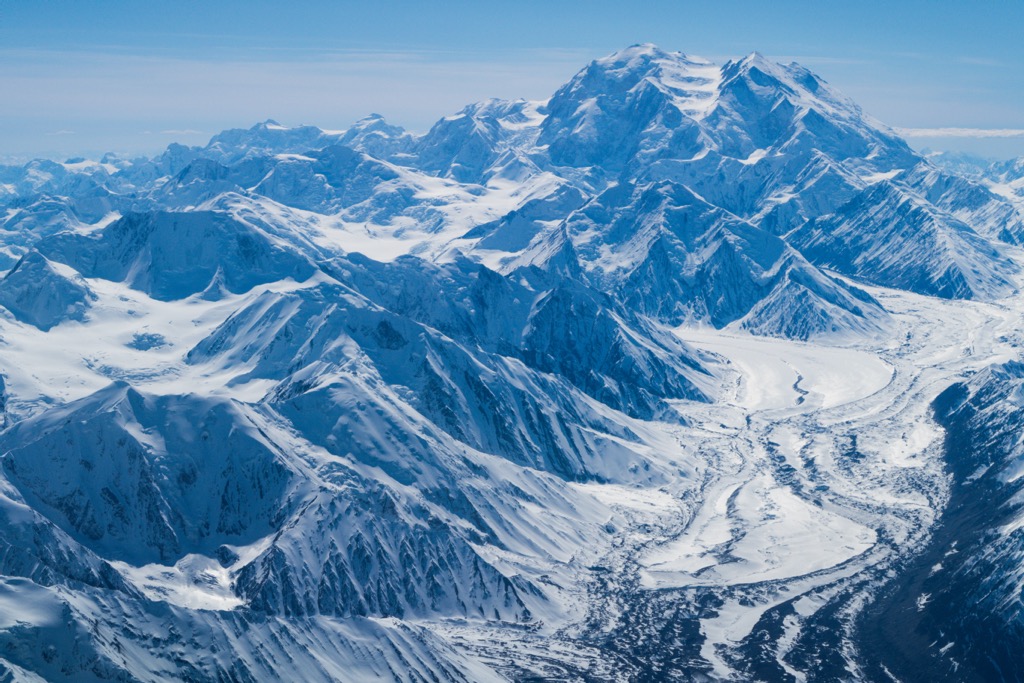
Speaking of massifs, Denali’s immense elevation puts it in another league of scale. Simply put, it’s a massive massif. Rising sharply from the surrounding tundra, Denali has an extraordinary prominence of 5,500 meters (18,000 feet), making it one of the largest vertical rises on Earth. Within the massif, Mount Foraker (17,400 ft / 5,304 m) and Mount Hunter (14,573 ft / 4,442 m) stand proudly alongside Denali. These three peaks form a block of mountains shaped like a kidney bean, extending approximately 75 miles (120 km) east to west and 50 miles (80 km) north to south.
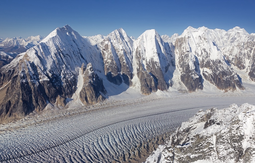
Vast glaciers also characterize the Denali region; the Kahiltna Glacier, the longest glacier in the Alaska Range, stretches over 44 miles (71 kilometers) and is just one of many long valley glaciers. The Ruth Glacier, another of Denali’s rivers of ice, features the Great Gorge, which stretches more than 10,000 feet below the ice (much deeper than the Grand Canyon).
The geology of Denali is a tale mainly of tectonic activity and glaciation. The Alaska Range was primarily formed through the ongoing collision of the Pacific and North American tectonic plates. The Denali Fault, a major strike-slip fault running parallel to the Alaska Range, is the result of the subduction of the Pacific plate under the North American plate and stretches down the American continent (it’s the same system of the San Andreas Fault in California). Over time, the compression and friction caused by the movement along this fault zone have pushed the mountains higher.
Today’s alpine and flowing valley glaciers are but a shadow of former eras. During the Pleistocene epoch, the entire range was blanketed by massive ice sheets, which carved today's deep valleys as they advanced and retreated.
Denali itself is primarily composed of granite. Like Yosemite Valley, thousands of miles south, the granite has been compressed and morphed by glaciation into extraordinary valleys. Take the Great Gorge along the Ruth Glacier. Its nearly mile-high walls form a valley not dissimilar from Yosemite. Meanwhile, the ice stretches as deep as 10,000 feet (3,000 m) in the depths of the Gorge. Denali is one of the final frontiers of rock climbing, and many of these valleys are purported to hold undiscovered trad routes that rival the world’s best (or at least longest) if you can find the right conditions.
The Denali region is a landscape of mainly snow, ice, and rock. However, the hardiest of species have adapted to survive here, and ecosystems have slowly made a comeback in the millennia following the last major glaciation.
Boreal forests of dwarfed black spruce, birch, and aspen trees now dominate the lower elevations of the mountains. Ascending from the lower valleys, the forests give way to vast swaths of alpine tundra, characterized by dwarf shrubs, grasses, and wildflowers that erupt in the short but intense summer.
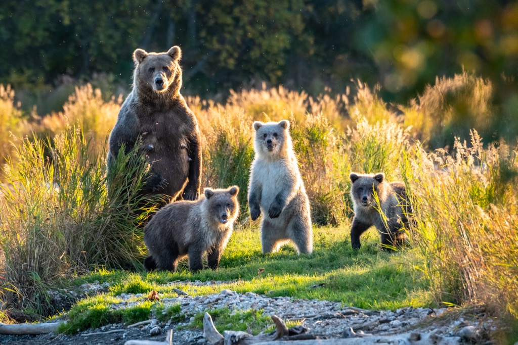
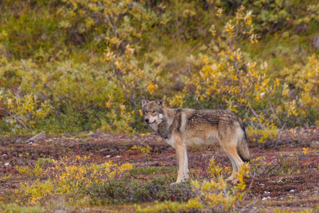
Regarding megafauna, the park is famous for its grizzly bears and wolves, which roam the tundra and lower slopes. Large caribou herds and moose provide sustenance for these predators, though grizzlies also eat plenty of plants and fish. The high alpine zones are home to Dall sheep and mountain goats, specially adapted to navigate the terrain.
The upper elevations above the tree line are largely barren, with only the hardiest plant species surviving in the harsh conditions of freezing temperatures, high winds, and low oxygen levels. For thousands of feet below the summit of Denali, nothing survives in temperatures that can freeze a pot of boiling water in mid-air.
The presence of large populations of migratory birds is also important. During the summer, golden eagles, falcons, and arctic warblers are a few species that flock to the area to breed and take advantage of abundant insects.
Most people know climate change brings longer summers and is melting Denali’s glaciers. Rising temperatures and shifting weather patterns threaten to disrupt the delicate balance of the area’s habitats. Still, the biggest story is a rapidly melting permafrost layer that is currently threatening park infrastructure and may, in the future, threaten to release massive amounts of greenhouse gases as frozen organic matter begins to decay.
The human history of the Denali Mountains dates back thousands of years to the Athabaskan people, who were descended from Asian hunter-gatherers. These first peoples arrived around 12 - 14,000 years ago and quickly dispersed throughout the Americas.
The Athabaskans were skilled hunters and foragers and relied upon caribou, moose, and other wildlife that populated the forests and tundra. The mountain was known as “Denali,” meaning “The High One” in the Koyukon language.
European exploration began in the late 19th century, with gold rushes drawing prospectors into interior Alaska. In 1896, the new arrivals named the peak "Mount McKinley" after then-presidential candidate William McKinley. The name remained controversial until it was federally changed back to Denali in 2015 (though, in Alaska, it was reverted to Denali much earlier).
The first successful ascent of Denali took place in 1913, led by Hudson Stuck. Shortly thereafter, in 1917, Denali National Park and Preserve was established. Today, Denali is a relatively popular mountain to climb, with over 1,000 climbers attempting any given year. According to McIntosh et al., the fatality to successful summit ratio was 3.08 as of 2008, and declining (less mortality). Denali is not a technical mountain to climb, but its Arctic perch and fearsome conditions have precipitated about 100 deaths since humans have attempted to climb it. About half of the deaths resulted from falls (the summit ridges are particularly exposed), while exposure and altitude sickness are additional culprits.
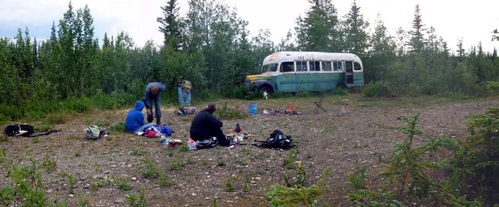
Christopher McCandless, the idealistic adventurer who was the subject of the book and film “Into The Wild,” perished in Bus 142, located just a few miles from the park entrance on the stampede trail (it’s just 6 miles from Healy). The bus gained infamy after the movie went big, and unruly tourists began trashing the site. Additionally, two more people died, as the location is remote and subject to the whims of a wild river.
The “hiking” on Denali is limited to the lower elevations. Check out PeakVisor’s Denali National Park and Preserve for information on popular hikes. I’ve outlined the Mount Healy hike below; then, we’ll dive into an overview of some of the standard mountaineering routes up Denali itself.
The hike up Mount Healy is one of Denali’s most popular. The Mount Healy Overlook Trail is maintained by the park service and originates on the Taiga Trail near the Visitor Center. This 5.4-mile round-trip hike takes an average of about three to four hours.
Upon starting, you’ll rise quickly out of a spruce forest as you make your way up switchbacks to a beautiful area above the treeline. The trail officially ends at a large open area with fantastic views to the south, but more experienced hikers can continue onward up Mount Healy’s ridges to the true summit.
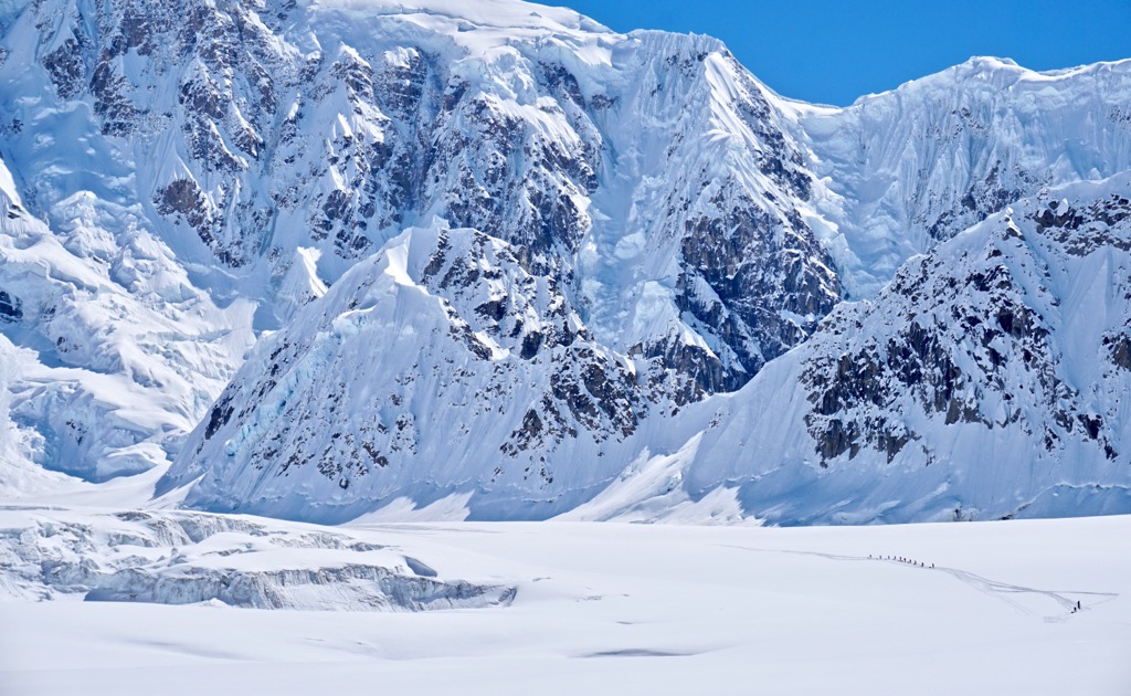
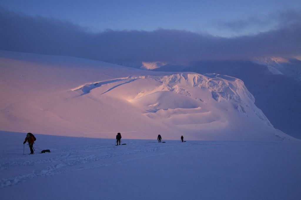
The West Buttress Route is by far the most frequently climbed route to Denali’s summit, accounting for more than 90% of all attempts. The West Buttress is the least technical way to ascend Denali; it doesn’t really require anything more than steep snow climbing, with an ice axe and crampons, as well as basic rope skills to protect against crevasse falls on the glacier.
However, let us be clear: this is an expedition climb. It takes about two weeks to climb the mountain. There are several camps, and climbers must allow time to acclimate. Despite being the most straightforward route, the high altitude and extreme weather still make it a serious mission. Nevertheless, if conditions are moderate, Denali can be a good mountain to develop expedition climbing skills for future climbs in, say, the Himalaya.
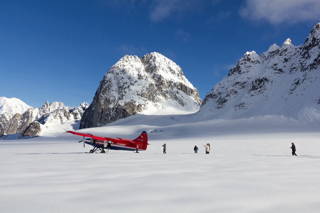
Starting at Kahiltna Glacier Base Camp (7,200 ft / 2,200 m), climbers navigate through heavily glaciated terrain, past Camp 1 and up to 14,000-foot camp. The most challenging part of the route is the steep snow climb up the Headwall (16,000–17,200 ft / ~5,000 m), followed by the narrow, exposed Pig Hill and the final ridge leading to the summit. Check out this virtual tour from the American Alpine Institute for an in-depth account and photos of the journey.
The Muldrow Glacier Route is the original route taken by the first successful summit team in 1913. The Muldrow Glacier Route is less traveled due to its relative inaccessibility and greater complexity, as it requires crossing dangerous rivers and remote wilderness before even beginning the ascent. The route offers a more isolated experience of Denali but demands a high level of expeditionary skill.
Unlike the West Buttress, this route approaches Denali from the north side. Climbers begin on the McKinley River and follow the Muldrow Glacier to the mountain’s north slopes.
The route then passes through the Karstens Ridge and Pioneer Ridge before reaching Browne’s Tower, where it joins the Harper Glacier near Denali Pass. From Denali Pass, the route joins the West Buttress summit ridge to the top.
Due to the “surging” of the Muldrow glacier in recent years, Denali’s original route is becoming even more committing. Depending on climate change and the glacier's behavior, it may or may not be possible/advisable to do this route in current/future conditions. But it will always be a historic route.
The West Rib Route is a more technical and direct alternative to the West Buttress. It diverges from the West Buttress at 11,000 feet, ascending steeper slopes along the West Rib, where technical rock and ice skills are requisite. The route crosses several high-angle snow slopes and vertical sections of ice.
Climbers typically set up camp on Kahiltna Horn and continue along the steep ridgeline before reaching the summit ridge, where the West Rib rejoins the final section of the West Buttress.
According to Bradley Washburn, who pioneered the West Buttress route, the West Rib is “so continually steep and difficult, and so exposed to the full force of the southwesterly storms that none but the most uniformly experienced and powerful team of climbers should even think of attempting it.”
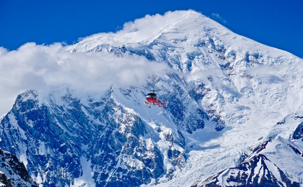
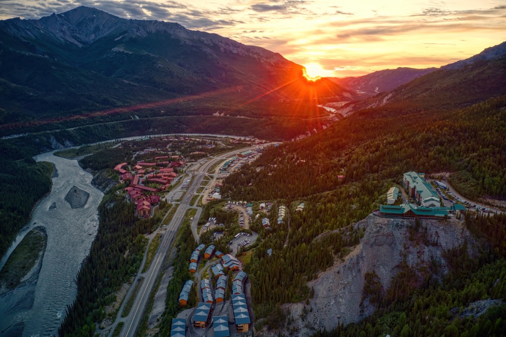
Denali Park Village is essentially a collection of hotels, lodges, and shops located around the park’s entrance. While it is not a traditional town, it functions as a hub for visitors to Denali National Park. It offers easy access to the park’s visitor center and shuttle buses. Here, you can access a range of tours, such as wildlife viewing, hiking, and flightseeing from the park’s small airstrip.
As a side note, Healy is just 11 miles north and offers cheaper accommodation than the village.
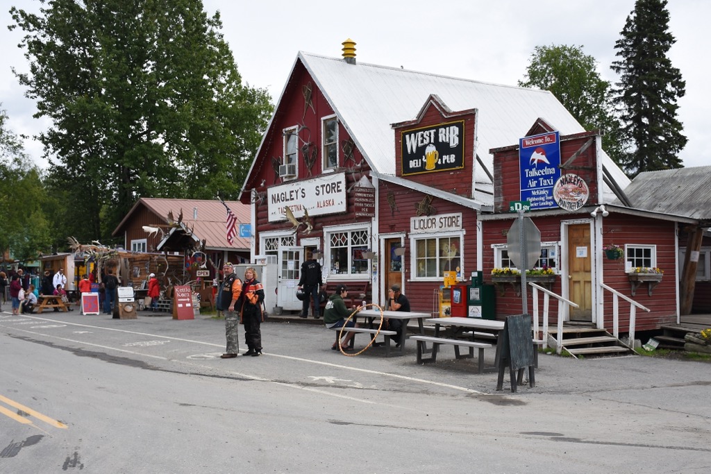
Talkeetna (pop. 1,100) is the most famous town near Denali National Park and is a gateway for climbers attempting to summit Denali. This quirky, historic town is located about 150 miles south of the park entrance—about halfway between Anchorage and the park entrance—and straddles the confluence of the Susitna, Chulitna, and Talkeetna Rivers. On clear days, the town offers stunning views of Denali, but the mountain is infamous for being shrouded in clouds much of the time.
Although the town is small, it is home to some good outdoor shops and a great craft brewery, so it’s a popular place to stay near Denali. Talkeetna is also the starting point for most Denali climbing expeditions, with bush planes taking climbers to the Kahiltna Glacier base camp from the (relatively) large Talkeetna Airport.
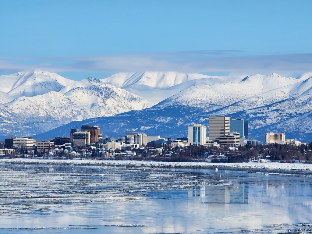
Denali National Park receives about 500,000 visitors annually, most of which will pass through Anchorage (pop. 287,000), Alaska’s largest city. Anchorage is nestled between the Chugach Mountains' snowy peaks and the chilly waters of the Cook Inlet. Anchorage is Alaska's economic and transportation hub, with nearly 40% of the state’s population calling it home. The city is less than four hours by car from the Denali Park entrance.
In town, visitors can explore the Anchorage Museum at Rasmuson Center to get an idea of Alaska’s rowdy history before venturing further afield. Even within the city, Anchorage is known for its wildlife; it’s not uncommon to see moose wandering through the streets.
In addition to its proximity to Denali, Anchorage provides access to vast wilderness just minutes from its center, with hiking, biking, and skiing within shouting distance. The Chugach State Park is just east of the urban area of Anchorage. Alyeska Ski Resort is 50 minutes by car, on the edge of the Chugach, further east from the park. The heart of the Chugach Range offers some of the world’s best heli-skiing and backcountry skiing, for those interested in pushing the limits of snowsports. Winters are dark, so spring is the best time to ski. In contrast, summer offers nearly 24 hours of daylight.


14er
ultra
glacier
alaska-13ers
fred-beckey-great-peaks
alaska-ultras
14er
ultra
alaska-13ers
alaska-ultras
14er
ultra
glacier
alaska-13ers
fred-beckey-great-peaks
alaska-ultras
14er
ultra
alaska-13ers
alaska-ultras
ultra
glacier
fred-beckey-great-peaks
alaska-ultras
Yes. Denali has 121 named mountains. The highest is Denali at 6,191 m.
The highest mountain in Denali is Denali, at 6,191 m.
Denali has 121 named mountains.
Denali has 5 fourteeners — peaks above 14,000 ft (4,267 m).


