
Scan the QR code and open PeakVisor on your phone
Charleston County is home to 5 named mountains. The highest is Windsor Hills at 14 m.
If you count both its land and water, Charleston County is the largest county in South Carolina, USA. The area comprises a low-lying belt of lush swampland and estuaries along the South Carolina coast. The county seat, Charleston, is the largest city in South Carolina and one of the most important cities in American history. You won’t find anything resembling a mountain here – the highest point in the county, Windsor Hills, sits 46 ft (14 m) above sea level. The nearest mountains are the Appalachians, which sit over 200 miles (322 km) to the northwest. However, outside of the bustling colonial city of Charleston, the landscape is full of dark, mysterious swamps, beautiful rivers, and exotic wildlife. If you’re looking for adventure, leave your crampons at home. But don’t despair; there is plenty of natural beauty to explore around Charleston.
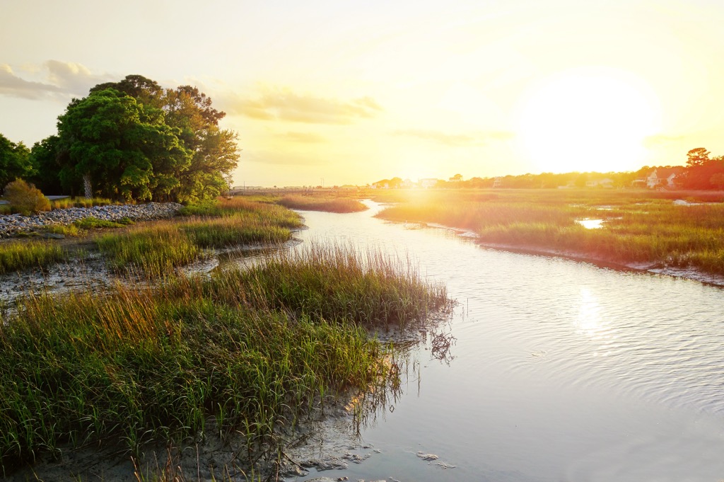
Charleston County is a landscape of estuaries and swamps. The county’s area is about two-thirds land to one-third water. When you add the total land area, rivers, and intertidal zones up, it’s the largest county in the state.
Charleston sits in the middle of a vast delta and the surrounding landscape is defined by its waterways. Everywhere you look, you’ll find a river, creek, or channel. Waterways range from fresh to salty, with plenty of brackish systems in between. The four largest rivers are the Stono, Ashley, Cooper, and Wando.
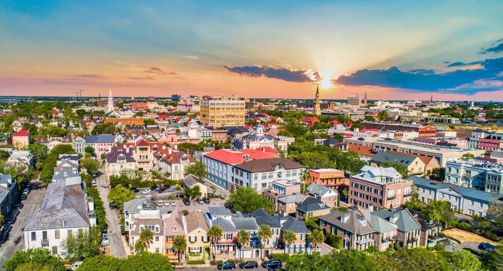
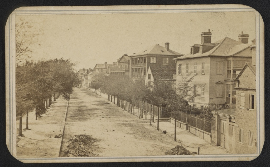
Charleston is the most populous city in South Carolina and one of the oldest in the US. The neighboring coastline is dotted with small uninhabited islands and old stone forts.
Don’t expect sweeping areas of wilderness around Charleston. But there are many (mostly private) wildlife reserves in the swamps and forests, and even some public land. The biggest and most intruiging natural area around Charleston is Francis Marion National Forest. Others include Caw Caw Interpretive Center, Dungannon Plantation Heritage Preserve, Cypress Gardens, and Santee Coastal Reserve.
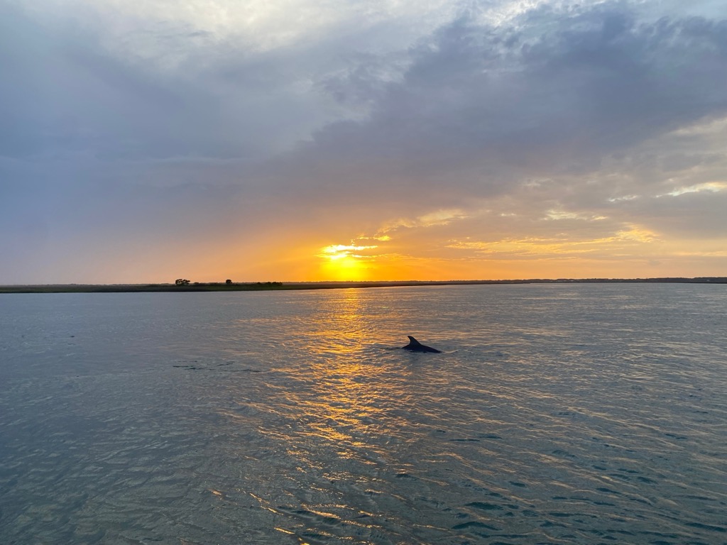
There’s not much vertical around here. In fact, the landscape is almost entirely flat and barely above sea level. But there are tons of places to hike, bike, or boat. The best way to explore the expansive landscape around Charleston is probably by kayak or paddleboard. The deep, dark swamps and forests around the coast provide habitat for many fascinating creatures. You can easily spot tons of reptiles (especially alligators), dolphins and manatees, and around 270 species of birds.
We’ve already discussed the fact that there are no mountains near Charleston County. The area around Charleston is all about water. If you’re standing on land, you’re probably not far from a water source.
All that water flows out of the faraway foothills of the Appalachian Mountains to the northwest. The Appalachians are the most significant geological feature on the East Coast. They sprout every major river from Georgia to Maine and cross over 1,500 miles (2,500 km). So, despite being far from the Atlantic Coast, they still shape the area around Charleston.

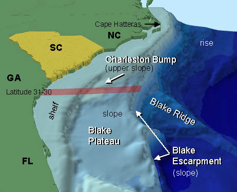
On a larger scale, Charleston is located on the edge of North America's continental shelf. In satellite images, the ocean floor suddenly drops away at the coast before stepping down again to a lower plain.
This lower plain is called the Charleston Bump. It directs the Gulf Stream upward, concentrating nutrients and creating a habitat for marine life.
If you visit Charleston thinking about high points, you’ve got the wrong idea. But if you’re a backyard naturalist, you’ll be thrilled. Just turning over a rock here is bound to reveal some brightly-colored amphibian, snake, or bug. And every murky river is undoubtedly full of turtles and alligators.
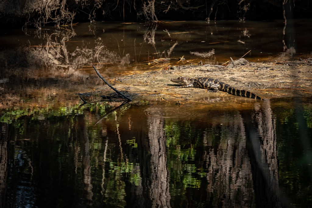
Let’s start with gators. If you’ve never seen one, alligators are pretty amazing. It’s a little like seeing a tyrannosaurus rex taking a nap on a golf course. No wonder they’re the unofficial symbol of the American South.
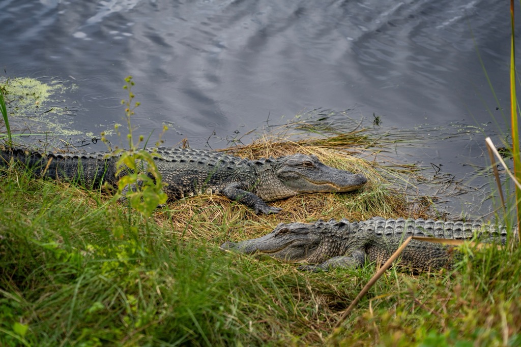
The American alligator is one of two remaining species of alligator in the world. They can measure up to 15 feet long (4.6 m) and weigh 1,100 pounds (499 kg). They eat large animals like deer whole. They’ve been around for at least two million years, cruising the swamps and eating just about anything they can snatch up.
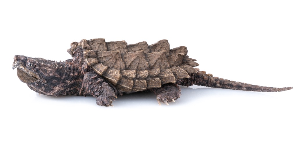
Swamps are full of strange, prehistoric-looking animals. Take the alligator snapping turtle, for example, which is reported to grow to over 400 lbs (181 kg) and can live well over 100 years. Individual specimens have been reported to live over 200 years, emerging from the swampy depths covered in moss and molluscs. Another is the amphiuma, a salamander that can grow up to four feet long (1.2 m).
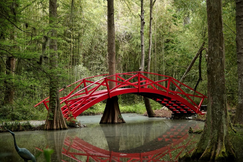
These swamp ecosystems are truly unique in the United States. If you get a chance, be sure to tour a local plantation reserve for a closer look at some of the weirdness in the coastal jungle.
As you get closer to the coast, the freshwater in rivers and creeks mixes with the ocean and turns brackish (mixed salt and fresh water), becoming an estuary. These environments are some of the most biologically productive on Earth.
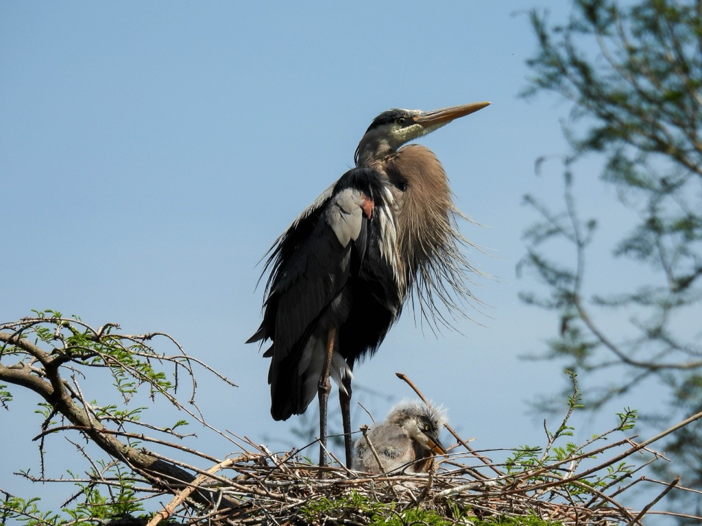
Estuaries produce a huge number of prey species, such as fish and shellfish, which form the foundation of a food web. Those prey species draw in predators, including everything from shorebirds to dolphins to snakes and otters. The estuaries around Charleston are famous for dolphin watching and birding and are also prime fishing spots.
In fact, some of the best outdoor adventures you can have around Charleston are by boat. There are free (or cheap) places to launch boats all around the city. Ashley River is a good spot to find alligators, and you can usually spot dolphins around Limehouse Bridge Landing. Lake Marion and Lake Moultrie are also great for wildlife watching and fishing. Plenty of guides offer dolphin tours by boat or kayak around Charleston.
Charleston County has a deep history, including some of America’s brightest and darkest moments. Outside of New England, Charleston is probably the most influential city in American history. It played a significant role in the American Revolution and the Civil War and was one of the most prominent influences on the American slave trade for two centuries.
Charleston’s darkest moments involve the human slave trade. After building the city in the late 1600s, its founders started exporting enslaved Native Americans to the Caribbean. By the mid-1700s, Charleston had become the capital of the slave trade in the Americas. The city imported about 40% of enslaved Africans to North America.
Unfortunately, they became extraordinarily wealthy doing it. The financial incentive of slavery was a huge factor in starting both the Revolutionary and Civil Wars.
Naturally, the idea of “taxation without representation” imposed by the British didn’t sit too well with the wealthy plantation owners of the South. So, South Carolina was enthusiastically in favor of American independence. During the war, the British repeatedly attacked the town, hoping to hurt the American economy.
After the war, Charleston flourished again. The city consistently had a black majority, which speaks to how universally popular slavery was among the white ruling class. South Carolina vehemently opposed the North in its attempts to abolish slavery. This ultimately led South Carolina to secede from the United States, sparking the Civil War. The rest of the South followed.
The Union still had troops stationed in Charleston Harbor at Fort Sumter, which resulted in the newly-formed Confederacy bombing the fort. Today, this is considered the first battle of the Civil War. If you are interested in history, you should definitely take a ferry to Fort Sumter for a tour.
Despite the lack of hills, Charleston has some incredible natural landscapes and plenty of cool things to explore. And if you’re willing to drive a few hours, your options open up considerably. Here are the best places to experience nature around Charleston.
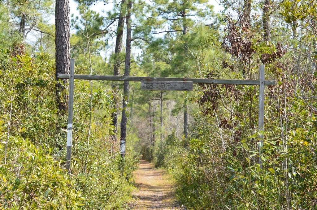
Francis Marion National Forest is a vast swath of subtropical conifer forest just north of Charleston. It is named for Francis Marion, the “Swamp Fox,” who waged guerrilla war on the British during the Revolutionary War.
The forest is one of the state's largest public land areas. It has hunting and fishing spots, many hiking and cycling trails, and a few campgrounds. The I’on Swamp Interpretive Trail is a short but sweet walk of about two miles (3.2 km).
The Awendaw Passage on Palmetto Trail is a little longer, totaling nine miles out and back through pine forest. The Carolina Bay Hike is another section of the Palmetto Trail that’s popular for cycling. It runs about 11 miles (17.7 km) through deep, dark woods and makes for a fun, fast bike ride.
You can also find some of the only remaining wilderness areas in South Carolina in Francis Marion. These places have no infrastructure—no roads, power lines, or buildings. They’re some of the most pristine, untouched, and wild places in the American South.
Caw Caw Interpretive Center is a privately owned wildlife refuge just south of Charleston. It covers a large expanse of hardwood forest and swamps, with lots of elevated walkways. It’s the perfect place to start learning if you’re interested in ecology and wildlife. The area is full of wild critters: deer, otters, bald eagles, and alligators are all easy to spot. Bring a pair of binoculars!
Many of Charleston’s historical plantations have been converted into public nature reserves. These are some of the best places to see wildlife and experience swamp ecosystems. Dungannon Plantation Reserve is a state-owned wildlife management area that covers around 600 acres (243 hectares) of pristine swampland and forest. There are interpretive trails and guided tours through the area, and you’re almost guaranteed to see some good wildlife along the way.
If you want real mountains, you’ll have to take a drive. But that’s no big deal because Great Smoky Mountains National Park is just a few hours’ drive from Charleston. The Great Smoky Mountains are an East Coast spectacle; they’re one of the largest national parks east of the Mississippi River.
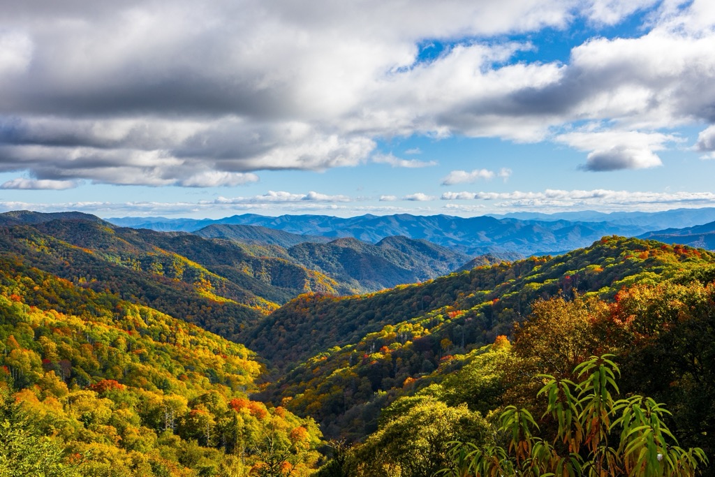
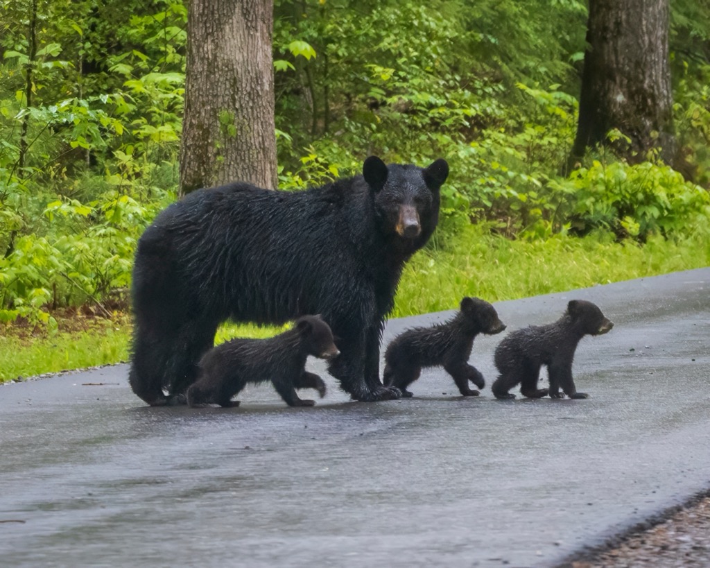
The park lies on the Tennessee-North Carolina border, covering over 500,000 acres (202,343 hectares) of the Blue Ridge Mountains, a subrange of the Appalachian Mountains. For the East Coast, this is about as wild and untamed as it gets. The park is full of wildlife, including black bears, and 848 miles (1,365 km) of hiking trails to explore. The most famous is the Appalachian Trail (or AT), a gigantic through-hike covering over 2,200 miles (3,541 km) along the East Coast. Great Smoky Mountains National Park sits near the southern trailhead, where most hikers start the trek.
But if you’re not ready for a six-month time commitment, there are plenty of shorter hikes around the park. Most of the most scenic (and strenuous) hikes sit near the crest of the Blue Ridge Mountains at the Tennessee border. Be sure to check out Peregrine Peak, Alum Cave to Mount LeConte, and the Charles Bunion section of the AT.
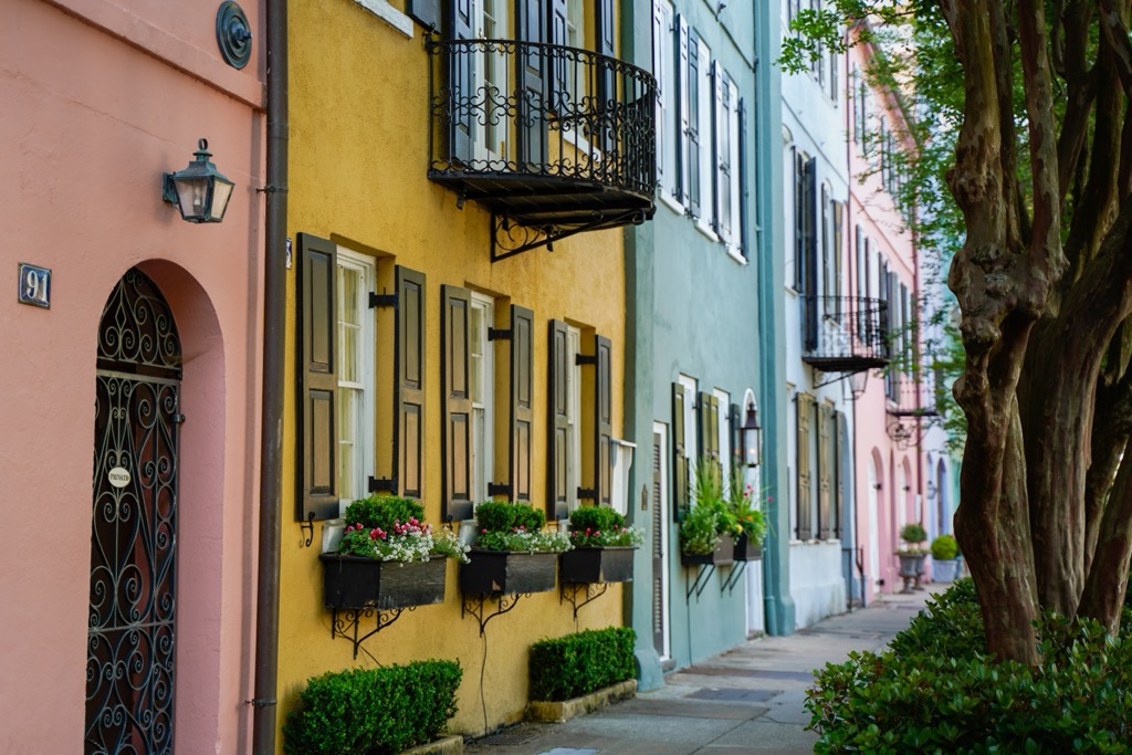
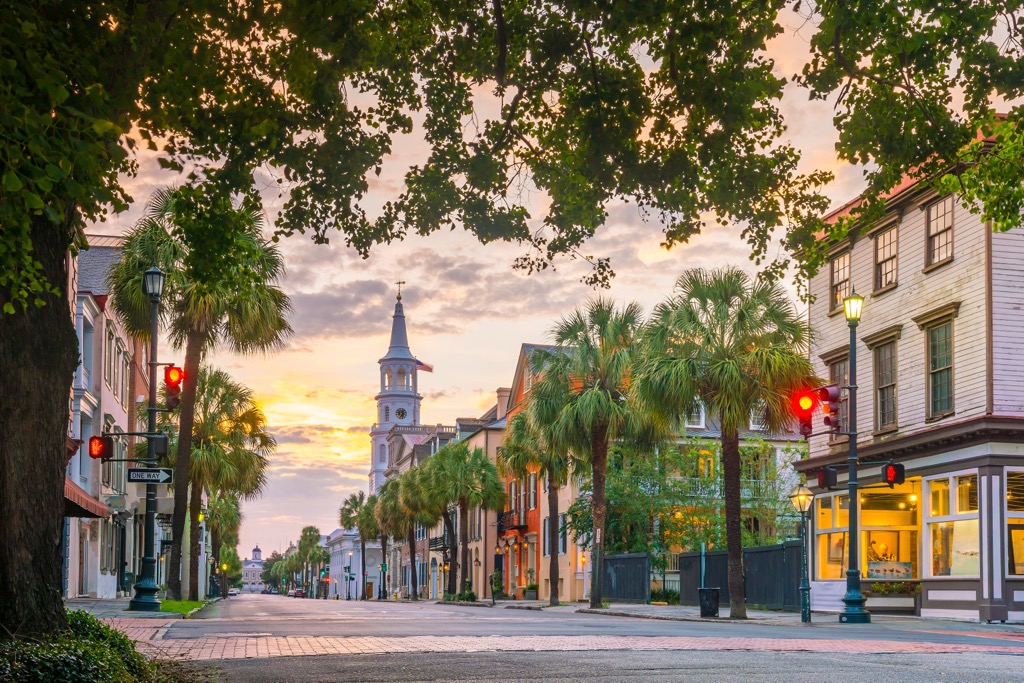
Charleston is the seat of Charleston County and one of the oldest cities in the United States, with three and a half centuries of history. Its colonial architecture, great food, and deep history draw visitors year-round. It’s the most populous city in South Carolina, with an urban area of almost 700,000 people. The city’s surroundings include sandy beaches, semitropical forests, swamps, and historical forts. You can take a ghost tour around the old town to see some historical buildings or hop on a ferry to Fort Sumter to see the harbor.
Downtown Charleston is a fantastic walking area full of great bars and restaurants. The city has a multicultural influence; you can find top-notch cuisine from just about anywhere. But the southern food, barbecue, and seafood are the specialty. Check out Lenoir, Lewis BBQ, and Bowen’s Island for a little of each.


Yes. Charleston County has 5 named mountains. The highest is Windsor Hills at 14 m.
The highest mountain in Charleston County is Windsor Hills, at 14 m.
Charleston County has 5 named mountains.


_by_Sam_Stukel,_USFWS_(52459090278).jpg)
_-_H.C._Foster,_photographer,_Charleston,_S.C_LCCN2016652269.jpg)