Elevation is the altitude of a place above sea level.
146 m
Prominence
Peak’s prominence is the least vertical to be covered to get from the summit to any other higher terrain.
Proportional Prominence889 m
Munro
Mountains in Scotland with a height of over 914 m / 3 000 ft bear a special name, the Munros. They are named after Sir Hugh Munro, the 4th Baronet (1856–1919), who produced the first list of such hills, known as Munro’s Tables, in 1891.
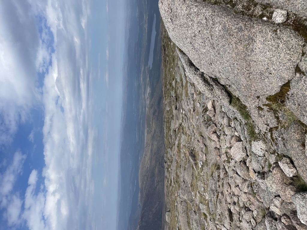
Cairn Gorm (Cairngorm) (Gaelic: An Càrn Gorm, meaning Blue or Green Hill) is a mountain in the Scottish Highlands overlooking Strathspey and the town of Aviemore. At 1245 metres (4084 ft) it is the sixth-highest mountain in the United Kingdom. It has given its name to the whole range, although these hills were historically known as Am Monadh Ruadh (the Red Hills) rather than the Cairngorms. Cairn Gorm is the most prominent of the Cairngorm mountains in the view from Aviemore, but it is not the highest.
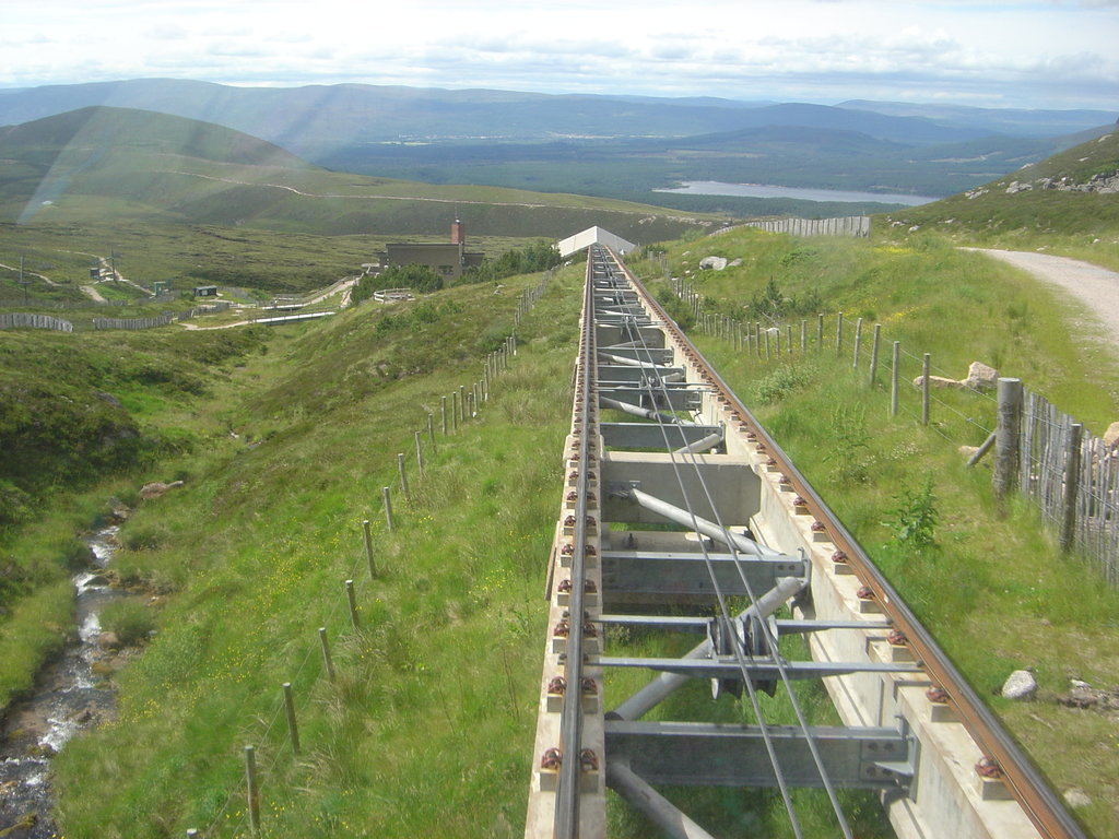
600 ha of the north-western slopes of the mountain have been developed since 1960 for downhill skiing, in Coire Cas and Coire na Ciste. In 2001 a funicular railway was constructed to provide access through Coire Cas to the Ptarmigan building at 1087m on Cairn Gorm.
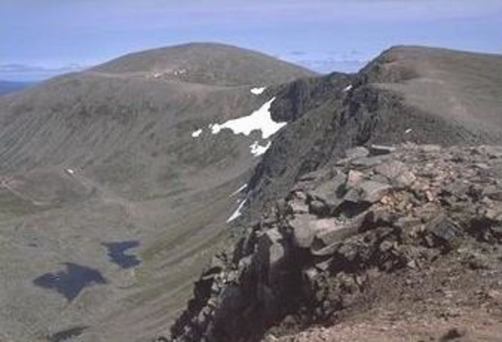
The corrie south of Coire Cas, Coire an t-Sneachda, is separated from the skiing area by a ridge known as Fiacaill a' Choire Chais. The southern side of Cairn Gorm overlooks the remote loch known as Loch Avon (pronounced Loch A'an).
There is an automated weather station (AWS) controlled by Heriot-Watt University on the summit of the mountain providing temperature and wind speed data. There is also a separate AWS run by the Met Office (synop code 03065).
There's a trail leading to the summit.
By elevation Cairn Gorm is
# 4 out of 4967 in Highland # 2 out of 428 in Moray # 8 out of 18277 in Scotland # 8 out of 34760 in United Kingdom # 2 out of 39 in Abernethy National Nature Reserve # 7 out of 1071 in Cairngorms National Park # 8 out of 5485 in the Grampian Mountains
By prominence Cairn Gorm is
# 31 out of 428 in Moray # 6 out of 39 in Abernethy National Nature Reserve # 92 out of 1071 in Cairngorms National Park
We use GPS information embedded into the photo when it is available.
3D mountains overlay
Adjust mountain panorama to perfectly match your photos because recorded by camera photo position might be imprecise.
Move tool
Rotate tool
Zoom
More customization
Choose which peak labels should make into the final photo and what photo title should be.
Next
Photo Location
Satellitte
Flat map
Relief map
Latitude
Longitude
Altitude
OR
Latitude
°'''
Longitude
°'''
Apply
Register Peak
Peak Name
Latitude
Longitude
Altitude
Register
Teleport
PeakVisor
This 3D model of Sagarmatha National Park in Nepal was made using the PeakVisor app topographic data. The mobile app features higher precision models worldwide, more topographic details, and works offline. Download PeakVisor maps today.
Download OBJ model
PeakVisor
The download should start shortly. If you find it useful please consider supporting the PeakVisor app.
PeakVisor for iOS and Android
Be a superhero of outdoor navigation with state-of-the-art 3D maps and mountain identification in the palm of your hand!