
Scan the QR code and open PeakVisor on your phone
The Taebaek Mountains include 2,085 named peaks. The highest is Daecheongbong at 1,708 m. Other notable peaks include Jungcheong, Piro Peak and 1604.
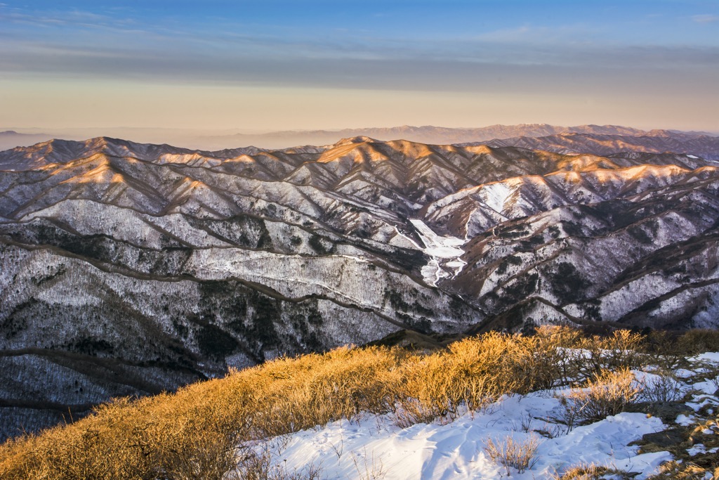
Measuring around 500 km (300 mi), the Taebaek Mountains are the main ridgeline of the Korean peninsula, stretching across North and South Korea. The range contains 2085 named mountains, the highest and most prominent being Daecheongbong (1,708 m/5,604 ft), the third-highest peak in South Korea.
The Taebaek Mountains comprise the main ridgeline of the Korean peninsula. The mountains measure roughly 500 km (300 mi) north-south along the peninsula's eastern side. Hwangnyong-san in North Korea is at the northern terminus, while Busan in South Korea is at the southern.
The range’s eastern side descends steeply towards the East Sea, while the western slope is relatively gentle. Several of the country’s major rivers begin in these mountains, including the Han, Naktong, and Kum.
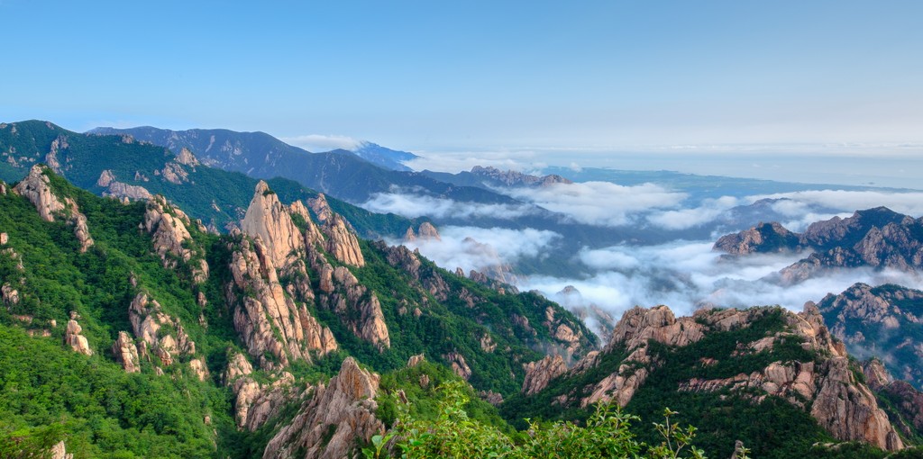
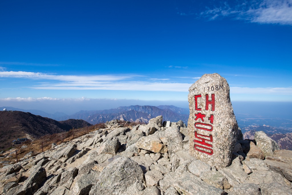
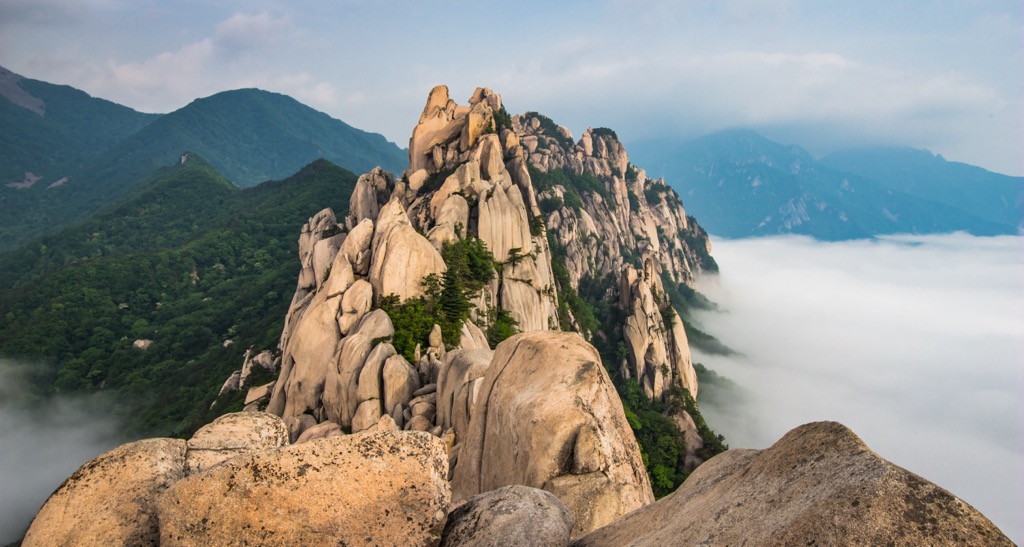
Of the range’s 2,085 mountains, Daecheongbong (1,708 m/5,604 ft) is the tallest and most prominent. The peak is located on Seoraksan Mountain, protected within Seoraksan National Park and part of the UNESCO Mount Sorak Biosphere Reserve. Rich with azalea and rhododendron flowers in spring and summer and decked out in colorful foliage in fall, the park is worth a visit in all seasons.
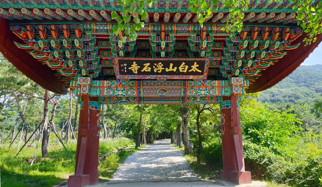
Taebaeksan National Park is the range’s newest park, created in 2016. The park protects thick forests and cultural heritage sites such as Manggyeongsa – a 1,460 m (4,790 ft) elevation temple that houses a statue of the Bodhisattva of Wisdom. Juwangsan National Park is another national park in the Taebaek Mountains, known for impressive limestone peaks and temples, including the Daejeonsa Temple. The park hosts the annual Juwangsan Royal Azalea Festival.
Odaesan National Park is a more remote park in Gangwon, Korea’s least populated province. About an hour's drive from any city, the park has several trails but far fewer people than more convenient and better-known parks in the country.
Some events of the 2018 Winter Olympics were held on the slopes of Pyeongchang-gun in the Taebaek Mountains.
The Taebaek Mountains are part of a more extensive mountain chain called Baekdudaegan, which Koreans traditionally reference when discussing their geography.
The Korean peninsula is part of the two billion-year-old Chinese Craton. More recently, approximately 252 to 66 million years ago, pieces of continental crust pushed up against the craton. This created the Korean landmass. As land masses of North and South China collided, the resulting upthrust created the first iteration of the Taebaek range. Before millions of years of erosion, the peaks would have been high and dramatic much like the Himalayas.
As the mountains wore down, sandstones, shale, and conglomerates filled basins, forming what is today known as the Nogam Formation. The name in Korean references the green color many of the rocks have due to the presence of the mineral chlorite.
Many of the hills and plains are composed of the Nogam formation. Steeper slopes are made of Daebo granite, a common rock on the peninsula, which formed around 170 million years ago when the Pacific plate was subducted beneath the Asian continent. The heat melted rock and caused magma to flow toward the surface. Granite formed as the magma cooled in the upper crust.
The same tectonic movement that opened the Japanese Sea around 28 to 20 million years ago uplifted the Nogam Formation and the Daebo granite batholith. Seoraksan Mountain, the tallest in the range, comprises dissected granite and gneiss. The Taebaek Range also contains resources of mining interest, such as iron, coal, tungsten, fluorite, and limestone.
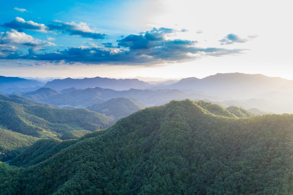
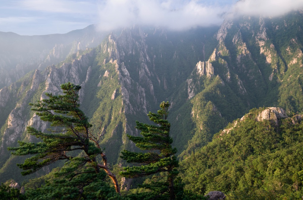
A large part of the Taebaek Mountains is forested. The province of Gangwon-do contains a large portion of the range, and forests account for 80% of the province’s total area. The range provides habitat for species such as the musk deer, Asiatic black bear, flying squirrel, golden eagle, Korean clawed salamander, the Eurasian sparrowhawk, goshawk, short-tailed viper snake, and the Korean salamander. Many of the protected forested areas are hotspots for reptiles and amphibians.
Native plants include painted maple, diamond bluebell, the iris odaesanensis, Korean maple, the herb Anagallidium dichotomum, Manchurian ash, Asian black birch, ash tree, snow lotus (Seoul saussurea), oak, needle fir, Taebaek stonecrop, Taebaek violet, and leontice (Leontice microrhyncha).
The mountains and their surrounding lands contain several protected areas. These include the Demilitarized Zone between North and South Korea; Chuncheonho, Paroho, and Soyangho Lakes protecting water sources to the west; and Seoraksan and Odaesan National Parks to the east.
The Mount Sorak Biosphere Reserve houses virgin forests with over 1,900 species of plants and is of particular ecological significance. The reserve is home to 44 species of mammals, including the Korean goral, musk deer, and otters. One hundred nine species of birds, ten species of amphibians, 19 species of reptiles, 43 species of fish, and 1,683 species of insects have been identified in the reserve.
The Silla Dynasty unified Korea in 668 AD from its previous state of competing kingdoms. The last of the ruling regimes in South Korea was the Choson Dynasty, which lasted from 1392 to 1910.
Korea remained relatively isolated for several centuries following invasions from Japan and the Manchus of East Asia during the late 1500s and early 1600s, respectively. During the 1800s, countries like Britain, the United States, and France attempted to engage in trade and diplomatic relations.

Japan occupied the Korean peninsula in 1905 following the Russo-Japanese War and formally annexed it in 1910. The following 35 years saw a repressive colonial rule as the Japanese industrialized the country and attempted to remove Korean cultural identity. Japan lost control of the peninsula at the end of World War II. At this time, the United States and the Soviet Union each took part of the divided peninsula and promoted their separate political ideologies. Syngman Rhee was the first leader of South Korea, and Kim Il Sung was the first leader of North Korea.
The Korean War lasted from 1950 to 1953 as South Korea vied for independence and North Korea attempted to take control of the peninsula. The demilitarized zone was created as part of the armistice agreement.
The Taebaek Mountains are less well-known than many other ranges throughout Asia, like the Himalayas or the volcanoes of Japan. Some folks still practice agriculture in rural regions by maintaining orchards, rice paddies, and growing fields.
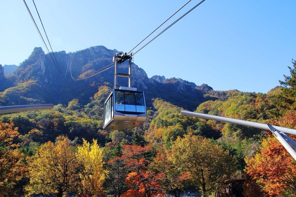
Commercial activity stems mainly from tourism and hospitality via hotels, restaurants, resorts, and tour operators. Another draw to the region is Taebaeksan. One of the holiest mountains in South Korea, the Cheonjedan altars near the peak date back to the Silla Dynasty. Ceremonies occur on New Year’s Day and the Taebaek-je Festival in October. Additionally, Pyeongchang County hosted the 2018 Winter Olympics, and the Taebaek Mountains hosted various events.
While much of Korea was once forested, the increased human population and accompanying need for forest products and space have altered much of the country’s forest cover and composition.
Hiking is popular in South Korea; many trails are highly maintained and fixed with stairs. More rugged trails exist in less visited or higher-elevation areas.
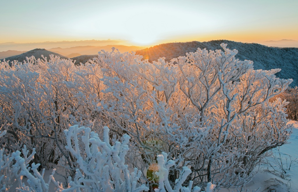
If planning a visit to the Taebaek Mountains, pay attention to annual closures in many of South Korea’s national parks. One closure is for fire prevention from mid-November to mid-December. Another is in spring between March and mid-May. During this time, lower trails may be accessible, but routes to summits and ridges will be limited.
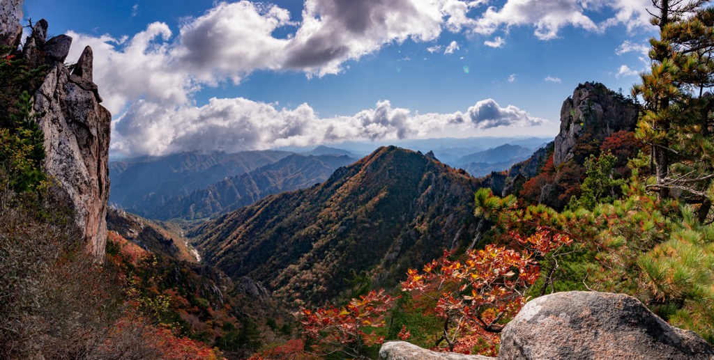
Daecheongbong is the tallest peak in the Taebaek Mountains and is on Seoraksan Mountain in Seoraksan National Park, near the city of Sokcho-si. The trail to the summit begins at Namseoraksan Information Center and is 15 km (9.4 mi) with about 1,362 m (4,470 ft) elevation gain. The trail is popular and well-maintained, but some sections require scrambling over rocks and climbing stairs.
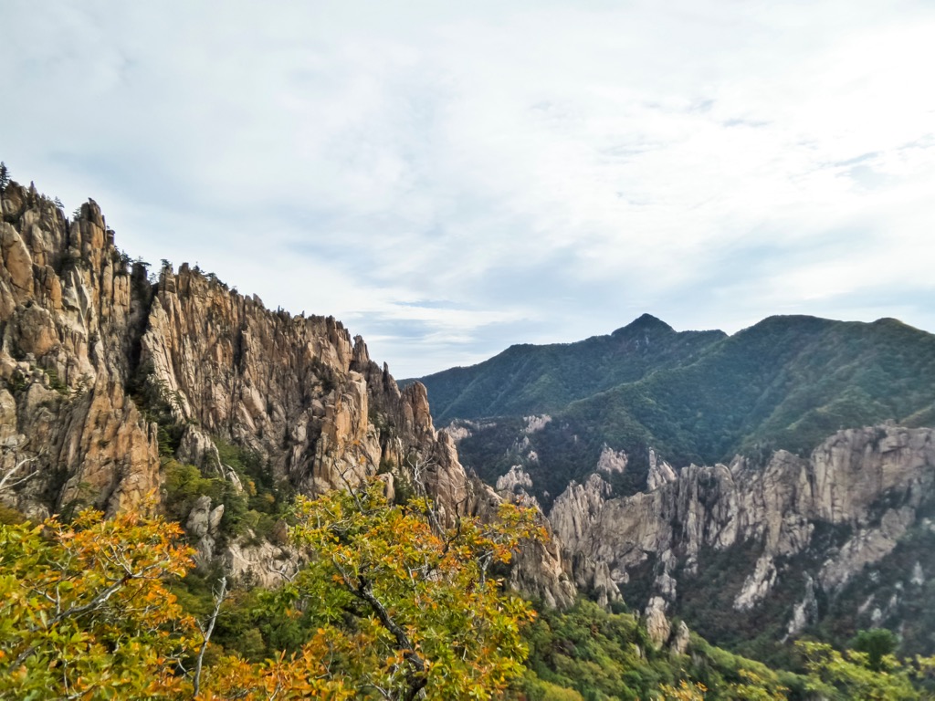
The peak is usually shrouded in clouds but provides incredible views on a clear day. The descent is also spectacular. As it drops from the alpine zone, the trail passes along a gorge and several waterfalls, offering views across the valley.
The Taebaeksan trail in Taebaeksan National Park is 9.3 km (5.8 mi) point to point with 678 m (2,225 ft) elevation gain. Be prepared to climb a lot of stairs! The trail passes by Buddhist temples and is particularly beautiful in spring as the rhododendrons burst into bloom. There are snacks and restaurants near the start and a few options for buying snacks near the summit.
The northeast portion of the 460 mi (740 km) Baekdudaegan Trek crosses through the Taebaek Mountains. This trek is popular among locals and foreign travelers looking to better understand Korean culture. Village homestays along the route allow hikers to appreciate both the mountains and Korean hospitality.
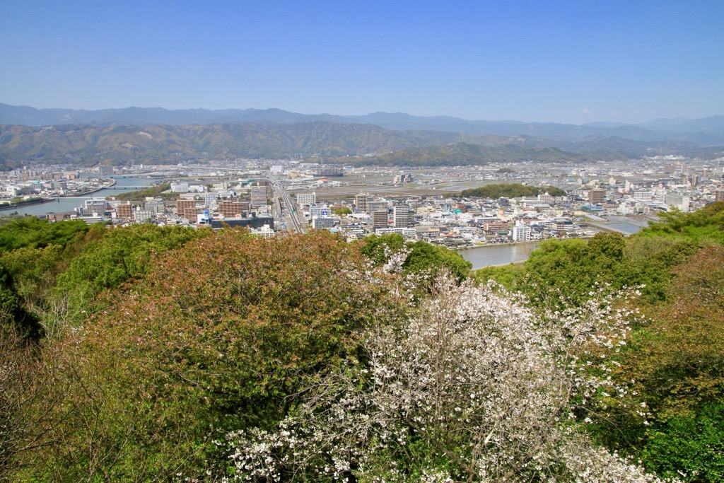
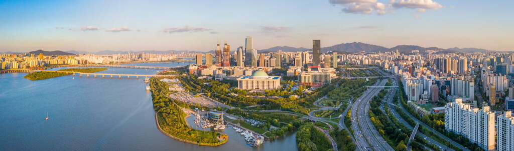
The Taebaek Mountains run along the peninsula's eastern side, but South Korea’s capital, Seoul, is only a few hours away. Smaller cities such as Taebaek and Sokcho sit at the foot of some of the mountains, and many small towns are dotted along the range.
Located a few hours from Taebaek in the northwest, Seoul is the capital of South Korea. The city is home to 9.78 million people and brimming with history, culture, culinary experiences, and urban amenities. Visit the Gyeongbokgung Palace, which originally had 7,000 rooms, the ancient locust and pine trees around the Jogyesa Temple, the main Confucian shrine Jognmyo, and the National Museum of Korea.
In addition to sampling food from the many street vendors, cooking classes are a great way to immerse yourself in the city. Accommodation ranges from budget to luxury. Both Jongno and Hongdae, Sinchon districts have backpacker-friendly hostels. Jjimjilbangs are another affordable lodging option. These typically offer luggage storage, shared rooms, and access to hot tubs and steam rooms.
Sokcho-si is located in the northeast of South Korea and is only a fifteen-minute drive from the entrance of Seoraksan National Park. The city has a population of 79,000. Besides hiking and admiring temples in the national park, visitors can bike around Yenghnangho Lake or visit the East Sea and Sokcho Beach.
Be sure to sample local foods such as raw fish, soft tofu, Korean sausage called ojingeo-sundae, and sweet potato wine. The city has a range of guesthouses and hotels, and you can camp by the beach in designated areas.
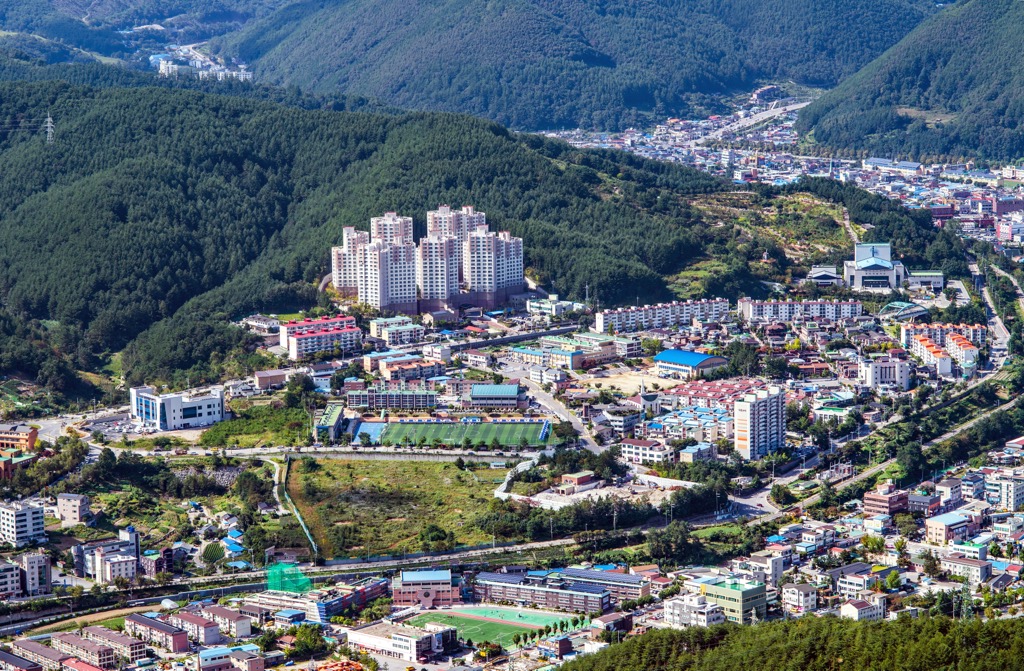
Taebaek is a small city with a population of 47,000 in the country's east-central region, near Taebaeksan National Park. While in the area, you can visit caves such as Yongyeon, Hwanseongul, Hwaam, and Cheongok. The Manggyeongsa Temple contains a statue of the Bodhisattva of Wisdom, another popular attraction.
The city offers a chance to absorb Korean culture away from a major urban center. Plan your visit for some annual festivals, such as the Taebaeksan Mountain Snow Festival, Gumunso Pond Dragon Festival, and the Sunflower Festival.


The highest peak in the Taebaek Mountains is Daecheongbong, at 1,708 m.
The Taebaek Mountains have 2,085 named peaks.


