
Scan the QR code and open PeakVisor on your phone
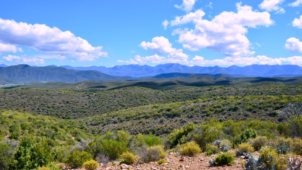
The Swartberg Mountain Range, located in the Western Cape of South Africa, is a prominent mountain range known for its rugged beauty, diverse ecosystems, and rich geological features. There are 391 named peaks in the Swartberg Mountains. The highest and the most prominent mountain is Seweweekspoortpiek, measuring 2,325 meters (7,627 ft).
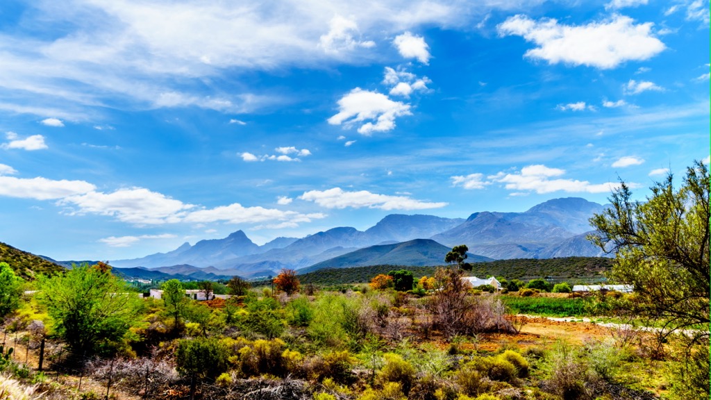
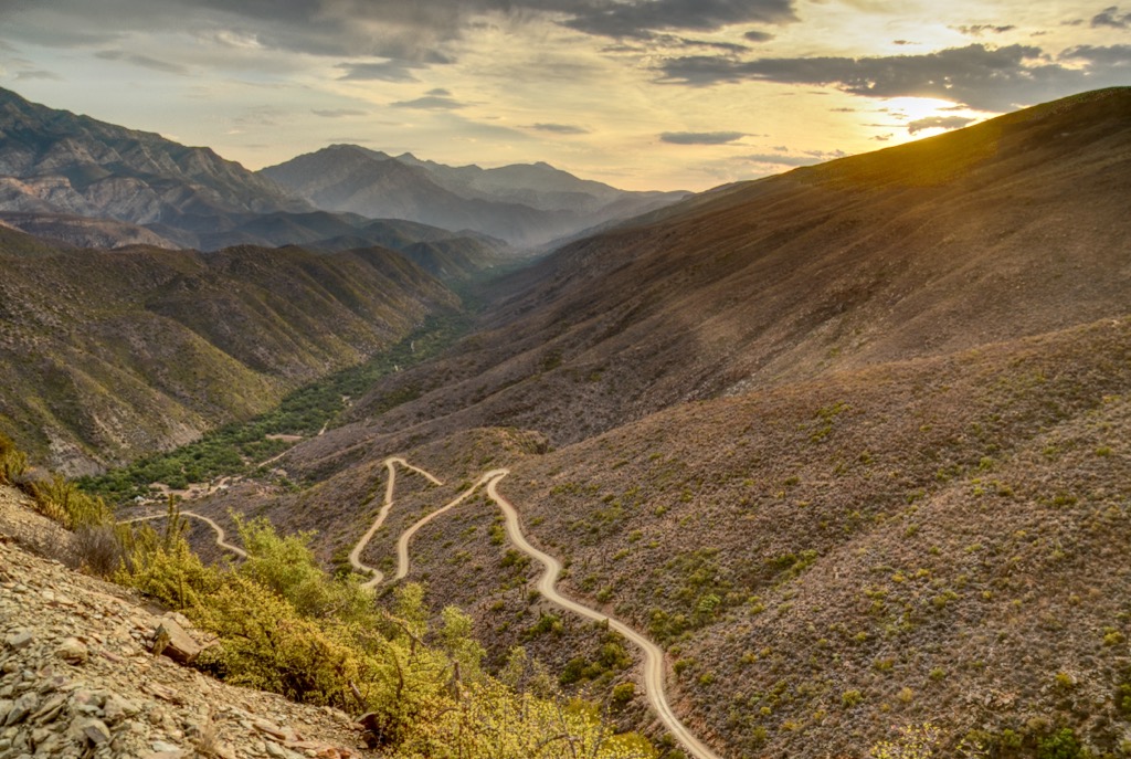
The Swartberg Mountains stretch approximately 230 km (143 mi) from east to west, situated between the Western Cape towns of Prince Albert in the south and Oudtshoorn in the north.
This southern sierra comprises two principal chains, namely the Smaller and Greater Swartberg, forming a natural barrier between the arid Great Karoo to the north and the more temperate Little Karoo to the south. The Smaller Swartberg, ironically, is distinguished as the loftier and more rugged of the two chains. Meanwhile, the Greater Swartberg is slightly lower in elevation.
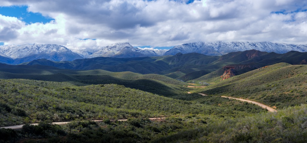
This region experiences extreme climatic conditions. During the winter season, temperatures drop significantly, leading to subzero temperatures and the accumulation of snow in the mountains. In contrast, summers can be uncomfortably hot, with temperatures exceeding 40°C (104°F). Precipitation is distributed throughout the year, with the highest levels occurring during early winter and spring.
Distinguished by its rich biodiversity, particularly in plant life, the Swartberg Mountains are an integral part of the Cape Floral Region, a UNESCO World Heritage Site for the world's largest and most diverse concentration of plants. The mountains are a sanctuary for various fynbos shrubland species. As a result, parts of the Swartberg Mountain Range are protected within the Swartberg Nature Reserve. A favored destination for nature enthusiasts, the Swartberg Mountains offer an array of trails, viewpoints, historical sites, and cultural attractions.
The Swartberg Mountains aren’t connected to major highways, making them slightly more off the beaten path than the ranges along the Garden Route. However, the range features a few impressive and renowned mountain passes.
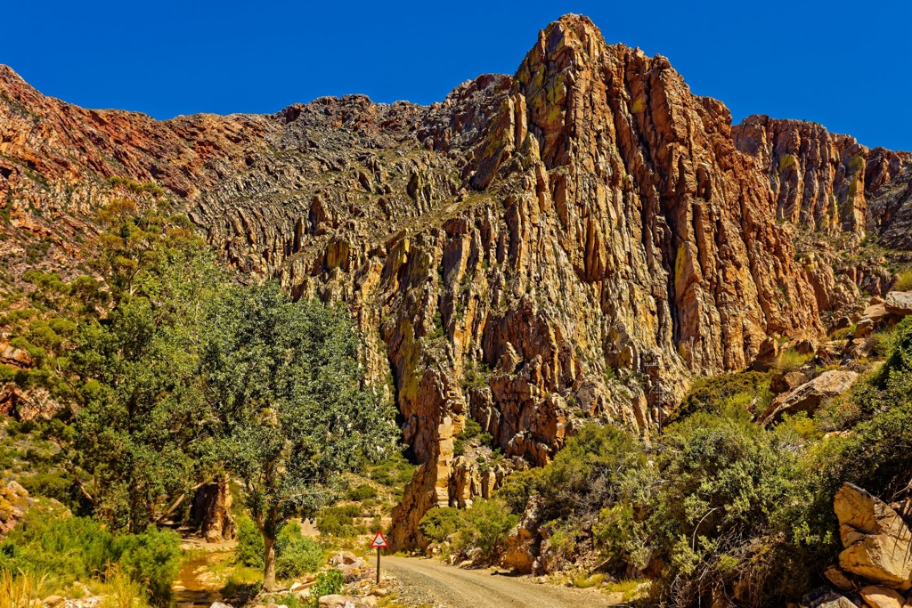
The Swartberg Mountains form a part of the Cape Fold Belt, a geological structure resulting from the collision of ancient continental plates approximately 300 million years ago. Tectonic forces subjected these formations to folding and uplifting. The belt is composed of diverse layers of sedimentary rocks, primarily quartzitic sandstone.
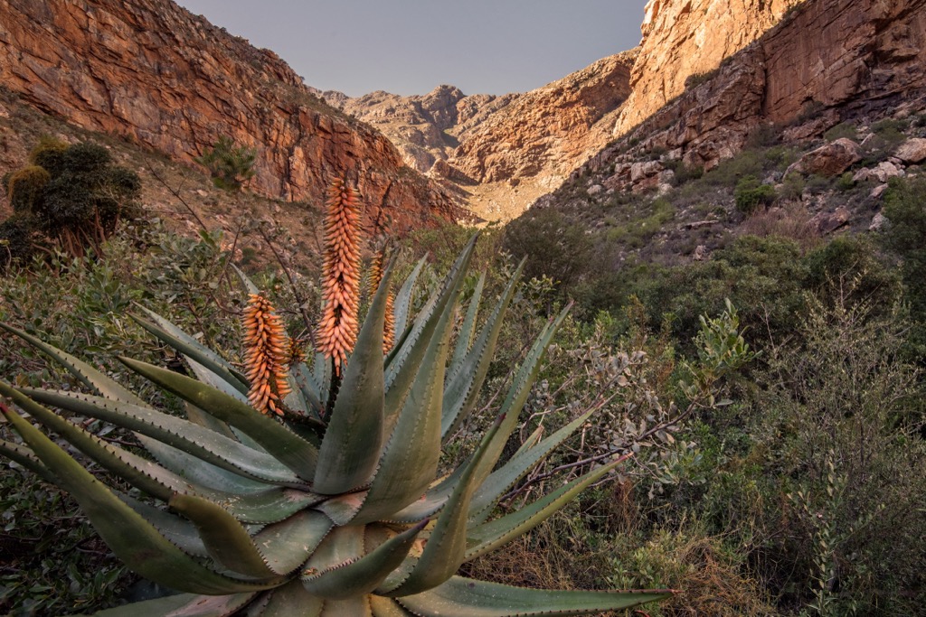
The rocks exhibit remarkable anticlines and synclines, upward and downward folds, in the layers. The quartzite surrounding the area presents a spectrum of colors, ranging from white to red to purple.
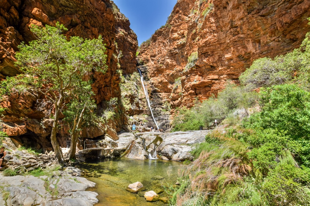
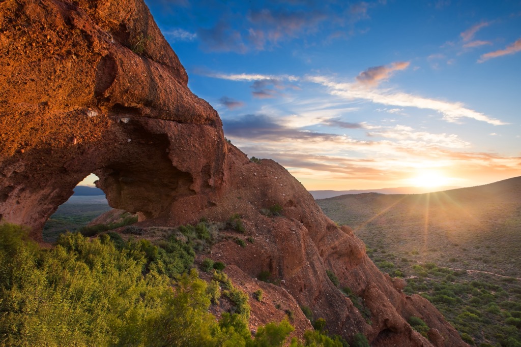
Adding to their uniqueness, the Swartberg Mountains boast distinctive features like the Wall of Fire, a 700-meter (2,296 ft) cliff of tilted quartzite often exceeding a 90-degree angle. Another notable characteristic is Towerkop, a peak with a summit cleft, which legend attributes to a witch's spell and a lightning strike.
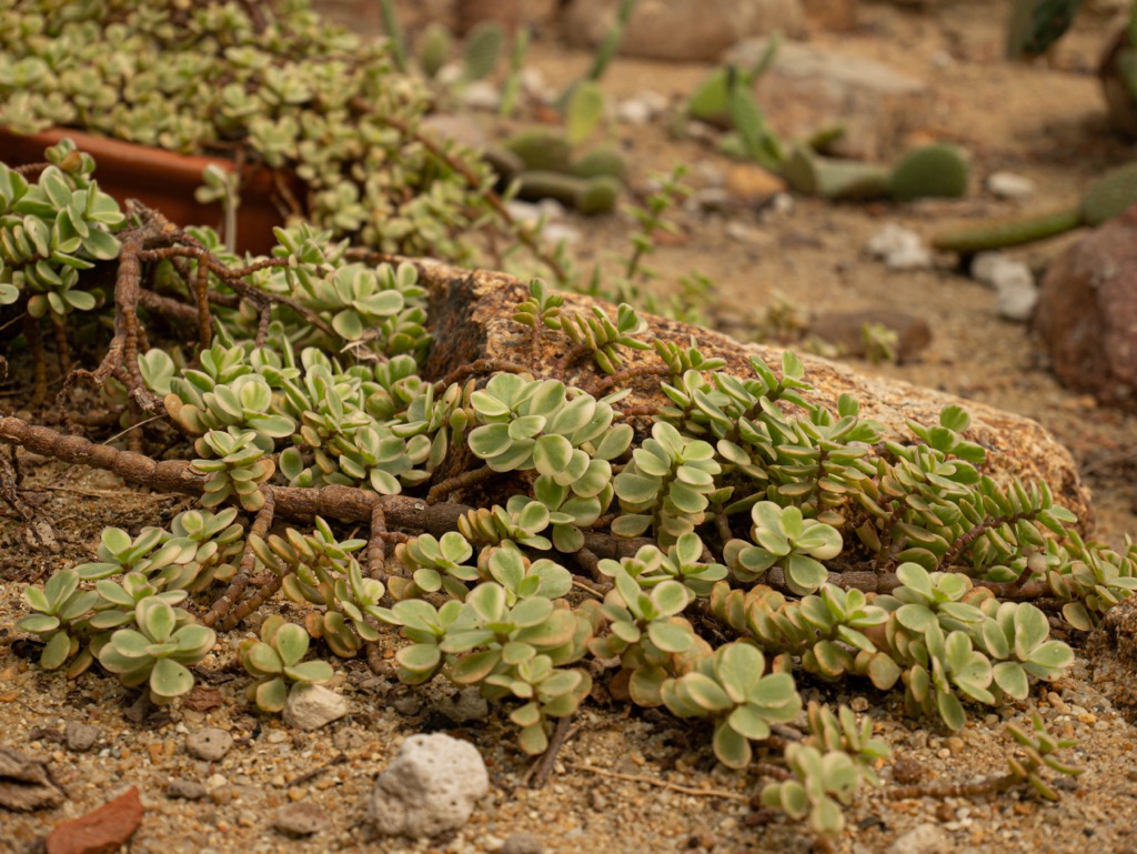
The Swartberg Mountains encompass diverse habitats, featuring alpine grasslands and fynbos on elevated slopes, while succulent karoo and thicket characterize the lower foothills and valleys. Numerous streams and rivers within the mountains sustain riparian habitats and aquatic life.
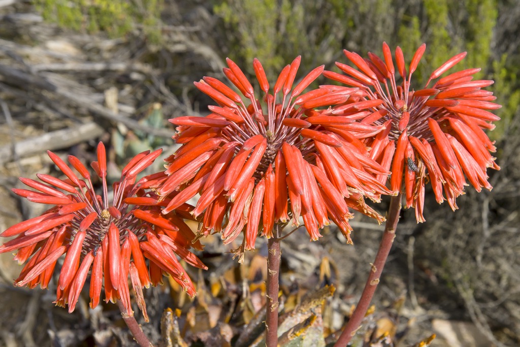
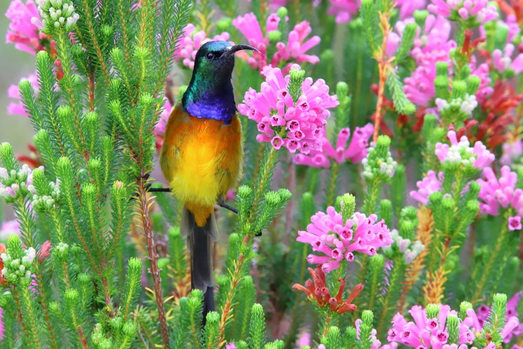
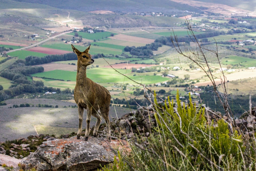
Renowned for its biodiversity, the Swartberg Mountains are a habitat for many endemic and threatened plant and animal species. This region forms part of the Cape Floral Region, harboring approximately 20 percent of the African continent’s plant diversity. Notable flora include proteas, ericas, restios, aloes, euphorbias, and pelargoniums.
The mountains are also home to an array of mammals, birds, reptiles, amphibians, fish, and invertebrates. Notable fauna include leopards, baboons, Cape mountain zebras, and birdlife, such as black eagles, Cape sugarbirds, and orange-breasted sunbirds.
The Swartberg Mountains bear a rich human history, extending across diverse eras and cultures. Dating back to the Stone Age, evidence reveals the presence of San hunter-gatherers who inhabited caves and shelters along the range. These ancient people left behind depictions of their lifestyle and beliefs in the form of rock paintings and engravings at sites such as Gamkaskloof, Seweweekspoort, and Die Hel.
The 17th and 18th centuries witnessed the arrival of Khoikhoi pastoralists and European settlers, marking a significant shift in the region's dynamics. The Khoikhoi introduced livestock, while the Europeans established farms and towns in the valleys and foothills.
The 19th-century construction of the Swartberg Pass, an engineering marvel by Thomas Bain, facilitated development and tourism, offering sweeping views of the landscape.
In the 20th and 21st centuries, conservation efforts have prioritized the Swartberg Mountains due to its inclusion in the Cape Floral Region and numerous endemic and threatened animal species. The establishment of the Swartberg Nature Reserve in 1974, covering approximately 121,000 ha (289,997 acres), aims to protect the natural and cultural heritage of the mountains.
Ensure you map out your route carefully, inform others of your itinerary, and check local weather forecasts. It can be sweltering in the summertime. Some hikes do not pass water or, for that matter, shade. Bring appropriate hiking gear and plenty of food and water.
The Swartberg Hiking Trail is a two-day trek spanning approximately 16 km (10 mi). The trail offers a variety of scenery, from rugged peaks and deep gorges to rolling hills and lush valleys.
This linear trail can be completed in either direction. The trail starts at either Oudtshoorn or Prince Albert, two towns on opposite sides of the Swartberg Mountains. It crosses several historical and cultural sites, such as the Swartberg Pass, Cango Caves, and the Gamkaskloof Valley, a remote and isolated area of cultural significance.
Along the trail, hikers will encounter mountain fynbos, observe rock formations, and may even spot wildlife, such as antelope, baboons, and dassies. While hikers may not summit any peaks, a constant mountainous backdrop of Platberg, Albertberg, Olienwegberg, and Gousberg surrounds them.
The Swartberg Pass Trail consists of a web of interlinking loops east of the Swartberg Pass, with entry and exit points at the Cango Caves, De Hoek, the top of the Swartberg Pass, and the north side of the pass. This challenging route ascends the Swartberg Pass at an imposing elevation gain of 1,000 meters (3,281 ft) in 12 km (7.4 mi).
The trail covers a distance of about 26 km (16 mi) over two days, with a total elevation gain of 1,323 meters (4,341 ft). The route includes climbing Scholtzkloof to the top of the pass and through the Meiringspoort gorge. Continuous views of peaks, such as Waboomsberg, Albertberg, Voetspadberg, and Platberg unfold, while hikers encounter diverse vegetation and spot various wildlife.
The Tierberg Hiking Trail is a challenging 12 km (7.4 mi) path that requires fitness and experience. The trail starts at the Gamkaskloof Valley and ascends to the Tierberg summit, which offers sweeping views of the surrounding valleys and Perdekop, Plooiberg, and Dorberg peaks.
The trail passes through an everchanging terrain of fynbos, grasslands, rock formations, waterfalls, and crosses several streams and rivers, which may be dry or flowing depending on the season. Several sections of the trail are not well marked, so a GPS device or a map (the PeakVisor mobile app) will be helpful.
The Albertberg Hiking Trail is a demanding but rewarding trail that leads to the summit of Albertberg, offering panoramic views of the Karoo and the Klein Karoo and the distant Outeniqua Mountains.
The 22 km (13.6 mi) long Albertberg Hiking Trail starts at De Hoek, a campsite and picnic area in the Swartberg Nature Reserve. Hikers will encounter a steep ascent from De Hoek to the ridge of the Swartberg Mountains, passing through various habitats such as renosterveld, mountain fynbos, and spekboom veld.
Hikers then follow the ridge to the summit of Albertberg, where they can enjoy views of Olienwenberg, Waboomsberg, Aalwynkop, and the Swartberg Pass. The trail then descends along a jeep track, which can be tedious, to a waterfall where hikers can refill their water bottles.
The Donkey Trail is a guided and fully catered hiking trail that takes you into the Swartberg Nature Reserve and the Gamkaskloof Valley. The trail features donkeys that accompany hikers, carrying luggage and supplies. This 30 km (18.6 mi) trail follows the historic route used by the farmers who lived in the isolated valley until the 1960s, when a road was built.
The trail starts at Living Waters, a farm near Calitzdorp, where hikers meet their guides and donkeys. The first day is a 14 km (8.6 mi) hike up the Swartberg hills to Wyenek saddle, following the original footpath that climbs about 1,500 meters (4,921 ft). The hike offers views of the mountain fynbos, nearby Osberg, Kangoberg, and Gamkasberg, and the Klein Karoo.
The second day is a 16 km (10 mi) hike down into the Gamkaskloof Valley, a narrow and secluded valley home to about 160 people at its peak. On the following day, hikers can enjoy leisure time in the valley, where they can relax, swim, or join a guided walk to learn more about the history and nature of the valley.
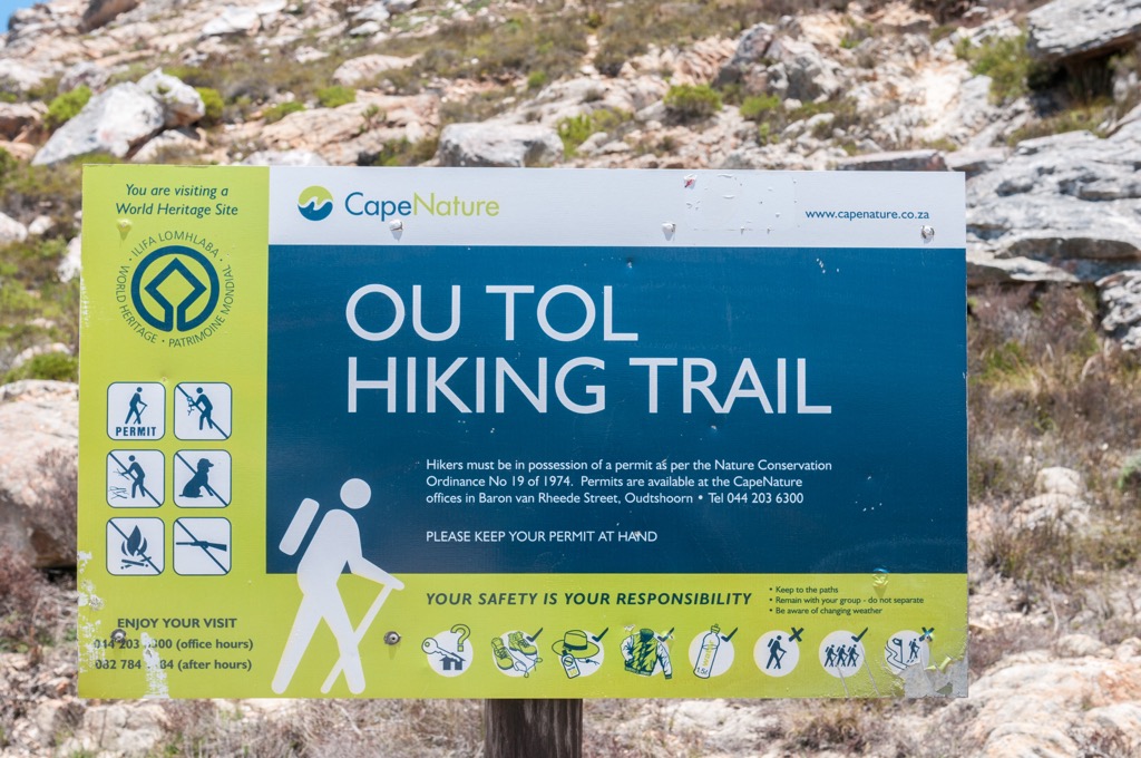
The Ou Tol Circle Route is a 6.4 km (4 mi) hiking trail in the Swartberg Nature Reserve. It is rated as hard, with much elevation gain and rocky sections. The trail offers prospects of the Swartberg Mountains and the Gamkaskloof Valley.
Starting from the Swartberg Pass, the trail passes through endemic vegetation, from renosterveld to mountain fynbos and spekboom veld. In addition, hikers may observe various wildlife, such as antelope, baboons, dassies, and, with an extraordinary amount of luck, leopards.
The Koningsgat Trail is a short and easy 1.4 km (0.8 mi) hike in the Swartberg Nature Reserve. The trail follows a river through a valley of fynbos and ends at a natural pool called Koningsgat, which means ‘king’s hole’ in Afrikaans.
Koningsgat Pool is a great place to cool off and enjoy the scenic views of the surrounding mountains. The trail suits all ages and fitness levels and can be completed in about an hour. The best time to hike to Koningsgat is in spring or autumn when the temperatures are moderate and the flowers are in bloom.
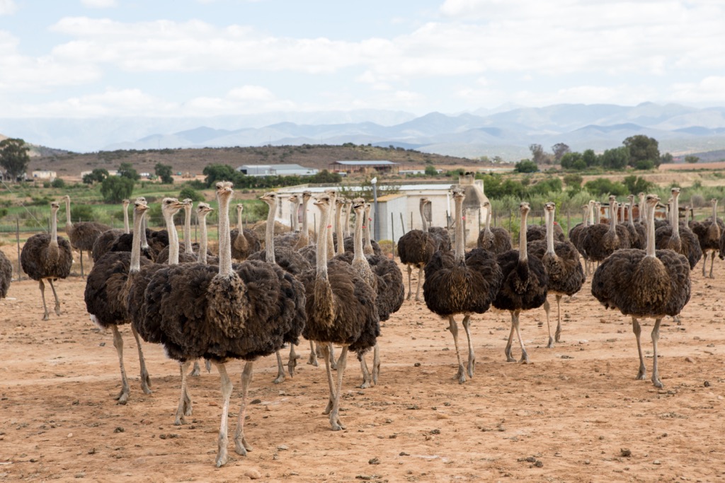
Oudtshoorn is a town in the Western Cape province, located between the Swartberg Mountains to the north and the Outeniqua Mountains to the south. It is known as the ‘ostrich capital of the world’ because of its large ostrich population and industry. Oudtshoorn has a rich history and culture and many natural attractions and activities.
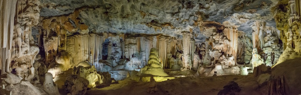
The Cango Caves are Africa's most extensive show cave system and one of the Seven Wonders of Southern Africa. The caves have been formed over millions of years by the erosion of limestone by water, creating a variety of stunning formations, such as stalactites, stalagmites, columns, and chambers. Tours showcase the caves' history and explore the narrow tunnels.
Visiting the ostrich farms in Oudtshoorn is a fun and educational activity, allowing visitors to interact with these amazing birds and learn more about their biology. Farms like Highgate Ostrich Show Farm, Cango Ostrich Farm, and Safari Ostrich Farm offer ostrich encounters and tours through the farms, demonstrating how ostrich feathers are plucked and how they weigh and carve eggs.
Over 90 species of animals inhabit the Cango Wildlife Ranch, a popular tourist attraction in Oudtshoorn. Resident wildlife includes cheetahs, lemurs, crocodiles, tigers, lions, and pygmy hippos. The ranch is also a conservation center that aims to protect and breed endangered animals and educate the public about wildlife and environmental issues.
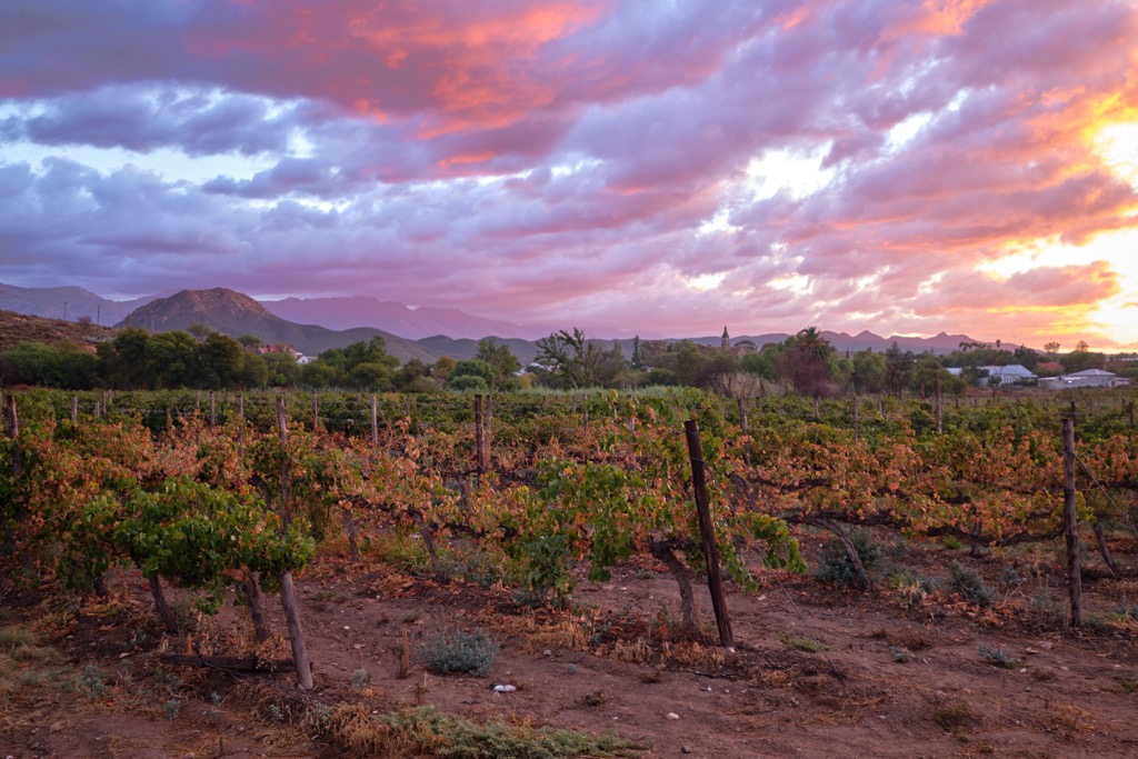
Calitzdorp is a charming town in the Western Cape province of South Africa, located on the scenic Route 62. It is known as the port wine capital of the country, as it produces some of the finest and award-winning port wines in the world. Calitzdorp is also an excellent destination for nature and adventure enthusiasts.
The Swartberg Nature Reserve is home to many plant and animal species. The Swartberg Nature Reserve's primary objective is conserving the unique ecosystems within its boundaries. The reserve also offers a network of hiking trails that allow visitors to explore the natural beauty of the Swartberg Mountains.
For those who don’t wish to hike, the Bojaankop 4X4 Trail is an adventurous route that summits Bojaankop Mountain, overlooking the Klein Karoo and the Swartberg Mountains. The trail is located on the Matjiesvlei Guest Farm, with a rich history dating back to the 1800s.
Finally, Calitzdorp’s vineyards attract wine enthusiasts and tourists eager to explore the wine culture of the Klein Karoo. Several wineries, like Boplaas, De Krans, and Calitzdorp Cellar, offer wine tours with insight into the wine-making process and tasting sessions.


