
Scan the QR code and open PeakVisor on your phone
Swartberg Nature Reserve has 34 named peaks. The highest is Tierberg at 2,132 m. Other notable peaks include Blesberg, Bloupunt and Kariegasberg.
The Swartberg Nature Reserve protects the western Swartberg Mountains of South Africa. There are 34 named peaks in Swartberg Nature Reserve; the highest and the most prominent is Tierberg, measuring 2,132 meters (6,995 ft).
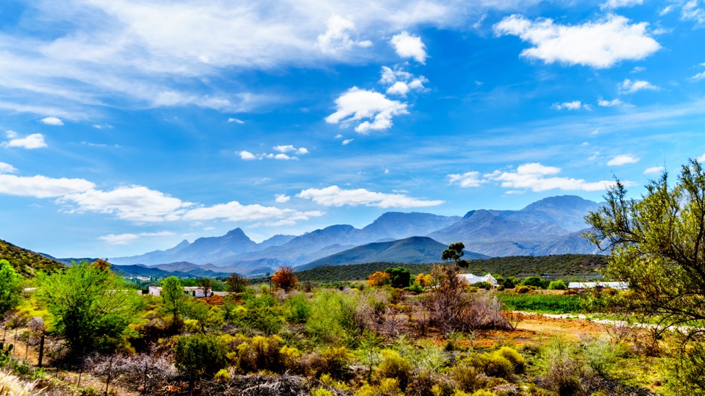
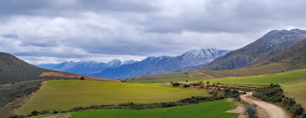
The Swartberg Nature Reserve is a protected area in the Western Cape province, covering an area of 121,000 ha (298,998 ac) between Prince Albert and Oudtshoorn. It forms a natural boundary between the semi-arid Klein Karoo region to the south and the greener, more fertile Great Karoo to the north.
The reserve is part of the larger Cape Floral Region, a UNESCO World Heritage site renowned for its exceptional biodiversity. It is home to a variety of habitats, from renosterveld to mountain Fynbos and spekboom veld.
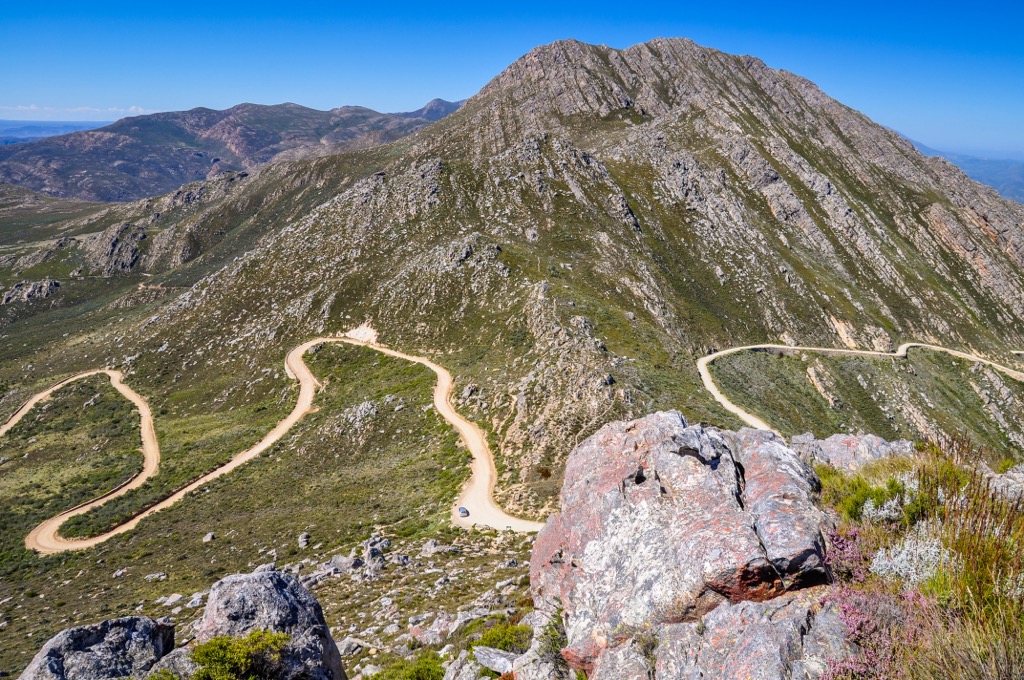
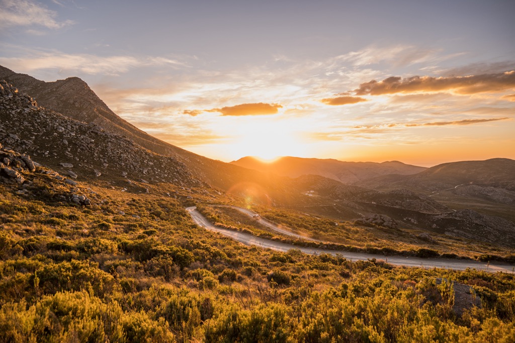
Due to its location, the Swartberg Nature Reserve showcases a variety of landscapes, from high mountain plateaus to deep gorges. One of the notable features is the iconic Swartberg Pass, a historic mountain pass that traverses the Swartberg Mountains. The reserve has a long history of human occupation, dating back to the Stone Age, and has many archaeological and cultural heritage sites.
Within the Swartberg Nature Reserve are several hiking trails that offer panoramic views of the Swartberg and allow visitors to explore its diverse landscapes.
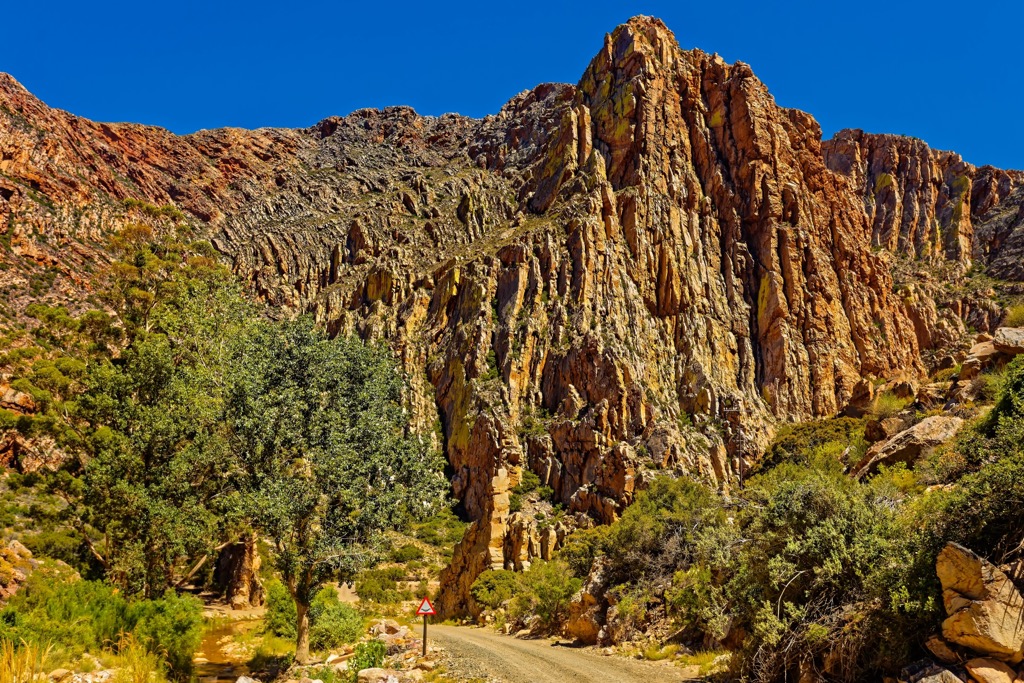
The Swartberg Nature Reserve forms a part of the Cape Fold Belt, a geological structure resulting from the collision of ancient continental plates approximately 300 million years ago. Tectonic forces subjected these formations to folding and uplifting. The belt is composed of diverse layers of sedimentary rocks, primarily quartzitic sandstone.
The rocks exhibit remarkable anticlines and synclines, upward and downward folds, in the layers. The quartzite surrounding the area presents a spectrum of colors, ranging from white to red to purple.
Adding to their uniqueness, the Swartberg Mountains boast distinctive features like the Wall of Fire, a 700-meter (2,296 ft) cliff of tilted quartzite often exceeding a 90-degree angle. Another notable characteristic is Towerkop, a peak with a summit cleft, which legend attributes to a witch's spell and a lightning strike.
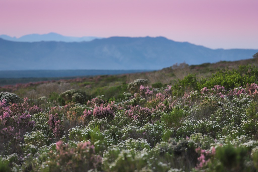
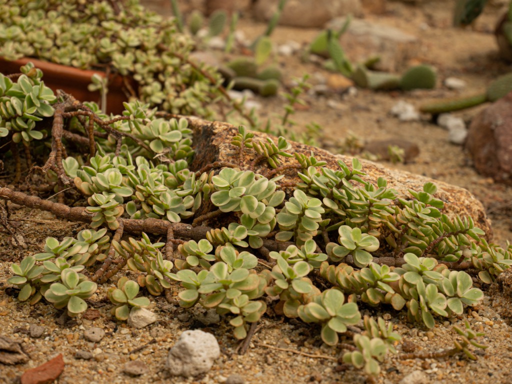
The reserve's vegetation ranges from renosterveld, a grassland dominated by Protea and other succulents, to mountain fynbos, a shrubland with colorful flowers and herbs. The reserve also has spekboom veld, a tree-dominated savanna with acacia and other trees. Karoo-veld and geophyte species are found in the lower slopes of the mountains, where the soil is more fertile and moist.

The reserve's wildlife includes many rare and endemic species adapted to the harsh Karoo environment. Fynbos is one of Earth's most endemic-rich and biodiverse ecozones, with an estimated 6,000 endemic species and 9,000 total plant species.
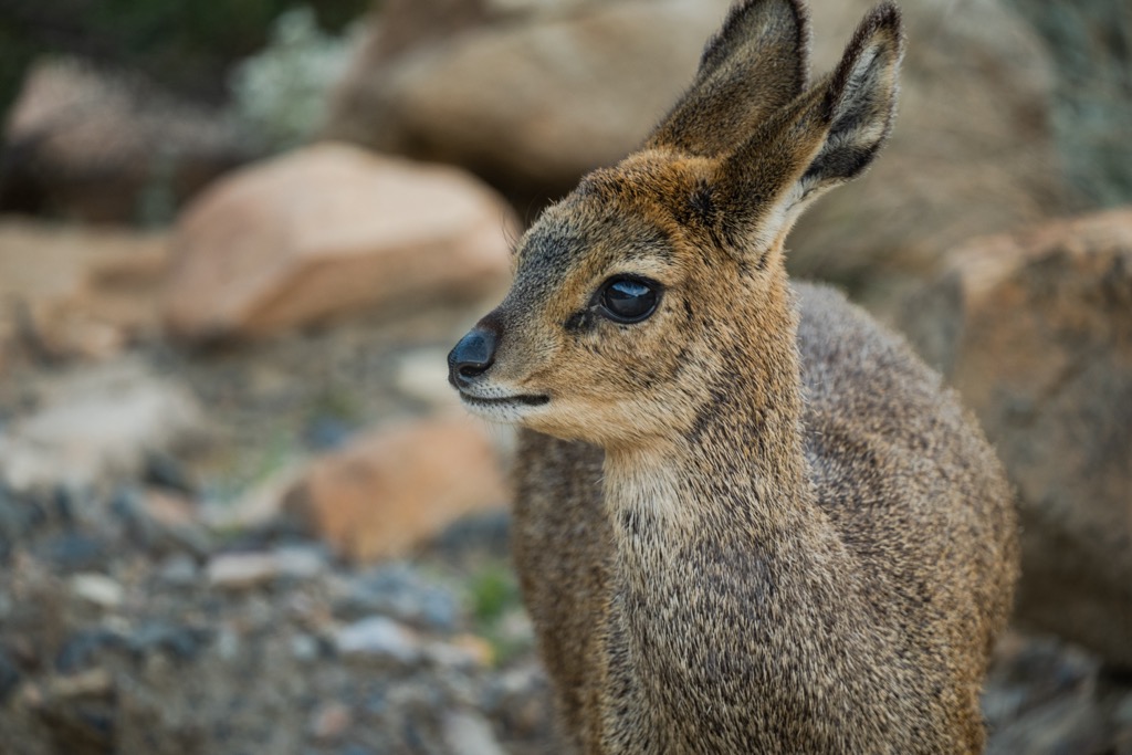
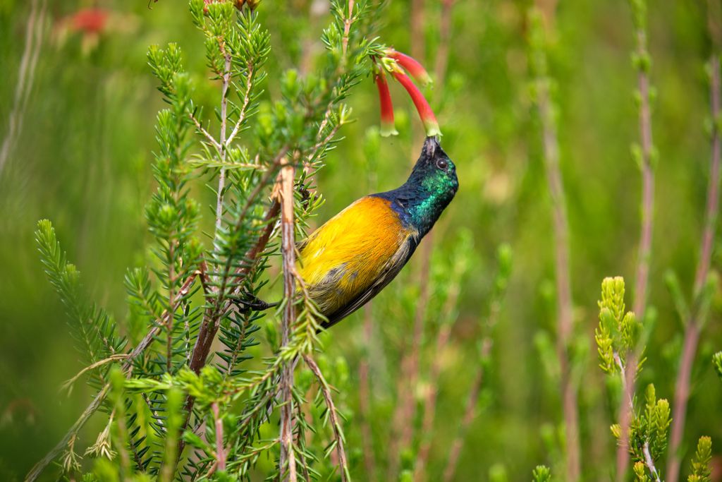
The Swartberg Nature Reserve is also home to many mammals, including antelope, baboons, dassies, leopards, bat-eared foxes, and springbok. Birds that live, migrate, or breed in the region include ostriches, flamingos, pelicans, eagles, owls, and warblers.
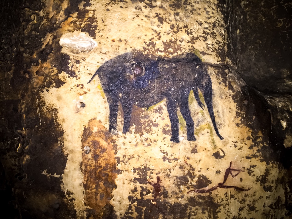
In the era of modern humans, the earliest known inhabitants of the Swartberg area were the San people, who are also known as Bushmen. They lived in caves and rock shelters and left behind many paintings and artifacts depicting their culture and lifestyle. Some sites, such as the Cango Caves, can be visited today.
In the 1700s, European farmers arrived in the area, establishing small settlements and making roads. These roads connected the Great Karoo and Klein Karoo regions and facilitated trade and travel. Some historic routes, such as the Toorwaterpoort Railway, Meiringspoort Road, and the Swartberg Pass, are still functioning. The Swartberg Pass was built by Thomas Bain in 1837 and is one of the highest paved mountain passes in South Africa.
In the late 19th and early 20th centuries, the ostrich feather industry boomed in the Little Karoo region, which includes the area around the Swartberg. Oudtshoorn, a town near the Swartberg, became a significant center for ostrich farming.
Recognizing the unique natural and cultural heritage of the Swartberg region, conservation efforts gained momentum in the 20th century. The Swartberg Nature Reserve was officially established in 1978 to protect the area's biodiversity, geological formations, and historical sites. Conservation initiatives focused on preserving the unique flora and fauna, including several endemic and endangered species.
The Tierberg Hiking Trail spans 12 km (7.4 mi) and includes some rocky sections and loose gravel that lead to the highest peak in the Swartberg Nature Reserve. Starting at the Gamkaskloof campsite, the first part of the trail follows the Gamkaskloof River, crossing it several times on wooden bridges.
Hikers follow a sheer ascent up the mountain as they pass by caves and overhangs. The final climb to the summit is the most challenging part of the trail, as it involves scrambling over large boulders and narrow ledges at a high elevation. From Tierberg’s summit, hikers can see the peaks of Perdekop, Plooiberg, and Dorberg; views reach as far as the Outeniqua Mountains and the Great Karoo on a clear day.
The De Hoek Day Trail is a two-day hiking trail offering views of the Swartberg Mountains, diverse vegetation, and wildlife. The route is circular, starting and ending at the De Hoek Mountain Resort, and is divided into two sections, each about 8.4 km (5 mi) long.
The first section leads from De Hoek to Bothashoek Hut, while the second section leads from Bothashoek Hut back to De Hoek, completing the loop. Hikers pass through renosterveld, mountain fynbos, spekboom veld, as well as rocky outcrops and the occasional waterfalls and rock pools along the way. The trail also offers a glimpse into the history and culture of the area, as it follows some of the old donkey trails that the inhabitants of the isolated Gamkaskloof Valley used.
The arduous 22 km (13.6 mi) Albertberg Hiking Trail starts at De Hoek, where a steep climb will take hikers to the ridge of the Swartberg, passing through the reserve’s diverse vegetation. From the summit of Albertberg, hikers have 360-degree views of the surrounding mountains of Olienwenberg, Waboomsberg, Aalwynkop, and the Swartberg Pass. The trail then descends along a jeep track to the endpoint, where a waterfall awaits.
The Donkey Trail offers an authentic heritage experience and is a unique way to explore the Swartberg and the Gamkaskloof Valley, also known as Die Hel. The 30 km (18.6 mi) trail follows the historic route that the farmers of Die Hel used to trade with the outside world, using donkeys to carry their goods over the mountain.
Donkeys accompany hikers on this guided trail. Hikers begin the trail at Living Waters, a family farm near Calitzdorp, and end at Boplaas, a guest house in Die Hel. Along the way, hikers can see the Swartberg Pass and the historic structures built by the Klowers, the original inhabitants of Die Hel.
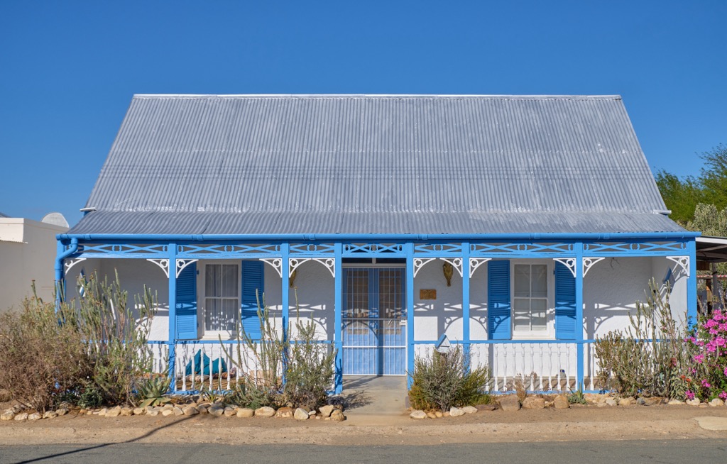
Prince Albert is a small town in the Western Cape province, situated on the southern edge of the Great Karoo region. Prince Albert is known for its well-preserved Victorian, Karoo, Cape Dutch, and uniquely gabled buildings, some of which are national monuments. It is a popular tourist destination for its scenic beauty, historical heritage, and artistic community.
Prince Albert is home to various galleries showcasing the work of talented South African artists. The town's creative community often hosts exhibitions throughout the year.
This semi-arid town is renowned for olive farming; visitors can explore local olive farms. Some farms offer tours where you can learn about the olive cultivation process and sample various olive products, such as oils and tapenades.
The town is located in a region with minimal light pollution, making it an ideal spot for stargazing. Visitors can find a guided stargazing tour on clear nights or go off independently.
Oudtshoorn is a town in the Western Cape famous for being the world's ostrich capital, as it has the most significant global ostrich population and industry. Oudtshoorn is also known for its cuisine, which features ostrich meat and eggs, as well as local wines and brandies.
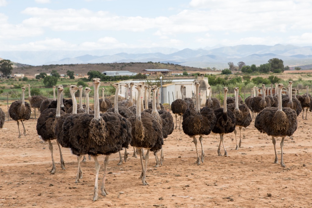
One of the top things to do in Oudtshoorn is visit one of the many ostrich farms in the area to learn about these flightless birds and their habits and even try ostrich riding. Highgate Ostrich Show Farm and Safari Ostrich Show Farm are popular choices.
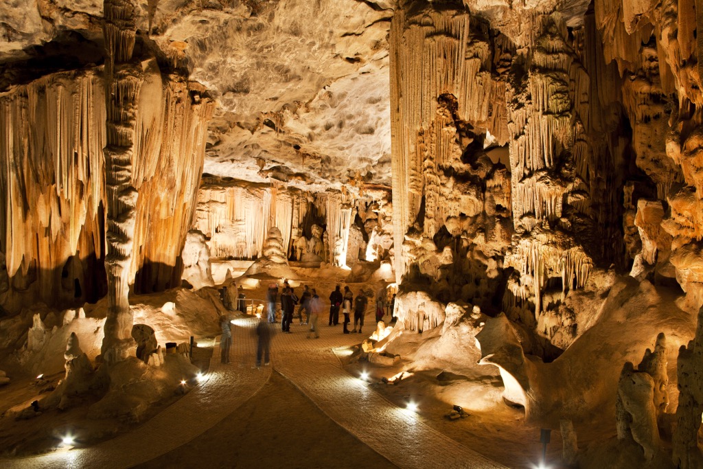
Oudtshoorn is also home to the Cango Caves, Africa’s most extensive show cave system, a natural wonder of limestone formations and chambers. This World Heritage Site is located in the Cango Valley, about 29 km north of the town.
Buffelsdrift Game Lodge is a luxury tented camp near Oudtshoorn, situated on the edge of a waterhole, where visitors can see hippos, giraffes, zebras, and other animals. There are many wildlife activities for visitors, such as a safari game drive, a bush walk, a horseback safari, and a meerkat safari.


The highest peak in Swartberg Nature Reserve is Tierberg, at 2,132 m.
Notable peaks in Swartberg Nature Reserve include Tierberg, Blesberg, Bloupunt, Kariegasberg and Spitskop.


