The Shikoku Mountains include 615 named peaks. The highest is Mt. Ishizuchi at 1,982 m. Other notable peaks include Minamisenpou, Misen and Mt. Tsurugi.
There are 418 named mountains in the Shikoku Mountains. The highest and the most prominent mountain is Mt. Ishizuchi (1,984m).
Shikoku, the smallest of the Japanese main islands is characterized by its varied nature, mostly unexplored, and some famous places barely known both by the locals and by tourists. Its name refers to the former four provinces that constituted the administrative division of the island. Four are also the current prefectures: Tokushima, Kagawa, Ehime, and Kochi.

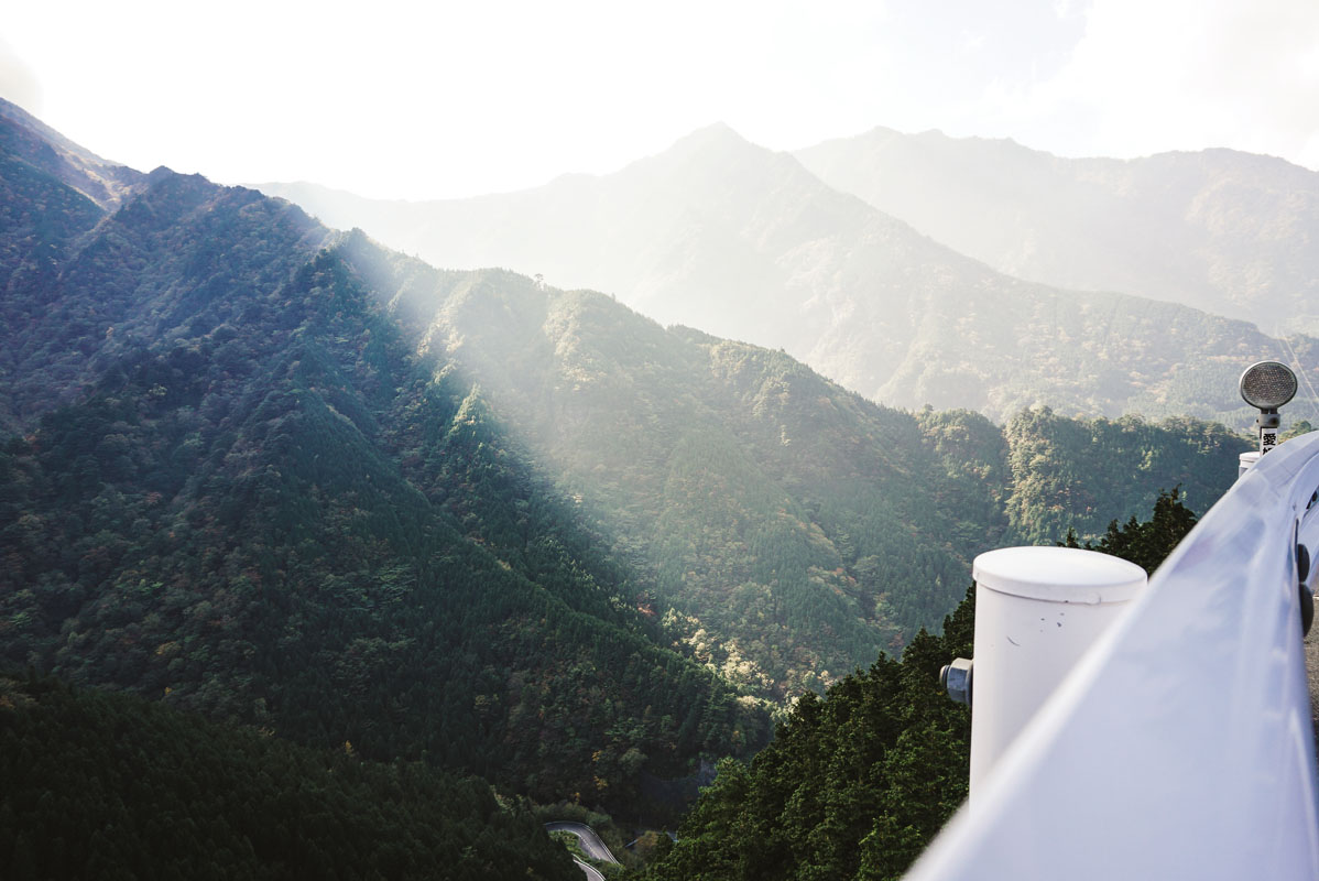
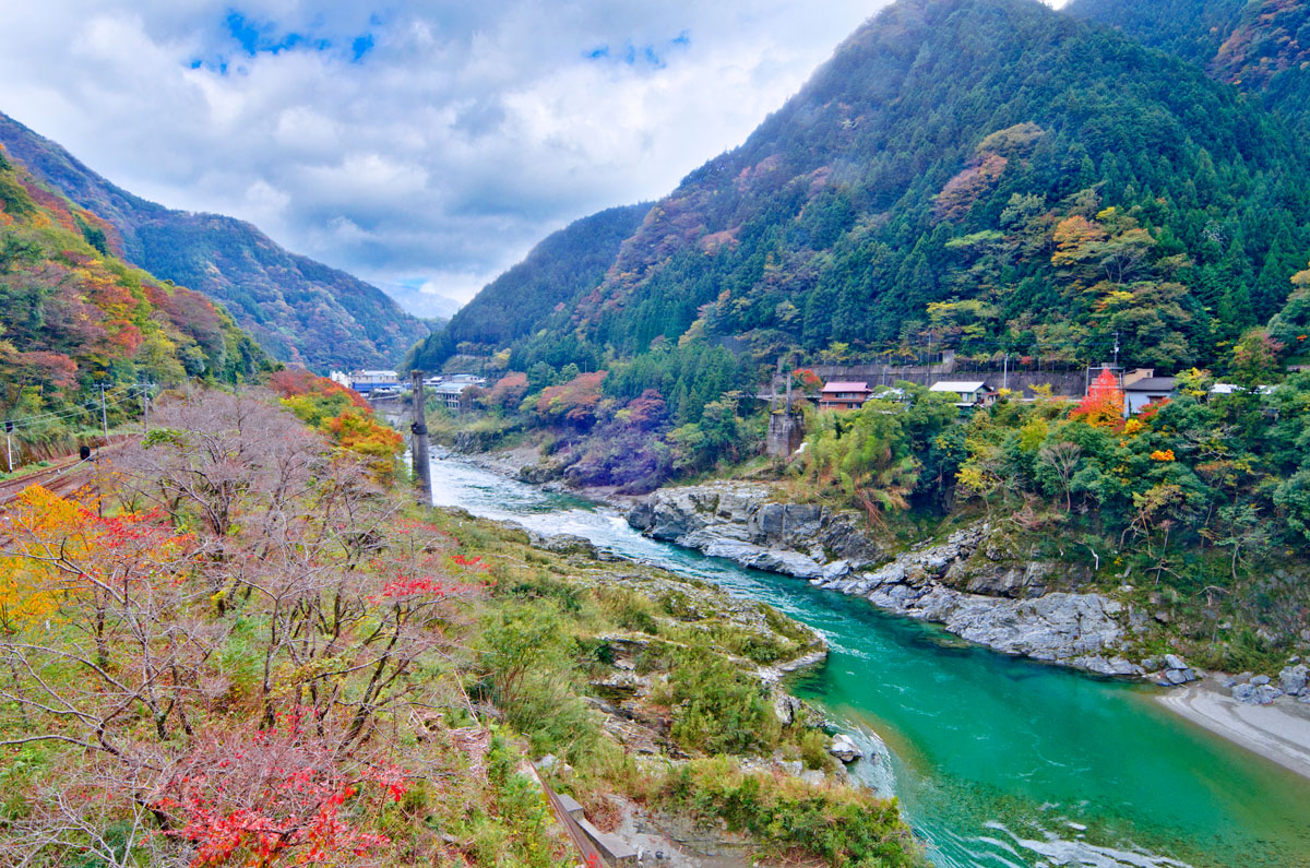
The Shikoku mountains are located inland, extending homogeneously in two main blocks from east to west, further divided into three minor ranges: the Ishizuchi range, the Akaishi range (do not confuse them with the Akaishi Mountains!) and the Tsurugi range. Despite 70% of Shikoku being covered in forests, the southern area is characterized by a dry climate which causes droughts in many territories. Cities oriented towards the mountains are usually the only places blessed by abundant water supply. In fact, mountains work efficiently as water reserves. On the whole, this mountainous area presents gentle slopes and small peaks with lots of farms located on the hills around. THis is the place where Masanobu Fukuoka, the author of The One-Straw Revolution, developed his natural farming methods, making this land a sanctuary for ecotourism lovers. Unlike the rest of Japan, there are no volcanoes here, yet the Dōgo Onsen hot springs are one of the most popular Shikoku’s attractions.
The Shikoku mountains have been worshipped since ancient times which makes them a place filled with a spiritual aura. In fact, numerous Shinto sanctuaries and some Buddhist temples belonging to the 88-temple pilgrimage are located on these peaks.
Major Hiking Areas
The entire island is full of natural treasures. However, besides being scarcely populated, Shikoku mountains are also one of the lesser-known tourism destinations of the country, which makes this mountainous area a perfect place for adventurers, but it may not totally satisfy hikers who are planning a comfortable trip and who are not used to “surviving” in a foreign country. Concerning the hiking trails, hikers can choose among numerous options. However, despite the majority of the trails being well marked, some trails may not be in good condition or can even be closed. Plan your hike carefully to avoid such inconveniences.
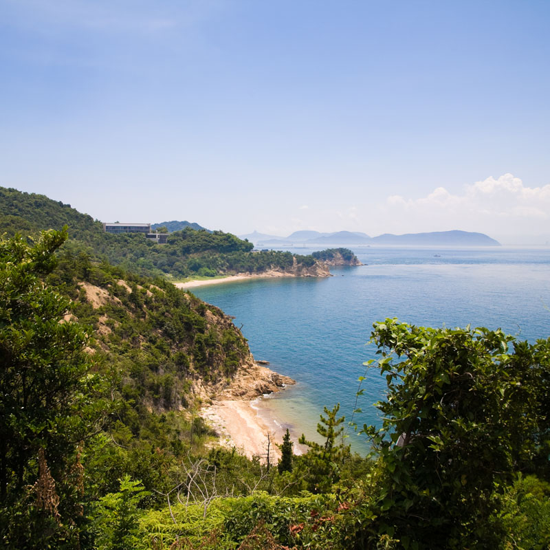
- Shikoku for Beginners. There are at least four recommended easy trails located on mountains of moderate elevation. Despite being feasible in less than 3h, they offer breathtaking views on the way to the summits. One of the first checkpoints is Mt. Iyofuji (1,756m), a peak located between Aichi prefecture and Kochi prefecture that offers a splendid view of the Setouchi Sea. It takes less than 1h to reach the top from Iyofuji trailhead. Intermediate hikers can enjoy this mountain as well by choosing the route branching off Mt. Kanpu (1,763m) trailhead, which is a little bit more difficult than the standard one. This mountain is also listed in the 300 famous Japanese Mountains, chosen by the Japanese Alpine Club (日本山岳会) in 1978 as an extended version of The Famous 100. Hikers are usually fascinated by the view of the sea from Mt. Iino (486m). Its moderate elevation makes it easy to climb. On the summit, there is a Buddhist temple and a massive indented stone. The rock is believed to be the footprint of the giant “Ojomo”, the mythical creator of this mountain. Also, it is popular for its Diamond, which is considered as beautiful as the one on Mt. Fuji. The Diamond is a phenomenon happening at sunset when the descending sun disk lines up exactly with the mountain edge, making it look like a luminescent pinnacle. If you are a flower lover, you can climb Mt. Kasatori (1,568m), famous for Azalea that paints its slopes pink during the warm season. A similar atmosphere can be found only in the Kyushu mountains. The fourth destination recommended to beginners is Mt. Kamegamori (1,898m) which is divided into a male peak and a female peak. From the main trailhead, you will reach the male peak and from there the female peak is reachable in 15m. The whole course takes 3h to be completed. You can also choose to walk along the UFO line, a paved road cutting the mountain from east to west called so due to some UFO witnessing happened there. Along with Mt. Ishizuchi and Mt. Sasagamine (1,860m), it is one of the Three Peaks of Iyo, the mountains in Ehime known for their natural beauty.
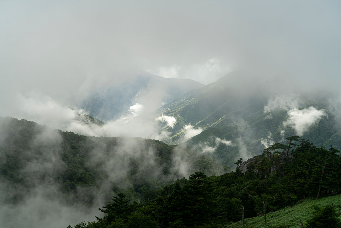
- Intermediate level trails. Most of these peaks are imbued with mythology and folklore. Knowing the legends hidden behind a peculiar mountain shape or forest will make your hiking experience even more fascinating. Mt. Ishizuchi (1,984m) is one of them. In addition to Tengu-dake, one of its three peaks and its highest point, the massif includes 10 peaks exceeding 1,700 m. These mountains feature diverse terrain and geological peculiarities, stunning valleys, and endemic alpine flora, making each hike a unique adventure. Two major clear-flowing waterways, the Niyodo river and the Yoshino river, as well as the Kamo river and the Uchinuki no Mizu springs, have their sources located within the Ishizuchi Mountain Range. The abundance of water here has formed gorges and waterfalls throughout the mountains. One can see the splendour of the Omogo Gorge, Shikoku’s largest ravine, and the Hodonono waterfalls. The central mountains of the Ishizuchi Mountain Range have been designated as part of the Ishizuchi Quasi-National Park. One of the main climbing routes ascends from Jōju-sha Shrine by ropeway. The Tsuchigoya route starts at the Tsuchigoya terminal and heads up along the Ishizuchi Skyline or Mount Kamegamori Forest Road. With its extremely balanced shape, Mt. Miune (1,893m) offers a combination of challenges and aesthetic delights. From the mountain top, you can enjoy a splendid view of the Tosa Bay. The trail connects to Mt. Tsurugi (1,955m). There are many variations on the main route that follows the ridgeline. There are four main routes suitable for multi-day hikes. The average walking time spans from 6h to 11h. Since it is a common opinion that sunrise and sunsets are spectacular on this peak, you can plan to stay in a hut near the summit, with a small lake on its side, or use a tent to stop in the place you think it is more suitable for your purpose.
- Extreme Hikes. Climb these mountains only if you are a professional hiker. Mt. Ishitate (1.707m) is the top class of its category. Steep slopes and rocky paths make this peak the most challenging of the Shikoku Mountains. It is located in the Southern side of the Tsurugi Quasi-National Park. From the trailhead located in the proximity of Befu ravine, it takes 4h to reach the summit. It is popular for a cliff on its western side, called “The peak of the renunciation from the world”, Buddhist expression that reminds the religious past of the mountain but also reflects the sense of being on the verge of death you may feel when you are on its top. Another route that is worth the fatigue is the trail connecting Mt. Higashi-Akaishi (1,706m) to Mt. Nishi-Akaishi (1,480m) (they have nothing to do with the Akaishi mountains!). The presence of iron gives the terrain typical red colour. The mountains here are also called the Asian Machu Picchu. This is a popular spot where you can visit ancient mines. The one-way trail usually takes 8h so it is recommended to split the route in two days.
Mystery Spots. Like many holy mountains in Japan, the access to Mt. Tsurugi was prohibited to women until the Shōwa period (1926-1989). This peak is surrounded by mystery and it is at the centre of many folk tales, the most appealing of which is the belief Solomon treasure is hidden there. Many theories state a possible connection of this place with Israel and Jewish ancestry. For example, it is said that a matsuri held on this mountain, which involves bringing the mikoshi (portable shrine carried around during festivals) on the mountaintop, re-enacts the moment when Noah's Arch moved to Mt. Ararat (5,137m). Just to give other examples, the shrine emblem on the doors of Yamato Ookuni Tama Jinja resembles a Menorah and the particular shape of Iwasaka Shinmei Jinja, made of a dry stone wall, is rare if not unique in Japan. Also, the shape of Kurishido Jinja resembles Noah’s Ark and, unlike other shrines in Japan, there isn’t a torii at its entrance.
Mt. Tsurugi is popular for scientific phenomena as well. In fact, it is one of the few places where it is possible to see the Brocken Spectre. Despite being one of the highest Japanese mountains, all its four main trails are suitable for beginners. The promenade course takes 80m and includes getting on a lift from the trailhead and a stop at Nidomi Observatory, while the Otsurugi course takes about 1h and includes a stop at Tsurugi Shrine, where you can wash your limbs with special rejuvenating water. The Onemichi Course joints with Tsurugi Shrine but the route is shorter and steeper than the other one. You can see the treasured sword of Emperor Antoku along the way. The Gyouba Course passes through a cave, it takes 90m to be completed and it is the most difficult.
Another place connected to folklore is Yamashiro Village, also called the spirits’ village. It is located in Tokushima Prefecture and surrounded by Shikoku mountains. The harsh environment where this village is located used to be full of dangers in the past and natural disasters were a daily threat, which is probably why the place was believed to be inhabited by spirits and strange creatures. Stories were told to children to make them pay attention to the perils hidden in the mountains. Nowadays, those stories play a pivotal role in revitalizing the Yōkai (spirit) village. Around the area, many wooden yōkai sculptures made by locals are on display together with a Yōkai tour and a Yōkai festival. There isn’t any specific trail, but you can plan your hike visiting numerous power spots connected with many legends.
- Mt. Kuishi (1,176m) is located in the northern part of Kochi prefecture. It hosts the first Japanese Recreation Forest. From the Akaragi tunnel to the summit it takes about 2h and from the panoramic point you can see the ocean and all the major peaks of the Shikoku Mountains. One of the interesting points of Mt. Kuishi is the presence of particular rocks. It is constituted almost entirely by limestones, some of them have a particular shape, some are worshipped or consecrated to local deities.
- The 88 Temples Pilgrimage can be considered the Japanese equivalent of the Camino de Santiago. Even though the route is not strictly limited to the Shikoku Mountains everyone who calls themselves a hiker must keep in mind the existence of this route. The route was created more than 1000 years ago by the Buddhist monk Kōbō Daishi. It connects 88 temples on an 800-mile-long route encircling the whole Shikoku Island. If you want to have a 360° experience you can act like a real pilgrim and fill the pilgrim stamp book called nōkyōchō. At each temple office, you can have someone stamp your book with the vermilion stamps bearing the temple’s name. Pilgrims are also recognizable due to their typical white clothing. Some local tourism associations or ONG may offer tourists an opportunity to rent these clothes and to try a real pilgrim experience. Although the pilgrimage is traditionally completed on foot, which takes around 30 to 60 days, modern means of transportation have become much more common today. Most of the temples are located along the coast, but some others are inland, on the Shikoku mountains. For example, Temple 12 Shosan-ji is not far from Mt. Tsurugi and Temple 45 Iwaya-ji is located near Mt. Ishizuchi and Mt. Kamegamori.
- Shikoku Karst is a terrain created on the earth’s surface by the dissolution of soluble rocks. The karst highlands, including Medurudaira and Onogahara, extend approximately for 25km, from 1,000m to 1,485m above sea level. They can be experienced by car as well, due to the presence of scenic driving routes. They are a perfect place to enjoy driving, cycling and camping through spring, summer, and autumn. The panorama is refreshing and relaxing, with cows feeding on the meadows and a starry night sky. The only trouble is, karst caves are treacherous and one can fall through the ground.
Major Cities and facilities
Shikoku is a place of the Mediterranean flavour, a land famous for tasty mandarin oranges and peculiar folk traditions, like the Uwajima Bullfighting (Ehime Prefecture).
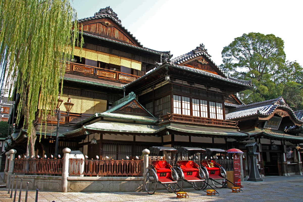
Among the most popular destinations, there is the Dōgo Onsen, a hot spring which provided inspiration for Spirited Away, the famous anime by Studio Ghibli, the Besshi Copper Mine in Ehime prefecture and the Naruto whirlpools in Tokushima.
Since Shikoku is scarcely populated and public transport leading to the mountain trailheads is almost non-existent, hikers should opt for a rental car.
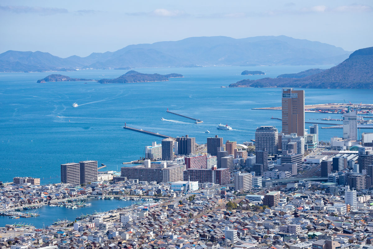
- Takamatsu is the capital of Kagawa, Japan's smallest prefecture. Takamatsu port used to be the main entry point to Shikoku Island until the opening of the Seto Ohashi Bridge in 1988. Takamatsu has some amazing spots of contemporary art displays, and since 2010, Takamatsu, has been host to the Setouchi Triennale, a contemporary art festival with many outdoor exhibitions by prominent artists from across the world. The city has a Ritsurin Garden, a feudal lord garden created in the Edo period. Takamatsu Castle is known for using seawater in its moat and recently the old keep of the castle was successfully restored and opened for public viewing. In the east of Takamatsu City lies the Yashima lava plateau which is home to various sightseeing spots. At the base of the mountain is the open air museum Shikoku Mura where aspects of regional history and culture are exhibited. On the mountain itself is Yashima-ji, number 84 of the Shikoku 88 temple pilgrimage. At the top of the mountain there is also an observation deck which offers views across the Seto Inland Sea.
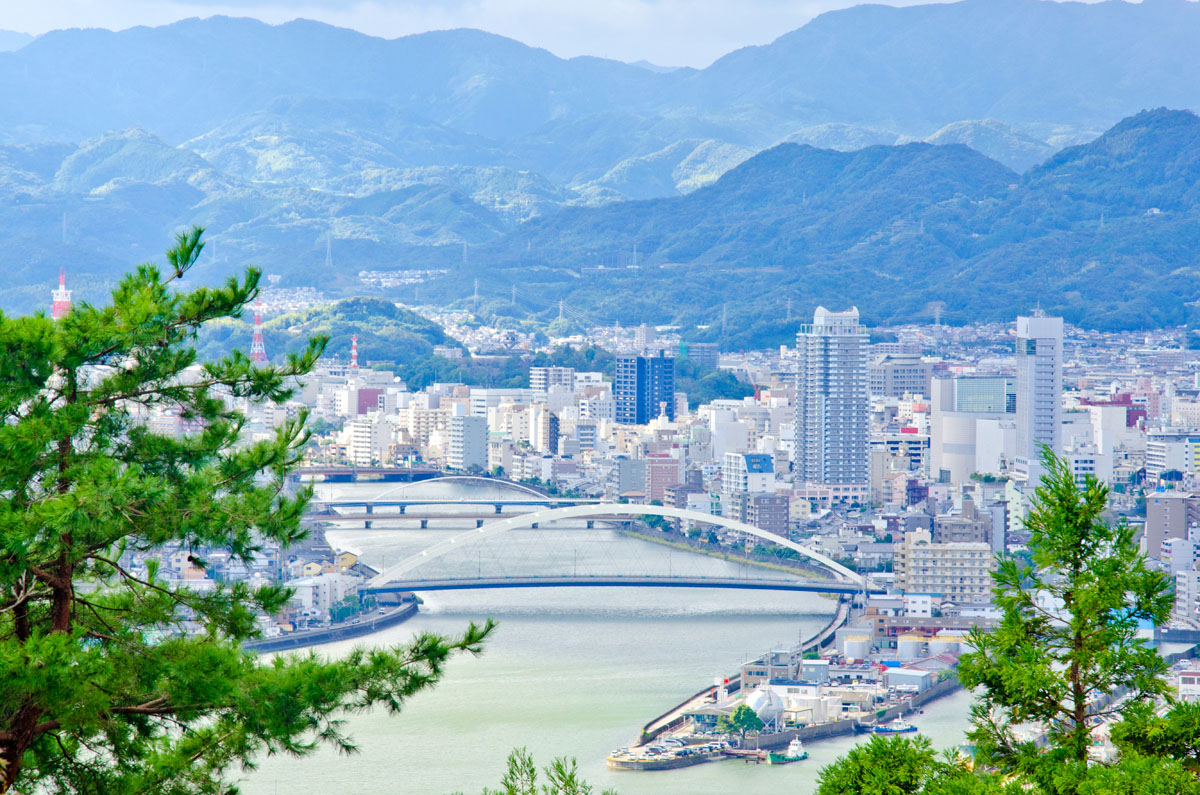
- Tokushima can boast that its Awa Dance is the largest in scale in Japan. The main dance is performed over 4 days between August 12 and 15, but before the dance itself, the "Awa Dance Evening Selection Festival" is held on the 11th. During the event period itself an "Awa Dance Selection" event is held at noon, with the Awa Dance itself being held on stage in the evening, giving visitors plenty of opportunities to enjoy the dance.
- Kochi is the capital city of Kōchi Prefecture with over 40% of its population, thus the entertainment is quite abundant here. There is unspoilt green nature, feudal-era castles, and an almost excessive amount of Sakamoto Ryoma statues (the man who helped overthrow the Tokugawa Shogunate and introduced Western ideals to Japan, which earned the Kochi-born samurai the Sir Stamford Raffles treatment). You can also do the whale watching here, grill your own Kochi specialty dish, the Katsuo no Tataki — a hunk of bonito fish roasted with straw for a minute, before it’s cut thickly and served 90% raw in the middle. No longer sashimi, yet not really aburi.
- Matsuyama is Shikoku’s largest city and the the birthplace of haiku, its name means "pine mountain".
- Uwajima is a coastal city in southern Ehime Prefecture, facing the Bungo Channel that separates Kyushu from Shikoku. The small city is home to one of only twelve extant original castles from the Edo Period (1603-1867).
- Saijo is home to some of the world’s most prestigious and oldest sake breweries. Saijo is sandwiched between Imabari and Niihama along the coast of the Inland Sea.
- Naruto is the town of whirlpools and a namesake of a manga character. The tidal current of the Naruto Strait is fast, ranked one of the 3 biggest tidal currents in the world, and the flow of this current into the narrow strait between the Pacific Ocean and the Inland Sea of Japan is the main cause of the whirlpools. You can also see the Ryozenji Temple, the first of the 88 Fudasho or temples visited by pilgrims, close to Bando Station. There are a lot of pottery workshops and Otsuka Museum of Art in Naruto Park exhibits more than 1,000 painting masterpieces duplicated with porcelain tiles.
- Iyo
- Tosa
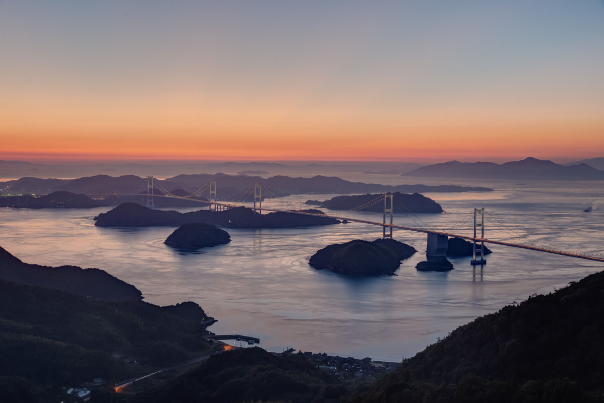
- Imabari is home to a variety of factories and historic sites which allow you to explore the culture of the area first hand. Imabari is home to the Shimanami Kaido, a series of nine bridges stretching across the islands of the Seto Inland Sea to Hiroshima prefecture.
- Niihama
- Imabari
- Marugame