Kyushu Mountainous Region (九州山地) features 1.196 named mountains. The highest and the most prominent mountain is Mount Nakadake (1,791m).
The Kyushu Mountains constitutes the main mountainous area of Kyushu, the third major island of the Japanese archipelago, located just beside Shikoku and Honshu. The island is formed mostly by mountainous terrain of volcanic origin. It lies at the very intersection of three tectonic plates and hosts relevant peaks like the famous Mt. Aso (阿蘇山1.592m), the second most important volcano of the country, erupted the last time in January 2004. The tectonic activity is clearly visible due to the presence of hot springs, the most popular of which are located in Beppu, in the central part of the island, it is the second largest concentration of hot springs in the world.

The Kyushu mountains can be divided into two major ranges: the Kuju Range and the Taisen Range, encircled by the prefectures of Oita, Kumamoto, Miyazaki, and Kagoshima. On the northern border, they are limited by the Japanese median tectonic line, while the southern border runs along the Miyazaki and the Kobayashi basin and the Kawauchi river. They cut Kyushu into equal portions: a northern and a southern part. These parts differ from each other in many ways, geologically and economically. The northern part is characterized by major urban and industrial development, while the south is generally dominated by poorer and agriculture-based activities.
The name Kyūshū (九州) literally means nine provinces, probably referring to its ancient administrative division. The region has been considered the cradle of Japanese civilization as is proven by the presence of numerous relics and ancient tumuli burial mounds together with pottery remains of both Japanese and Korean origin. Also, this territory has always been a melting pot for different peoples and cultures, not only of Asian origin but also European, e.g. the Portuguese, the Dutch and the English. Yet, the Crypto-Christian churches or religion-related festivities you encounter in Japan may seem to have nothing in common with their counterparts in the rest of the world. In addition, many mountains are connected to myths and episodes of folklore create a particular atmosphere that will make you feel as if you were in a completely different Japan.
Major Hiking Areas
- The Aso-Kuju National Park is an area of interest for outdoor lovers, due to the combination of lush nature and volcanic phenomena. For this reason, it is particularly crowded, especially in May, when the azalea and the rhododendrons flowers start to blossom and the whole area gets covered with a wonderful pink blanket. These rhododendrons are reported to bloom only on mountains that have volcanic activity and a disrupted ecosystem; you cannot see them anywhere else. The area attracts flower lovers who don’t want to miss this fabulous spectacle. This volcanic region is dotted with onsen (natural hot springs). At the foot of the mountains, some ryokan (traditional inns) and hotels allow visitors to enjoy their baths. Due to the terrific earthquake in 2016 some areas may not be accessible as indicated in specific guides.
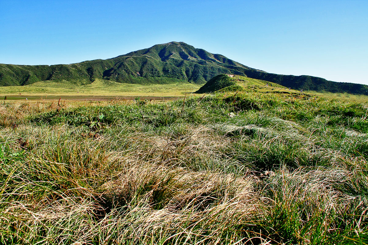
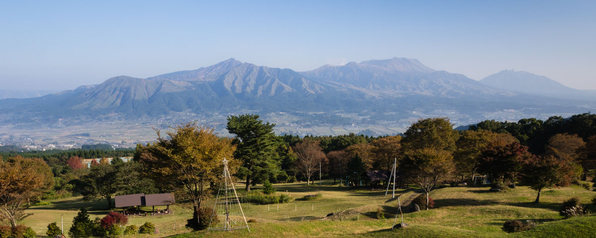
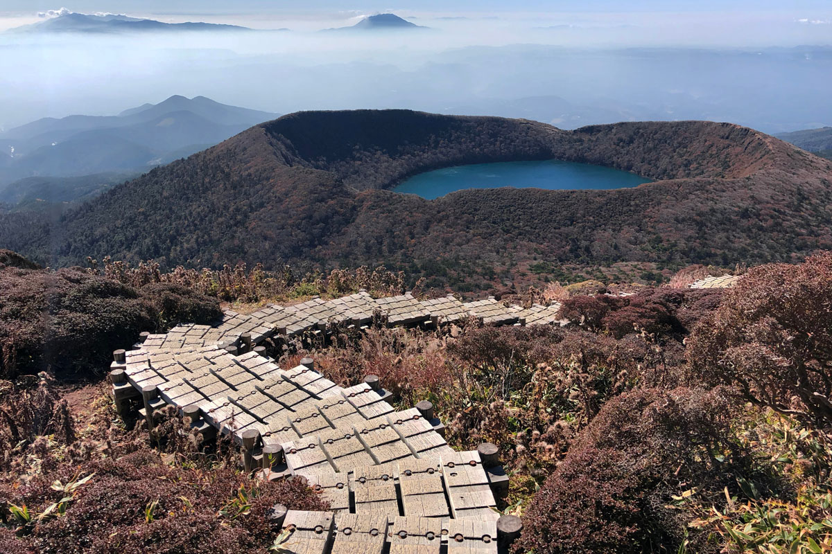
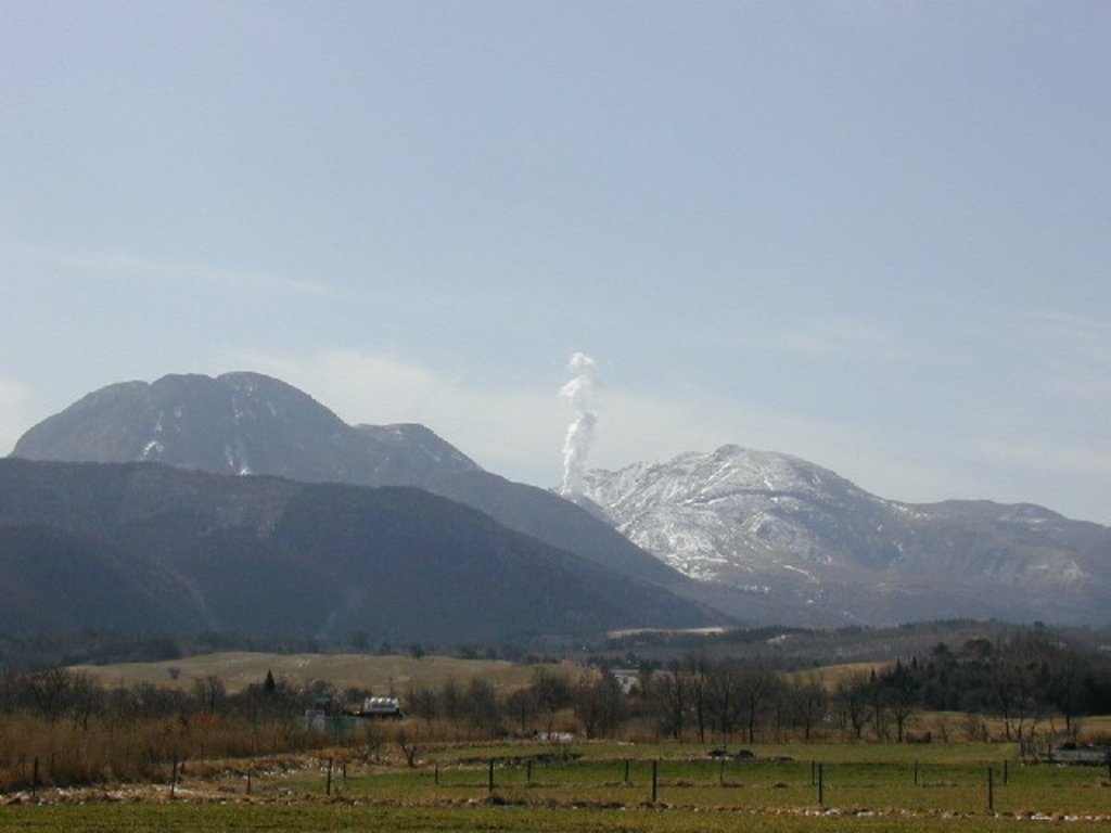
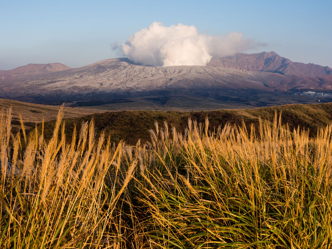
- The King of Park is Mt. Aso (阿蘇山1.592), the second highest volcano of Japan, the symbol of Kumamoto prefectures. It is not only a double volcano but also the world's largest volcano. Its height and beauty are only comparable to those of Mt. Fuji (3,776m), with which it has been mentioned in the 100 Famous Japanese Mountains. It is composed of five peaks: Mt. Takadake (高岳1,592m), Mt. Nakadake (中岳1,506m), Mt. Nekodake (根子岳1,433m), Mt. Eboshi (烏帽子岳1,337m) that occupy the territories of three municipalities: Aso, Takamori, Minami Aso. There is a parking lot immediately near the volcano, from where you can reach the crater in less than an hour. Difficult hiking can be avoided if you use a cable car that will bring you from the parking lot to the top of Mt. Nakadake (1,506 m). Inside its crater lies a beautiful fuming blue lake that can be seen from above. Mind you, the access may be restricted due to toxic gases released by the lake. For the same reason, avoid getting too close to the crater, especially if you suffer from asthma or heart problems, is a safer choice. Do not forget this is an active volcano; it may happen that usual transportations and routes have been closed due to recent volcanic activity. In addition to the Aso Volcano Museum and various restaurants you'll find there, it is also possible to enjoy walking or even taking a horse ride. On the way to the Nakadake crater, there is a place called Kusasenri. It is a very popular spot with an amazing view and beautiful grassland. When accessing the crater is not possible this is the best place to enjoy a view on the fuming Nakadake. Sunasenri is situated just next to the Nakadake crater. Unlike Kusasenri, the place may sometimes look like a desert. It is a popular path for everyone who wants to hike on Mount Aso. Another interesting spot is Komezuka, a moderate peak that looks like a bowl of rice turned upside down. It is not possible to climb it and there is no public transportation available to this place in order to protect the flora, but if you stop at Kusasenri and climb Mt. Kirishima (霧島山1,421m), you'll have a beautiful view of it.
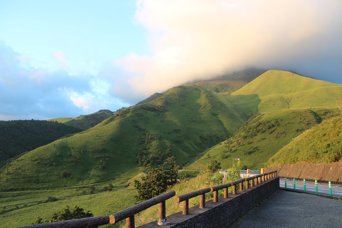
- The Kuju Area counts 5 major peaks, three of which are particularly famous: Mt. Kuju (1,787m), Mt. Nakadake (between Aso area and Kuju Crater) and Mt. Hossho (1,762m). A tour of the main peaks takes between 4 to 6 hours. Visitors often enjoy picnics along the shores of many volcanic lakes strewn generously throughout the area. For those not interested in mountaineering and those who just want to have a nice walk in the mountains, there are lots of small hiking trails branching off the Chojabaru Visitor Center. Nearby, a swampy area has been converted into a promenade, where a 2.5 km circuit lets you walk peacefully while enjoying the view of the mountains. The two other main trails start from Makinoto Pass. Leaving Makinoto Pass at 1,330m you will enjoy a delightful walk along a ridge in the heart of the Kuju Mountain Range directly to Mt. Kuju, Mt. Hossho, and Mt. Inaboshi. Another mountain situated on the eastern edge of the Kuju Volcano Group is Mt. Taisen, one of the most popular peaks in this volcano group. Standing on the northeast tip of the Kuju Volcano Group is Mt. Kurodake (黒岳 1,984m), the site of a primaeval forest of beeches, oaks (Quercus serrata Murray), white alders (Clethra Barbinervis) etc. This area is also famous as the location of the Oike Pond, Shiramizu Mineral Spring, Kakushimizu, and other famous waters.
- One-day trekking around the cities. Fukuoka, the most densely populated city of Kyushu and the capital of the prefecture with the same name is a city full of surprises. Hikers don’t need to get too far from the city to plan a one-day hike in beautiful places.
- Mt. Hiko (1,199m) is an hour and a half drive from Fukuoka. You can reach it by car and leave your car in one of the several large parks in Kane-no-torii, just where the trail starts. This trail offers an unforgettable opportunity to challenge your strength while enjoying the mix of nature and traditional architecture. The difficulty level of the route varies depending on the route, but in general, this is an intermediate level hike taking 5h-6h to be completed. There are two options for ascending to the start of the trail. The recommended option is to walk the great stone staircase to Hohei-den (奉幣殿 ), one of the beautiful Shinto shrines located on this route. The trail passes under several torii gates and has been well-marked by centuries of pilgrims. On both sides of the trail magnificent maple and camphor trees stand out against the sky. In 2005, a small monorail was built, it runs parallel to the staircase and will transport you to Hohei-den in just under 15 minutes, but then you’ll miss out the beauty of the sacred path. The mountain is constituted by three major peaks: Minami-dake (南岳1,200m), Naka-dake (中岳1,188m), and Mount Kitadake (北岳1,192m) connected to each other by trail junctions.
- Mt. Sarakura (622m) is one of the symbols of Kitakyushu, as a mountain that's near the city but still lush and with a great view from the summit. There are 8 different trails, from the Sarakuraomote Tozanmichi course for beginners to the Kousai no Mori course for serious hikers. There is also a cable car or a slope car. Beginner hikers or families who want to discover Kyushu historical heritage and don't necessarily aim for the summit may choose Mt. Shiouji (410m), where they can see the Dazaifu Seicho Ruins, the Ohno Castle ruins and Kagamigaike. Shifting to Saga Prefecture, Taradake Yokodan Rindo, a scenic road which you can take and admire the changing expressions of the four seasons on Mt. Taradake (997m). On its summit, there is a temple that is worth visiting. There are four trails in ascending order of difficulty. They all start at Nakayama Camping Site and each stops at a different panoramic spot; the most popular is probably the historical walking doable in 2h30m (歴史散歩コース).
- Onsen trails are usually called “Hells” (地獄Jigoku) due to the infernal atmosphere of smoky calderas. In this sense, Beppu is a hot spring area of peculiar beauty. It enjoys its fair number of jigoku or "hells", which here mean places where geothermally heated water bubbles up to the surface as steamy ponds or sulphurous gloop. These hells are given the full tourist treatment so be prepared for tack.
- Mt. Tsurumi (1,374m) is accessible directly from the city ropeway (別府ロープウェイ). From Beppu, you can expect to reach the summit in about 4 hours. The starting point for the hike is Matogahama Park (的ケ浜公園), approximately a 10m walk from Beppu Station.
- Another place you may want to discover is Mt. Unzen (1,342m) a volcanic massif inside the Unzen Amakusa National Park, one of the first national parks in Japan. On the Unzen Jigoku, you can see boiling water reaching temperatures around 98°C, bubbling from the ground when the sulfuric steam isn’t clouding your path. During the persecution of Christianity in the 16th century, over 30 people were boiled alive in the hot springs for following the Christian faith. Despite this sad history, it is still a perfect place for onsen lovers. The town provides accommodation as well as convenient access from Shimabara City, Nagasaki, and Fukuoka, making it a good base for climbing Mount Unzen. The most convenient and pleasant hike starts in Unzen town, but you can decide to start from Nita-toge Pass as well. From there, the Unzen Ropeway will lead you directly up to the mountain slope. In the winter, you can also catch sight of the hana boro (hoarfrost), a natural phenomenon that makes the trees on Mt. Unzen draped in frost. The same phenomenon can be seen in Hokkaido as well.
- The 100 famous. If you want to indulge and linger to your "fetish" for famous mountains or if you want to trace back the process that led Kyūya Fukada to choose the most representative mountain of Japan, Kyushu is the right place to fulfill your dreams. Except for Mt. Aso, already mentioned in the section above, there are at least other two peaks you may like to discover.
- Mt. Sobo (1,756m) is one those of the 100. According to Japanese mythology, gods descended here in ancient times. At its feet on the northern side you can visit Takeoshimokori Shrine, where Kyushu's God is believed to dwell. Among the numerous trails leading to its top passing through steep slopes and rocky paths, the most popular is a ring route located in Kitagaya (Miyazaki prefecture), feasible in 5-6h.
- Mt. Kirishima (1,421m) is another peak on the list and one of the most versatile peaks of the area in the Kirishima National Park. Actually, it indicates a group of active volcanoes, where hikers can find trails for all tastes and difficulty levels. The Takakankokudake course is probably the most interesting due to the panoramic view hikers can enjoy from its top. Not only it hosts the highest volcanic lake of Japan, but from the mountaintop you can also see the land profile of North Korea looming at the distance. The lake trail allows you to admire three different volcanic lakes and it’s the best option to have a nice walk without getting exhausted.
- Mt. Yufu (1,583m) is a perfect choice for beginners. Actually, it isn't listed in the chosen 100 famous, despite the extraordinary panorama opening from the top. Also, it has a long history as a holy mountain, and it was even mentioned in the Man'yōshū. That's why at the time the famous 100 were chosen many people complained this peak wasn’t considered at all. However, it is an awesome spot to admire such 100 famous as Mt. Kuju, Mt. Sobo, Mt. Aso, and Mt. Unzen. This peak can be reached through three trailheads, the most crowded of which is the central one. Depending on the trailhead you choose, the difficulty level may vary, but on the whole the absence of particularly complex spots is the reason why this peak is a challenging yet safe place for beginners. Reaching the mountaintop takes on average 2h, no matter the trail you decide to take.
Major Cities and Facilities
Kyushu is famous for its trains. It can boast perhaps of the most attractive trains in entire Japan. It is not just a matter of cleanliness or the fact they are always on time (like every train in Japan), but they are also elegantly designed. Just to give two examples, from the Aso Boy train you will enjoy a breathtaking view of Mt. Aso while sitting in fabulous coaches provided with an interesting book collection and a wooden filled pool for kids. Alternatively, if you get on the Aru Ressha, you will be fascinated by the old-fashioned style of the furniture, which seems to have come out directly from the 19th century. Finally, if you are an adventurer, renting a car won’t be a bad choice.
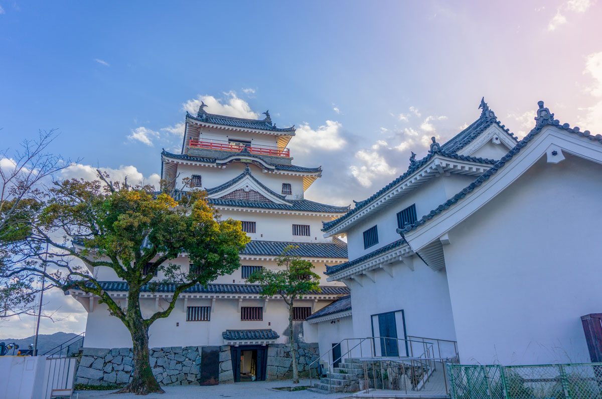
- Saga. Visit the old feudal Saga Castle with is killer whale gates, have a bite of Saga beef which is relatively new to the culinary scene, appearing in 1983, but has already established itself as a mouthwatering alternative to more famous brands such as Kobe and Matsusaka. From the Japanese wagyu breed, the meat is known for its glossy marbling and depth of flavor.
- Arita and Imari offer great shopping for traditional pottery and crafts.
- Karatsu