
Scan the QR code and open PeakVisor on your phone
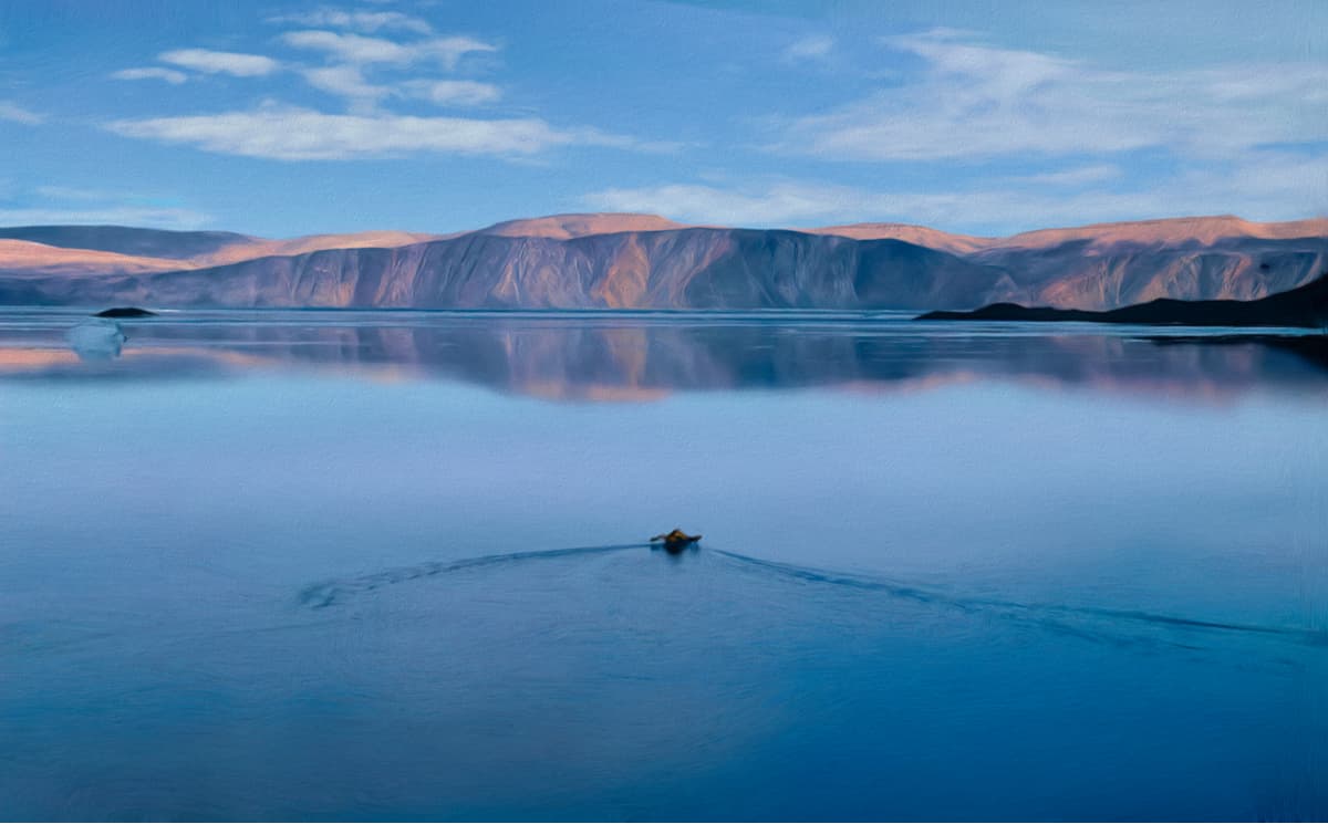
Some of the world’s largest islands sit in Canada’s Arctic Archipelago. Split between Nunavut and the Northwest Territories, the Queen Elizabeth Islands are a collection of islands that encompass roughly 161,800 square miles and approximately 14% of the global glacier and ice cap area (excluding ice sheets in Greenland and Antarctica).
The discovery of the islands is generally credited to English navigators William Baffin and Robert Bylot, who laid eyes on the island chain in 1616. However, the islands were not actually explored and surveyed until the 19th century British Northwest Passage expeditions and the Norwegian exploration.
In fact, the islands were originally identified as the Parry Islands or Parry Archipelago, after the British Arctic explorer Sir William Parry, but were renamed in 1953 after Elizabeth II, the former Queen of Canada. Today, it’s not uncommon to hear the term ‘Parry Islands’ used to refer to the southwestern region of the archipelago.
Today, the Queen Elizabeth islands remain mostly uninhabited, with exception of two small communities, Resolute and Grise Fiord, and several weather and research stations.
The Queen Elizabeth Islands are generally grouped into three geographical regions: Ellesmere Island, Sverdrup Islands, and Parry Islands.
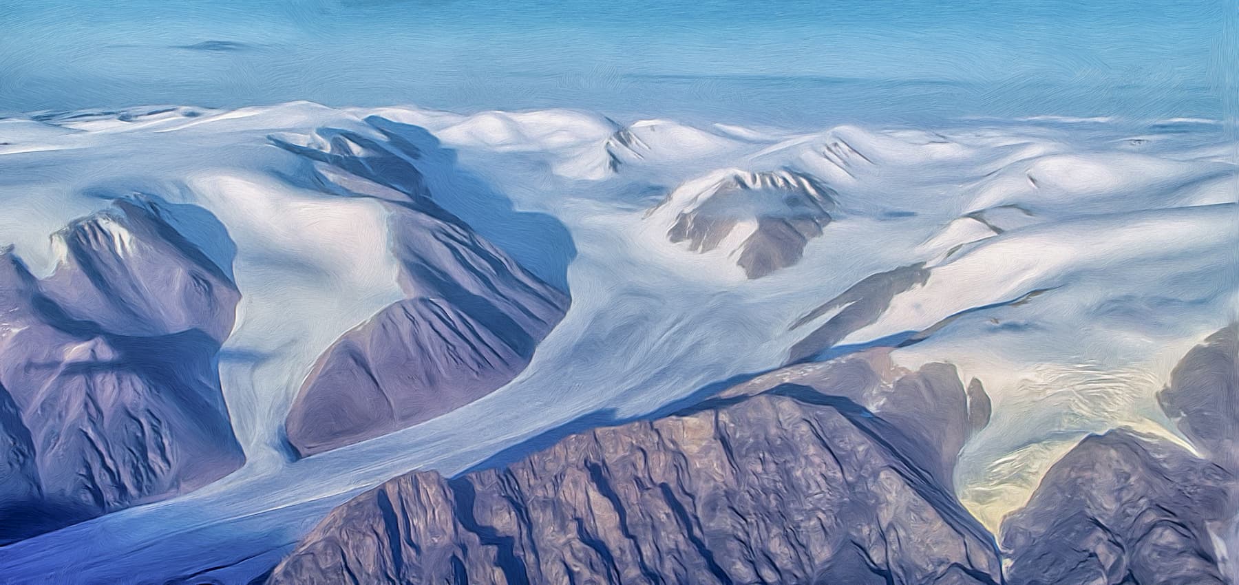
Canada’s third largest island, Ellesmere Island, covers over 75,000 square miles and is 520 miles long. Ellesmere is not only the largest, but is also the most northerly and most mountainous island in the group. The Arctic Cordillera mountain system spans the majority of the Island and impressive peaks including Commonwealth Mountain, Mount Whisler, Barbeau Peak, and Mount Oxford dominate the landscape. More than a fifth of the island is protected as Quttinirpaaq National Park, which contains acres of fjords, glaciers, lakes, and summits.
Located west of Ellesmere, the Sverdrup Islands is a set of smaller islands named after Norwegian Arctic Explorer Otto Sverdrup. The main islands in the group include Axel Heiberg Island, Ellef Ringnes Island, Amund Ringnes Island, and Meighen Island, though many other, smaller islands can be found in the archipelago. Axel Heiberg, the largest of the Sverdrup Islands, is home to one of the tallest peaks in the Queen Elizabeth Islands, Outlook Peak.
The Parry Islands encompass all of the remaining islands south and west of Ellesmere Island. The Parry Islands consist of several larger islands, including Melville, Bathurst, and Cornwallis islands, as well as a number of smaller islands. Melville Island, the largest of the Parry Islands, is the 33rd largest island in the world. Though the island has little to no vegetation, several summits on Melville reach over 2,400 feet in elevation.
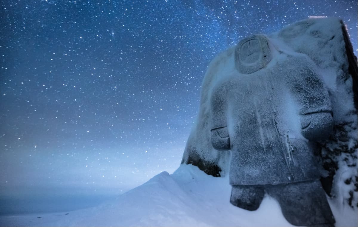
The Queen Elizabeth islands are notoriously remote and seldom visited. With the exception of roughly 400 Inuit locals, the islands are mostly visited by scientists working in remote research centers.
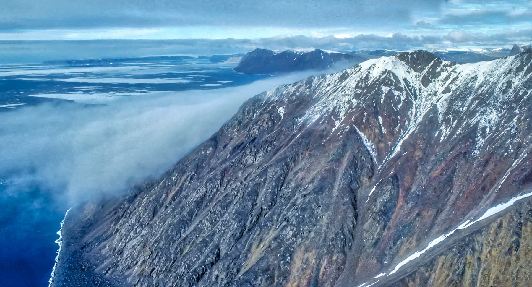
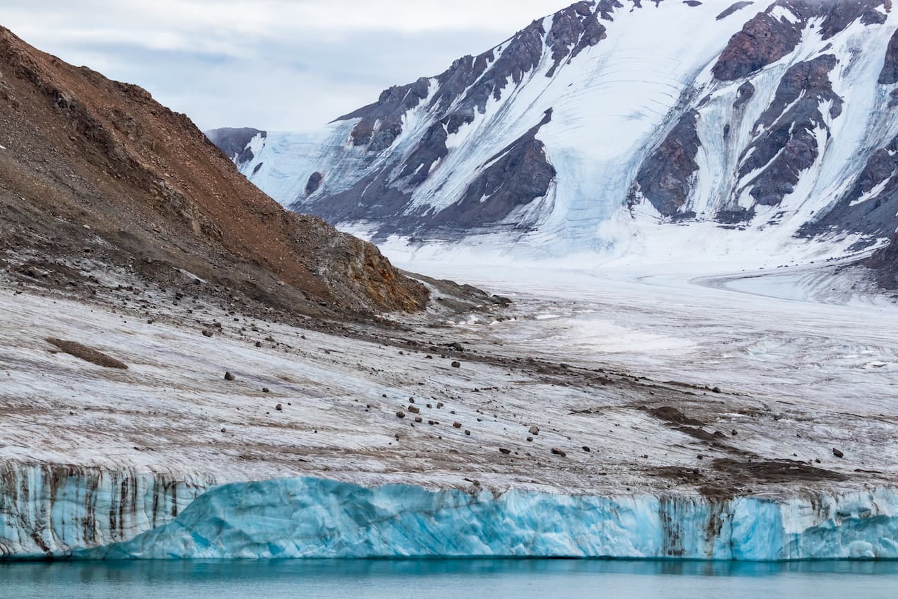
Located in the northeastern corner of Ellesmere Island, Quttinirpaaq National Park (pronounced ‘koo-tin-ir-pa-ak’) is a 14,585 square mile stretch of isolated wilderness in the Qikiqtaaluk Region of Nunavut, Canada. The second most northerly park on Earth, Quttinirpaaq receives just 50 visitors each year. The park is a polar desert that is dominated by rock and ice. Large, spectacular ice fields, ice caps, and glaciers cover the park. More than half of the park is covered by imposing peaks, including Barbeau Peak, the highest peak in the Canadian Arctic.
Quttinirpaaq is just 600 miles from the North Pole, so reaching the park is not cheap or easy. In fact, visitors can expect to pay approximately $10,000/person to reach this desolate landscape. However, those willing to make the trek to this arctic retreat are guaranteed to be greeted by complete solitude.
The Weatherhaven is a semi-private tent cabin located in Quttinirpaaq National Park. The Weatherhaven is a truly unique accommodation that was built to insulate visitors from the unpredictable elements of the High Arctic. Weatherhaven is divided in half – each side has two bedrooms – and offers visitors a cozy area to kick back and relax after a long day of exploring the Arctic tundra. There is no washroom or cooking facilities in the unit, but a fully equipped visitor kitchen is nearby.
Resolute is a small Inuit hamlet on Cornwallis Island. Resolute is known as the ‘place with no dawn,’ due to its harsh, long winter nights. However, Resolute houses an airport and serves as an excellent starting point to exploring Quttinirpaaq National Park. The Tudjaat Co-op, part of the Arctic Co-operatives, runs a grocery/retail store and a hotel in Resolute. Accommodations in Resolute include the Narwhal Hotel, Qausuittuq Inns North, and South Camp Inn.


-R4.jpg)


