Scan the QR code and open PeakVisor on your phone
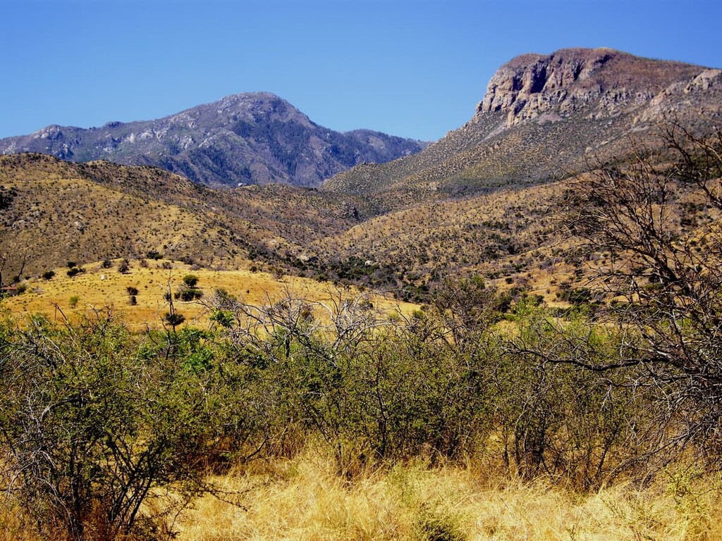
The Mule Mountains and a small mountain range located in the southeastern part of the US state of Arizona. The range is surrounded by relatively flat terrain, and has a long history of mining. There are 26 named mountains in the range with the tallest and most prominent peak being Mount Ballard at 7,379 feet (2,249 m) tall with 2,894 feet (822 m) of prominence.
The Mule Mountains are a north to south running mountain range situated in southeastern Arizona. The range spans across the south-central part of Cochise County, named after the Native American Chief Cochise.
From north to south the Mule Mountains cover 21 miles (34 km) of terrain. From east to west they span 33 miles (53 km), for a total area of roughly 500 sq miles (1,300 sq km). The rugged range is surrounded by sweeping desert basins.
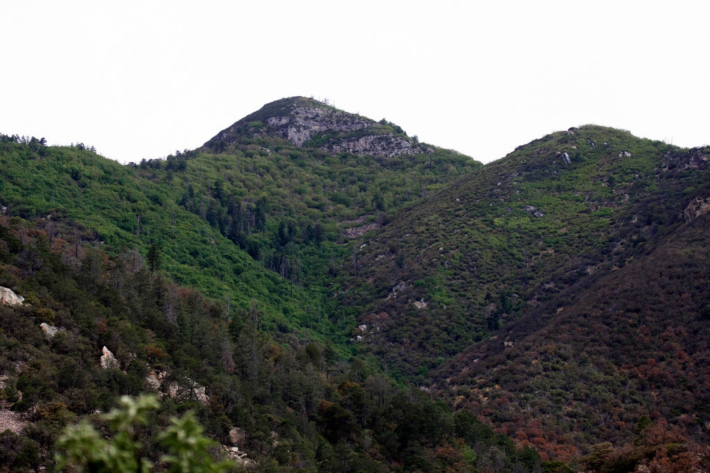
Much of the range is marked by steep slopes and deep canyons. Though the range was once heavily forested, widespread logging and mining has left the Mule Mountains almost unrecognizable from their natural state.
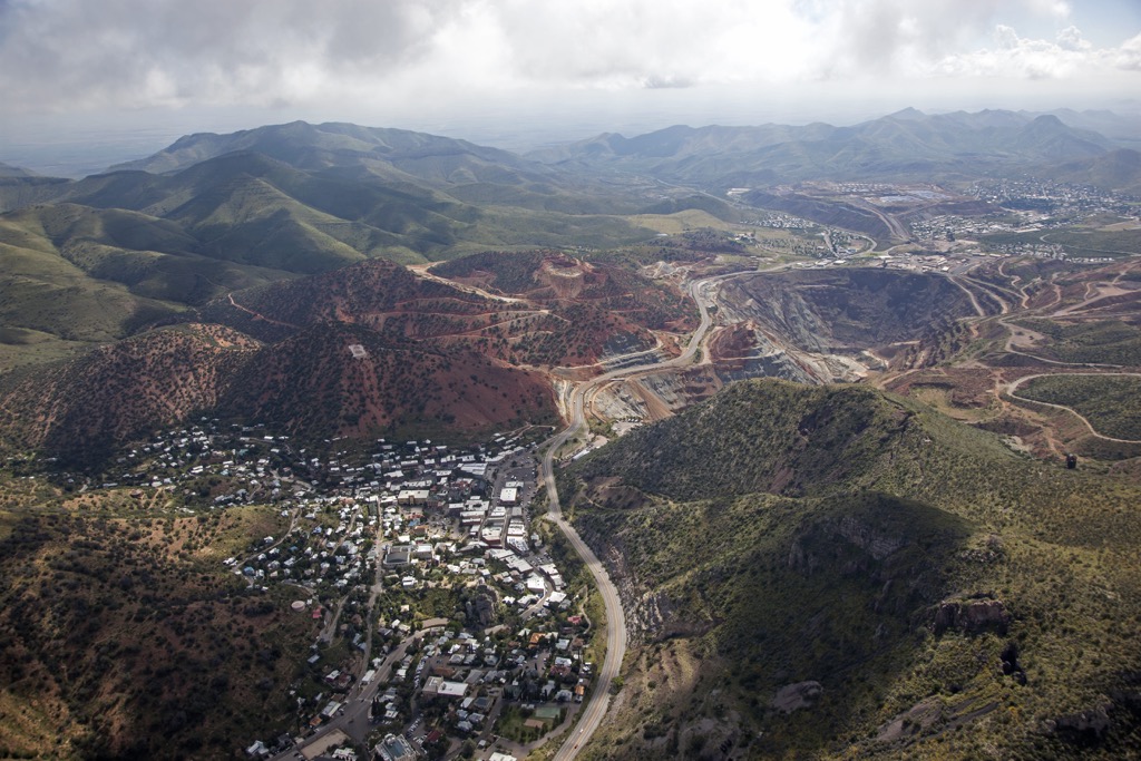
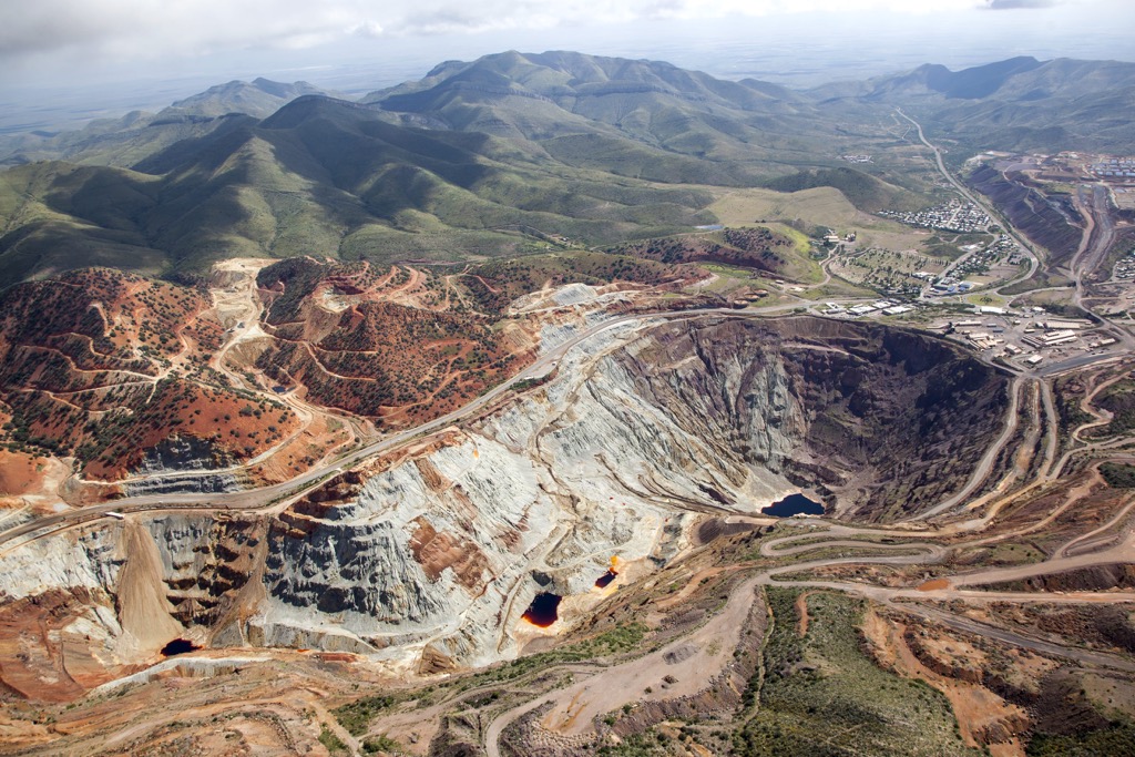
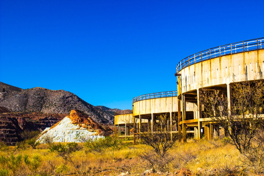
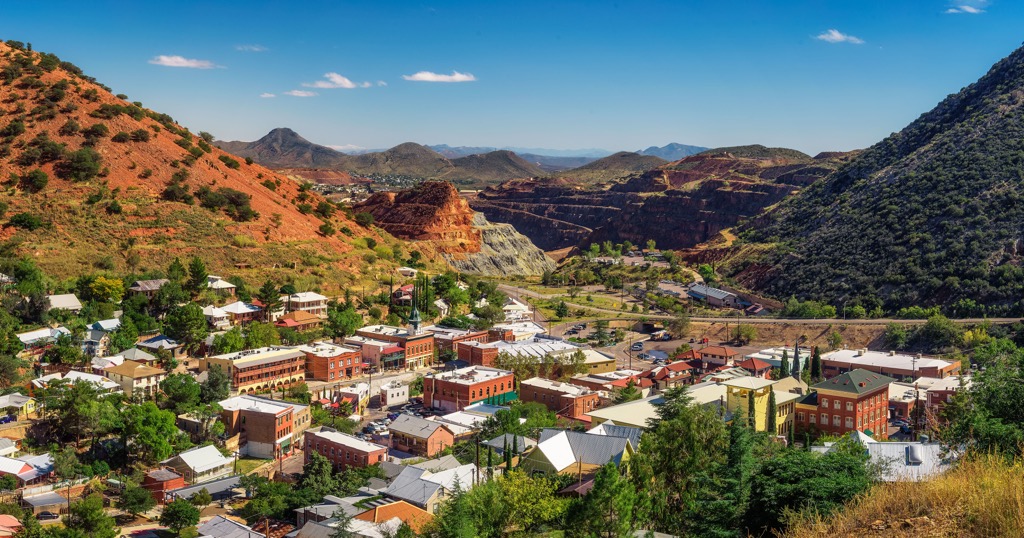
Sulphur Springs Valley is situated along the eastern edge of the range with the San Pedro River Valley, and river, located to the west of the range. Along the east side of the Mule Mountains also lies the Lavender Pit open pit copper mine and the Copper Queen Mine.
Elevation changes are rather rapid throughout the range, quickly rising from the nearly flat foothills, up to the series of ridgelines and valleys that define the Mule Mountains. The southern edge of the range lies just a few miles north of the US and Mexico border.
Additionally, the Mule Mountains are surrounded by other popular outdoor recreation areas. To the west lies the San Pedro Riparian National Conservation Area as well as sections of the Coronado National Forest, including Miller Peak Wilderness. Both north and east of the range lie other sections of the Coronado National Forest.
The Mule Mountains are considered a sky island mountain range, similar to those found throughout the surrounding Coronado National Forest.
These peaks were formed by a combination of both volcanic activity and block faulting. Shifting of the tectonic plates led to this block faulting which caused portions of the landscape to rise up steeply, creating the peaks visible today.
Around 50 million years ago, much of the surrounding region experienced volcanic activity as the North American Plate was thrust over the Pacific Ocean. This continual movement further helped form the Mule Mountains.
Over the course of 25 million years, erosion would carve out the peaks, giving way to the deep valleys and gorges within the range. The peaks visible today mark just the summits of much larger mountains and ranges that are now buried beneath sediment.
Major peaks within the range include Mount Ballard, Juniper, Gold Hill, Grassy Hill, and Fissure Peak.
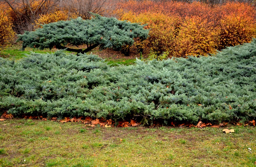
Before the range was used for widespread mining, the slopes were densely populated by Rocky Mountain Douglas-fir among other conifers. The trees were used for building houses and feeding the ore smelting furnaces nearby.
Today, the vegetation consists primarily of juniper, lowland oaks, lowland pines, manzanita brush, and low growing grasses. Some of the tallest peaks and buttes are free of flora.
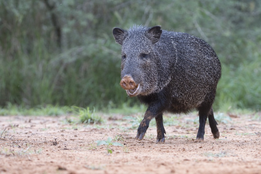
This rough terrain helps support a few animal species. Hikers are likely to spot white-tailed deer and mule deer. Collared peccary, also known as javelinas, can be found in the range and are similar to wild boar. The desert landscape also supports multiple species of birds, rodents, and lizards.
The land within and surrounding the Mule Mountains has an extensive human history dating back over 11,000 years. The earliest traces of human settlement are centered around the Mogollon, Sobaipuri, and Hohokam cultures. Remnants of these cultures are still being found to this day.
This region of the land marks part of the ancestral homelands of many peoples, including the Tohono O’Odham Nation, Chiricahua Apache Nation, and the Salt River Pima-Maricopa Indian Community, among many others.
In the seventeenth century, the first peoples of European descent began arriving in the region. The Spanish missionary Eusebio Francisco Kino founded the Mission San Xavier del Bac in present-day Tucson in 1700.
Near the end of the eighteenth century, the Spaniard Hugh O’Conor established a military fort in the region. The increased presence of both settlers and military personnel led to numerous conflicts and battles with the local Tribal Nations. Despite their continual efforts, many of the Indigneous peoples were forcibly removed from the region.
Following the Mexican War of Independence, the region became part of the Mexican state of Sonora. After the Mexican–American War ended in 1848, the region then became part of the United States.
Over the following decades, Tucson acted as a stopping point for US settlers traveling along the San Antonio-San Diego Mail Line. During this time mining began to take over the Mule Mountains. The Copper Queen Mine marked the richest copper deposit ever-recorded during its time, bringing many people to the region.
Construction and completion of the railroad across the US, brought more people to the region, including a large number of Chinese immigrants. Tucson continued to grow, quickly establishing itself as one of the largest commercial centers in the region.
The first steps to establishing Coronado National Forest began in 1902 with the establishment of the Santa Rita Forest Reserve. The reserve was continually expanded, combined with other forests, and redesignated until reaching its current size in 1953.
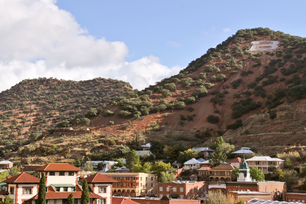
Lavender Pit and Copper Queen Mine drastically altered the natural terrain and beauty of the Mule Mountains. Near the Copper Queen Mine lie numerous mining tunnels that were dug under the mountains in search of copper ore. None of the mines in the region are currently being used.
The Mule Mountains are home to multiple hiking trails, many beginning in the small city of Bisbee. Here are some of the top hiking areas to visit in the forest:
This loop trail winds through the town of Bisbee and climbs up into the nearby Mule Mountains. Hikers are able to wind through the historic town with stunning views of the surrounding canyon and mountains.
The trail is a mix of urban and trail walking. Some sections of trail may be quite narrow and offer little to no shade coverage. This loop is 3.7 miles (6 km) in length and features 469 feet (143 m) of total elevation gain.
This loop trail begins in the Old Town section of Bisbee before climbing steadily into the surrounding mountains. Once away from the town, hikers are fully immersed in nature near the center of the Mule Mountains.
Hikers have views throughout due to the lack of tree coverage. Along the path lies various shrubs and low growing grasses. Round trip the loop is 4.9 miles (7.9 km) and features 964 feet (294 m) of total elevation gain.
Mural Peak marks the fifth most prominent peak in the range and lies a few miles east of Bisbee. This trail begins in the town and climbs steadily throughout, passing through the series of alternating peaks and valleys before reaching the summit.
Much of the route follows along old mining roads. From the summit of Mural Peak are stunning views of the rest of the range. The out and back trail is 5.8 miles (9.3 km) long and features 1,473 feet (449 m) of elevation gain.
Looking for a place to stay near the Mule Mountains? Here are some of the best cities and villages to check out in the region:
Bisbee is situated in the southern section of the Mule Mountains. Home to around 5,000 residents, the city is home to the Bisbee Mining and Historical Museum as well as the Bisbee Restoration Museum.
Besides being surrounded by the Mule Mountains, Bisbee is also located near the Queen Mine which offers underground tours of the mine. Homes and businesses nestled in Tombstone Canyon are part of the historic town center, marking structures once owned by the early miners of the region.
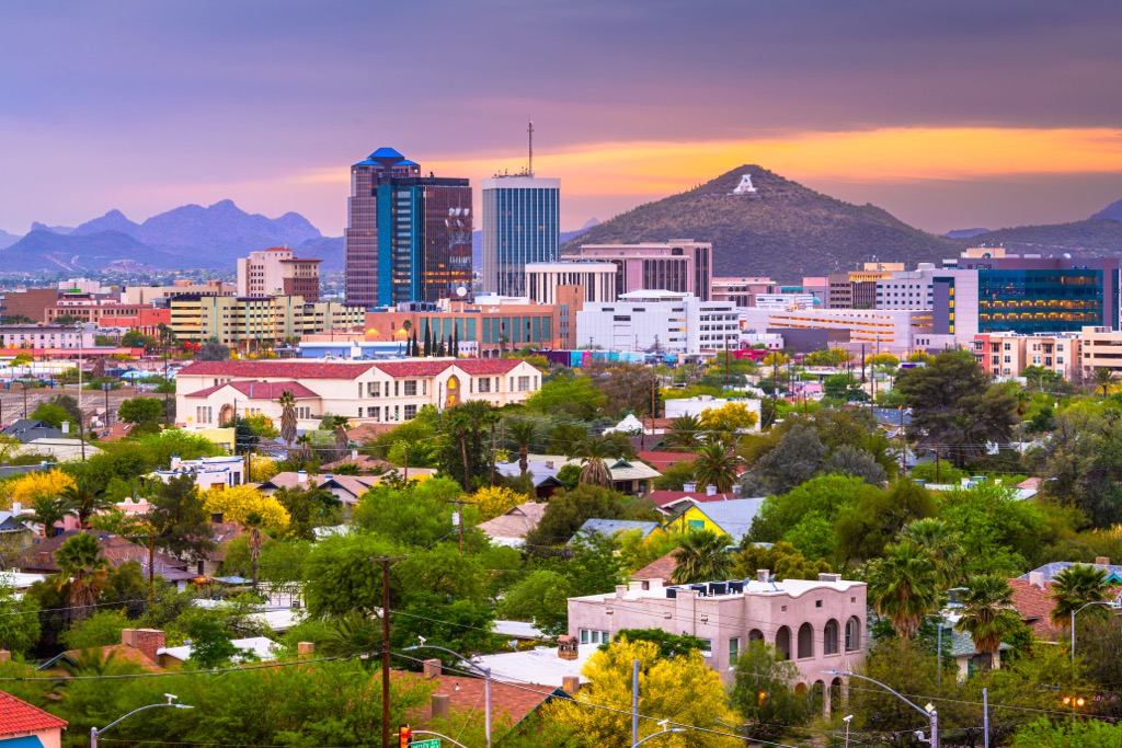
The city of Tucson lies an hour and half drive northwest of Bisbee. Home to around 550,000 people, it marks the closest major city to the range. Tucson lies along the western side of the Coronado National Forest and boasts a metro population of over one million.
Home to the University of Arizona, Tucson marks the second largest city in Arizona. Despite its relatively large population, Tucson is surrounded by numerous areas for outdoor recreation. Nearby national forests and national parks provide both locals and visitors alike opportunities for year round recreation. The city has a thriving food scene, and features some of the best Mexican cuisine in the country.