
Scan the QR code and open PeakVisor on your phone
The Lesser Khingan include 127 named peaks. The highest is Píng Dǐng Shān at 1,352 m. Other notable peaks include Bái Shí Lì Zǐ, Yàn Wō Shān and Yuanmodingzi Shan.
When people talk about the Khingan Mountains, there exist some confusing concepts. So let's take the chance to make it clear here. Khingan is the Mongolian name for the mountains divided into the following three ranges:
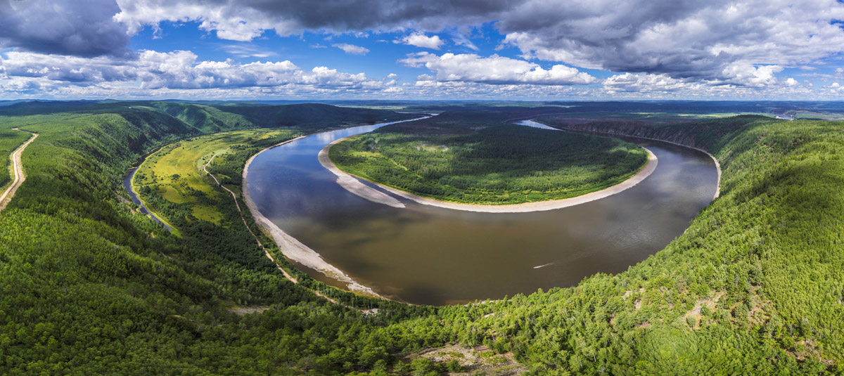
To outline their spatial relationships, on the south coast of the Amur River (also called Heilong Jiang in Chinese), the Nen River (or Nenjiang) separates the Greater Khingan in the west and the Lesser Khingan in the east; and to the north of the Amur River, the Stanovoy Range runs in the territory of Russia. the Greater Khingan and the Lesser Khingan connect with each other in bodies, constructing the natural shield to the northern part and the northeastern part of Heilongjiang Province. Quite cold climate makes the north section of both ranges the coldest region in China, with the lowest temperature reaching minus 50-degree Celsius in winter. The entire range is rich in natural and mineral resources, there is a great variety of timber, ore mines, animals, and plants.
There are 102 named mountains in Lesser Khingan. The highest peak of the Lesser Khingan is Pingding Shan at an elevation of 1,429 meters and the most prominent mountain is Yuanmodingzi Shan. There are many mountains in the range, and many of them have been developed as tourist attractions thanks to the well preserved plants, water resources and virgin landforms.
Speaking of where to go in the range of the Lesser Khingan, Wudalianchi Volcanic Cluster has a great reputation with the two youngest volcanoes in China, Laohei Mountain and Huoshao Mountain, the stone seas, the fairy palaces and the volcanic landforms. Visitors can also find other spots such as the bonsai garden, the five-color beach, the garden of grotesque pines and the garden of Chinese ilex.
As a UNESCO Global Geopark and one of China's AAAAA tourist attractions, Wudalianchi Global Geopark is named for a string of five scenic lava-dammed lakes and consists of 14 cinder cones capping a 500-square-kilometer shield-like lava plateau in northeast China. The volcanic cluster, whose name means "five joint ponds", was formed during five eruptive cycles from the early Pleistocene to historical time. Among the 14 volcanoes, Laohei Shan and Huoshao Shan were freshly formed during eruptions in 1720-1721, which finally silted up the Bai River and divided the river into a set of five interconnected lakes, shaping what it is now.

The Wudalianchi Scenic Area boasts of its fresh air and natural beauty of lakes and mountains in the elegant environment, thus deserving to be a perfect destination for tourists. Its characteristic volcanic scenery, landscapes and therapeutic hot springs all contribute to a comprehensive natural scenic spot covering a wide range of functions like sightseeing, recuperating rest and scientific research. Most importantly, Wudalianchi Global Geopark is recommended to anyone who wants to have a real feel of how the volcano erupts, what it leaves behind and also how it looks like. Here are some of the major features of the park:
Laohei Shan & Huoshao Shan
Laohei Mountain, also called Heilong Shan or Xianren Shan, is the highest one among the 14 volcanoes. Laohei Shan is 515.9 m a.s.l. and is 165.9 meters above the ground. The mountain is piled with black pumice, volcanic ash and volcanic rocks. The north slope is where the famous and spectacular scenery of "Stone Sea" is situated, which consists of a large area of volcanic rocks that are exposed to the air. The volcanic rocks stretching 17 kilometers southward collectively look like a huge dragon lying on the ground and thus make another spectacle of the mountain called "Stone Dragon". The summit of Laohei Shan is reachable via the climbing trails on the east and north sides of the mountain, and there is a footpath around the crater where the bottom of the crater can be seen.
Huoshao shan is about 3 kilometers to the northeast of Laohei Shan, and had a smaller scale of eruptions than that of Laohei Shan. Due to the destructive second explosive eruption inflicting the cinder cone, the mountain looks like a broken basin made of baked clay.
Situated in the south of Wudalianchi Volcanic Cluster, Yaoquan Shan is at an elevation of 355.8 meters and 60.8 meters above the ground, making it the lowest and smallest volcano of the 14 yet one of the most rewarding places to go. Yaoquan Shan is well known for the rich mineral springs spread at the foot of the mountain, as well as over 50 sanatoriums. Zhongling Zen Temple is built on the mountain and often visited by the locals. When you reach the top, you will see a white-marble statue of Bodhisattva Guanyin. It also grants panoramic views of the whole Yaoquan Scenic Spot after a relaxing walk to the top that only takes less than twenty minutes.
Wenpo Lake
Wenpo Lake, meaning "warm lake", is a popular sightseeing spot in Wudalianchi. It is a mini-escape-style scenic spot consisting of three small lakes, named Jingpo, Bipo, and Lipo. It is special that these three lakes are very different from each other in scenery, although they exist in the same water area under identical geological conditions. The lakes never freeze even in winter, covered by some steam fog in the sunshine, constituting a landscape that you will never be able to forget.
Beiyin Spring & Nanyin Spring
Beiyin Spring and Nanyin Spring are famous for the mineral water springs that are said to yield various therapeutic benefits. It's worth trying for those who are fond of the frappe bubbling soda beverage with a flavor of rust, and those who are looking for a scenic garden of golden reed marsh, too. The two springs are separated from each other by standing on both sides of a street as two independent scenic spots, and charge admission fees separately of course. They are 1.3 km away from Yaoquan Shan, 7.5 km from Laohei Shan, and 9.8 km from Huoshao Shan. Erlong Spring nearby is said to be more acceptable in taste and is popular with the locals.
Bailong Lake
Bailong Lake is the third lake of the five connected lakes, and also the biggest one. It allows the best views of the clear mirror-like lake before 8 in the morning and after 4 in the afternoon.
* The detailed information about timing and tickets rates could be found here on the Travel China Guide.
By Train: From Harbin, Heihe or Qiqihar, you can take a train directly to Wudalianchi Station, which is 30 kilometers away from the Wudalianchi Scenic Spot that is reachable by a taxi or a bus.
By Plane: Harbin, Heihe and Qiqihar are reachable by plane. And then transfer to a train and a bus.
By Bus: There are direct buses to Wudalianchi Global Geopark available fromHarbin, Heihe, Qiqihar and Daqing on a daily basis.
In the Park: Wudalianchi Global Geopark takes up a large area of dispersed scenic spots, and shuttle buses are available in some of them. You can also hire a car or a chauffeur, or purchase a one-day tour bus service.
Huazi Shan (357m) is named for its shape that resembles a plow, which is spelled as Li Hua in Chinese. With the beautiful scenery of mountains and streams, it has been a very popular attraction with the locals in Tonghe County.
As a part of the stretched range of the Lesser Khingan, Huazi Shan is only 18.2 kilometers to the northwest of Tonghe County. The mountain range taking an area of about 85 square kilometers, is made up of the three major mountains, named Dahuazi (Big Spade), Erhuazi (Second Spade) and Sanhuazi (Third Spade), and other lesser mountains. The main peak is at an elevation of 680.7 meters with gentle slopes covered in abundant forests. Huazi Shan is reputed as the Small Mount Tai of Tonghe. It’s ridge is the symbol of Tonghe.
The forest park was established to preserve the beauty of the area and some of rare plant species found here. Huazi Shan Forest Park with rich plants, clear water and fresh air, allows a healthy hiking while learning much about various trees that are hundreds of years old. The 3,000-kilometer climbing trail made up of 2,600-meter plank road and 400-meter stone stairs is rich in beautiful scenery and legends.
The admission fee is 40 RMB per person. The scenic spot of glass skywalk takes 70 RMB extra per person.
8:00 a.m. - 5:00 p.m.
From Harbin, take a bus to Tonghe County and then take a taxi to the forest park.
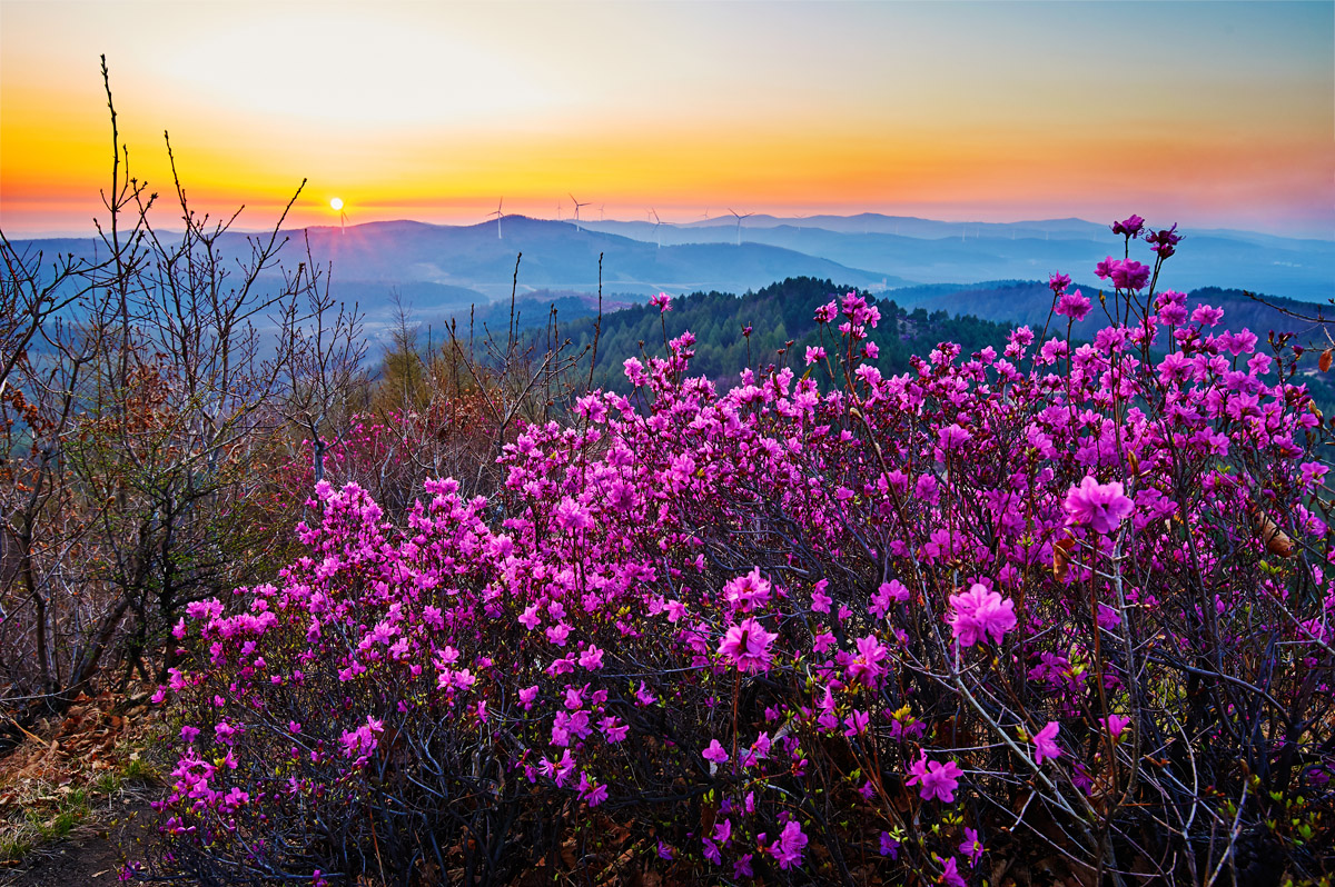
Now we come to the most exciting part - the highest mountain in the Lesser Khingan range. As the main peak of the Lesser Khingan, Pingding Shan (1,429 m) is almost as high as the famous Mount Tai (1,545 m). It is still a virgin mountain that is hiding its staggering natural scenery barely known by people. Spectacular waterfalls or rushing streams will burst into your sight anytime. A large sky garden is stretching on the flat top of the mountain to offer the best views of wild flowers during late June and early July, as well as a perfect location to see the surrounding mountains.
As a piece of undisturbed land, Pingding Shan is neither equipped with infrastructure nor enjoys proper management for tourist purposes. The whole trek in the mountains is about 30 kilometers. The hiking trails are tough and require experienced and skilled hikers. For safety's sake, get everything prepared and learn the hiking routes in advance. You will be able to find some routes shared by other hikers online, or hire a local guide.
Pingding Shan is situated more than 40 kilometers to the southeast of Taoshan Town, Tieli City, Yichun City, Heilongjiang Province. The mountain is not serviced by the public transportation, so you will need to hire a car or a chauffeur-driven car to get there.
In the south part of the Lesser Khingan Range lies the spectacular Daqing Shan (1,203m). It is located 10 kilometers to the southwest of Dailing District, Yichun City, Heilongjiang Province. Daqing Shan is the second highest peak of the Lesser Khingan, and its summit is reachable easily by car. When you ascend high enough, you will see a sea of trees stretching before you, and behind the forests are the wave-like chains of mountains linking or overlapping with each other.
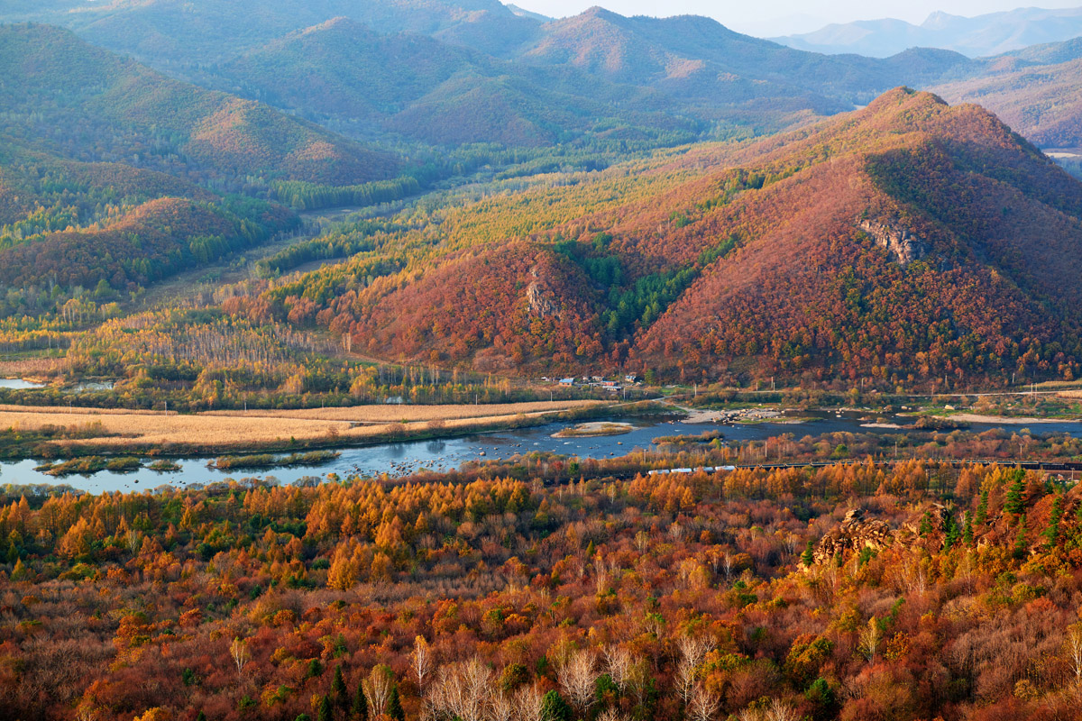
A great number of domestic and overseas photographers have been attracted by the fascinating scenery here. Many of them have stepped into the mountains after some snowfalls to capture the epic moment of the exquisite landscapes. In winter, the stones and rocks in the "stone sea" are covered by thick snow and just look like delicious marshmallows. When you raise your head you see tall trees stretching their white and silver branches towards the blue sky. Like most scenic spots in the Khingan Range, Daqing Shan has the beauties that vary with seasons. Standing on the top of the mountain, you are rewarded with the staggering panoramic views of the lush forests under your feet and the Songnen Plain at a distance.
Dailing Daqing Shan Forest Park is free to the public.
Daqing Shan is about 10 kilometers away from Dailing District as the crow flies, but the driving route from Daqing District directly to the top of the mountain is 28 kilometers long, among which 23 kilometers are mountain roads.
By Plane: You can take a plane to Yichun Lindu Airport that is 120 kilometers away from Dailing District.
By Train: Dailing is reachable by train from Harbin and Jiamusi.
By Bus: By a coach from Harbin, Yichun and many other locations.
* Note:
Erke Shan (431m) is a lava dome consisting of two mountains that stand facing each other. Situated no more than 2 kilometers to the north of Kedong County in Heilongjiang Province, this 431-meter-high mountain has been one of the most popular places to go for the locals. A great number of temples had been established on the mountain before they were all wiped out in history. Now the newly built Lengyan Temple is standing there, welcoming the devout worshippers.
On the south slope of Erke Shan, the climbing trail paved with man-made stairs stretches all the way directly to the top of the mountain, where there is a pavilion for visitors to have a rest while enjoying panoramic views of the whole Kedong County, the meandering Wuyuer River and even Wudalianchi.
By train, and is a 3.5 hours' drive from Qiqihar.
Wuying National Forest Park is located in the north part of Heilongjiang Province and in the forest region on the south slope of the Lesser Khingan Range. Every summer and autumn, the forest park has lush vegetation and pleasant temperatures, which makes it the best time for visiting. It allows having a relaxing mix of lakeside walks, cog railway trips into forests, and walks in the woods with cute squirrels. Wuying National Forest Park has the most Korean pine trees in China, and they can be seen from the top of Guantao Tower in the park.
As an AAAA tourist attraction, the forest park is well developed and under proper management. Shuttle buses are available in the park to cover the long distance between several scenic spots. Lifeng Lake is near the departure station of the sightseeing train. Vessels are available to provide a scenic drifting experience on the lake. On the west bank of the lake are villas, hostels, restaurants and souvenir shops. There is a campsite in the park too.
The admission fee and sightseeing bus service total is 80 RMB per person. 3 RMB is charged on each car for parking.
Wuying National Forest Park is located in Wuying District, Yichun City, Heilongjiang Province, China. You can take a train to Yichun Wuying Station and then transfer to a minibus or hire a car to the forest park. The bus trip takes about 30 minutes. You can also take a bus from Yichun Passenger Station to Wuying and then transfer to a minibus to the park.
Fenglin Nature Reserve was established in 1958 to protect the ecosystem of the north temperate conifer and broadleaf tree mixed coniferous forest, as well as the rare and valuable wildlife in the area. In 1997, it joined the International Man and Biosphere Reserve Network of UNESCO. In the Reserve there are 568 species of higher plants, among which the Korean pine is a rare and precious species in the northeast of China. The diameter is 1.4 meters at most and the highest tree reaches 37 meters.
A part of the reserve has been planned and managed as the tourist area, covering a variety of scenic spots such as the Greeting River, the Viewing Tower, the Greeting Pine, Gaoxuan Ridge, Dujuan Shan, a campsite and great trails for hiking and sightseeing.
Fenglin Nature Reserve is also situated in Wuying, Yichun, Heilongjiang, China. You can take a Yichun-Wuyi Ling train (1.5 hours) and get off at Wuying Station and then transfer to a car to the destination.
Hegang National Forest Park is the most famous tourist attraction in Hegang, a city in the northeast of Heilongjiang Province. The park gathers a great many well-known scenic spots, including the Jinding Shan Scenic Spot, and is on the list of the must-visit locations for tourists in Hegang. With the highest peak at an elevation of 840 meters, Jinding Shan is a great option for hiking, as well as the only geopark in Hegang City for the views of various characteristic micro reliefs such as erosional valleys, fault scarps, colluviums and marshes.
Hegang National Forest Park is also a comprehensive park that allows a mixed experience of entertainment, sightseeing, ethnic culture and ecotourism.
The admission fee is 40 RMB per person.
8:00 a.m. - 5:30 p.m.
Hegang is reachable by train or by bus from Harbin, Jiamusi, Qitaihe, Hebei. In Hegang, you can hire a car to the forest park.
Yitai Shan Scenic Area is famous for the scenery of Luotuo Mountains (Camel Peak, 540 m), which is named for its shape resembling the humps of a camel. On the top of the mountain, there is one of the best spots for the Song River and Bayan County views. Autumn is the most favourite season of the photography enthusiasts in the northern part of China when "Wuhuashan" comes to decorate the mountains, and Yitai Shan offers a perfect location to witness the fall scenery created by "Wuhuashan".
There are several options of trails and methods for you to choose on how to enjoy the beauty of the place. The climbing trails have been paved with stones and planks. Both easy and hard routes are available depending on your physical strength and both are utterly rewarding. Recreational facilities such as Dryland Slipping and Zip Line are provided too. Tourists of all ages can have fun here.
The admission fee is 38 RMB, excluding the recreational programs. Through ticket is available online at a discount.
Yitai Shan Scenic Area is 20 kilometers away from Bayan County in Heilongjiang Province, at the border of Bayan County and Mulan County. There is no public transportation available so you will need to hire a car or take a taxi to get to the destination.
Taoshan National Forest Park with rich scenery and various landscapes is a popular attraction of choice for both the locals and tourists, whether it is summer or winter. The park features the scenic spots such as the primeval forest, Xiangsi Shan, Baxian Lake and Taoyuan Lake, among which the Xuanyang Feng Scenic Spot is the core of the park. At an elevation of 900 meters, Xuanyang Feng is the highest peak in the area, abundant with virgin forests and natural scenery. Another perfect hiking area in the park is Xiaodonggou scenic spot, home to the Korean pine trees from 300 to 600 years old and many other precious tree species. There are two elegant hot spring resorts around the area for those who just waht to have a rewarding hike with panoramic mountain views and have a good rest afterwards.
Xuanyang Feng: 80 RMB
Xiaodonggou Korean Pine Primeval Forest: 40 RMB
Taoshanyu Hot Spring: 138 RMB
Drive-it-yourself travel: It takes about 4 hours driving from Harbin to the scenic area. As the scenic spots are relatively widely dispersed in the area, 10-50 kilometers apart from each other, a car will make it much easier for visitors to plan visiting several scenic spots in one go.
Xuangyang Feng: 200 RMB for a round trip.
Xiaodonggou: 200 RMB for a round trip.
Taoshanyu Hot Spring: 30 RMB for a round trip.
Heilongjiang Province in the northeast section of China is one of the most popular tourist destinations to go especially in autumn and winter. Some famous attractions are:
Here comes the part worth mentioning specifically. Wuhuashan, meaning Five-Flower Mountain, is not a mountain but a kind of special scenery presented by the vast forests in Heilongjiang Province in autumn. When the weather gets cold in late September each year, the leaves of the trees such as Korean pine, larch, birch and maple turn into green, white, yellow, red and purple, constituting a gorgeous landscape of "Wuhuashan" that attracts tourists across and beyond China.
The stunning scenery won't last long and the best time to catch it lies in and around China National Day holiday, which is October 1st to 7th. Tens of trails and locations are available for enjoying the picturesque scenery.
Huzhong is in the middle of the Huma River. It is a refreshing town embraced by streams and lawns in the south part of the Greater Khingan range and here lies Huzhong Nature Reserve. Huzhong can be reachable directly by train from Qiqihar or by coach from Beiji Village, Mohe that is a three-hour drive away. From Huzhong, you can reach out to the views of the vast forests in Dabaishan Scenic Area, as well as the Cangshan Stone Forest Scenic Area, which is in the woods on the top of the mountain 6 kilometers away from the Cangshan Tree Farm. Huzhong Nature Reserve is still under development and thus is not yet open to the public. If you are going to explore the nature of the area, prepare food, water, camping gear and other necessities, as well as hiring a local guide.
Yichun is in the northeast part of Heilongjiang Province, bordering Hegang and Jiamusi in the east and Harbin in the north. The city is rich in scenic spots such as Tangwanghe National Park, Wuying National Forest Park, Nancha Xianweng Shan, Riyuexia National Forest Park and Maolan'gou National Forest Park.
Dailing District is in the south part of Yichun and lies in the south foothills of the Lesser Khingan Range. Its major scenic spots include Daqingshan Forest Park, Bishui Chinese Merganser Nature Reserve, Liangshui National Nature Reserve, and Hongguang Fengqing Campsite.


The highest peak in the Lesser Khingan is Píng Dǐng Shān, at 1,352 m.
The Lesser Khingan have 127 named peaks.


