
Scan the QR code and open PeakVisor on your phone
The Greater Khingan include 517 named peaks. The highest is Dōng Hóu Dǐng at 2,294 m. Other notable peaks include Haituo Summit (Big Haituo), Bīng Shān Liáng and Songshan Summit (Small Haituo).
When people talk about the Khingan Mountains, there exist some confusing concepts. So let's take the chance to make it clear here. Khingan is the Mongolian name for the mountains divided into the following three ranges:
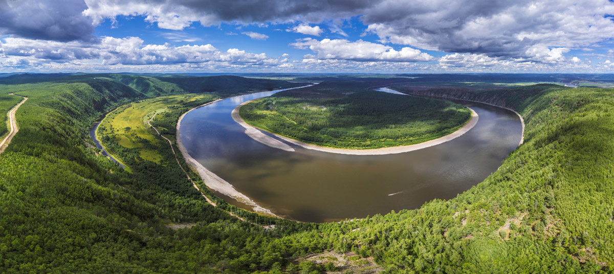
To outline their spatial relationships, on the south coast of the Amur River (also called Heilong Jiang in Chinese), the Nen River (or Nenjiang) separates the Greater Khingan in the west and the Lesser Khingan in the east; and to the north of the Amur River, the Stanovoy Range runs in the territory of Russia. the Greater Khingan and the Lesser Khingan connect with each other in bodies, constructing the natural shield to the northern part and the northeastern part of Heilongjiang Province. Quite cold climate makes the north section of both ranges the coldest region in China, with the lowest temperature reaching minus 50-degree Celsius in winter. The entire range is rich in natural and mineral resources, there is a great variety of timber, ore mines, animals, and plants.
The area of the Greater Khingan has an elevation of 1,200 to 1,300 meters. There are 77 named mountains in the area. Dōng Hóu Dǐng is the highest point, while the most prominent mountain is Yunwu Shan.
Arxan National Forest Park, an AAAAA tourist attraction of China, is located in the southwest of the Greater Khingan in Inner Mongolia. It is also the center of the forest region of the Greater Khingan. It is noteworthy that Arxan Mountain is also at the junction of the Hulunbuir Grassland, the Xilingol Grassland, the Horqin Grassland and the Mongolian Grassland which endorse the beautiful scenery in the area. However, the Arxan volcano group has more than that, as it is the best known for having the densest and the most alpine crater lakes in the world. There are Seven Heaven Lakes and 40 lava-dammed lakes offering a great feast for the eyes.
Besides the staggering volcanic lakes, you can also enjoy the rich natural views such as the geological relics of the Quaternary volcanic eruptions (Shitanglin), Rose Peak (Meiguifeng), Zhangsong Ling, the Halaha River (a famous ice-free river), Santanxia, the Arxan Grand Canyon, and hot springs. However, should you feel weary of the abundance of the natural scenery, the Arxan is also rich in places of historical and cultural interest including the abandoned airport, a railway station, and war relics.

The admission fee is 180 RMB for an adult in high season from June to September, and 150 RMB in low season. The shuttle bus in the park charges independently 105 RMB for each adult or each child over 1.2 meters tall. Discounts and free offers are available for the elderly, children, students and other special groups of people entitled to social benefits. Tickets are also available online at a discount.
8:00 a.m. - 5:00 p.m.
The best time to visit is actually all year round, but high summer season is more preferable because of the warmer weather. You will surely be surprised by how much the stunning views can vary as the seasons change.
* Please note that some scenic spots in the park may be closed in winter, usually for the sake of safety.
There is a convenient and developed transport system in and around the area. Arxan Yi'ershi Airport is situated 25.4 kilometers north of Arxan City, and services air travel to and from Beijing and Hohhot primarily. Planes also fly to Hangzhou, Harbin, and Ulaanbaatar, the capital of Mongolia, as well as many other locations.
The railway to Ulanhot (formerly known as Wang-um Sume or Red City) connects Arxan with Beijing, Tianjin, Hohhot, Shenyang, Changchun, Dalian, Harbin and other major cities in China.
There are several options you can choose from to cover the last few miles from Yi'ershi Town to the Arxan Park:
Remember to make sure the vehicle you choose will take you to your destination (it both concerns the petrol and the location point you need to get to) before you get into it.
Dabai Shan (1,080m), meaning a big white mountain in English, got its name because the mountain is snow-capped and white for most of the time, due to the cold climate even in summer. Located in the southernmost part of the Huzhong Nature Reserve, Dabai Shan (1,080 m) is the highest mountain in the north section of the Greater Khingan. The most rewarding thing to do on Dabai Shan is climbing, to cast a long loving look on the surrounding mountains and vast forests from the top. In May and June, the snow-capped mountain seems outworldly different from the green landscape at the foot of the mountain.
The mountain is much steeper on the south side so climbing up from the gentler north slope is an easier choice. The first 2,000m meters of the trail has been paved to offer a relaxing walk while ascending gently, but it will end shortly and the slope begins to show its true colors.
Free
Spring, summer, and autumn. The mountain changes colors each season.
There is no convenient public transport system to Daba Shan, but there is a 10-km road leading to the area of the starting point of the climbing trail, so it is better to hire a car. Take special care to checkout the weather and road conditions before embarking on a journey.
From Harbin, you can go to Jiagedaqi by plane or by train, and then take a bus to Huzhong Town. From Beijing, you can go to Mohe by plane and then go to Huzhong Town by bus.
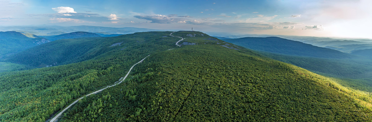
Huanggangliang, at 2,029 m, is the highest peak in the Greater Khingan and the place where the Huanggangliang National Forest Park is located. It is a great place to appreciate the staggering golden autumn views of the Khingan range in late September and early October. You can take a perfect photo everywhere easily. Located in the northeast of the Hexigten Banner, a banner of Inner Mongolia, China under the jurisdiction of Chifeng City, the Huanggangliang National Forest Park preserves the intact variety of landforms of the Quaternary glaciation, demonstrating the typical valley glaciers. Although Huanggangliang is the highest point of the range, the climbing trail is gentle and relaxing. The summit is reachable by car and it is also a nice place for biking. No managed scenic spot is set there so you can be free to walk wherever you see the beauties of nature.
Over 3 hours
Free
All day long, all year round
From Chifeng City, take a bus to Linxi County, and then hire a car to Huanggangliang. It is on the way to the Asihatu Stone Forest.
Jiagedaqi Beishan Park is a well-established and convenient leisure park where you can take an easy walk in the forest of the Greater Khingan. The park, with abundant cultural and historical attractions, has paved trails on the gentle slopes, making it a great place for the locals and tourists to seek for natural beauties and perfect photos with no sweat.
Free
9:00 a.m. - 5:00 p.m.
Jiagedaqi Beishan Park is only 3 kilometers away from Jiagedaqi Railway Station. You can go to the park by taxi or by foot.
Moerdaoga National Forest Park in the Greater Khingan Range is a fairyland that you cannot afford to miss when you are planning your northeast Inner Mongolia tour. Moerdaoga is Mongolian literally meaning "to set out for a battle on a horse", and legend has it that the word was shouted out by Genghis Khan in 1207. The park is an AAAA tourist attraction in China, featuring the following scenic spots:
Long Yan Lan Sheng
Long Yan Lan Sheng means "visiting the scenic spot of Dragon Rock" in English. Located to the east of Moerdaoga Town, Longyan Mountain is 1,000 meters high and over 35 kilometers long from east to west. A 200-meter-long dragon-shaped rock lies on the west slope of the mountain and gives the mountain its name.
Da Han Ping Diao (Genghis Khan Park)
The 2,500-square-meter Genghis Khan Park is built on Longyan Mountain. The park presents an 18-meter statue of Genghis Khan riding a horse.
Hong Dou Po (Cowberry Slope)
Hong Dou Po sits 9 kilometers further into Moerdaoga National Forest Park, and is well-known for the cowberries growing all over the slope. Don’t get it confused with a famous manga series roughly translated as “The Battle through the Heavens”.
Yan Song You Jing (Path of Siberian Dwarf Pine)
This scenic spot is located 12 kilometers further into the park, taking up an area of over 1,900 hectares. It is called "the wonder of the Khingan" by ecologists for the unusually dense and wide growth of Siberian dwarf pines.
Yi Mu Jiu Ling (Nine Mountains at a Glance)
The viewing platform is at the top of a mountain that is 16 kilometers away from the entrance of the forest park. It allows staggering panoramic views of the whole Greater Khingan. Viewed from the top of the mountain, the mountains at a distance overlap and connect with each other.
Bailu Island
Bailu Island is a scenic location strongly recommended by many tourists. Surrounded by the Ergune River, the island grows a great number of white birch trees and presents beautiful colors in autumn. It is one of the favorite locations of photographers. 9-kilometer-long rafting is also provided for water sport enthusiasts.
The admission fee is 150 RMB per person. There is a cog railway in the park covering a journey of 10 kilometers in 90 minutes, it stops for several minutes at each of the four scenic spots. The cog railway service costs 100 RMB per person.
The Moerdaoga National Forest Park is located near Ergune City, Hulunbuir City, Inner Mongolia Autonomous Region, China.
You can go from Hailar to Moerdaoga Town by train or by bus. The forest park, which covers a very large area, is 12 kilometers away from Moerdaoga Town. There are more than 100 kilometers between the gate of the park and Bailu Island, without a shuttle bus provided. Therefore travelling in the park requires a car. You can hire one in Moerdaoga Town.
Qingshan Yanjiu Scenic Spot, also called Daqingshan Yanjiu Scenic Spot, is a special scenic spot on the southeast edge of the Greater Khingan. Located on Daqing Shan in the east of the Hexigten Banner, Chifeng City, Inner Mongolia. The scenic spot takes up an area of over 30 square kilometers with the highest peak at 1,574 meters. It has the largest, best kept and protected groups of pothole erosion phenomena, including various caves and grottoes. There are more than 1,000 pothole erosions within an area of 1,000 ㎡ on the south side of the summit of Qingshan Mountain. In addition to the divine stones, forests and potholes, which are collectively regarded as the three most important features of the scenic spot, it also allows having a mixed sightseeing tour by cable car over the colorful forests, grassland walks and panoramic mountain walks. The streams in the valley add some touching beauty to the landscape, too.
Being one of the most important tourist attractions on the Hexigten Grassland and in the Inner Mongolia, Qingshan Yanjiu Scenic Spot is a viewing platform with well-developed infrastructure. Cable cars and electric cars are available in place for you to enjoy your time viewing all the beautiful scenery.
The ticket package is 120 RMB per person, including the admission and cable car service. The electric car costs 30 RMB extra per person.
The scenic spot is 25 kilometers away from Jingpeng Town, 200 kilometers from downtown Chifeng, and 580 kilometers from Beijing.
From Chifeng Bus Station, you can take a coach to Jingpeng Town and then hire a car to Qingshan Scenic Spot. Again, it is highly recommended to hire a car or take up a package tour for the sake of convenience.
Huashan has unique, beautiful scenery composed of a mountain and a peninsula in Wanghada Village, Huma County in the range of the Greater Khingan. Standing beside the Amur River, Huashan mountain (2,160m) has a sharp and steep face as if it had been cut by a knife. The rich colors on the face of the mountain make it look like a naturally made oil painting hanging over the river when being viewed from a distance.
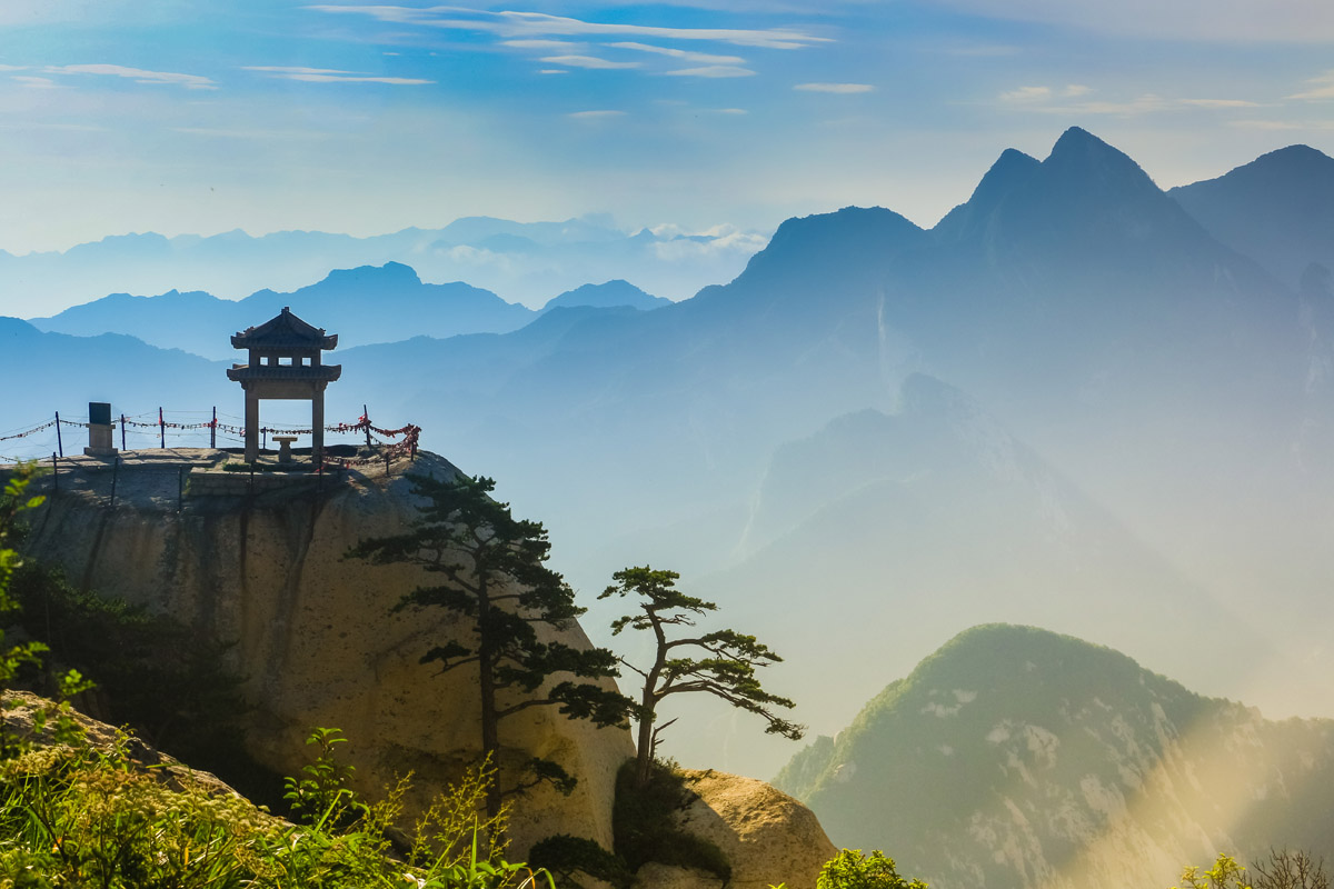
There are two options to explore this sacred mountain (one of the five in China). Traditionally, people resort to efficient walking-ascending and then cable-car-descending routes. Yet, you can take a cable car to the top if you feel dizzy with heights and fear walking the narrow wobbly plank road to the top of the mountain which is rightly dubbed the “most precipitous mountain under heaven”. Actually, an ancient Chinese legend states that there is only one true path up Mount Huashan – the 12km trek rising 1800m that took 3000 years to build. There is no single path, but an array of pathways split across the mountain, heading off towards various temples and peaks. Vertical ladders dug into rocks allowed access to higher points, sometimes with only steel bars or chains for support, but often with nothing to arrest your fall.
The most dangerous trails are located on the East Peak (facing the sun). One well-known scenic spot, the Immortal's Palm Peak, ranked as one of the Eight Scenic Wonders, is located there. It refers to the natural rock veins of the cliff, which look like a giant palm-print. The path definitely worth taking is marked “Plank Walk In The Sky”. The path is only 50m or so, but the rumours of 100 people a year dying on this mountain may be well grounded.
Another wonder path leads to the Chess Pavilion that is jutting out from the East Peak. It is a lonesome pagoda in a precarious position. The only way to reach it is via a dangerous climb down a slippery rock face, with aged footholds carved into the side and metal bars providing the occasional leverage. Unlike the Plank Walk in the Sky, the hike to the Chess Pavilion can only have a limited number of people on it at once. It just isn’t wide or large enough for a whole barrage of adventurers trampling down the side of the cliff.
Climbing to the top of East Peak of Mt. Huashan takes 4 to 6 hours. It has an altitude of 2,090 meters (6,857 feet), forming a platform for visitors to view the sunrise. An astronomical telescope is provided here. The reference time for sunrise is 5:00a.m.-6:00a.m. in spring, 4:30a.m.-5:20a.m. in summer, 5:00a.m.-5:20a.m. in autumn and 5:30a.m.-6:00a.m. in winter.
In general, Huashan is adorned with influential Taoist temples, and it has been part of folklore for thousands of years. Five peaks make up the jagged mountain, with each one holding teahouses and shrines.
A section of over 20 kilometers of the Amur River can be seen from the top of the mountain. On the peninsula, a lot of willow trees that have lived for a few dozens of years and clusters of beautiful wild roses grow on the grassland. There are several pools and two ditches on the island. When the water level of the Amur River rises, the river connects with the pools and fish can swim into the island directly, forming a great place for fishing. In the southeast of the peninsula is a 2-kilometer-long beach, while in the east lies a forest of various trees for you to pick some fruits.
From Harbin, you can go to Heihe by train, and then transfer to a coach (about 3.5 hours) to Huma County. In Huma, hire a car to the scenic spot to cover the 30-km drive.
Heilongjiang Province in the northeast section of China is one of the most popular tourist destinations to go especially in autumn and winter. Some famous attractions are:
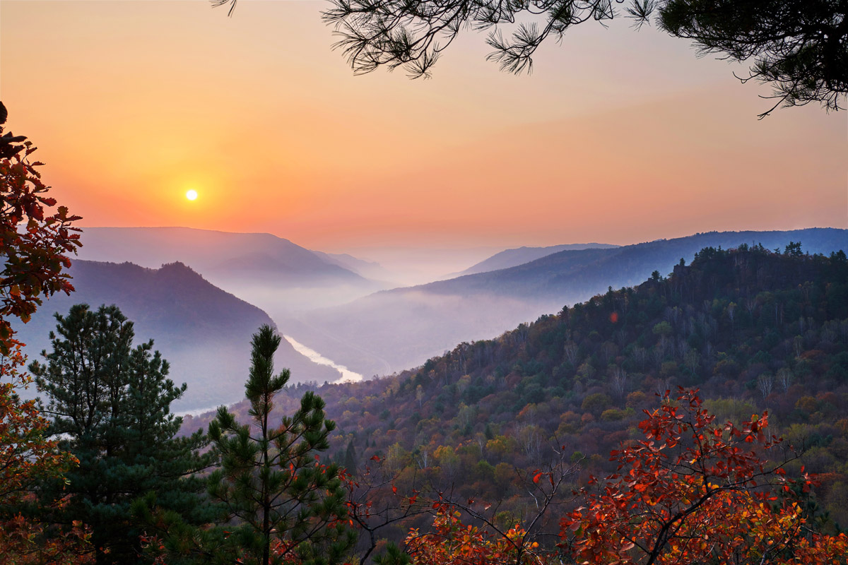
Here comes the part worth mentioning specifically. Wuhuashan, meaning Five-Flower Mountain, is not a mountain but a kind of special scenery presented by the vast forests in Heilongjiang Province in autumn. When the weather gets cold in late September each year, the leaves of the trees such as Korean pine, larch, birch and maple turn into green, white, yellow, red and purple, constituting a gorgeous landscape of "Wuhuashan" that attracts tourists across and beyond China.
The stunning scenery won't last long and the best time to catch it lies in and around China National Day holiday, which is October 1st to 7th. Tens of trails and locations are available for enjoying the picturesque scenery.
Huzhong is in the middle of the Huma River. It is a refreshing town embraced by streams and lawns in the south part of the Greater Khingan range and here lies Huzhong Nature Reserve. Huzhong can be reachable directly by train from Qiqihar or by coach from Beiji Village, Mohe that is a three-hour drive away. From Huzhong, you can reach out to the views of the vast forests in Dabaishan Scenic Area, as well as the Cangshan Stone Forest Scenic Area, which is in the woods on the top of the mountain 6 kilometers away from the Cangshan Tree Farm. Huzhong Nature Reserve is still under development and thus is not yet open to the public. If you are going to explore the nature of the area, prepare food, water, camping gear and other necessities, as well as hiring a local guide.
Yichun is in the northeast part of Heilongjiang Province, bordering Hegang and Jiamusi in the east and Harbin in the north. The city is rich in scenic spots such as Tangwanghe National Park, Wuying National Forest Park, Nancha Xianweng Shan, Riyuexia National Forest Park and Maolan'gou National Forest Park.
Dailing District is in the south part of Yichun and lies in the south foothills of the Lesser Khingan Range. Its major scenic spots include Daqingshan Forest Park, Bishui Chinese Merganser Nature Reserve, Liangshui National Nature Reserve, and Hongguang Fengqing Campsite.


The highest peak in the Greater Khingan is Dōng Hóu Dǐng, at 2,294 m.
The Greater Khingan have 517 named peaks.


