Scan the QR code and open PeakVisor on your phone
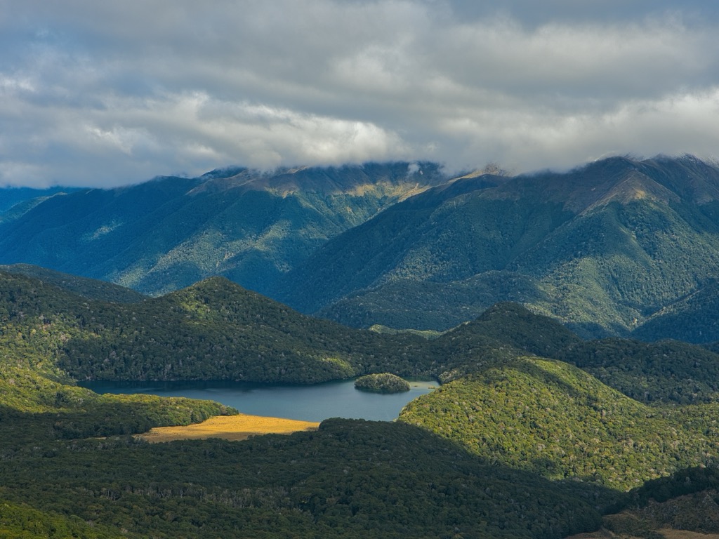
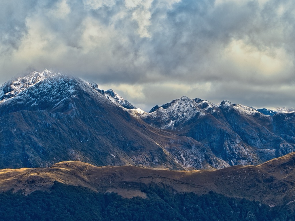
The Hunter Mountains are perched in the southern region of the South Island of New Zealand. The small range is sandwiched between the Hope Arm and the South Arm of Lake Manapouri and extends south to Green Lake. The mountains lie within Fiordland National Park, featuring 12 named peaks. The tallest and most prominent is Flat Mount (1,758 m / 5,768 ft), with a topographical prominence of 1,246 m (4,088 ft).
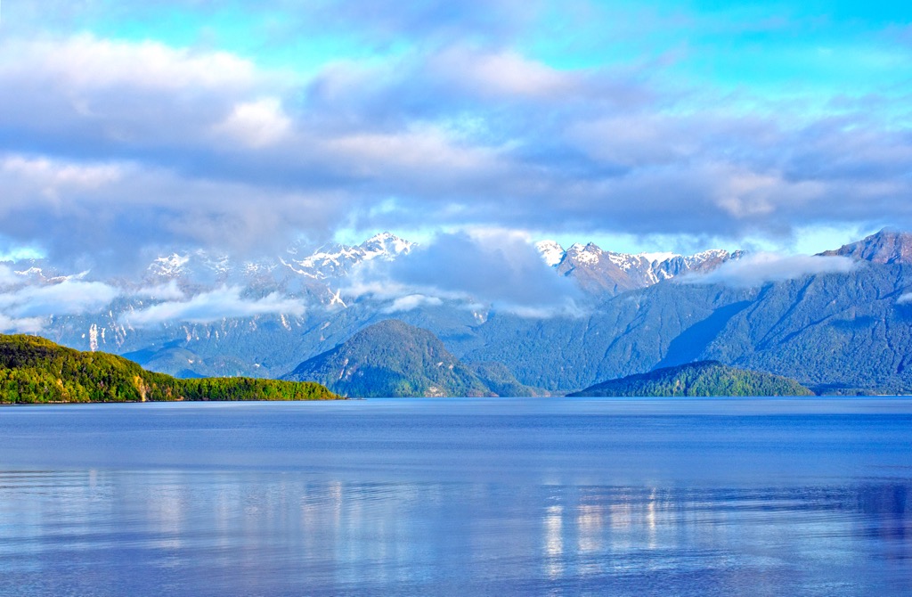
The Hunter Mountains lie within Fiordland National Park on the South Island of New Zealand. The northern end touches Lake Manapouri between the South Arm and Hope Arm, while the southern tip reaches Green Lake. In addition to the lakes at either end, there are numerous small bodies of water, rivers, and creeks. The Kepler Mountains and the Turret Range neighbor the Hunter Mountains.
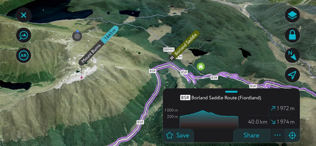
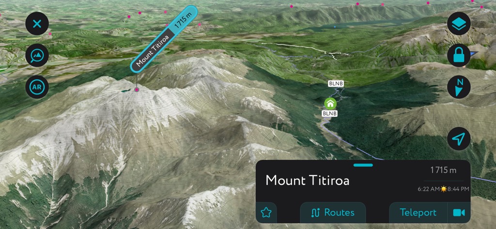
Points of interest include the Borland Road, which provides access to this remote range, Grebe Valley, Mount Burns (1,645 m / 5,397 ft), and the white granite sands and bouldered summit of Mount Titiroa (1,729 m / 5,627 ft). The mountains overlap with Te Wāhipounamu South West New Zealand World Heritage Area, renowned for its biodiversity and ecological importance.
New Zealand’s geology extends back to the supercontinent Gondwana. Around 540 million years ago, New Zealand formed along the supercontinent’s edge. Rivers carried sediment, and underwater eruptions generated ash that hardened into the rocks underlying most of the country today.
New Zealand sits near the boundary between the Australian and Pacific plates. Around 100 million years ago, magma welled up and caused volcanic eruptions and splits along faults. By 85 million years ago, the Zealandia land mass separated from Gondwana and the Australian mainland and began to drift across the Pacific Ocean.
Twenty-five million years ago, Zealandia split, and sections of the continent were uplifted. There has been further uplift in the last 1.8 million years, such as the Southern Alps on the South Island and volcanic eruptions, which continue in the present. During the Ice Age, glaciers carved out valleys and shifted rocks and sediment.
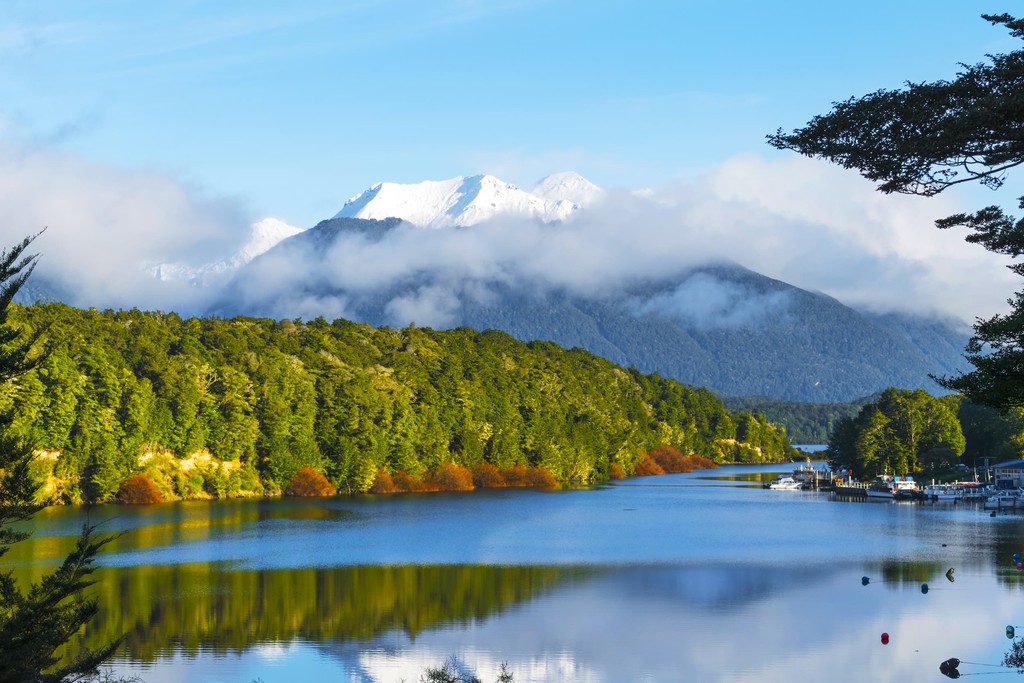
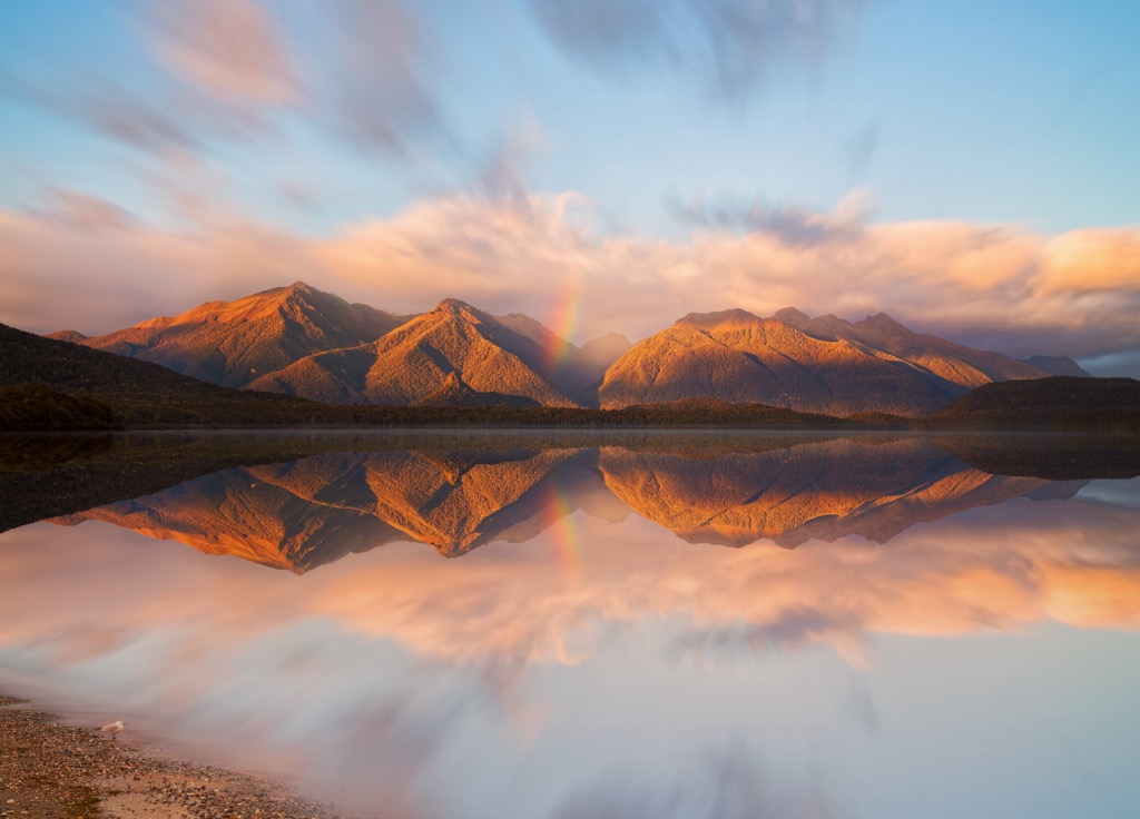
The region around the Hunter Mountains was shaped significantly by the Ice Age. Around 20,000 years ago, glaciers spread across present-day Lake Te Anau and Lake Manapouri. As they went, glaciers carried and deposited long ridges of rock and gravel. When they began to melt, water gathered and formed lakes between ridges. Manapouri is the second deepest lake in New Zealand.
The mountains were the site of an enormous landslide 12,000 years ago. Weakened by ancient faults and a shrinking glacier, an earthquake is the assumed catalyst for the landslide that shifted 27 cubic km (6.5 cubic miles) of the earth and a 9 km (5.6 mi) portion of the Hunter Mountains. The event is called the Green Lake Landslide; the Green Lake sits in a basin at the foot of the ancient landslide debris.
The Hunter Mountains are part of Fiordland National Park and Te Wahipounamu South West New Zealand Heritage Site. The region supports southern beech and podocarp forests. There are depressions formed around the landslide debris shelves of Green Lake that support tussock grassland.
More than 45 bird species live around the Borland area. The Borland Nature walk leads through beech forest, home to New Zealand robins, riflemen, tomtits, fantails, brown creepers, grey warblers, kakariki/parakeets, waterfowl, finches, ruru/morepork, and long-tailed or shining cuckoos.
There is a chance to spot kakas and falcons in the mountains. Keas, the world’s only mountain parrot, are sometimes spotted above the treeline. Rivers and creeks in the area are home to trout, eels, and cockabullies.
Around Lake Manapouri, there are stands of kahikatea in swampy areas. Podocarps like rimu, miro, and matai grow along with kamahi and beech in lowland areas. Regenerating shrublands comprise mahoe, tree fuchsia, kaikomako, kōwhai, and wineberry.
Early Māori inhabitants came to Lake Manapouri to harvest kiwi, kākāpo, weka, pigeons, teal, paradise shelduck, shags, gulls, and cabbage trees growing along the lake's edge. They also trapped eels along waterways.
Early European explorers arrived at Lake Manapouri in the 1860s, and the mountains are named after a famous anatomist, John Hunter. The lake was the focus of one of the country’s first considerable conservation efforts in the 1960s when citizens banded together to protest planned water level rise for power generation.
The construction for Borland Road began in 1963 to support a transmission line between the West Arm Power Station on Lake Manapouri and the Tiwai Point Aluminium Smelter at Invercargill. While still serving some of its primary purposes, the road is also an essential point of access to the mountains.
There is permitted hunting in the area; red deer were released in 1901. Much of the trail system around the lake remains from early hunters in the area.
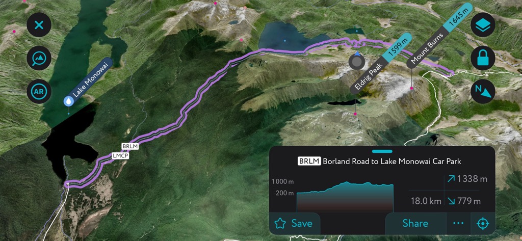
The Hunter Mountains are accessible via Borland Road or tracks along Green Lake and Lake Manapouri. There are two overnight spots along Lake Manapouri for trekkers – Hope Arm Hut and South Arm Campsite. The Department of Conservation has a brochure of walks in the area and around the neighboring Lake Monowai.
Fly and spin angling fishing are permitted year-round at Lake Manapouri but only allowed between November 1 and May 3 on tributaries. There is an excellent white water run for knowledgeable kayakers along the Grebe River as it flows towards Lake Manapouri.
Borland Lodge is an equipped hotel within the mountains. There are several backcountry huts – Green Lake Hut, Borland Bivy, and Hope Arm Hut – for basic accommodation along the trail.
The Green Lake Track snakes along the range’s southern terminus. It can be done as a long day hike or an overnight at Green Lake Hut. From Borland Road or the nearby Borland Bivy, it is roughly 6.8 km (4.2 mi) to the hut. The route passes through tussock grasslands, around small lakes, and through beech forests with just under 365 m (1,200 ft) of elevation gain.
The trail is well-trodden and easily followed, and abundant birdlife exists in the forest. Be aware that there may be boggy sections and high grasses that make for slow-going out of the woods. Hikers can either return the way they came or carry on to the Monowai Campsite.
Borland Bivy is a rustic, two-bed hut that operates on a first-come, first-serve basis and is free. The Green Lake Hut has 12 beds, first come, first serve, but requires a fee.

The trail to Mount Burns is short – 1 km (0.6 mi) each way. The path begins at Borland Saddle and leads to the tussock-carpeted summit of Mount Burns. The flora along this route, some of it endemic to New Zealand, is worth noticing and includes hebes, Spaniards (Aciphylla species), daisies (Celmisia species), and Dracophyllum species. Hikers sometimes spot keas here.

Experienced hikers looking for an adventure can head to the top of Mount Titiroa (1,729 m / 5,627 ft). The mountain often looks snow-covered because of white granite sand. The boulder field on the summit is called Geiger’s Garden and was formed as a result of the exfoliation of granite.
There is no marked trail leading to the summit, and hikers should be confident navigating and ensure they carry proper gear and emergency equipment. A point-to-point option goes between Manapouri and Borland Road with the option to stay at Borland Lodge if you book ahead.
With some steep sections, the solitude, sweeping views, and exploration off-trail make this a fun option for those looking to push themselves.

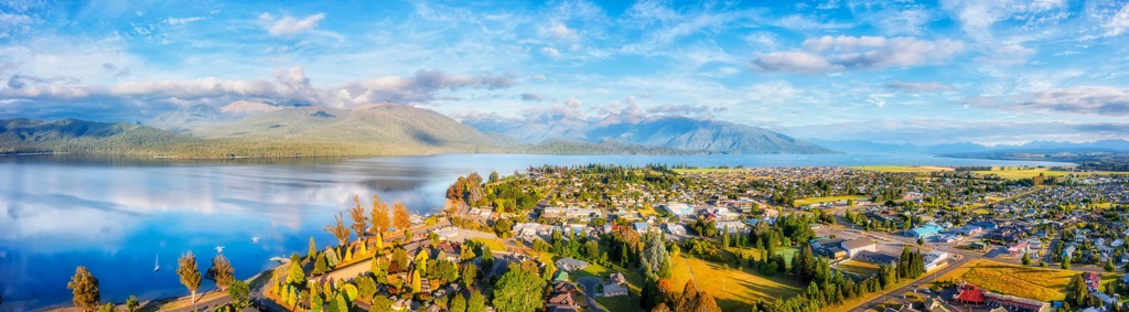
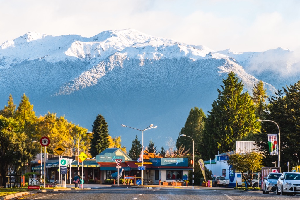
The nearest town to the Hunter Mountains is Te Anau. This small town of 3,000 people is a gateway into Fiordland National Park. Visitors can restock supplies and refuel vehicles before heading out into remote parts of the mountains. Te Anau provides easy access to three of the country’s Great Walks – the Milford, Kepler, and Routeburn Tracks.
Despite being a small town, there’s plenty to do while there. Go for a cruise on the lake, visit caves with glow worms, and explore Punanga Manu o Te Anau, the local bird sanctuary. Lodging options include backpacker hostels, lodges, and hotels. It is best to book in advance for visits during peak season. The dining scene will not disappoint for a small town and is perfect for hikers getting out of the mountains and ready for a big meal.
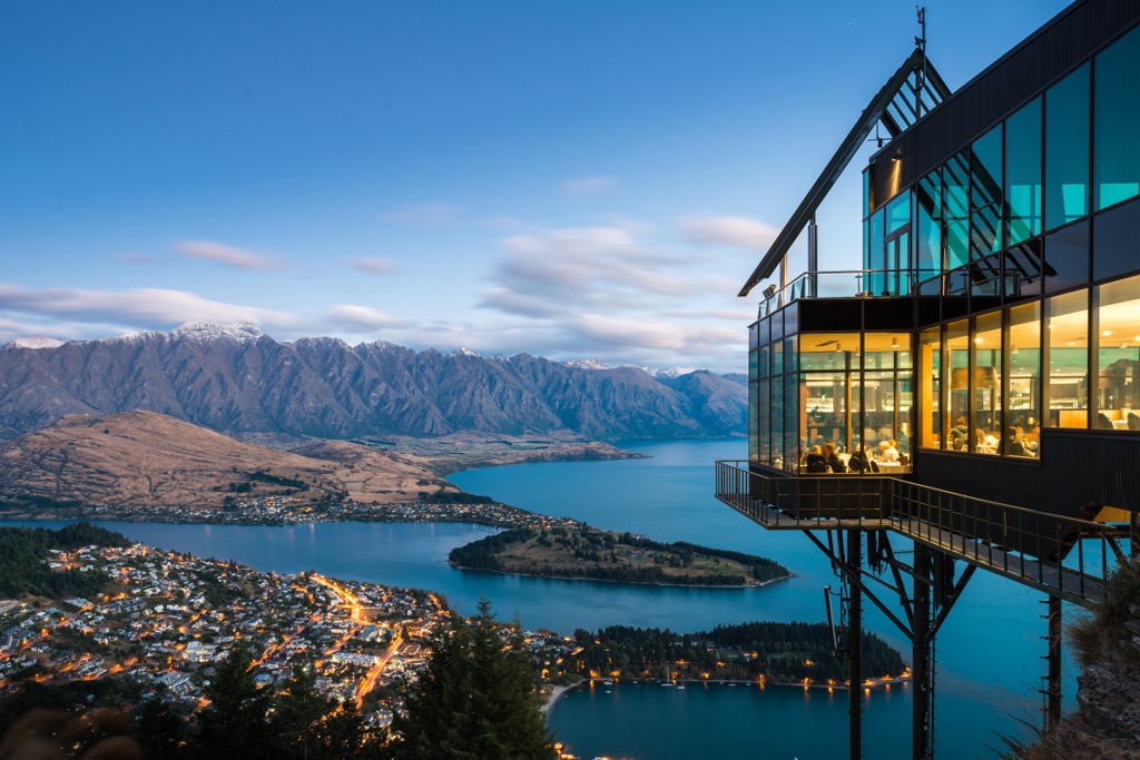
With a population of 15,000, Queenstown looks out over Lake Wakatipu, and the Remarkable Mountains rise steeply around the town and lake. It’s a perfect jump-off point for Mount Aspiring National Park. As a popular tourist destination, it’s a bit pricier than other small towns.
Queenstown has earned the moniker ‘The Adventure Capital of the World.’ From Queenstown on the banks of Lake Wakatipu to the surrounding alpine peaks of the Southern Alps, visitors can mountain bike, hike, boat, ski, cycle, raft, trail run, rock climb, mountaineer, bungee jump, and go horse trekking. Those looking for a lowkey way to appreciate the outdoors can visit the Kiwi Birdlife Park, home to over 10,000 species of flora and fauna, or take a wine tour in one of the surrounding vineyards.
Fans of The Lord of the Rings series may recognize several spots near Queenstown used in the film’s production. Visitors can take a day trip to the historic mining town Arrowtown to try gold panning and visit the Lakes District Museum.
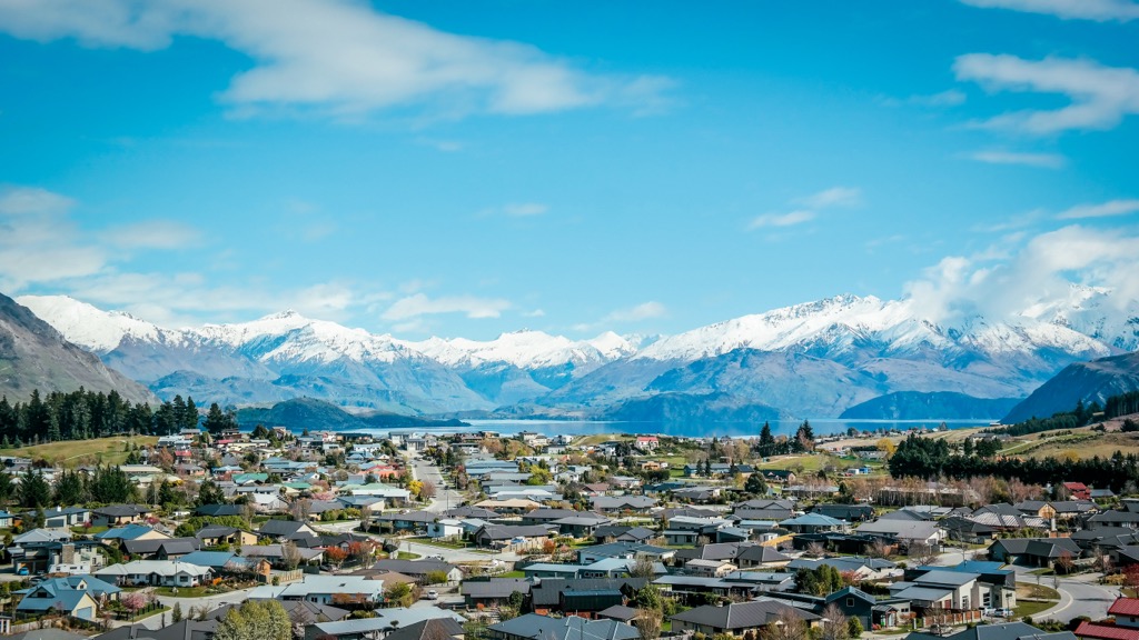
Wanaka is a town of 9,000 people north of the Hunter Mountains. It’s a scenic alpine town with easy access to Mount Aspiring National Park. In addition to hiking and skiing, it's a great spot for more adventurous activities like skydiving, canyoning, and climbing. Enjoy the local lakes and rivers by fishing and kayaking.
The town boasts a vibrant dining scene with good food and wine, lakefront dining, and local farmers' markets. Wanaka hosts a number of festivals and events each year, such as the Rhythm & Alps Music Festival and Challenge Wānaka – a long-distance triathlon.