
Scan the QR code and open PeakVisor on your phone
The Hida mountains (飛騨山脈 Hida Sanmyaku) are a massive Y-shaped mountain range located in Honshū island, between Nagano, Toyama and Gifu Prefectures. They belong to the Japanese Alps. The name “Alps” was given by the British archaeologist William Gowland due to their resemblance to the European Alps. Nowadays the name “Japanese Alps” covers not only the Hida mountains (thus called the Northern Japanese Alps 北アルプスKita Arupusu ) but also the Kiso and Akaishi mountains.
The name “Hida” is an intricate combination of historical implications and myths. 'Hida' means something like 'a wild flying horse'. In fact, 飛 (tobu, hi) means 'to fly', and 騨 (ta) indicates a particularly wild grey horse. This probably refers to a sacred horse offered by the inhabitants of this territory to the emperor, circa 702 AD. Alternatively, it might refer to shape-shifting practices of Japanese gods who played evil jokes on people or travelled between the worlds when they took a shape of a horse.
There is a nice translation of one of such myths, featuring a horse-shape-shifter. Source: Basil Hall Chamberlain’s “Aino Folk Tales”
A very beautiful woman had a husband. He was a very skilful fellow. Once he went to the mountains and disappeared. But at night he returned, bearing a deer on his back. After feasting on the deer, they went to bed. But in the middle of the night, the woman wept and screamed, saying: “This man is not my husband. Though with shame, I will declare the fact as it is. His penis is so big, so big, so big, that it will not get into my vagina; and if it did get in, I should die.” Alarmed by her cries, the neighbours ran out, and came into her house; and one strong fellow took a stick, and beat the husband, saying: “You must be some sort of devil,” whereupon the husband turned into a horse, and ran away neighing. Afterwards, he was beaten to death. The truth was that the husband had been killed and supplanted by the horse. That was the first the Ainos saw of horses. In ancient days every sort of creature could thus assume human shape. So it is said.—(Translated literally. Told by Penri, 12th July, 1886).
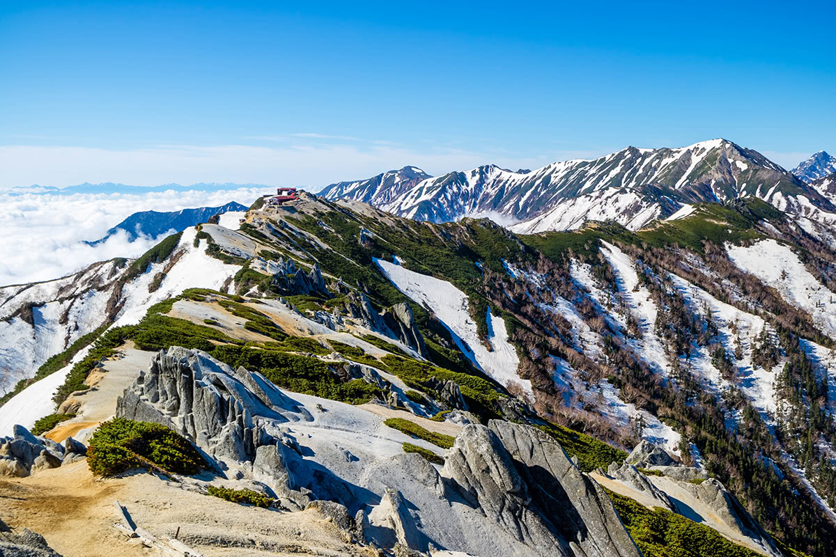
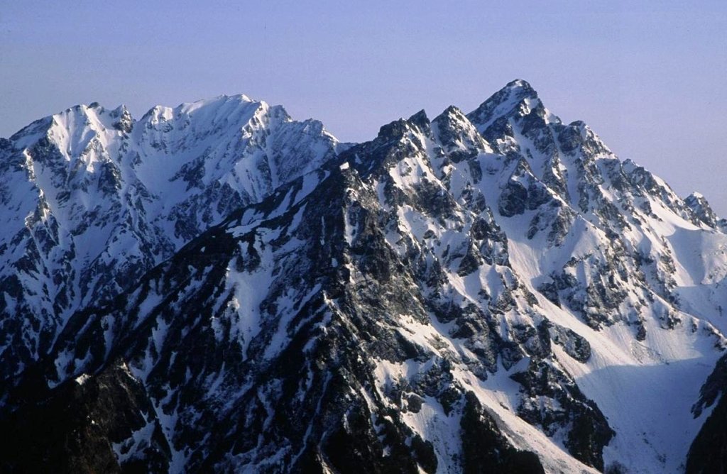
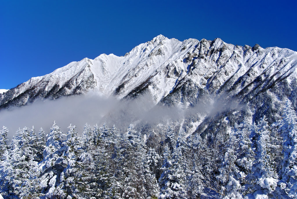
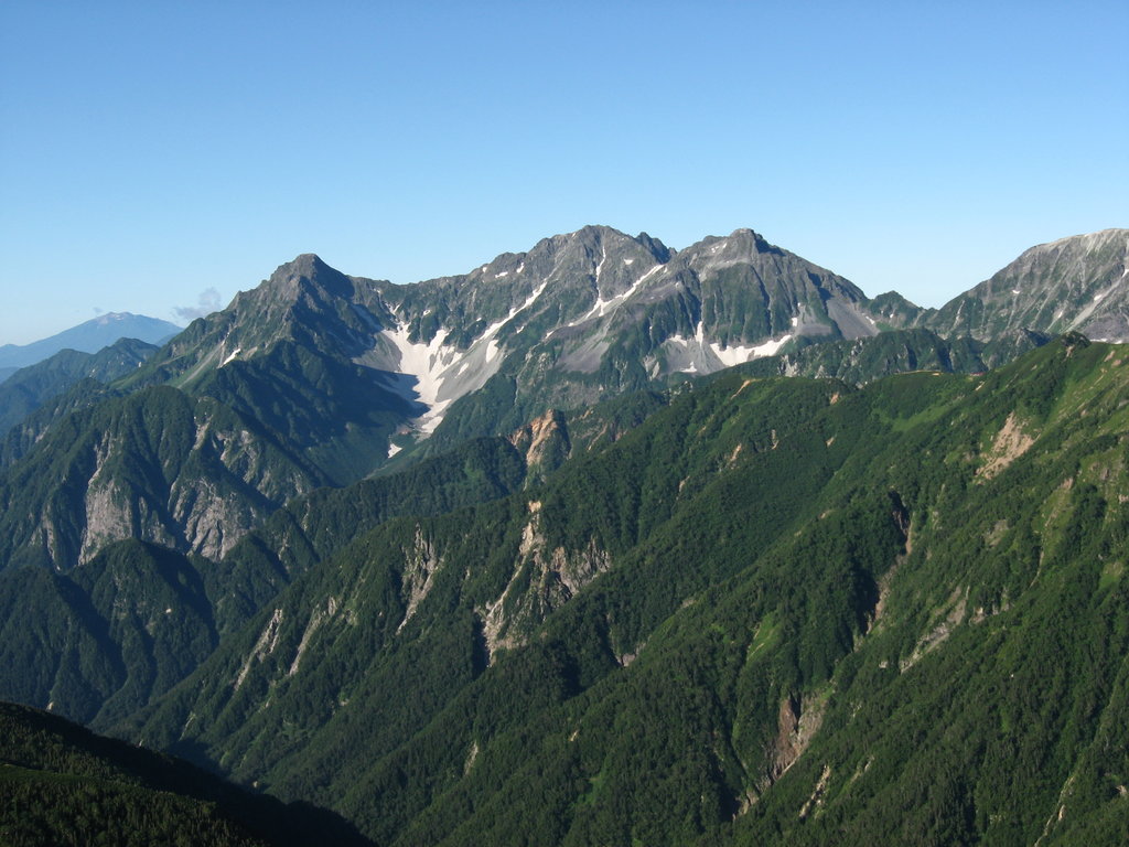
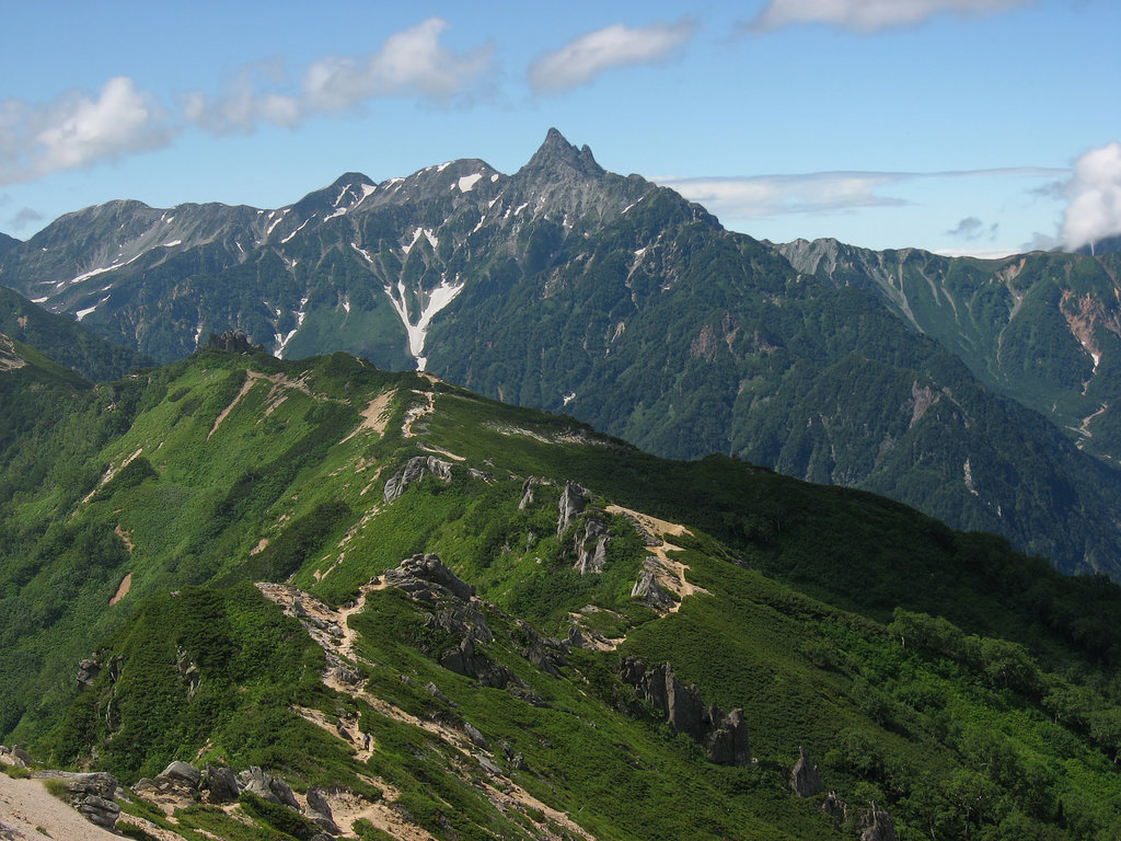
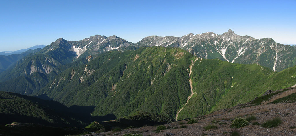
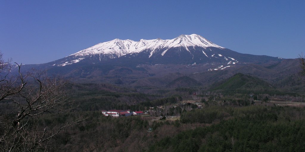
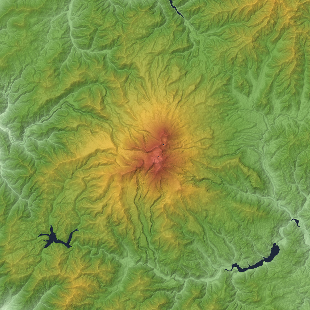
Regarding their geology, the Hida Mountains chiefly consist of granite pierced through by crystalline rocks containing feldspar. They came into being as infiltrations of volcanic magma between the earth's crust, which caused their progressive shaping. There are still some active volcanos in the area, like Mount Ontake, the main reason for the presence of so many natural hot springs around here. The Hida Range is almost totally included in Chūbu Sangaku National Park. It is well known as a centre of mountaineering and skiing. Several of the mountains’ rivers, such as the Ōtaki and the Kurobe, have been harnessed for the production of hydroelectric power.
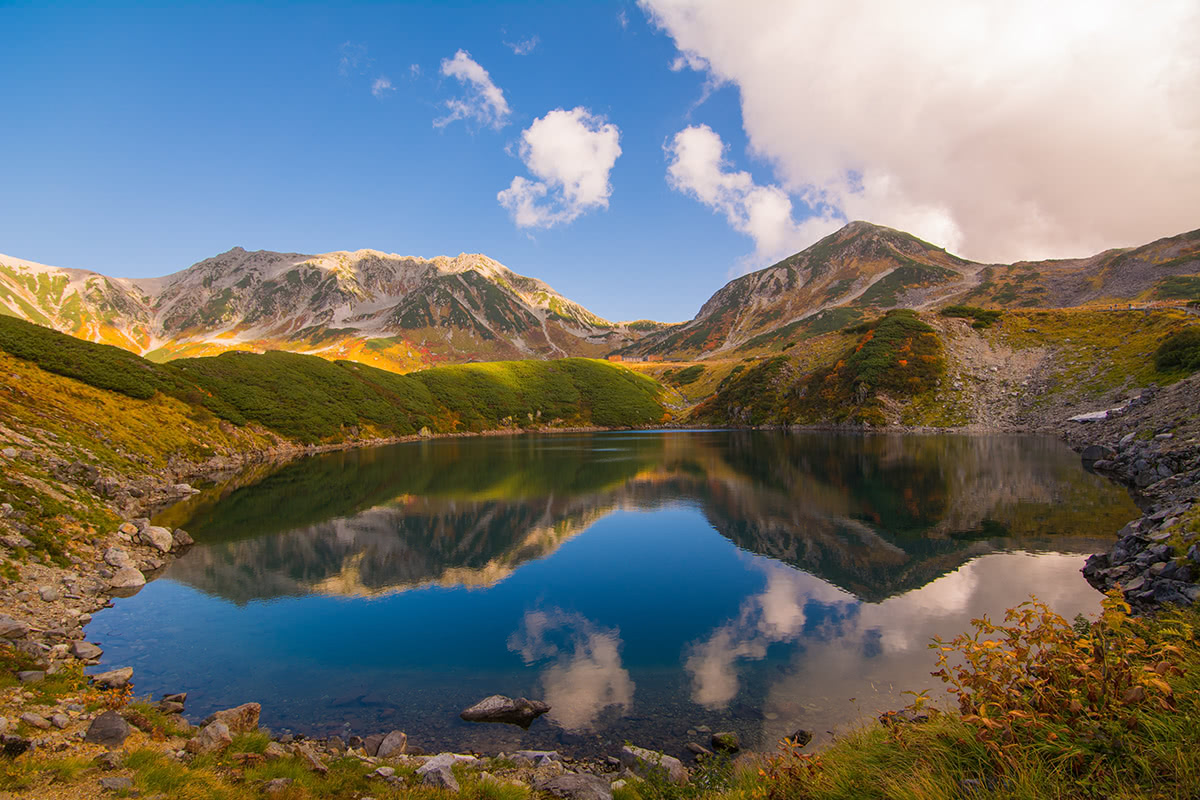
The Hida Mountains includes 209 named peaks, the highest and the most prominent of which is Mt. Oku-Hotaka (3,190m), the third highest Mountain after Mount Fuji and Mount Kita. Mount Tate, one the 100 Famous Japanese Mountains belongs to this range as well.
Despite the Hida Mountains being located in a region that has been scarcely populated until recent times, they were also one of the first mountain ranges explored by foreigners, thus becoming a famous tourist destination. The Hida mountains are usually very crowded all over the year. In fact, this range is not only the right place to admire landscapes, flower blooming and trees blossoming, or night skies, it is also a perfect place for hiking and doing winter sports; the popularity of winter sports has increased significantly after the city of Nagano hosted the XVIII Winter Olympic Games, in 1998.
In Japanese language there is an expression used to describe places like this; 自然に恵まれた地域 Shizen ni megumareta chiiki, literally “a territory blessed by nature”. It includes the idea of coexistence of natural world with human activities, something different from the idea of wild nature, which is more related to gods and the intangible rather than to human an material things. So, if you like mountains but you also don't want to give up your comfy holiday, the Hida Mountains are definitely a good compromise.
A brief list of hiking routes, places to see, and things to do in the Hida Mountains area.
This is a 'must-see' place because Japanese hiking culture has begun right in this valley, at 1500m, in the middle of the Chūbu-Sangaku National Park.
A day trip is perfectly feasible, but if you are planning a longer trip, we suggest you take a stroll in Matsumoto city, where one on the few Japanese black castles will be waiting to share its treasures with you and it is well-worth visiting.
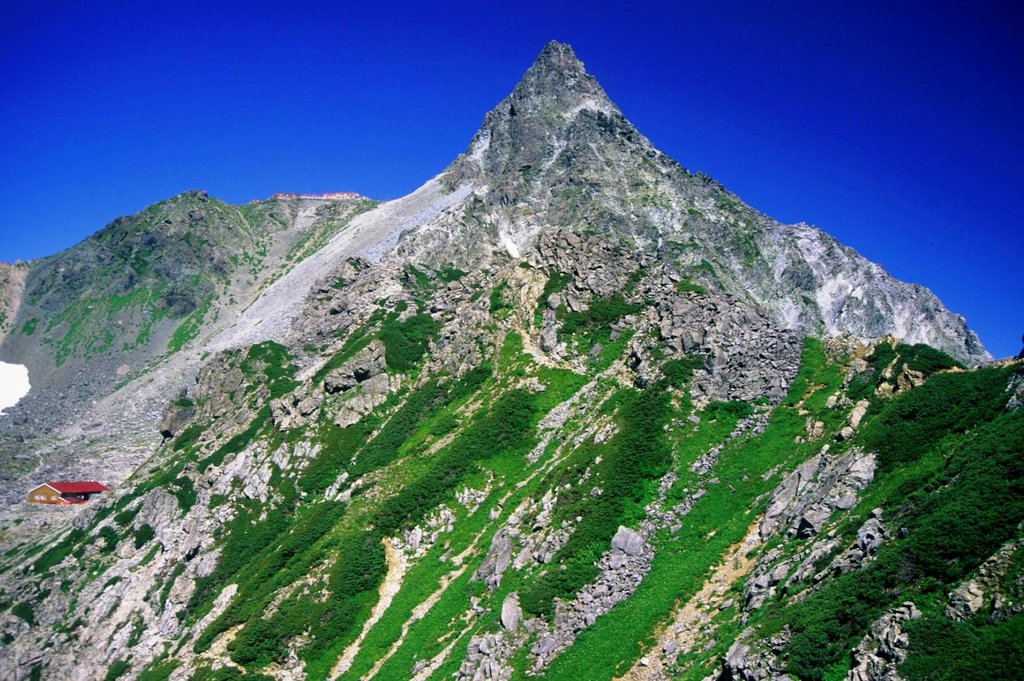
From here you can also climb Mount Hotaka, one of the 100 Famous Japanese Mountains.
Access
The main trails: There are three easy trails doable in about 2h-4h, with stops at the most significant places: Kappa Bridge, Walter Weston Monument, Lake Myojin, Lake Taisho, Tokusawa Swamp. These trails can be also walked in winter, providing you are using snowshoes. But in this case, you may need a little more time to complete the whole route.
Yakedake Trail: Yakedake (焼岳), literally the 'burning mountain', is an active volcano, reaching the top of which usually takes 8 hours if you start from Kamikochi. We suggest taking this route in case you want to spend the night in Kamikochi area, or if you just want to see how it feels to walk around an active volcano. Despite the rugged landscape, this trail is really easy to walk, even though it is quite long.
If you want to visit Matsumoto area, taking a bus or renting a car and going to Utsukushigahara Highland (see the article 100 Famous Japanese Mountains for more details) will be a great idea. Mountains and trails are amazing there. For family trips, you can also decide to drive along the panoramic road called Venus line (can be covered by bicycle as well), a great side trip with beautiful scenery around every curve.
Kurobe dam is a massive panoramic dam and a well-known tourist attraction. You can enjoy the view of the Northern Japan Alps from the large observatory and even see the dynamic release of water (only in summer and early autumn). Another option is to take a walk along the trails and then have a cup of tea at the rest house. It is possible to choose both a short route (one day) or a longer route (two days or more).
When it comes to tourism, the city of Azumino is not exactly a traveller’s first choice, because there aren’t any particular attractions, except for a wasabi farm where you can spend a few hours training yourself how to grow wasabi while tasting wasabi ice cream and talking with a guide. Despite that, this city is loved by the locals and there is an abundance of local associations trying to boost its popularity by attracting foreign tourists.
It takes 20 minutes from Matsumoto by local train to get to Azumino. Once you arrive at the station you can rent a bike and cycle along the paddy fields or choose one of the following routes to admire the Hida Mountains closely. Don't be afraid to ask local people for information, they will be glad to help.
Mount Tsubakuro is known as the Queen of the Northern Alps. It is the best for medium-level hikers who are planning a long hike.
Main street trail: it goes from Mount Tsubakuro to Mount Yari. Along the way, there are two mountain huts where you can stop for the night.
Kassen Ridge trails: From the trailhead, the Kassen Ridge trail ascends 1250m up to a hut. It is considered one of the three steepest ascents in the Japanese Alps. The trail is long and steep but is well maintained and it is perfect for beginner to intermediate hikers, while the Higashizawa route is for experienced hikers only. Nakabusa Onsen and Ariake Onsen hot springs are located near the trailhead.
The beauty of this city resides in the perfectly preserved historic village. Takayama gained importance as a source of high-quality timber and home of highly skilled carpenters during the feudal ages; during the Edo Period (1615 - 1868) this area was populated by merchants whose wooden houses and shops are still there. Hot springs and a castle are also attractions of this area. It goes without saying that mountains are the cherry on top. For example, Mount Tengai is a peak that offers a broad view on the Northern Alps. It takes 2h to reach the summit walking through a green tunnel in broadleaf forest. Mount Kitanomata is another panoramic spot for alpine flowers and offers a main trail that goes from Hietsu tunnel to Mount Teraji. But most importantly, Hida Takayama is also the home of Mount Ontake, Mount Haku and Mount Yake, three big volcanos that are also three peaks of the 100 Famous Japanese Mountains.
History and hiking go hand-in-hand in Shirakawago as well. It is located in Gifu Prefecture and was declared a UNESCO world heritage site in 1995. It is famous for its traditional gassho-zukuri farmhouses, some of which are more than 250 years old. The area is rich in easy trails for beginner hikers and families and has a 20km trail suitable for cycling. You can plan a one-day trip from Takayama to Shirakawago reaching it by bus.
If you liked this article and you want to discover something more about the Hida Mountains please let us know via email at peakvisor@routes.tips.
ja100
ultra
japan-3000ers
japan-ultras
ja100
ultra
japan-3000ers
japan-ultras
ja100
ultra
japan-3000ers
japan-ultras
ja100
ultra
japan-3000ers
japan-ultras


