Scan the QR code and open PeakVisor on your phone
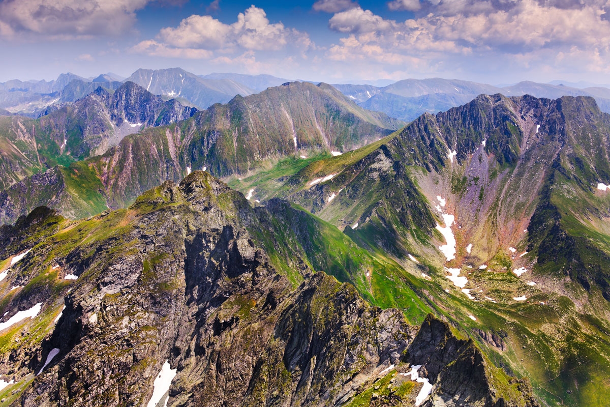
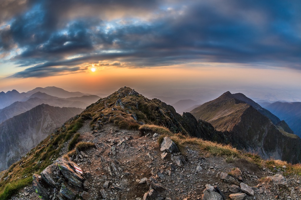
The Făgăraș Mountains are the defining peaks of the Southern Carpathians (also called the Transylvanian Alps). They boast the highest summits in Romania, all sitting along the same imposing spine. The colossal ridge line is visible from hundreds of kilometers across the low-lying plain of Transylvania to the north. The mountains stand out for their impressive steepness, jagged (and sometimes chossy) character, alpine ecosystems, and remoteness. Large portions of the range are far from populated areas in mountain wilderness. The highest peak in the range is Moldoveanu (2,545 m / 8,350 ft), the highest in Romania.
The Făgăraș Mountains are Romania's longest and highest mountain range. The chain of peaks runs east-west for about 70 km (44 mi).
The north slope of the Făgăraș is very steep, rising about 2,000 meters (6,561 ft) in just 14 km (8.7 mi). The south face is more gradual, covered in long, winding canyons and foothills.
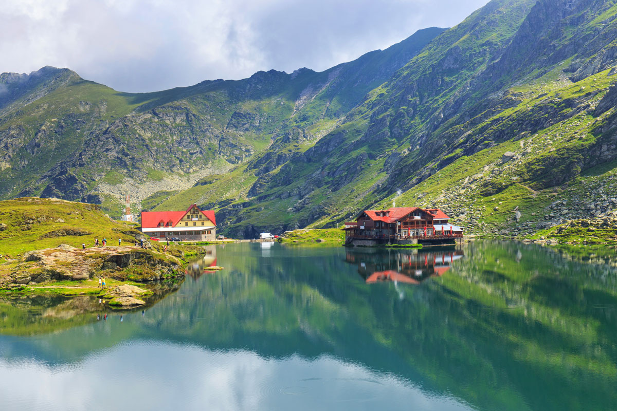
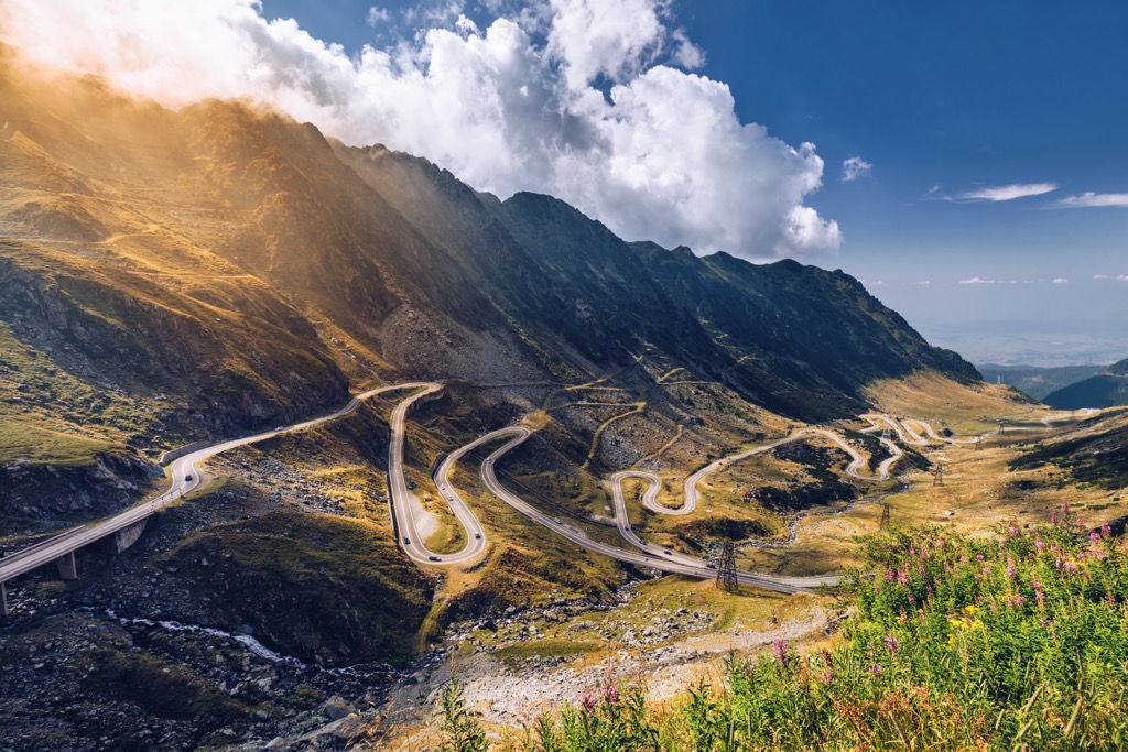
The Făgăraș demarcate the boundary between Transylvania (to the north) and Wallachia (to the south). Most visitors approach from the north slope using the famous Transfăgărașan Highway, a Soviet-era road considered one of the world's most beautiful drives. The highway provides excellent access to the center of the range, around Bâlea Lake, cutting straight through the mountains to the south side. It’s a marvel of engineering and a convenient way to cut days off your approach time.
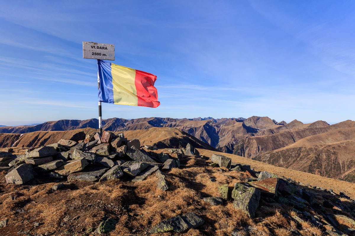
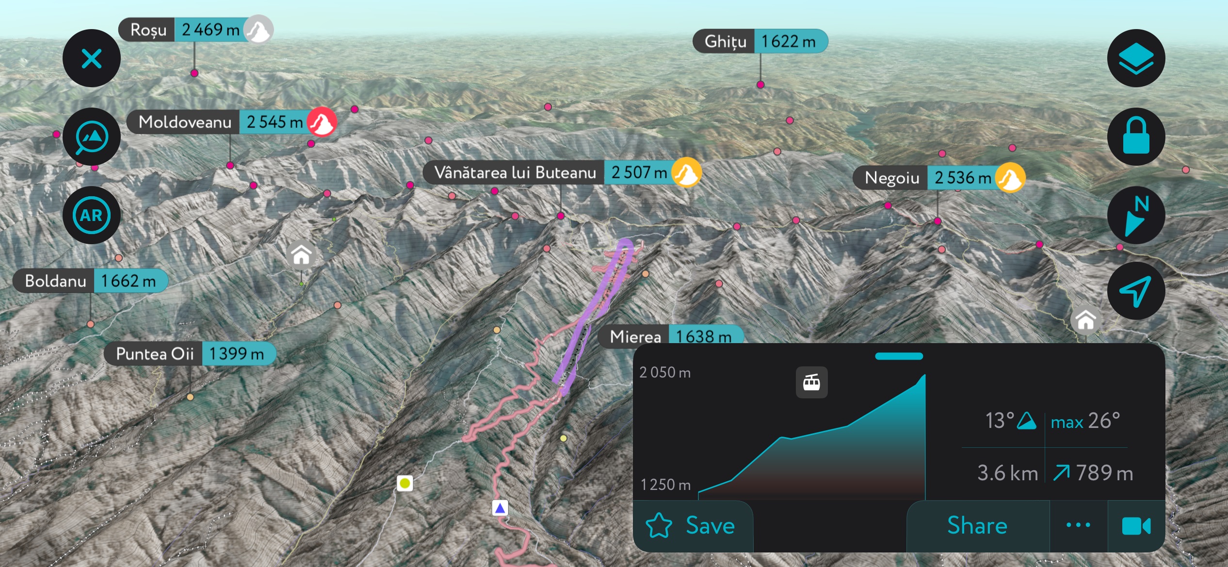
Most of Romania’s highest peaks are within just a few kilometers of each other in the Făgăraș. Moldoveanu, Negoiu (2,535 m / 8,317 ft), Viștea Mare (2,524 m / 8,281 ft), and Lespezi (2,522 m / 8,274 ft) all sit within 10 km (6.2 mi). Other notable summits include Vânătarea lui Buteanu (2,507 / 8,255 ft), Podragu (2,462 m / 8,077 ft), and Dintre Strungi (2,476 m / 8,123).
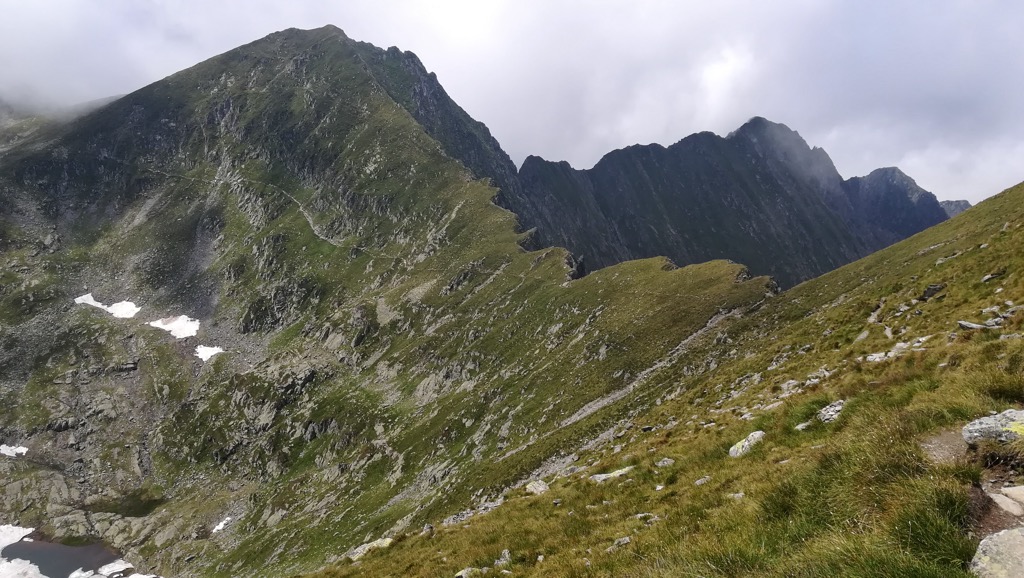
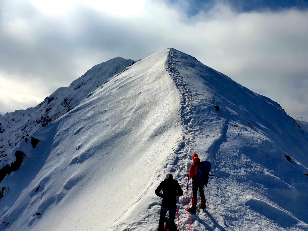
The Făgăraș range’s skyline is impressive. All the above peaks are connected along a single spine, which cuts a jagged line visible from considerable distances in Transylvania. If you’re climbing a summit in the Făgăraș, you will usually approach from the north, which means a significant elevation gain, or you will hike along the ridge. Ridge hiking is exhilarating and beautiful but exposes you to weather and fall danger. It’s also much more technical, with lots of scrambling and talus to negotiate between the peaks.

The Făgăraș Mountains are somewhat remote by European standards. Brașov and Sibiu are medium-sized cities located northeast and northwest of the mountains, respectively. Both have international airports and major train stations. The range’s sparsely populated southern expanse is peppered with picturesque towns and villages, but there are few population centers near the peaks. Thus, public transport to the mountains is scattered. There is one bus from Sibiu, but it only runs once daily and costs €65.
As usual, the best way to the Southern Carpathians is by car. Fortunately, rentals in Romania are cheap. In a small city like Timișoara or Cluj Napoca, you can find rentals for around €5/day.
Staying around Balea Lake with a car can save you time. Peaks further from this central point, especially to the east, usually involve long approaches from the north. On the north slope, a few small towns (see Victoria and Breaza) serve as jumping-off points for these longer, more solitary treks.
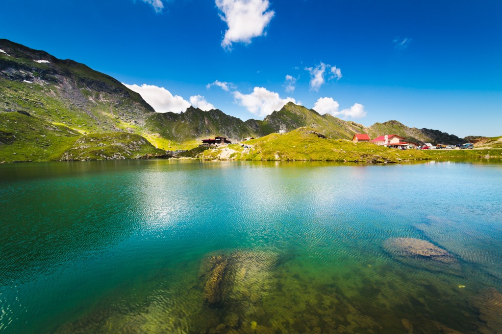
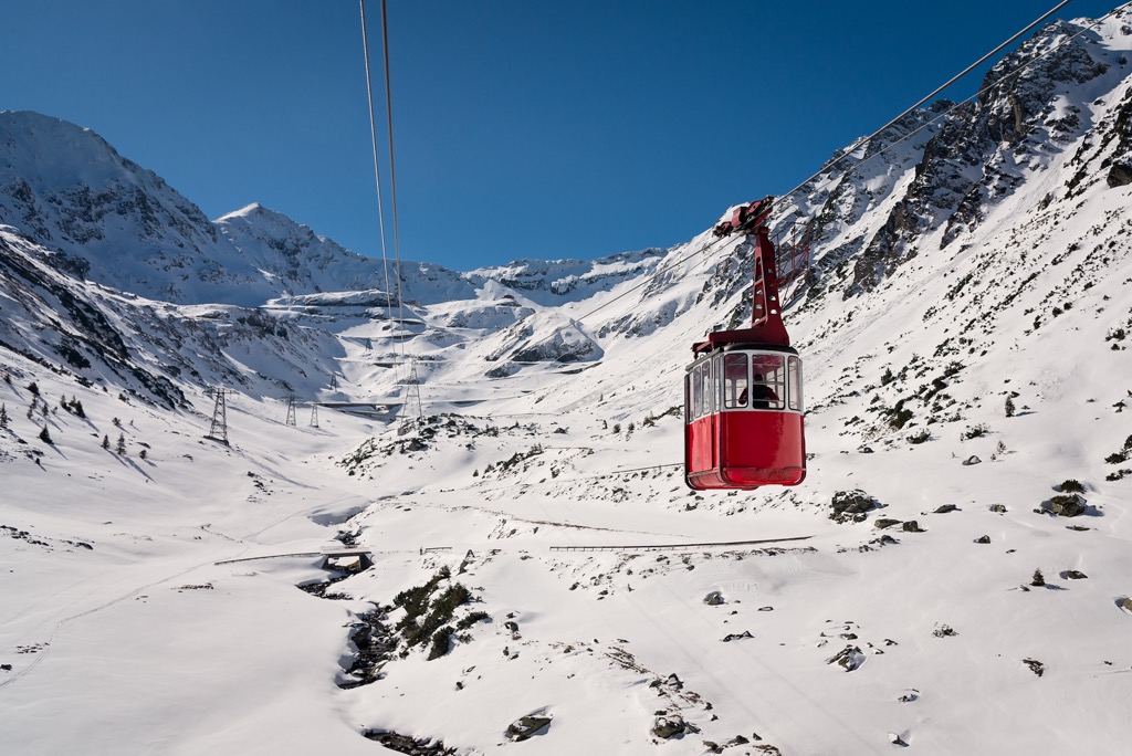
In the winter, the higher part of the Transfăgărașan Highway may shut down due to snow. Luckily, a year-round cable car runs from Balea waterfall to Balea Lake. Tickets cost about 30 lei (€6) per person, and the views along the way are outstanding.
Although the Southern Carpathians look like a single continuous geological formation, each individual range comprises different rock. For example, Bucegi is a conglomerate plateau, Piatra Criaului is a sharp limestone knife ridge, and Retezat is a collection of classic granite spires.
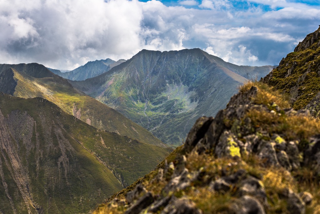
The Făgăraș, by contrast, is a long spine of schists broken up by deep saddles. Buttresses of flaky rock line the glacial canyons, breaking off at angles from the main ridge. Rockfall is expected in the higher elevations, as schists are often chossy and loose.
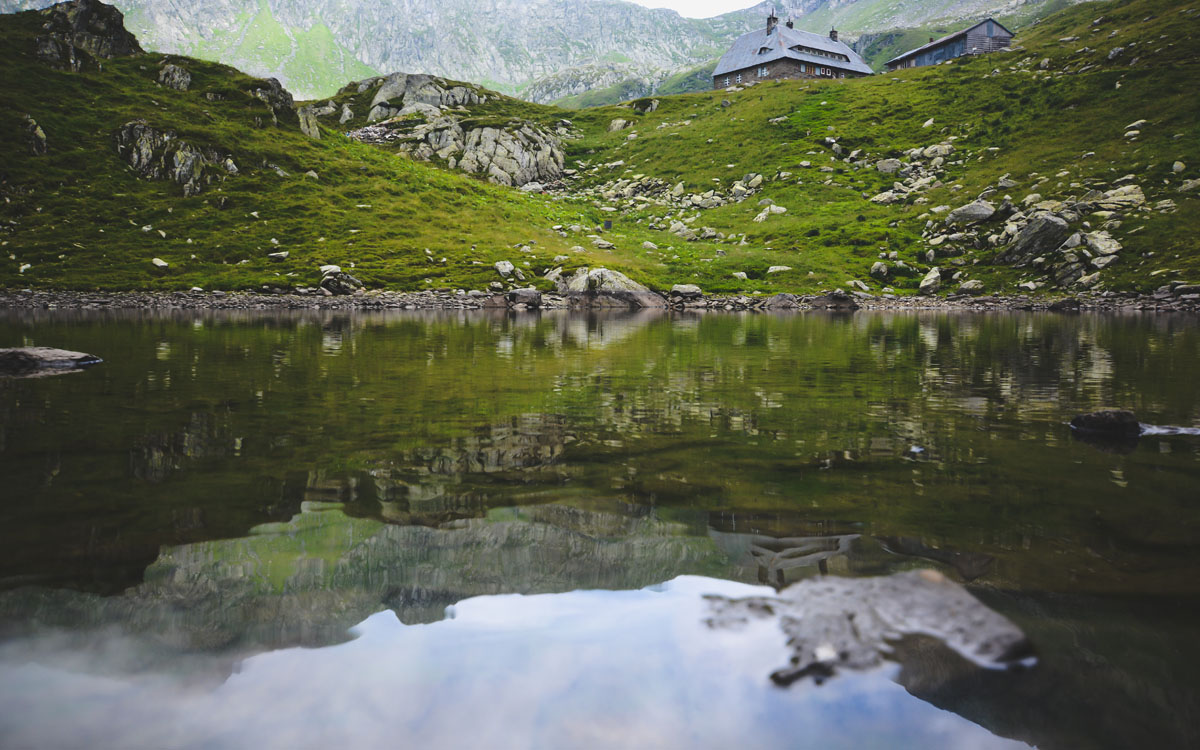
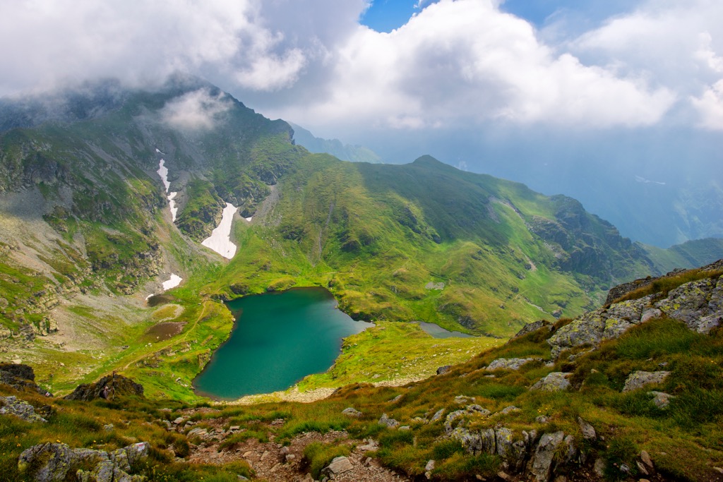
The range has a long history of glaciation. Deep glacial canyons scar the mountains’ south aspect. Though the glaciers have long since receded, there is still evidence of them in the alpine tarns (small glacial lakes) in many high valleys.
The Făgăraș Mountains showcase the biological diversity of the Carpathian Range. The Transylvanian Alps feature three main ecosystems, each with a unique set of plants and animals.
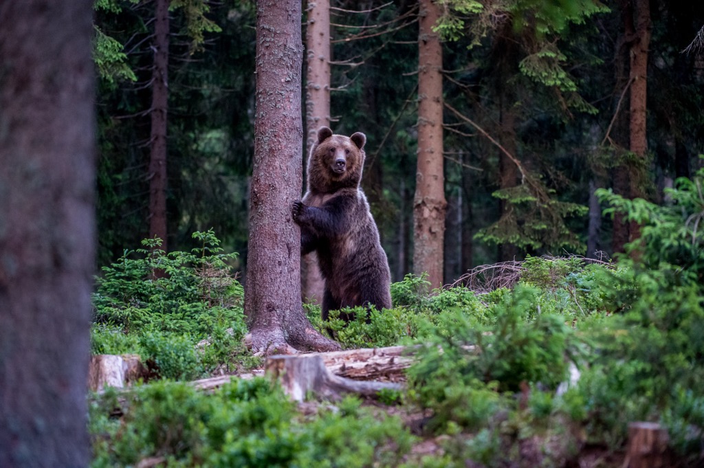
Some of the world’s last primeval beech forests thrive in the lowest elevations. These are among Europe’s last untouched ecosystems. These ancient forests are home to a complex ecology, including apex predators like lynx, wolves, and brown bears. In fact, brown bears are common throughout the mountainous regions of Romania, and it’s a good idea to keep an eye out while hiking. Make noise to alert the locals of your presence—it’s the most foolproof way to avoid a bear attack. Bear bells are an effective way to make enough noise without having to think about it.
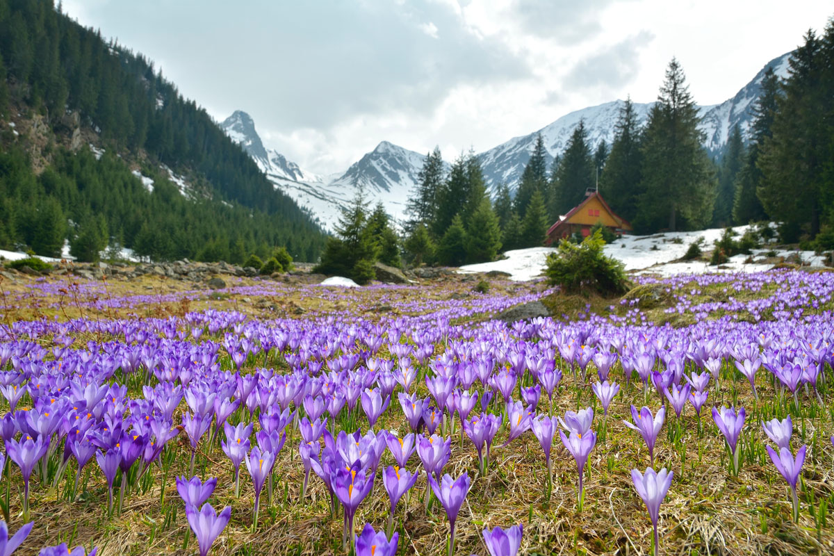
Higher up, the beech forests give way to mixed coniferous forests. Large mammals like wolves and deer are most common in these areas. Coniferous trees do well in cold winters and can survive at high elevations. In alpine regions, some trees take on a Krummholz form, appearing stunted to cope with high wind and extreme cold.
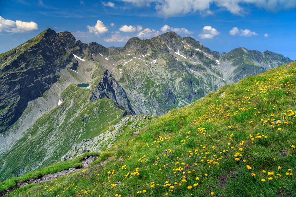
Alpine grassland dominates the highest elevations. The Făgăraș are unique because they hold some of the only proper alpine grasslands in the Carpathian Mountains. These landscapes are defined by rock, short grasses, and wildflowers. They give the mountains a rugged feel and provide a habitat for high-elevation specialists like chamois.
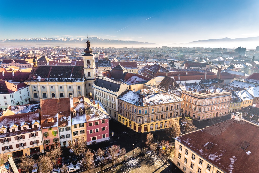
Romania is steeped in history; all it takes is a jaunt through a city like Sibiu to understand that this is an ancient place. The country’s most famous figure is Vlad the Impaler, who terrified his enemies and inspired the character Count Dracula. Almost everyone is familiar with Romanian legends, as the myth of the vampire was born here.
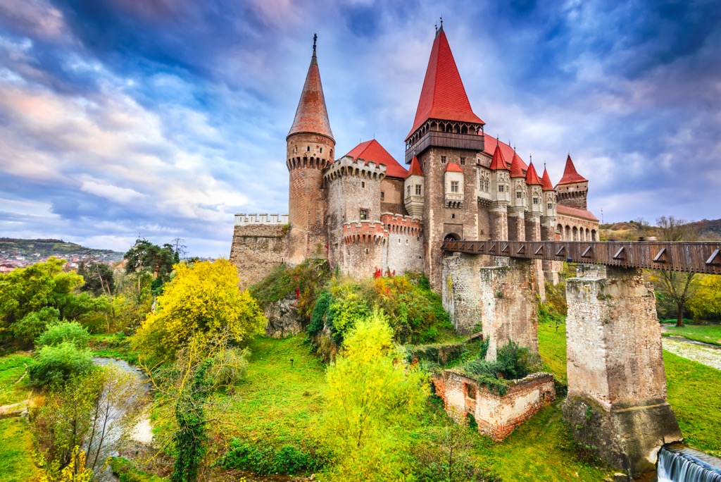
Like many mountainous places, Romanian history is replete with stories of repelling invaders from fortified castles high in the hills. No trip to the Carpathians would be complete without seeing a few of these magnificent structures. As it happens, the Făgăraș Mountains are close to three of the nation’s finest castles. Bran Castle, which matches the description of Dracula’s, sits just east of the mountains. Peleș Castle, a royal summer home, is a little further along, just south of Brașov. And Corvin Castle, the most picturesque in the country, sits in the foothills west of Sibiu.
While you’re at it, the mountains are also full of lovely monasteries. These peaceful places share many of the same charms as a good castle. One of the best in the country, Cozia Monastery, is just south of the Făgăraș.
If you just want a short day hike surrounded by mountain scenery, head up the Transfăgărașan Highway to Balea Lake. The drive alone is worth the trip, but once you get to the lake, you’ll want to get out of the car and start hiking. You can also take the cable car to the summit.
The lake is an alpine wonderland, where grassy, rolling hills around the water give way to jagged rock escarpments. Scree and talus pour out of narrow gullies, leading to a crown of rocky summits. The peaks around the lake are just a few hundred meters above the trailhead, but they all require at least a little scrambling and talus hiking to reach the summit.
The most noticeable summit to the east is Văiuga (2,443 m / 8,015 ft). The Blue Triangle trail climbs 400 m (1,312 ft) from the lake in just 1 km (.62 mi). Heading back south, you’ll pass over a saddle and back up to the peak of Iezerul Caprei (2,418 m / 7,933 ft) along the green stripe trail.
From here, the trial continues west, circling the lake. It’s a picturesque outing, with great views of both sides of the Făgăraș. After the summit of Paltinu (2,399 m/7,871 ft), the trail descends back to the lake.
As Romania’s highest peak, Moldoveanu is synonymous with the Făgăraș. It’s charismatic but also quite an undertaking. Depending on how you do it, you can change your plans slightly to summit several other mountains.
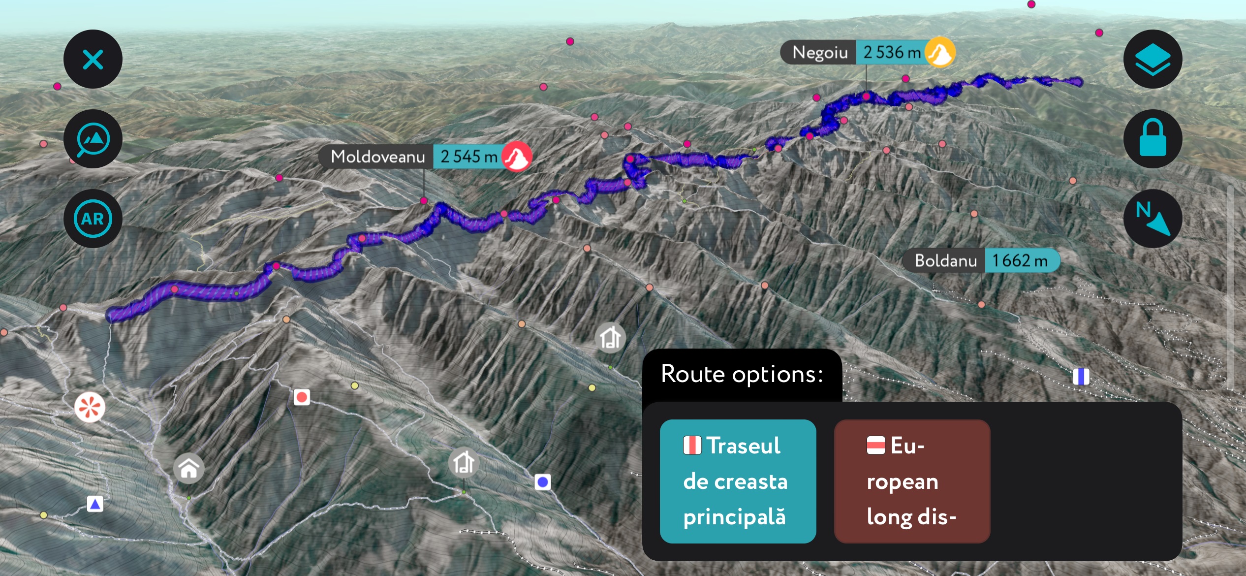
There are two ways of approaching Moldoveanu. The first is to drive to Balea Lake and follow the main ridge of the Făgăraș east through several saddles and over a few peaks. The second involves coming from the north, starting on the plain below the foothills.
The Făgăraș Ridgeline Trail
The entire Făgăraș Range is connected by a series of trails traversing along the main ridge. The section east of Balea Lake is (arguably) the most direct route to the Moldoveanu Summit.
The traverse is a spectacular, technical, and exposed route. It doesn’t include as much total vertical as the north approach, but there are steep climbs and descents as you traverse along the ridge. The other challenge of the west approach is weather. Being above 2,000 meters (6,562 ft) for multiple days puts you at a higher risk of getting caught in a storm.
These are the finer points of the west approach. From Balea Lake, follow the blue triangle toward Saua Caprei and Iezerul Caprei (2,418 m / 7,933 ft). At Fereastra Zmeilor, just past Fantana (2,375 m / 7,791 ft) peak, switch onto the blue cross trail and continue onto the north slope as you pass Podragu (2,462 m / 8,077 ft) to Saua Podragu. At the saddle, link back up with the red/green stripe and continue west over a few saddles to Viștea Mare (2,524 m / 8,281 ft), then turn south to the summit.
The most efficient route from here is to follow the red stripe trail over the saddle toward Capra Lake. It’s generally faster and safer, but it skips many of the peaks along the way, such as Vânătarea lui Buteanu (2,507 / 8,255 ft), Mircii (2,470 m / 8,104 ft), and Podragu. You can always link up with the spur routes leading off the high trail to the summits if you want.
Aside from wild camping, the primary option for splitting up the distance is Cabana Podragu. Depending on your speed, the route might take two or three days.
The north approach, by contrast, is more strenuous but not as dependent on perfect weather conditions. It’s also less technical and more like standard trail hiking. To start, drive to Viștișoara and head up the Red Triangle trail.
The route leads straight up a narrow canyon, with Vistea Mare at the end. There are two refuges on the way. Valea Viștei is about halfway up the canyon and is more of a cabana. Refugiul Viștea Mare sits on the ridge below Vistea Mare and is more barebones, with places to sleep.
The majority of visitors to the Făgăraș stick to the area around Balea Lake or head east toward Moldoveanu. But there is also plenty to see to the west of the lake.
As you traverse the main ridge, the Red/Green stripe trail leads over a few dramatic peaks. About 7km (4.3 mi) along, you’ll arrive at Refugiul Căltun, one of the range’s most picturesque refuges. It sits above a small lake, facing an imposing wall and three summits: Negoiu (2,535 m / 8,317 ft), the second highest mountain in Romania, Dintre Strungi (2,476 m / 8,123), and Lespezi (2,522 m / 8,274 ft).
Using the refuge as a base camp, you could spend multiple action-packed days just in this area. There are a few routes from the refuge to each peak. The Red Stripe trail leads directly up a steep section through Strunga Doamnei to a high ridge, a quick approach to Lespezi. The Red Cross trail leads north around Negoiu and circles back up an incline to the summit.
There aren’t really any ski areas in the Făgăraș. The snowy parts of the mountains are high and isolated from major populated areas.
But, because the mountains are accessible year-round by gondola, they’re a popular spot for winter mountaineering. A few guides in the area lead multi-day trips on Lespezi and the peaks near Balea Lake. Adding mixed climbing to an ascent will surely get your blood pumping, and you’re guaranteed to see the Făgăraș in a way that few visitors ever do.
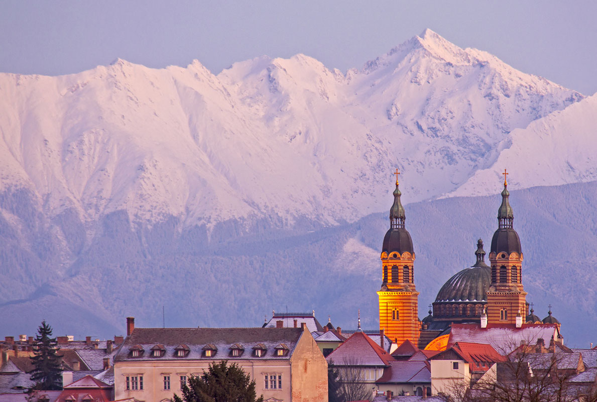
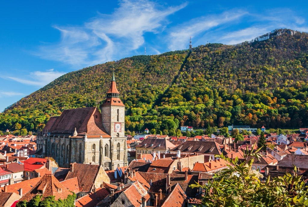
Brașov is the closest medium-sized city to the Făgăraș. It’s a central hub situated on the edge of Transylvania next to the Bucegi, Piatra Craiului, and the Făgăraș ranges. Like many Romanian cities, it’s a worthwhile destination in and of itself, with cathedrals and beautiful scenery. It also has a major airport and train station. If you’re planning a trip to the Southern Carpathians, chances are you’ll pass through Brașov at some point.
Sibiu is about two hours northwest of the Făgăraș. Its population is about half that of Brașov, but it still has an airport and train station. The city was settled about a thousand years ago and is full of history and Transylvanian culture. If you plan to check out Retezat National Park along with the Făgăraș, stop in Sibiu on the way.