Scan the QR code and open PeakVisor on your phone
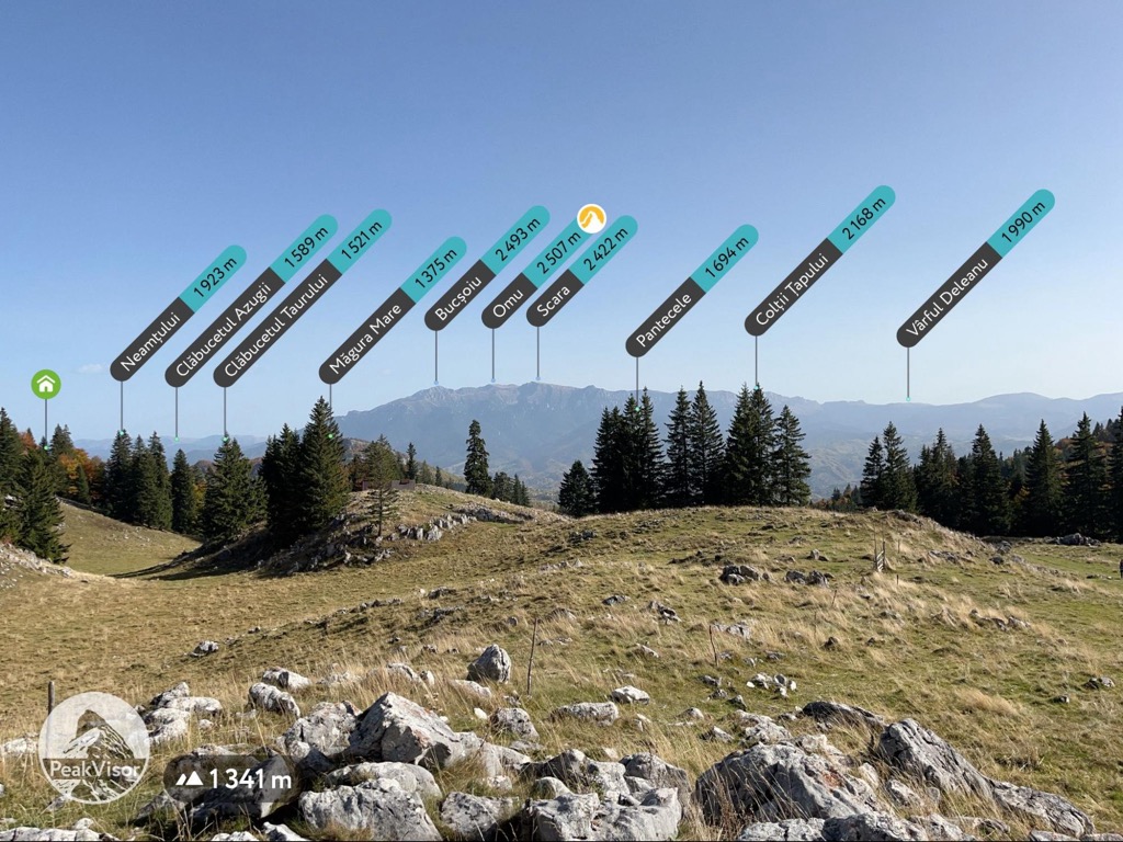
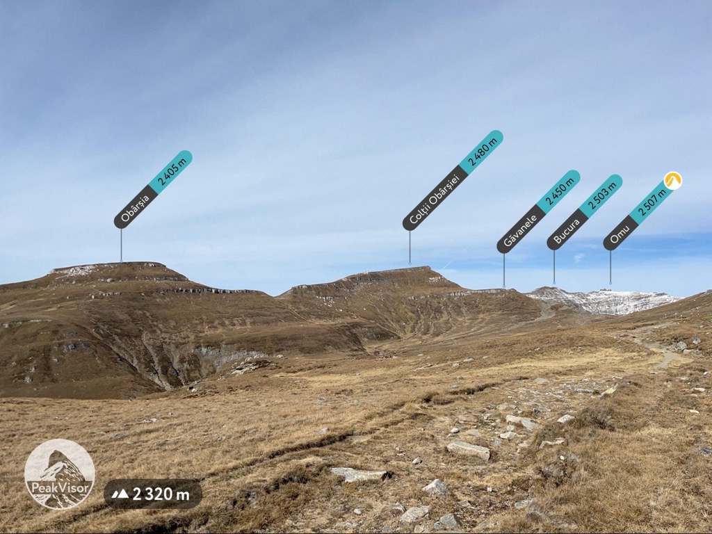
Bucegi (“boo-cheh-djee”) Natural Park is one of the premier destinations of the Transylvanian Alps. The park includes some of the highest peaks in the Southern Carpathians, set on a windswept alpine plateau above stunning canyons lined in sheer rock outcroppings. The park's upper reaches are full of mystic sandstone formations, while the surrounding towns feature fantastic castles and monasteries. It is easily accessible from Bucharest and Brașov, with or without a car, and features year-round activities. The summer months are perfect for hiking on the plateau, and the snowy winters are great for skiing. There are 244 named peaks in the Bucegi Mountains, the highest of which is Omu Peak (2,507 m / 8,225 ft).

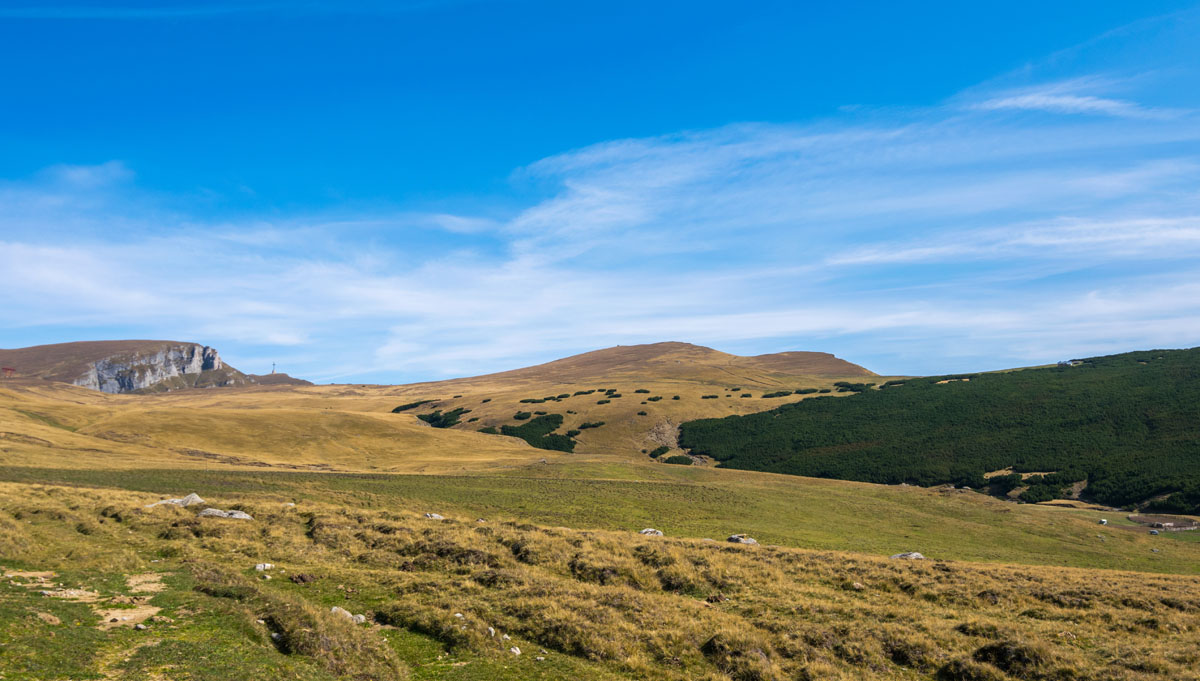
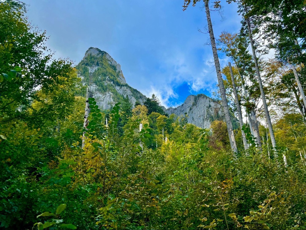
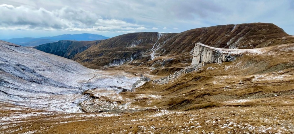
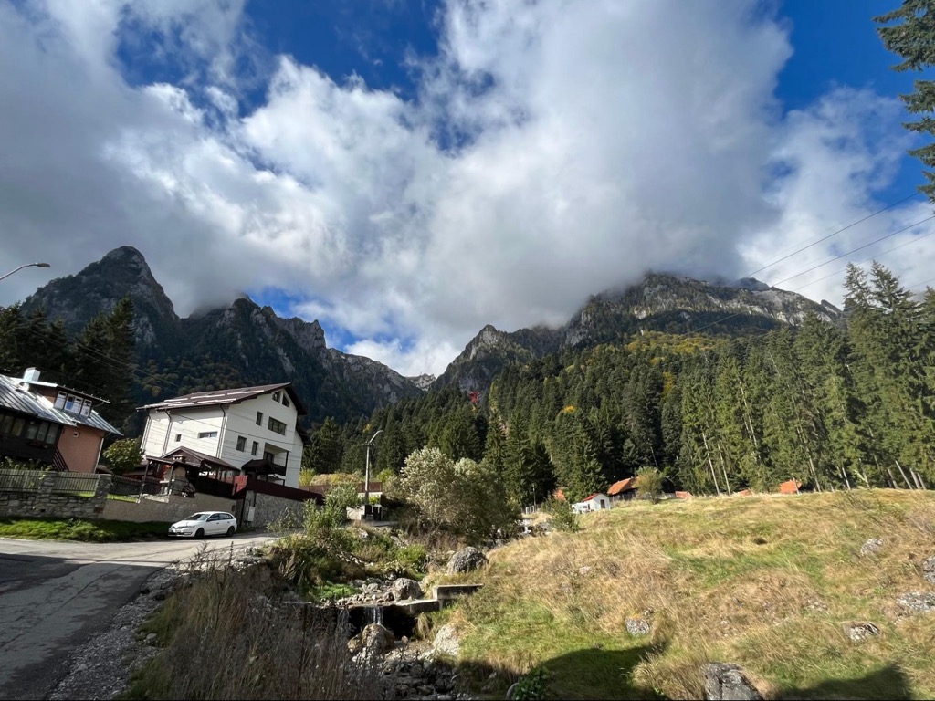
The main feature of Bucegi Natural Park is the Bucegi Plateau, an elevated plain that towers over the surrounding valleys. Even from far away, the plateau’s profile is easy to pick out on the horizon.
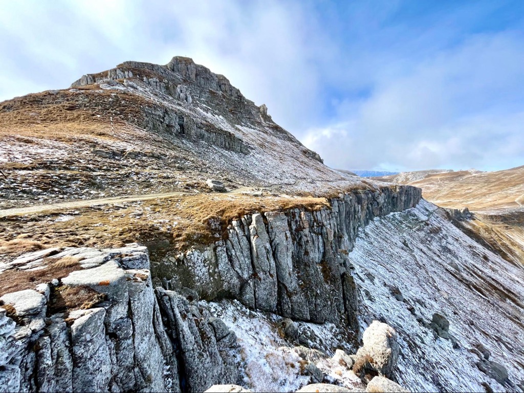
From Bușteni, the plateau rises around 1,325 m (4,347 ft) through steep canyons. The top of the plateau is comparatively flat. Most of the peaks only have a few hundred meters of extra prominence, starkly contrasting to the rest of the Southern Carpathians, mostly steep knife ridges that run in straight lines.
This upper plateau is roughly horseshoe-shaped and flanked on all sides by massive canyons. These include the Mălăiești Valley and Caraiman Valley, which leads into the mountains from Bușteni. Massive buttresses of conglomerate rock form the park’s canyons. In the center of the horseshoe is a deep valley that runs downhill to Lacul Bolboci, an artificial lake.
Bucegi is considered the eastern boundary of the Southern Carpathians. As you move east from Bucegi, you’ll notice a distinct drop-off in elevation, and mountains are more hilly and sparsely inhabited.
To the west, a broad valley separates Bucegi from Piatra Craiului National Park. Beyond that are the Făgăraș Mountains, the highest peaks in Romania (including Moldoveanu).
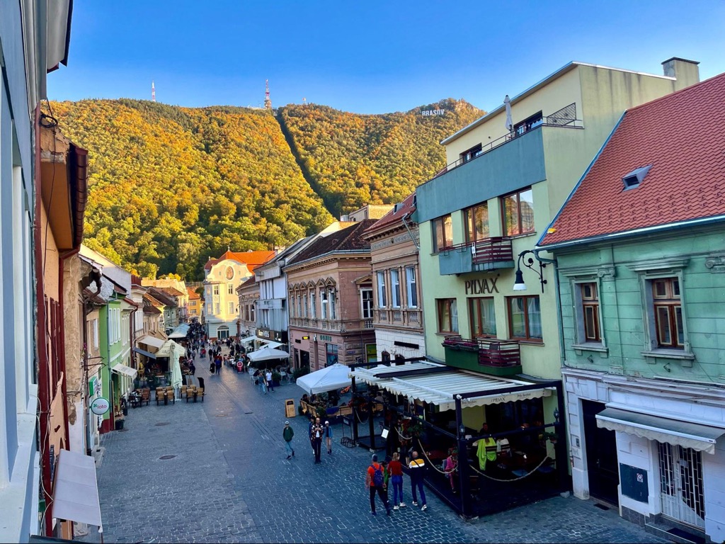
To the north, the foothills below Bucegi roll onto the Transylvanian Plateau. The city of Brașov sits on the northern edge of these foothills. To the south is a similar landscape of forested river valleys, which ends in the Danube River Valley in Wallachia.

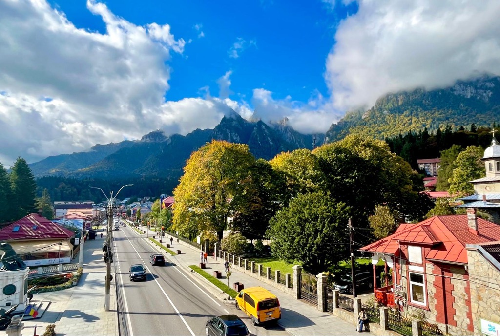
The Bucegi Mountains have plenty of transportation infrastructure. The main highway through the Southern Carpathians connects Brașov to Bucharest directly through the Prahova Valley, just east of Bucegi. There are two towns here, Sinaia and Bușteni, which can be reached easily by train from Brașov or Bucharest.
On the western side of the mountains, the best access point for the park is the town of Bran. You can get to Bran from Brașov either by taxi or bus. Taxis are hit or miss in Romania. Prices for yellow cabs vary wildly, and the number of active drivers around limits apps like Uber and Bolt.
Buses to Bran are reliable and cheap (13 lei or ~3€), though much less comfortable than taxis. They depart from the Autogara 2 in Brașov every hour, year-round.
Hiking around Bucegi is much easier if you have a car. There are good roads onto the plateau from the Prahova Valley, which drastically cut down the long approaches.
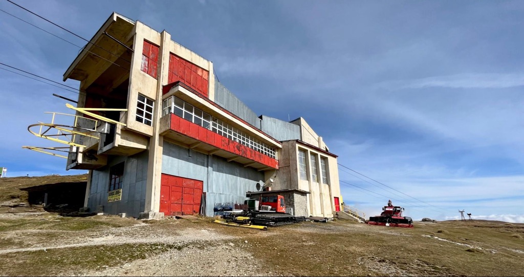
If you don’t have a car, there are two main options. One is to take one of the cable cars from Sinaia or Bușteni onto the plateau. The cable cars are fast and scenic but also expensive. Return tickets cost 190 lei (~40€). The other option is to hire a car in the Prahova Valley.
If you can, avoid hiring a car on the street— local drivers offer tourists the same price as the cable car and then upsell by offering to stop in scenic locations. Instead, ask the host at your lodging. They should know a local driver who will give you a fair price.
Bucegi’s geology defines its unique landscape. Most Transylvanian Alps comprise white limestone, forming steep, sharp ridges, sinkholes, and caves. By contrast, Bucegi is made almost entirely of sandstone and different types of conglomerate.
The sedimentary rock that makes up Bucegi sits in horizontal layers which protect each other from erosion. The layers on top protect those underneath, which makes the landscape wear away into a broad, elevated plain. This elevated plain is the Bucegi Plateau.
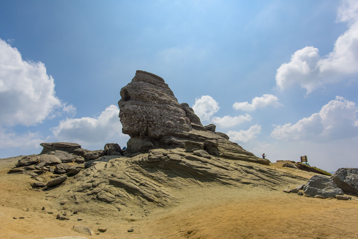
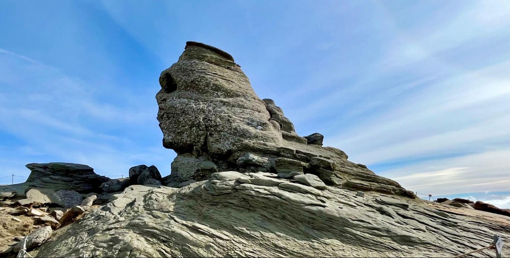
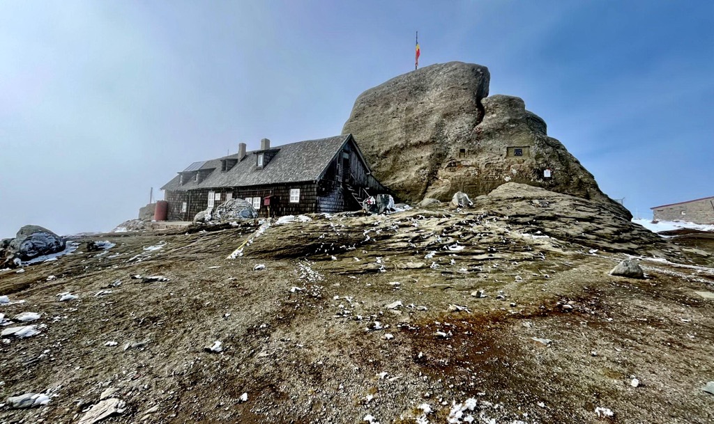
The top layer of the plateau is a swath of sandstone that has weathered to produce some of the park’s most recognizable formations. The Bucegi Sphinx and Old Women of Babele are sandstone monoliths created by wind, water, and time. There is no ancient history to these formations, but some people harbor the belief that they draw supernatural energy.
The lower canyons of the plateau showcase the layers of the plateau. Buttresses of conglomerate (including most of the major peaks), breccias, and olistostromes are all visible in different parts of the park. Because the canyons are the result of rivers and not glaciers, the canyons in Bucegi are all distinctly V-shaped, with steep walls and a narrow bottom.
Beneath the different types of sedimentary rock, there are still pockets of limestone in Bucegi. One of these pockets created Lalomita Cave, a deep limestone cavern formed by the mineralization of snowmelt from the plateau. When archaeologists first explored the cave, they found the bones of cave bears dating back at least 25,000 years. Today, it’s one of the most visited caves in Romania.
There is a stark contrast in landscapes between the lower and upper elevations in Bucegi. The canyon bottoms are full of lush old-growth beech forest. Meanwhile, the plateau is dominated by swaths of grassland in every direction.
If you’re hiking up a canyon toward the Bucegi Plateau, you will always start your ascent in a dense forest. The forests of the Southern Carpathians are some of the most pristine ecosystems left in Europe. In particular, beech forests are dense hubs of biodiversity, and 50% of Europe’s plant species live in forests like those in Bucegi.
Beech trees create a thick, high canopy of leaves that shades out other trees, creating open spaces on the forest floor where plants that prefer dim light can thrive.
The canopy lowers the ground temperature and traps moisture on which amphibians and fungi thrive. Beech forests produce edible plants, seeds, mushrooms, and roots and harbor prey animals for predators; for example, you’re bound to see bushels of mushrooms in a beech forest, typically with bite marks from bears and small mammals.
The forests are also where you’re most likely to run into bears. The Eurasian brown bear (Ursus arctos) is the same species that live in North America (Grizzlies), meaning they’re big, territorial, and potentially dangerous. Because of their remote and rugged nature, the Carpathians are home to Europe's highest concentration of bears.
Always be aware when hiking and make noise to alert the locals of your presence. Bears don’t seek out conflict and normally flee if they hear humans moving their way.
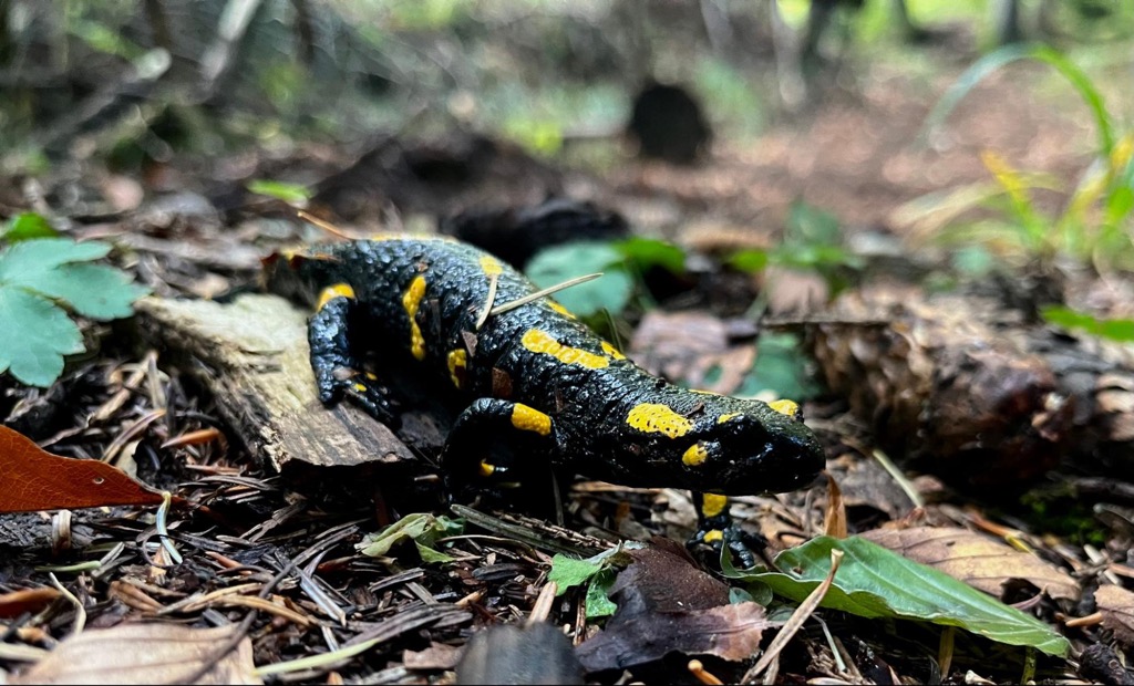
Beech forests are also home to mammals like wolves, lynx, roe deer, red deer (called elk in North America), and pine martens. You might see alpine newts and fire salamanders on the forest floor, while birds like capercaillies and black woodpeckers occupy the canopy.
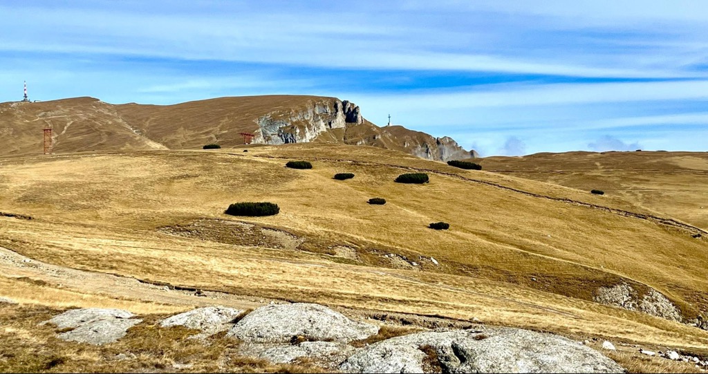
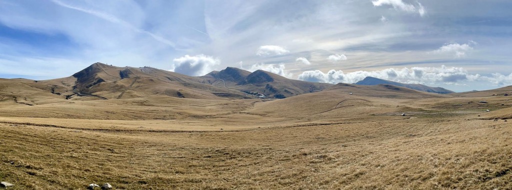
The Bucegi Plateau is a much more barren landscape than the forests below. The first thing you’ll notice is the lack of water. There are very few water sources on the upper plateau, and most of them stop running once the snow melts in the spring. As a result of the arid soil, high winds, and cold temperatures, trees don’t survive in the alpine. That leaves a few hardy species of grass, sedge, and wildflowers.
Grasslands are crucial to a few charismatic animals, such as the chamois (capra neagra in Romanian). Chamois are mountain-loving grazers similar to mountain goats that hop up rocky cliffs to nibble on bits of greenery. You may spot giant birds of prey like golden eagles soaring over the plateau. It’s also an excellent place to look for wildflowers like martagon lily.
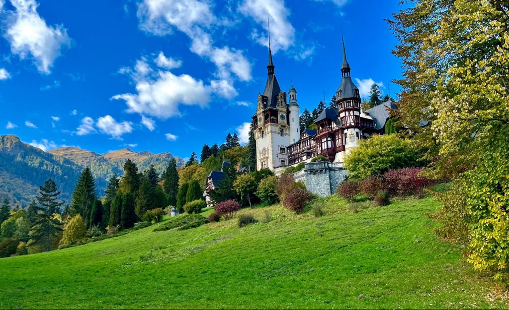
Outside of the pristine hiking and great skiing, most people visit Bucegi to see castles and monasteries. Fortresses surround the park; some were used to hold off mountain passes from enemies in ancient times, while others were opulent summer homes for Romanian royalty.

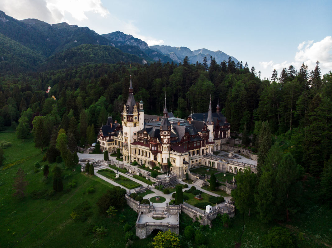
Peleș Castle in Sinaia is an example of the latter. It was built in the early 1900s for Carol I of Romania and is considered one of the most beautiful castles in the country, especially because of the mountain scenery. The interior is lavishly decorated and has everything you might imagine in a fantasy castle: secret staircases, removable stained glass ceilings, and gigantic Murano glass chandeliers.

Peleș Castle sits next to Pelisor Castle, formerly the home of Marie of Romania, the country’s last queen. Marie was incredibly popular both at home and abroad. She was an avid writer and curator of art, and you can see her writing work and art collections in both castles. Today, her heart is kept in a small silver box draped with a Romanian flag in The Gold Room of Pelisor Castle.
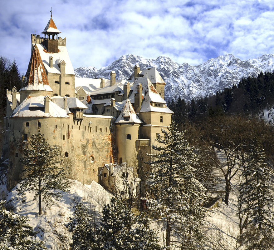
You can find a much older and more practical fortress, Bran Castle, on the other side of the mountains. Bran Castle overlooks a critical pass that was once the border between The Austro-Hungarian Empire and Wallachia. It was built by the Teutonic Order and has been inhabited by dozens of people in the centuries since, including Vlad the Impaler.
The Carpathians are also full of beautiful monasteries, most of which are still active. These monasteries are splendid buildings, all built under the Romanian Orthodox Church. But many of them served a dual purpose.
The Southern Carpathians changed hands between local rulers and the Ottoman Empire for centuries. Boyars in the Carpathians built new monasteries with fortified walls at strategic points throughout the mountains. The monasteries served all their normal functions but could also be used to guard valuables during sieges.
There are two good examples of this in the Bucegi area: Sinaia Monastery, which sits at a good vantage point overlooking the Prahova Valley, and Ialomita Peștera Monastery, built into the mouth of Ialomita Cave.
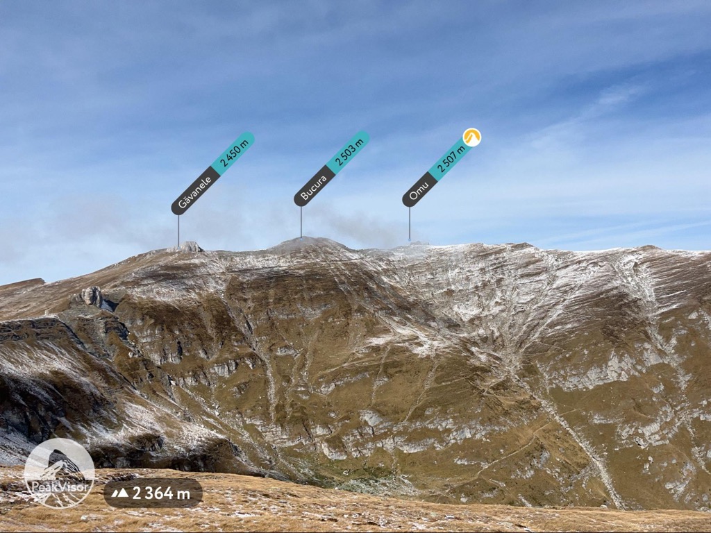
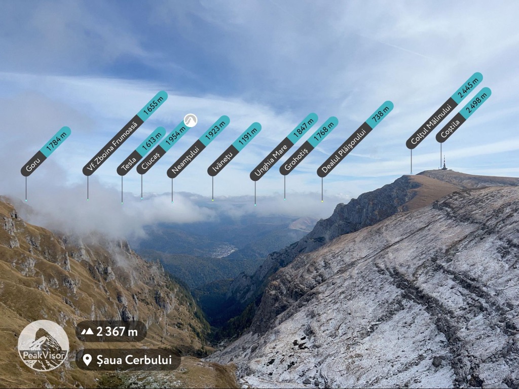
Omu is the highest peak on the Bucegi Plateau, topping out at 2,500 m (8,202 ft). The trail to the summit conveniently passes all of the park's most famous sights, plus many amazing alpine views.
If you approach it from the valley in Bușteni, you’re in for a colossal ascent— just over 1,616 m (5,302 ft) of elevation. Even for experienced hikers, this is a demanding day and may require camping to split the mileage. To get around most of this climbing, most visitors take the cable car from Bușteni to Babele, hire a taxi, or drive onto the Bucegi Plateau.
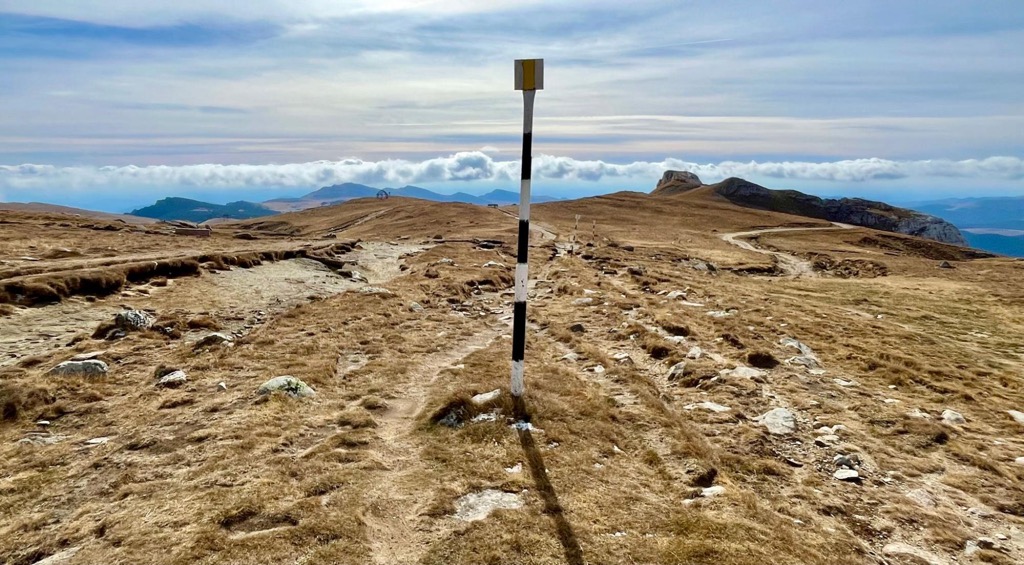
The upper elevations of Bucegi are a hilly grassland perched on top of massive, rocky cliffs. Be aware that the Bucegi Plateau is very dry, and depending on the time of year, there may be no water available.
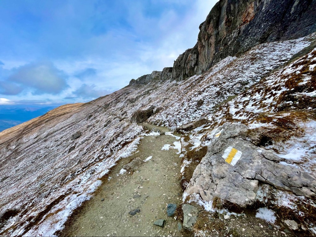
Starting from Babele, you will pass all of the major sights in Bucegi, including the Sphinx, an enigmatic sandstone formation. The trail ascends slowly through sweeping valleys and over large rock shelves to the summit, giving views of the entire surrounding area on clear days. For a moderate hike with very little vertical, the payoff is enormous.
The Mălăiești Valley is one of the most spectacular parts of the park. It’s a classic alpine valley set just below the highest parts of the Bucegi Plateau, surrounded by giant cliffs. The valley itself is worth the trek to see, but it’s also a good starting point to summit many of the park's high peaks.
There is a lot of technical terrain in this area. Trails often include scrambling, chimneys, and considerable exposure. There are also a few rock climbing areas in the canyon— Padina Crucii and Turnul Mălăiești are high-quality conglomerate walls with many good routes (buy a local rock climbing guide for specific beta). If you’re looking for a bigger adventure than hiking over the plateau, Mălăiești Valley should be at the top of your list.
The valley is also very remote. If you’re going to hike in, stay at least one night at Cabana Mălăiești. For one thing, it’s one of the most scenic mountain huts in the Southern Carpathians. For another, you will want to split up the mileage to get back to the trailhead.
There are two main ways to hike to the Mălăiești Valley: from the top of the plateau or the Bucegi Mountains' foothills. Both are long and require a half to a full day of hiking.
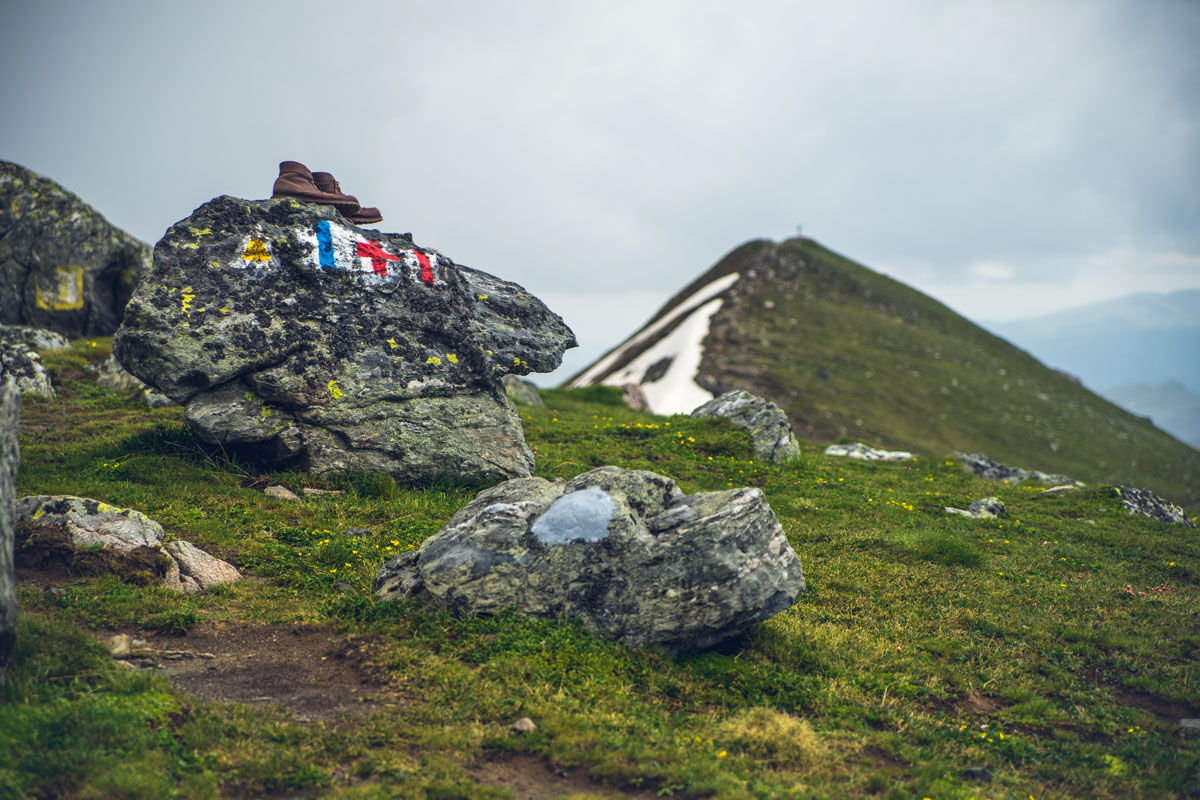
If you don’t have a car, the obvious choice is to take the cable car to Babele from Bușteni and follow the yellow stripe trail toward Omu. You’ll pass over the Omu summit, turn left, and start following the blue stripe trail. This path leads down a saddle toward Scara before dropping into the canyon below.
This route is fantastic but be prepared for some steep sections. Between Omu and Cabana Mălăiești (a stretch of 5 km/3.1 mi), you’ll descend 787 m (2,582 ft). There are a lot of short switchbacks in exposed areas before the trail mellows and reaches the canyon floor.
The other option is to hike up to Cabana Mălăiești from the north or west. The west approach is just outside Bran and could be feasible without a car (with the help of a taxi). The trailhead sits next to the local mountain rescue station (Salvamont Bran). Follow the blue circle markers up a towering ridge toward Muntele Țigănești.
Eventually, you’ll meet up with the red stripe trail and then the yellow stripe trail. The route circles south around the summit of Țigănești, over a low saddle, and past Țigănești Refuge. From here, follow the yellow stripe trial through one valley and over another ridge to the cabana.
If that sounds complicated and adventurous, it’s because it is. The north approach is much shorter and less complex, but still includes a ton of vertical gain. Plus, you’ll need a car to get to the trailhead. Following Road 101 from Râșnov, you’ll end up at the blue stripe trailhead. The trail ascends straight up the Mălăiești Valley along a creek. This is the shortest way into the valley, only 4.2 km (2.6 mi).
From Cabana Mălăiești, you can quickly get to the summits of Vârful Scara (2,306 m / 7,566 ft), Țigănești (2,019 m / 6,624 ft), Bucșoiu (2,493 m / 8,179 ft), and Omu. The surrounding high points are accessible with the blue stripe, blue triangle, yellow stripe, and red stripe trails. Most surrounding peaks can be done as short loops if you start and end at the cabana.
The trail to Bucsoiu (blue triangle) is an especially coveted route. Locals call it Brana Caprelor, the Goat’s Ledge. It follows narrow cliff ledges high above Cabana Mălăiești to the Bucsoiu summit, climbing 1,000 m (3,281 ft) in just 5 km (3.1 mi).
6 km (3.8 mi) 712 m (2,336 ft)
Cascada Caraiman is one of the best sights in Bucegi Natural Park, and the trailhead is just outside Bușteni. The trail begins in an old-growth beech forest and climbs rapidly before transitioning into the alpine part of the park. The waterfall is an excellent reward for the ascent. It’s easily one of the best in Romania. It looks best in the late spring when the water flow is highest.
Starting from town, follow the blue cross trail up the Caraiman Valley. You’ll follow the cable car the entire way. Be mindful while hiking— the canyons near Bușteni are full of bears. The trail ascends over 700 m (about 2,250 ft) in just 3 km (1.9 mi). The ascent leaves very little time for rest. Be prepared for uphill, uphill, and more uphill.
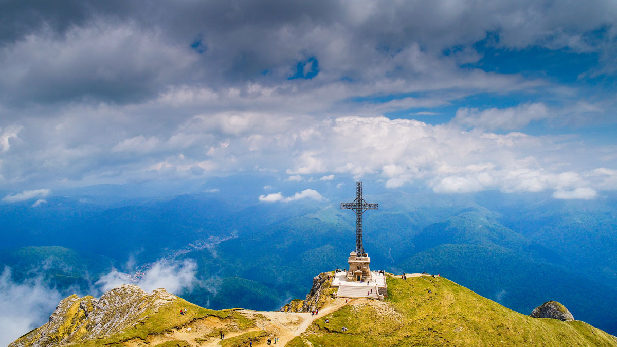
But the views in the canyons are worthwhile. Through the breaks in the forest, you’ll catch glimpses of the cliffs high above. The canyon's right side runs uphill to Caraiman Peak (2,384 m/7,822 ft), where the Heroes’ Cross overlooks the Prahova Valley.
Cascada Caraiman sits just below the top of the plateau. If you’re tired from the ascent, you don’t necessarily have to turn around and hike back down. From here, you could finish climbing to the plateau and summit Caraiman, then simply take the cable car back to town. Once you’re on top, the terrain is relatively flat and much easier to hike.
Along with great hiking, Bucegi also has some of the best skiing in Romania. The biggest and best resorts in the country are either in the park itself or nearby.
Valea Soarelui (Sunny Valley) is the main resort in the Prahova Valley. It includes four chairlifts, a tram, and a gondola. The resort’s terrain covers two faces on the Bucegi Plateau well above tree line. The back side of the resort, which runs down onto the plateau, is a more relaxed, open slope. Most of the steep terrain is on the front face, which descends from the resort summit to Sinaia. The front side is also much taller, covering 677 m (2,221 ft) of vertical. The back side, by contrast, only rises 327 m (1,073 ft).
Because Poiana Brașov attracts so many skiers from Bucharest, Sinaia usually has more room to spread out. It’s also Romania’s second-highest resort, meaning more snow and a longer season. If you’re after a more “locals only” experience with more room to yourself, Valea Soarelui should be at the top of your list.
Poiana Brașov is the most popular ski resort in Romania. It sits north of Bucegi Natural Park, in the foothills of the mountains just outside Brașov. The infrastructure on the mountain is modern— the main face is serviced by two trams, one gondola, and two chairlifts.
The terrain is also more varied than other resorts in the Carpathians, with a nice mix of open faces and tree runs. Poiana Brașov also boasts an impressive vertical rise, totaling 842 m (2,762 ft) from base to summit. It’s not as high up as Sinaia, so there isn’t as much snow. But day tickets are relatively cheap (around 170 lei or €34).
Azuga is an honorable mention in the Prahova Valley area. It sits north of Bușteni and features a single gondola and a handful of surface lifts. The terrain is mostly forested, with a few wide-open pistes on both sides of a central drainage. The resort covers 561 m (1,841 ft) of vertical. Azuga operates year-round, catering to downhill mountain biking in the summer.
Many visitors come to Bucegi from Brașov (or even Bucharest). Driving up is a viable option for a single-day trip to Peleș Castle, but it won’t give you enough time to see the mountains. These are the best spots to find lodging if you want to spend your time hiking or skiing around Bucegi.
The Prahova Valley runs along the eastern edge of Bucegi Natural Park. It includes the towns of Sinaia and Bușteni, both of which are in ideal spots to explore the Bucegi Plateau and its canyons. You can get to either town by train. Tickets are cheap, and the trains run frequently.
There are lodging options to suit big and small budgets in both towns. Sinaia, in particular, has some very high-end hotels. If you’re on a budget, you should be able to book a room in a “pension” hotel (“pensiunea” in Romanian). Pensions are a kind of cross between hotels and hostels, with private rooms and bathrooms but shared kitchens and common areas. Nightly rates are much cheaper in pensions than traditional hotels.
If you’re coming to Bucegi in the winter, stay in Sinaia. Chances are, your lodging will be within walking distance of the ski resort. If you’re visiting in the summer, Bușteni is better for access to trailheads. The Bușteni cable car runs to a more convenient place on the plateau, and the canyon hikes are better.
Bran isn’t as convenient as the Prahova Valley for seeing Bucegi. Still, if you have a car and want to see both Bucegi and Piatra Craiului National Park, it’s in a decent central location. You’ll find the same options for lodging in Bran that you would in Bușteni or Sinaia. From here, you can also get to the western trailheads, like the west approach to Mălăiești.
A few mountain huts (cabanas) around Bucegi Natural Park make multi-day trips into the mountains possible.
As I mentioned, Cabana Mălăiești is the most strategic place to stay if you’re looking for an adventure in Bucegi. Mălăiești is open year-round, and you can make reservations by email or phone.
Cabana Babele sits near the Bușteni cable car’s summit station. It’s open seasonally and popular with tourists who want to stay a night in the mountains. But it's a good option if you’re through-hiking Bucegi and need a place to stay on the plateau.
Cabana Omu sits on the Omu summit. It’s a central location and would be a pleasant stopover after ascending Omu from Bușteni. However, it has been known to close without much warning. Before planning to stay, check the cabana’s website or call Salvamont Bușteni, the local search and rescue office.