Scan the QR code and open PeakVisor on your phone
Retezat National Park is one of Romania’s most pristine, scenic, and adventurous mountain destinations. Situated at the western edge of the Carpathian Mountains, its steep, jagged granite peaks overlook sweeping basins full of glacial lakes and wildlife. Retezat was the first national park set aside in Romania. Fortunately, conservation preserved the range before humans could degrade the environment; as a result, Retezat is one of the last true wildernesses in Europe. It includes some of the highest mountains in Romania, including Păpușa (2,508 m / 7,569 ft), Vârful Retezat (2,482 m / 8,143 ft), and Peleaga (2,509 m / 8,232 ft), the highest peak in the Retezat Mountains. In total, there are 87 named peaks in the park.
Retezat is the westernmost cluster of high peaks in the Transylvanian Alps. It represents the end of the skyline of the Southern Carpathians. To the southwest, the summits drop, becoming hilly as they roll into Serbia. The Retezat Mountains are also some of Romania's most isolated high peaks. Compared to the Făgăraș and Bucegi Mountains, Retezat is much harder to access from populated areas and is much less busy.
The western shoulder of the Southern Carpathians includes some of the highest peaks in the range: Peleaga (2,509 m / 8,232 ft) and Păpușa (2,508 m / 7,569 ft), which are just one meter different in height. These peaks have considerable prominence, rising almost 2,000 meters above the valley.
The peaks in Retezat are connected by a prominent, branching ridgeline that forms several alpine bowls. As such, you could hike from any peak in the park to almost any other without leaving the main ridge. Overall, Retezat offers a dense collection of exposed peaks connected by an exciting ridge line. Moreover, Retezat’s alpine grasslands are full of glacial lakes, giving excellent water access.
If you’re visiting Romania without a car, the most challenging part of hiking Retezat is getting there. There are no nearby train stations or major cities, and options for lodging outside the park are scant (although there are some pensions and guesthouses).
If you’re an affable adventure seeker, you might try hitchhiking into the park. Because the 686 Road attracts so many visitors, you’ll have good odds of catching a ride. Romanians are amicable people, and I’ve had great success catching rides to and from trailheads in the Carpathians. Of course, this advice comes with a caveat: caution is, as usual, mandatory.
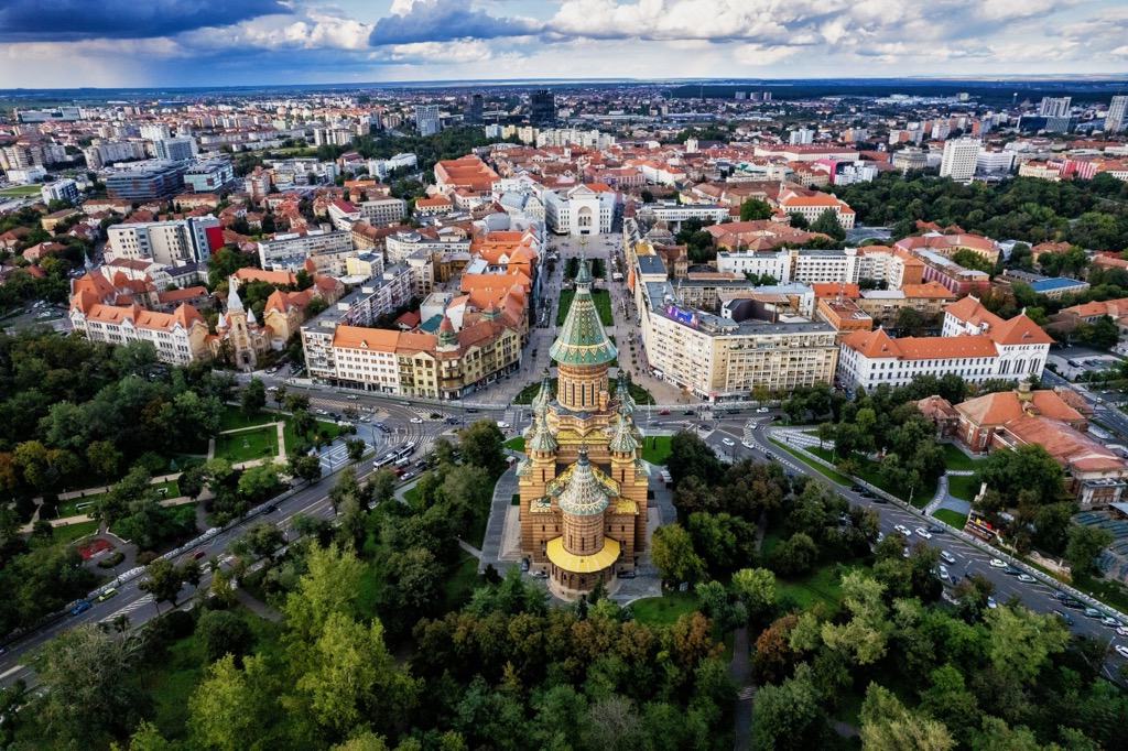
Otherwise, you’ll need a car to get anywhere near the park. The nearest large city to Retezat is Timișoara, which has an international airport and a few car rental agencies. Renting a car in one of the smaller cities in Romania is shockingly cheap - rentals run for as little as €5 per day.
The nearest city to the park is Hațeg. From here, just head south along Road 686. The road into the park is paved almost the entire way, switching to gravel a few kilometers before Poiana Pelegii.
Another option is approaching Retezat from the north, starting in Nucșoara or Peștera. These towns sit in a canyon leading to the Peleaga summit, although they involve much more vertical than approaching from Poiana Pelegii.
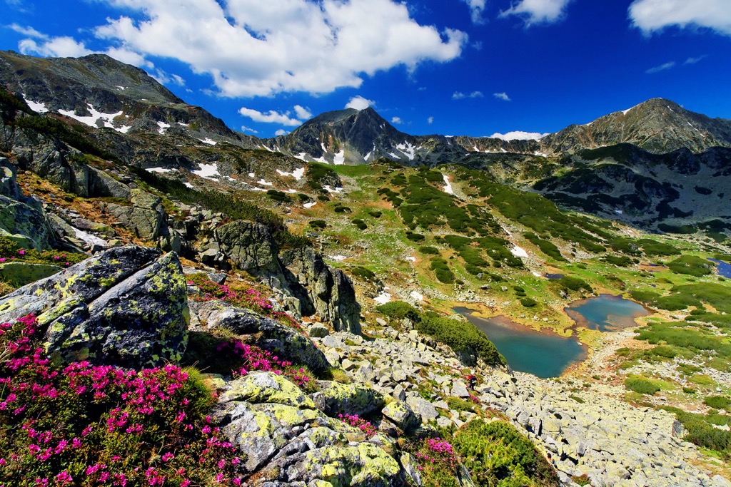
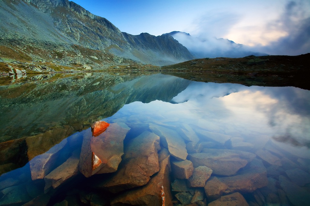
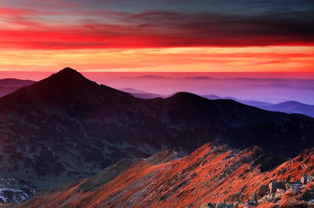
The Retezat Mountains are a single, towering granite massif that rises sharply above the surrounding U-shaped canyons. The peaks feature lots of exposed rock with steep, craggy faces. The terrain makes for exciting trail hiking and scrambling, especially when crossing the park’s main ridge.
This area has a long history of glaciation and still receives a lot of snow in the winter, which leads to frost wedging. As a result, rockfall is very common. When crossing fields of talus and scree, be mindful of overhead danger.
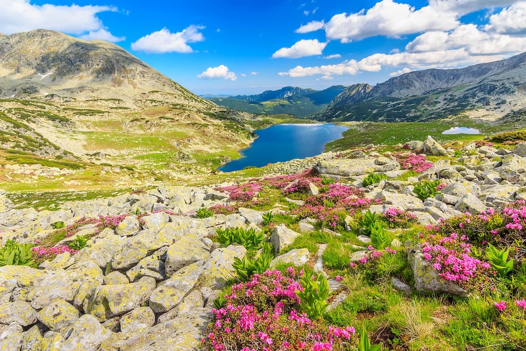
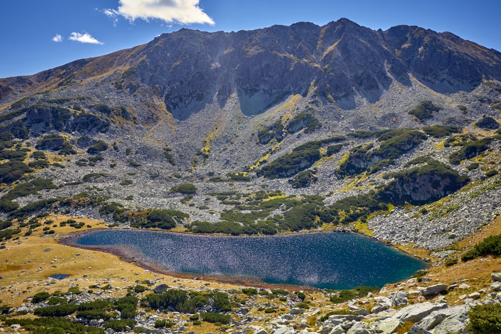
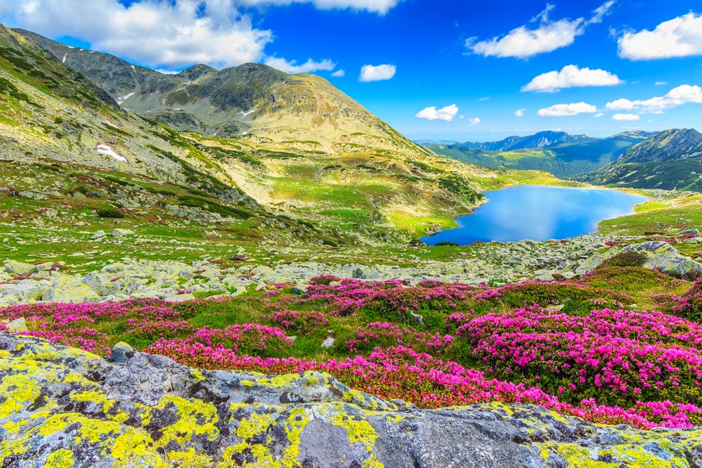
The other result of Retezat’s glacial history is the broad, rounded alpine valleys that make up most of the park. These basins are immaculate, full of grasslands and crystal-clear glacial lakes. In total, there are around 80 glacial lakes in Retezat. The glaciers have long since retreated but have shaped Retezat into one of Romania's most classically “alpine-looking” places.
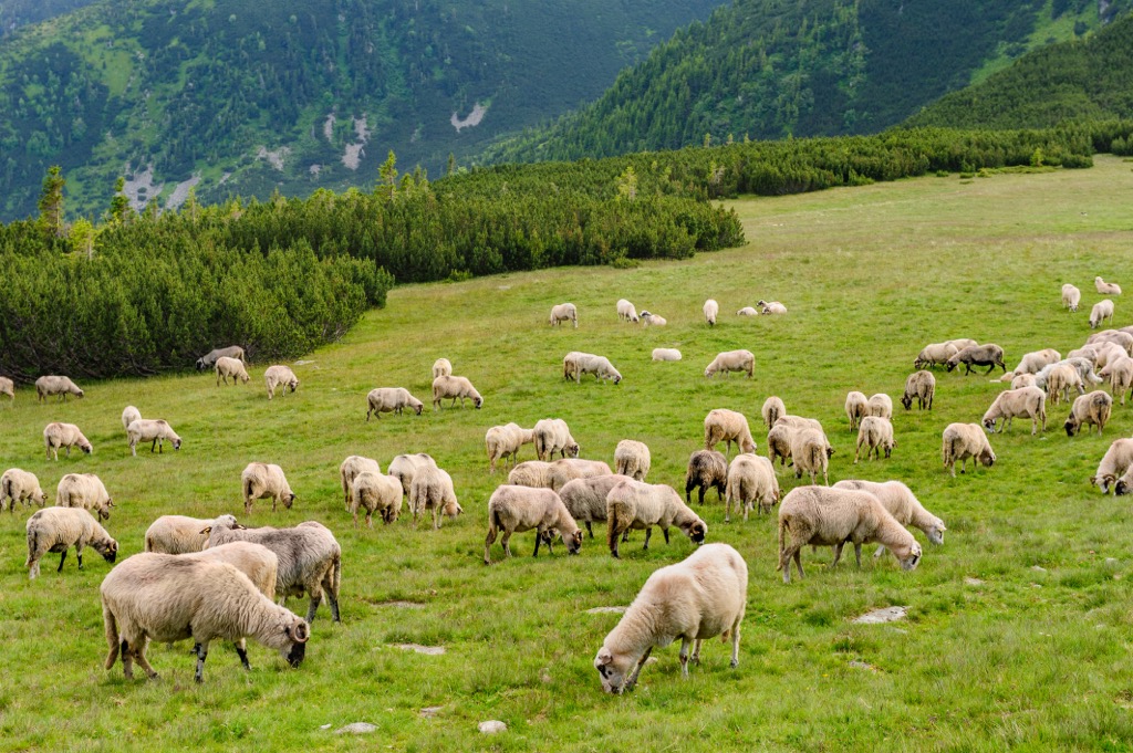
Retezat is one of the most biologically diverse places in Romania. It covers a range of elevations, rising from old-growth beech forest to true alpine grassland. There are over 1,000 plant species, the same number of butterflies, and 55 mammal species in the park.
While hiking, keep your eyes peeled for wildlife. Partly because there are many amazing animals here and partly because some could hypothetically eat you. I’m talking specifically about brown bears, which are common in Romania. The Transylvanian Alps are home to the largest population of brown bears in Europe.
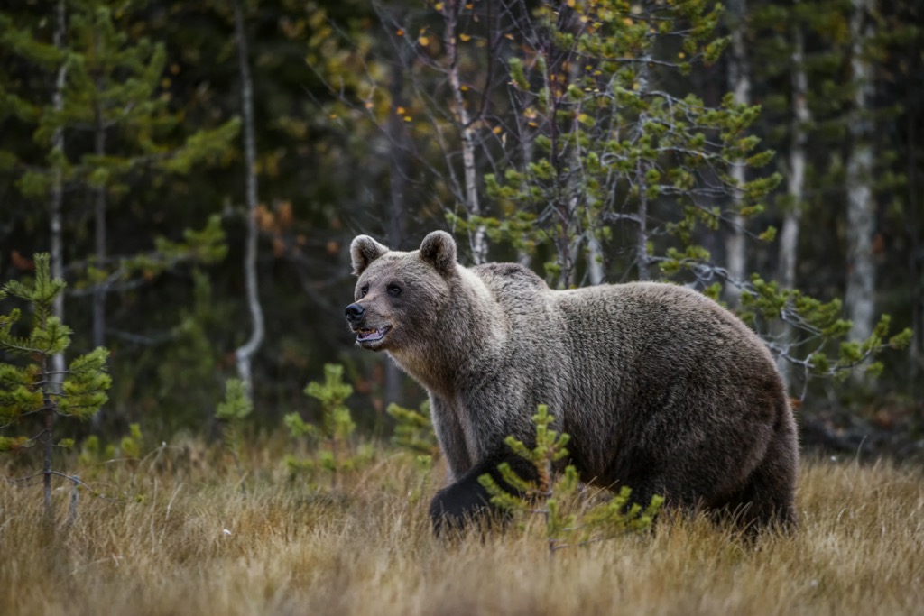
While European brown bears aren’t as notorious as American grizzlies, they’re still territorial and aggressive. The best way to stay safe while hiking in the backcountry is to make a lot of noise. Bears instinctively move away from people and are usually not a threat unless surprised or provoked.
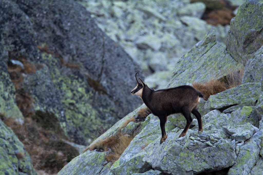
Other than bears, you might spot wolves, chamois, lynx, wild boars, wildcats, otters, and martens in the park. Most of these are rare but not unheard of. You have a good chance of spotting chamois in the higher reaches of the mountains. Small mammals like martens and lynx are more common in the beech forests around Retezat’s foothills.
Culturally, Romania is full of legends. Nearly everything in Transylvania has some kind of myth or folktale attached to it. And Retezat is no exception.
In Romanian folklore, Retezat was home to two giants. These brothers lived happily in the mountains until one tried to steal the other’s land. The first giant swung his sword at his brother and missed, chopping the summit off one of the peaks. Hence, the name Retezat translates roughly to “cut off,” referring specifically to Vârful Retezat’s (2,482 m / 8,143 ft) unusually flat summit.
Retezat is also noteworthy as Romania’s first national park. In the 1930s, biologists Alexandru Borza and Emil Racoviță campaigned to protect the area’s natural beauty. The park was dedicated in 1935.
Where most efforts to conserve European land worked backward, trying to preserve areas already inhabited or disturbed, Retezat was a true wilderness when it became a park. This precedent matters because it left vast areas of Romania untouched by human civilization and logging. These are some of the last pristine landscapes in Europe.
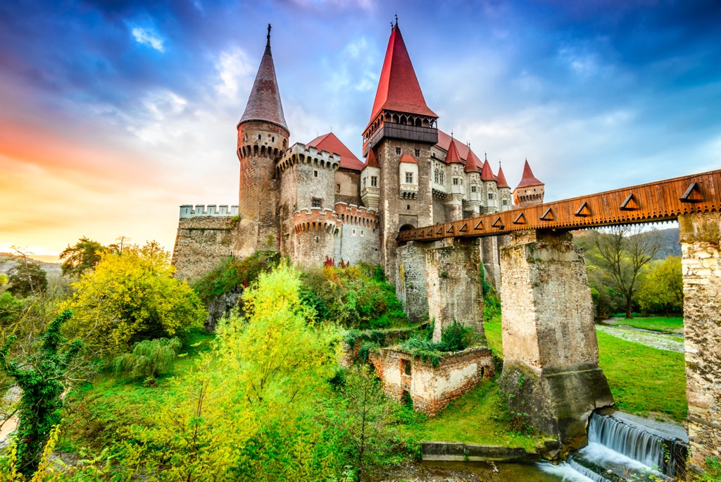
But even in a mountain wilderness, you’re never far from a good castle in Romania. And wouldn’t you believe it, the country’s best castle sits about a half hour north of the park. Corvin Castle (Castelul Corvinilor) was built in the 1400s by Voivode John Hunyadi and is a classic example of a gothic “fairytale” castle.
Complete with conical turrets and a huge footbridge leading to the main entrance, it’s everything you would expect a castle to be. If you need a break from heavy trail miles, it’s a perfect diversion near Retezat.
Retezat’s upper reaches feature a concentrated network of awe-inspiring trails. You can connect most trailheads, saddles, and high points with just a few main routes. Beyond that, it’s all about which objectives you want to tackle.

7 km (out and back), 430 m of vertical
If you’re not doing anything else in the park, you should at least hike to Bucura Lake. It’s a short jaunt from the trailhead at Poiana Pelegii, with some fantastic views of the park’s highest peaks.
The flip side of the easy payoff is that this is the most crowded place in Retezat. Most locals visit the park just to hike to Bucura Lake for the day, so you’re liable to see many other people on the way. It’s a popular wild camping spot for locals as well.
From the Salvamont office at Poiana Pelegii, head left (northwest) up the blue stripe trail. It climbs quickly, covering about 400 meters of vertical in 3.5 km. Whether hiking to see the lake or continuing to one of the peaks, you will likely hike this stretch while visiting Retezat.
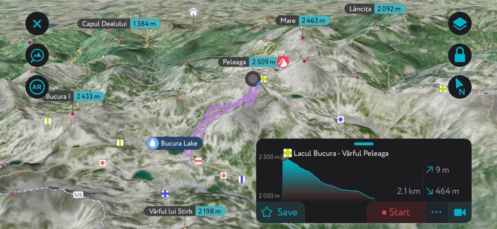
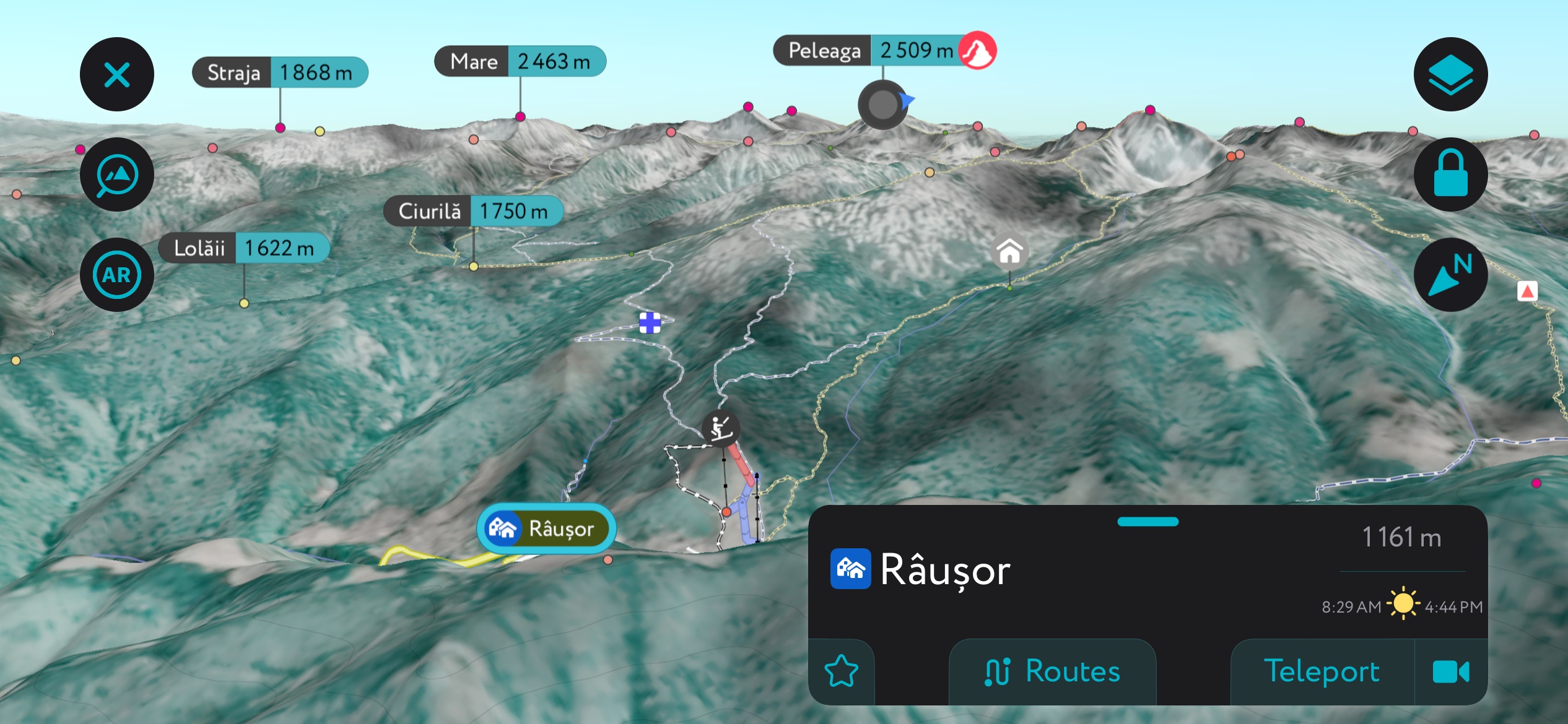
Peleaga is the most popular summit in Retezat. It’s the highest in the range and the seventh highest in Romania. There are two main ways to get there: the busier way and the more challenging way. Both are great. Either way, you’ll have at least 10 km of trail over 800 m of vertical, and some spectacular views along the way.
The busier routes are the south approaches, which start at Poiana Pelegii. This quicker, more direct approach lets you cover a lot of the distance via car.
You can follow the blue stripe from the trailhead to Bucura Lake (the busiest option) or the blue circle to Pelegii Saddle (Saua Pelegii). The perk of going via Bucura Lake is the access to water. The Pelegii Saddle approach is less crowded. Both are equally direct, very efficient, and scenic.
The harder (less crowded) approach starts to the north of the park. This route is considerably longer and will probably require an overnight at Cabana Gențiana. The upshot is that it’s much less busy. It’s also a loop as opposed to an out-and-back.
For starters, drive south up road 667A to Cabana Cascada. You can park here for a few lei per night. Hike south past Cabana Lolaia until the trail forks. The left-hand route (yellow triangle) leads steeply up a ridge toward Pelegii Saddle. The right (blue stripe) heads toward Cabana Gențiana and Bucura Saddle.
How you go depends on when you want to split the distance. If your weather window is better on the first day, go for the summit the first day and sleep at the cabana on the way down. Summitting on the first day is a slog; you’ll probably finish in the dark. The other option is to head to the cabana, rest up, and save the hard part for the second day.
Either way, the routes continue south up adjacent canyons. They both lead directly to a saddle. At this point, you’ll find the Retezat ridgeline trail (red stripe). Follow it over the summit and back down the far side.
Total distance: about 16 km. Vertical ascent: roughly 1,500 m. If you’re after a longer, more contemplative, more adventurous outing, this is how you should do Peleaga.
As a bonus, you can modify this route slightly to summit Bucura I (2,433 m / 7,982 ft) instead. The loop just moves one canyon to the right (west). You’ll use the blue stripe and blue triangle trails to get to the ridgeline (red stripe). Along the way, you’ll pass Cabana Gențiana and Cabana Pietrele, an excellent opportunity to split the distance and spend even more time in the mountains.
A few well-marked trails connect all of the ridge lines in Retezat, which is handy for bagging multiple high points in one outing. The main stretch of the ridge from Vârful Retezat to Păpușa (2,307 m / 7,569 ft) is marked with a red stripe. If you get a chance to hike any of this ridge line, you won’t regret it. The entire route is dramatic and exposed, with spectacular park views.
Two main branches from the red stripe trail connect it to most of the other high points in Retezat.
One is the SJS trail, which crosses over the summit of Sîntămăria (2,400 m / 7,874 ft). The SJS connects to the red stripe through the yellow and red triangle trails, traversing south from Bucura I, past Tăul Porții, and under a ridge before climbing back to a high knife-edge ridge.
The other is the yellow cross trail. This one heads southeast from the summit of Păpușa to Păpușa Mică (2,376 m / 7,795 ft) and Custura (2,457 m / 8,061 ft). You can connect most of the park’s high points using these routes.
But it might be slower going this way. A lot of scrambling is involved on the ridge line, and sometimes, nearby objectives will take hours to get to as you negotiate the terrain. It’s not necessarily the most efficient way of connecting two points, but it’s the most fun.
If you’re into this kind of hiking, you might want to check out the Retezat Skyrace. This giant alpine race covers much of the high ridge in Retezat, from Pelegii Saddle to Custura. It’s a challenging route for hardcore mountain folk and is one of the biggest adventures in Romania.
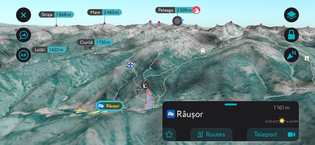
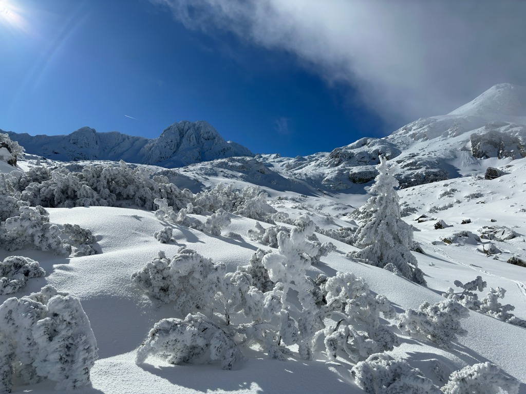
Retezat’s elevation guarantees a skiable snowpack every year. One small ski field, Râușor, is located in Rau de Mori. It has two chairlifts and covers a few hundred meters of elevation.
Other than that, you can always try your hand at backcountry skiing in Retezat. The main challenge here is the lack of information about avalanche conditions. Retezat is very steep overall, with large swaths of avalanche terrain.
Your best bet for a safe, fun ski trip is to wait until spring when the snowpack stabilizes. On good snow years, the snow hangs on well into late spring. If you’re interested in planning a trip, contact Salvamont Hunedoara, the local mountain rescue organization. You’re sure to encounter fewer people than on a trip to the Alps or Norway, and you can check out the terrain options using the PeakVisor App.