Scan the QR code and open PeakVisor on your phone
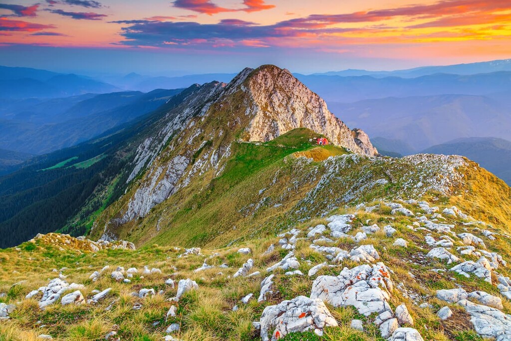
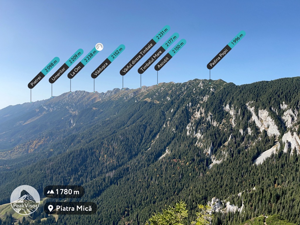
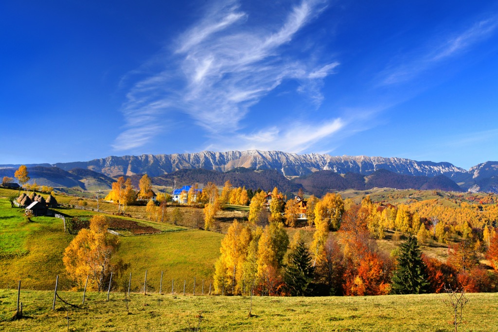
Piatra Craiului (“Royal Rock” or “King’s Rock”) National Park is one of the most popular destinations for hiking and mountaineering in the Southern Carpathians. Its most prominent feature is the Piatra Craiului Massif, a steep limestone ridge with stunning gorges and sheer cliff walls. The crest is a playground of objectives, requiring intense scrambling in the summer and steep snow climbing in the winter. In total, there are 55 named peaks in Piatra Craiului National Park. The tallest summit is La Om (2,238 m / 7,343 ft), the 22nd highest in Romania.
Piatra Craiului sits east of the Făgăraș Mountains, an imposing subrange that holds Romania’s tallest peaks, including Moldoveanu (2,544 m / 8,346 ft). To its east is a broad river valley which separates it from Bucegi Natural Park. To the north is the Transylvanian Plateau, a mostly flat plain encircled by the Southern and Eastern Carpathians. To the south are the foothills of the Transylvanian Alps and the region of Wallachia.
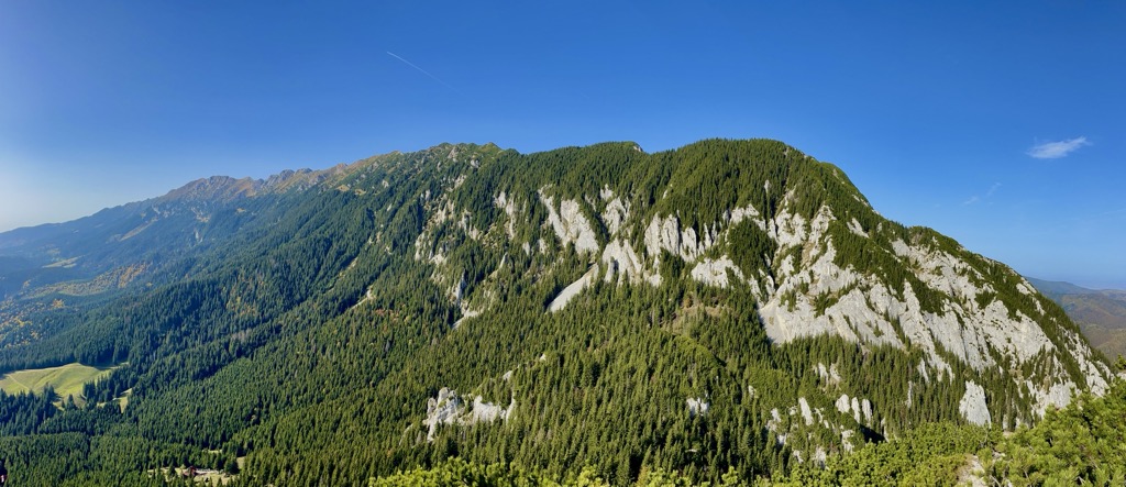
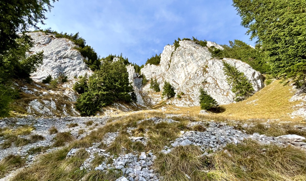
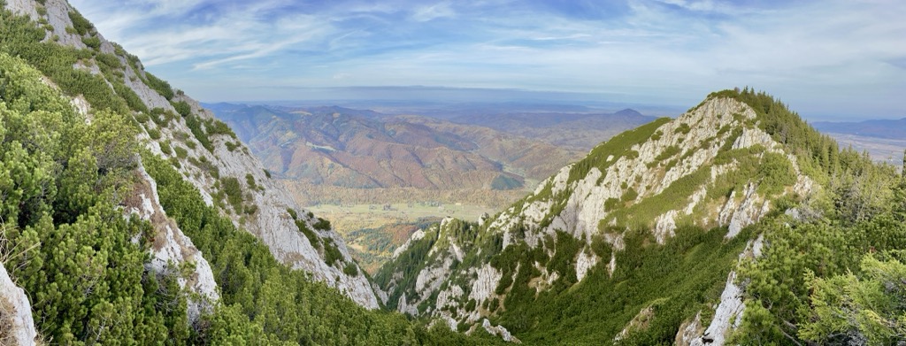
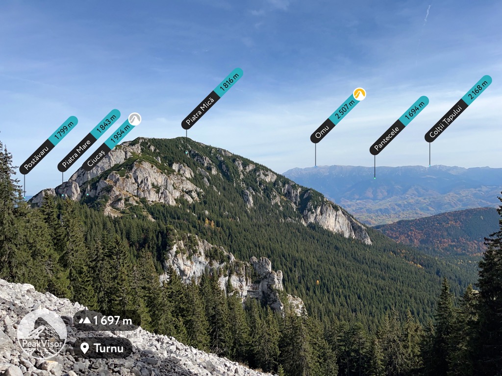
The Piatra Craiului Massif comprises two prominent, perpendicular ridges that meet at the Saua Crapaturii (Cracked Saddle). The Zărnești Gorges, a network of sheer limestone canyons, separate them.
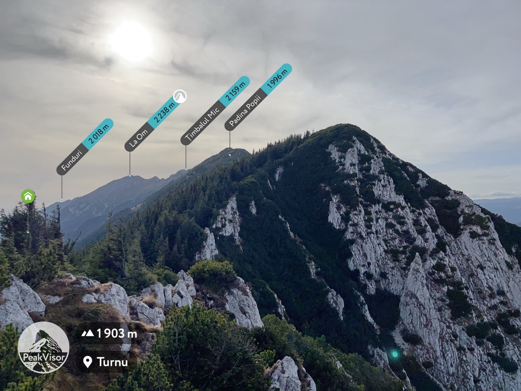
The main ridge spans 25 km (16 mi), running roughly southwest to northeast, and includes the range’s tallest peaks. Major summits include La Om, Umerilor (2,209 m / 7,247 ft), Vârful dintre Țimbale (2,238 m / 7,343 ft), Padina Popii (1,996 m / 6,549 ft), Ascuțit (2,150 m / 7,054 ft), and Vârful Turnu (1,911 m / 6,270 ft). Most of these peaks have almost no prominence; high saddles connect them along the same knife ridge.
East of the massif is a smaller ridge capped by Piatra Mică (1,816 m / 5,958 ft). Southeast of the two crests is an elevated plateau of forested hills.
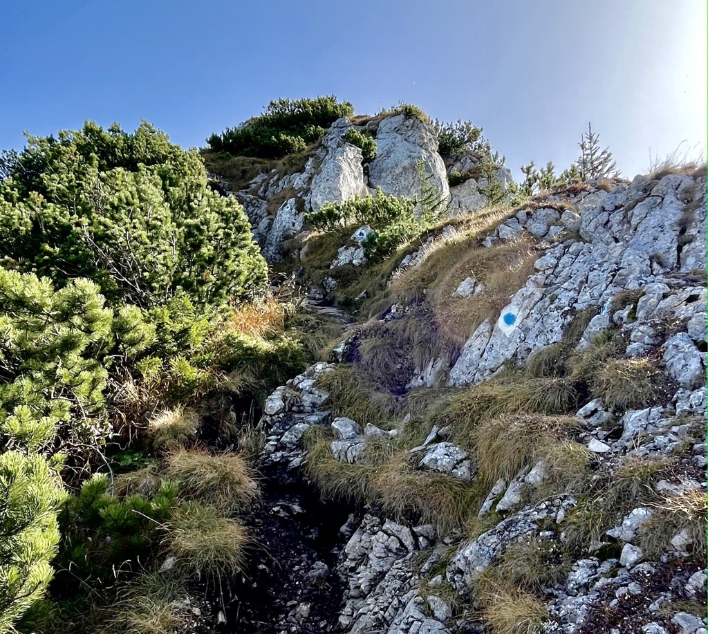
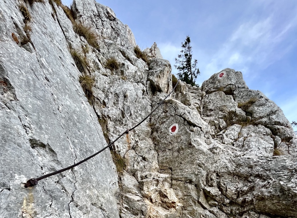
Brilliant white outcroppings of limestone define the mountains in Piatra Craiului. Below the peaks, the massif is flanked by stark limestone fins, which form steep chutes and freestanding towers. The high-quality rock features smooth, vertical walls with good handholds for climbing and scrambling.
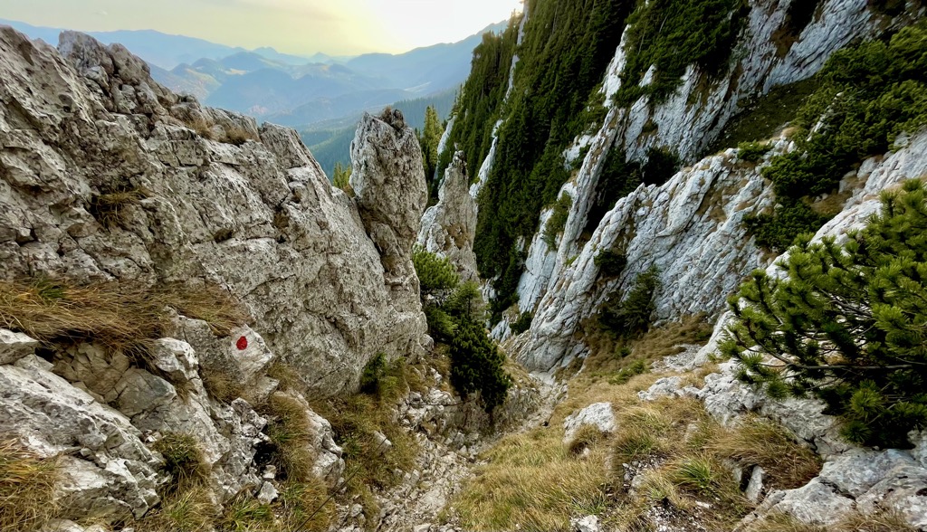
The Piatra Craiului Massif is a prime example of karst topography. Karst landscapes are characterized by limestone rock and variations in height: steep slopes, cliffs, sinkholes, and canyons, which drive the movement of water and concentrate precipitation underground.
This process drives the formation of limestone caves. Most of the rock formations in the park can be attributed to limestone erosion. Some of the park’s most exciting formations are La Zaplaz and Cardacul Stanciului, natural rock arches on the west slope of La Om.
Piatra Craiului showcases all of the montane ecosystems in Romania in one place. Like all mountainous terrain, the landscape's appearance is contingent on elevation.
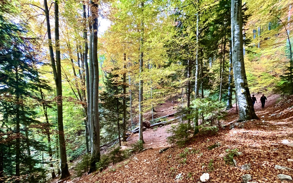
The canyon bottoms below the central plateau in the park are forested with old-growth beech trees. Romanian beech forests are hubs of biodiversity and some of the best-preserved ecosystems in Europe. It’s common to see a high, thick overstory of leaves that blocks almost all sunlight on the forest floor.
Higher up, tree communities shift to conifers like hemlock. Conifers do well in cold mountain climates and have no trouble growing on steep terrain, including cliffs and ledges.
Alpine grasslands exist around the high summits of the Piatra Criaului Massif. The grass, sedges, and endemic wildflowers that grow in the cold upper reaches of the mountains are essential for the park’s grazing animals.
The Carpathians are widely known as home to the largest population of brown bears in Western Europe. Brown bears are territorial and dangerous to people but rarely seek conflict. While hiking, make noise to let them know you’re entering their habitat (bear bells are the surest way to alert bears and other animals). If you see one from a distance, leave it alone. Bears rarely attack people unless provoked.
Keep an eye out for chamois (capra neagra in Romanian). These goat-antelope are some of the most unique animals in Romania and a charismatic symbol of the Carpathians. They spend their time in the higher reaches of the park, grazing long cliffs and in scree fields.
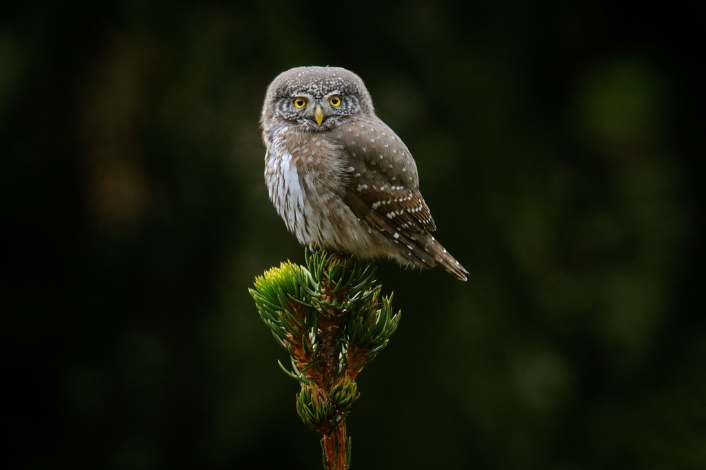
If you’re a birder, bring binoculars to Piatra Craiului. You can spot everything from black storks and capercailles to raptors like the pygmy owl and black kite in the forests and shrublands around the peaks.
It’s worth noting that bear bells or excessive noise will reduce your chances of spotting charismatic wildlife, in addition to reducing the chances of startling a bear.
Piatra Craiului National Park sits near the junction of three major regions of Romania: Transylvania, Moldovia, and Wallachia. Until the late 1800s, the Southern Carpathians were a natural border between Transylvania (then part of the Austro-Hungarian Empire) and Wallachia.
If you’re a history buff, you probably already know that Wallachia was a powerful European nation that existed for almost 600 years. But even if you’re not, you’re probably familiar with Wallachia’s most famous ruler: Vlad the Impaler.
Vlad is a mythologically terrifying figure who is known widely for his cruelty. He inspired the character Count Dracula and left a mark as one of history’s most ruthless rulers.
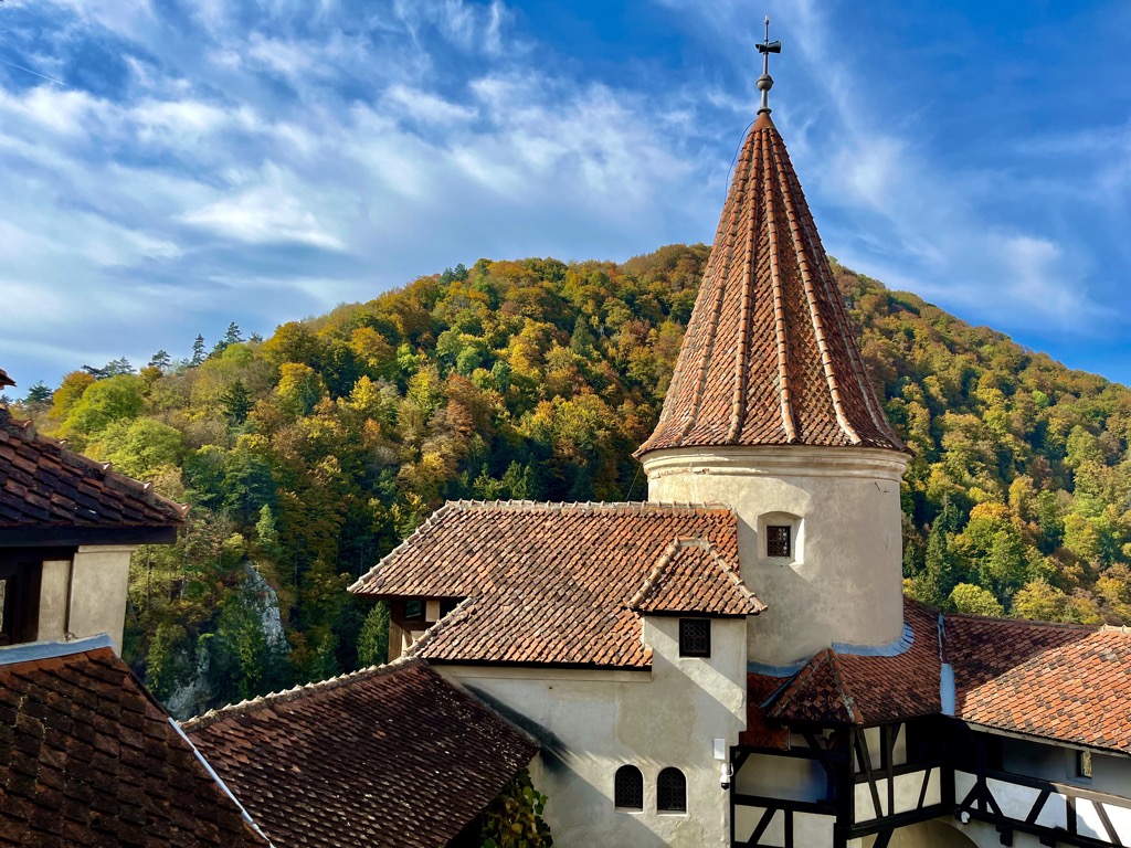
Long before Vlad’s time, one of the only routes between Transylvania and Wallachia was a narrow pass through the mountains just east of Piatra Craiului, defended by a picturesque castle built by the Teutonic Order in the 1200s: Bran Castle. Aside from being exceptionally well-preserved and beautiful, Bran Castle is marketed as the inspiration for Bram Stoker’s description of Dracula’s Castle in Dracula.
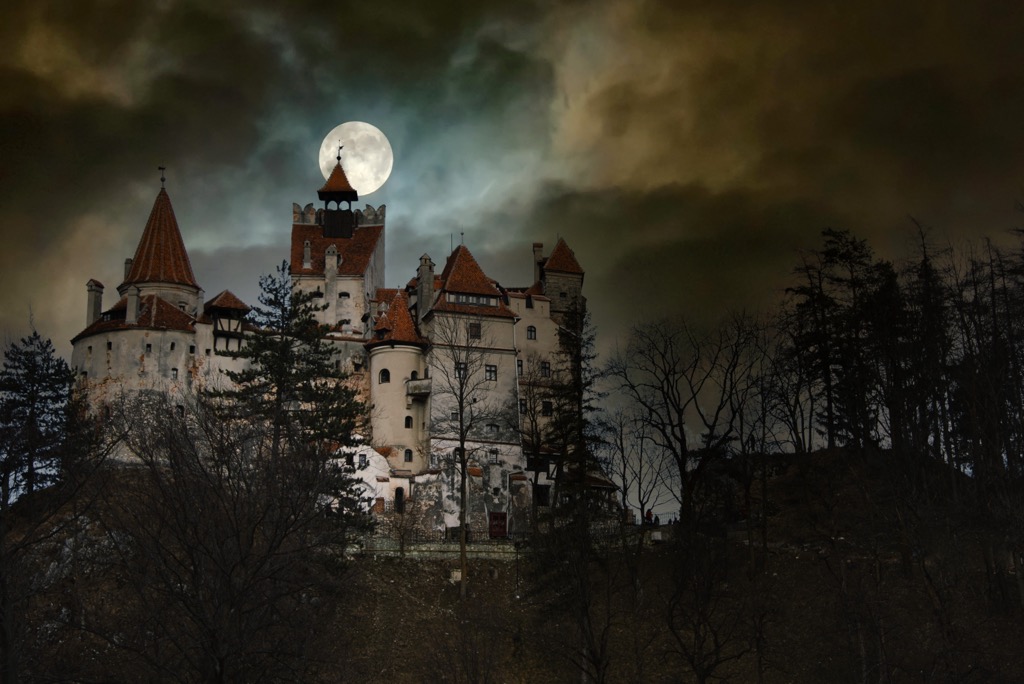
Transylvanian folklore is rich with mythical creatures. The most well-known is the strigoi, the first version of the vampire. Strigoi legends inspired Dracula and are the model for every depiction of vampires in TV and film.
Strigoi were said to be undead people who rose from the grave to drink blood and could transform into animals. Ancient Romanians came up with several versions of the vampire, including the Pricolici, a kind of werewolf-vampire hybrid. Other folktales tell of the Solomonari, wizards who could control the weather and rode on dragons like the balaur.
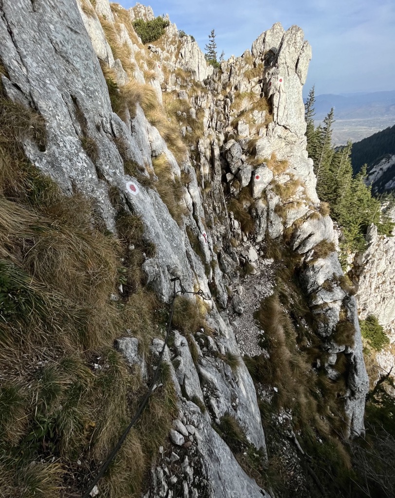
Hikes in Piatra Craiului are steep, scrambly, and spectacular. There are many Class III-IV (Grade 2-3) scrambles aided by permanent hand lines and steep scree fields across the park. Most of these routes lead to one of the two ridges. Expect a lot of vertical gain and fun, technical sections ascending bare rock.
There are two main types of hikes in Piatra Craiului. There are long loops and through-hikes, which start and end in town, and shorter day trips, which begin and end at mountain huts. If you have a few days to spend in Piatra Craiului, I recommend staying in one of the cabanas to give you a jump start on the approach to the ridge lines.
Piatra Craiului is a popular destination year-round. In the winter, mountaineers take on the crests with crampons and ice axes. There is very little ice in the park; most summer scrambles become mixed rock/snow climbs in the winter. If you do plan to go in the winter, get in touch with Salvamont Romania, the Romanian mountain rescue service. Salvamont operates the mountain refuges around the park and can help with insights on route planning and conditions.
18.5 km (11.5 mi), 914 m (3,000 ft) vertical
Piatra Mica is an adventurous day hike with hearty vertical, lots of fun scrambling, and breathtaking views.
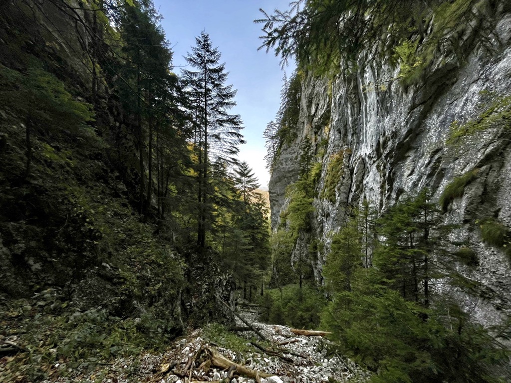
Beginning in Zârnești, follow the yellow stripe trail. You’ll traverse along the forest edge and into old-growth beech forests. The trail turns and ascends through jaw-dropping limestone gorges to a saddle between the two major ridge lines of Piatra Craiului National Park. Most of the trail’s 914 m vertical climb is covered in the short, intense climb through the Zârnești Gorges, which is around 2 km long. Be prepared for loose scree and some scrambling.
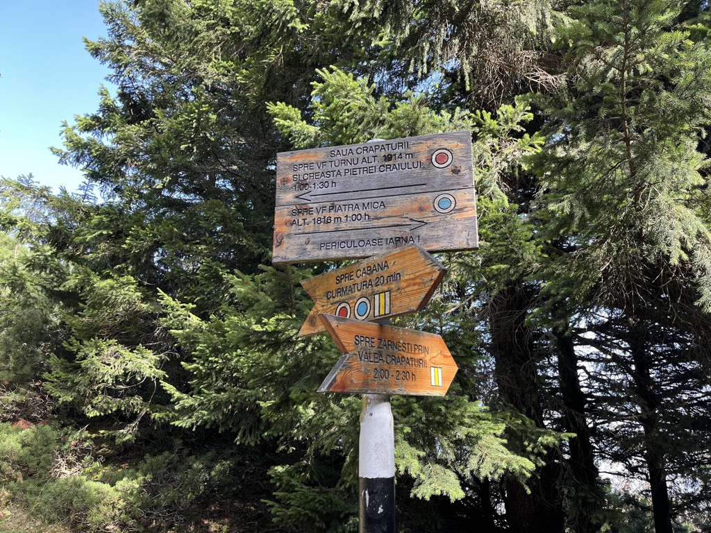
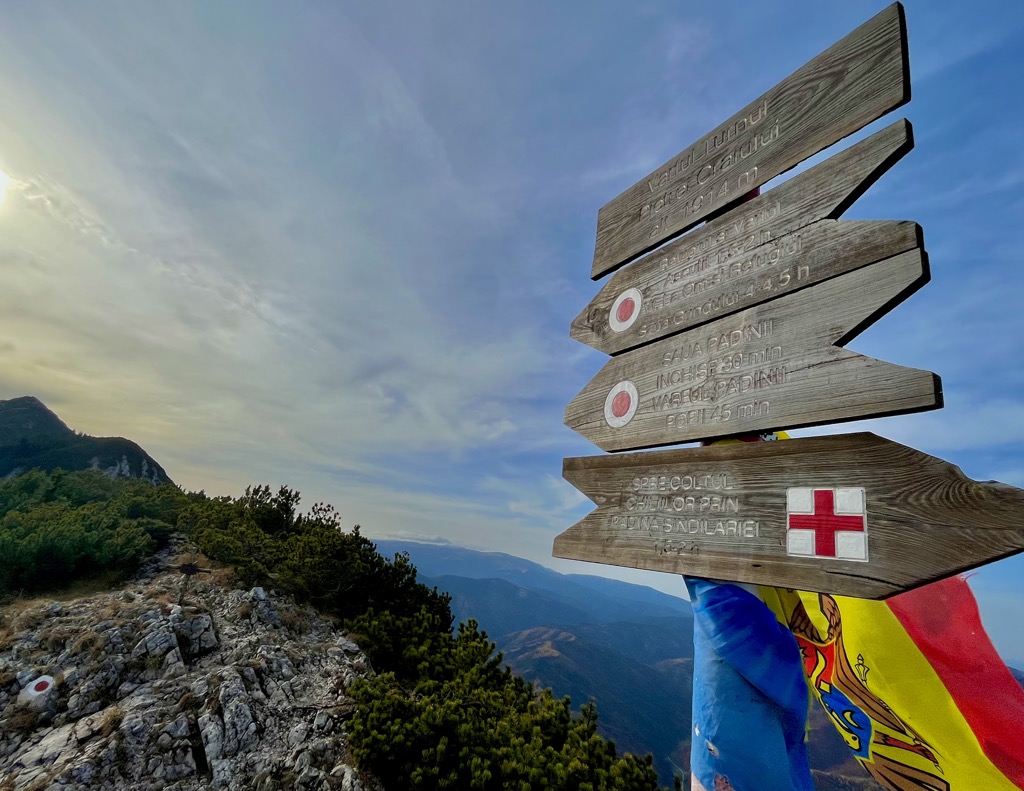
Eventually, you’ll emerge onto the Saua Crapaturii. The trail to Piatra Mica turns left and heads east through several steep chimneys and exposed scrambles. Follow the blue circle trail to the summit. There are hand lines for stability, which are particularly helpful on the way back down. The Piatra Mica summit affords the most spectacular views of La Om’s imposing knife ridge in the park.
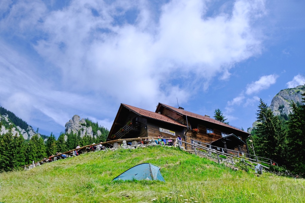
Head down the peak and continue across the saddle due south to Cabana Curmatura, an excellent spot to fill up on water or grab food. Next, you begin a long descent through pristine beech forests. When you reach the parking lot, turn left and follow the road back to town.
Roughly 24.6 km (15.3 mi), 848 m (2,782 ft) vertical
The Creasta Nordica (North Crest) is a coveted route that follows the ridge from the summit of La Om peak to Varful Turnu and down. It covers about half the total length of the Piatra Craiului massif.
There are multiple approaches, one of which ascends from the west slope of the mountains, starting at Cabana Plaiul Foii. It’s also worth mentioning that this route uses several marked trails and has many shorter variations, all of which are worthwhile. The full route is a long day, even when starting from Curmătura.
But the most efficient route for tackling the Creasta Nordica starts and ends at Cabana Curmatura. I recommend going straight up from the cabana, following the red circle trail toward Vârful Turnu. This ascent is exhilarating, heading straight up the rock. Sections of polished limestone offer good holds but are slick. Hand lines are helpful and, in some cases, necessary.
The first stretch from Cabana Curmatura to Turnu ascends 470 m (1,542 ft) in just 1.5 km. If you want a shorter day, you can proceed from Turnu to the blue stripe trail just before Padina Popii and return to the cabana.
Otherwise, continue following the red circle. The ridgeline is slow going, with lots of ups and downs. The trail sometimes leads directly over peaks, other times around them. You’ll cross Ascuțit, Țimbalul Mare, and Vârful dintre Țimbale before reaching La Om.
From the summit, turn left and follow the red stripe down. Over the next 2.5 km (1.6 mi), you will descend 848 m (2,782 ft). It’s a steep descent, which involves downclimbing through rocky sections. Use the hand lines for support. Scrambling gives way to hiking, but the trail is still steep. A trekking pole or two would come in handy for this section.
You’ll pass Refugiul Grind - you can take a breather here - and then come to the low point on the trail. Follow the red triangle northwest until it meets a dirt road leading you back to the cabana.
Roughly 12 km (7.5 mi), 1,390 m (4,560 ft) vertical
The E8 is a massive through-hike across the breadth of Europe, starting in Ireland and ending at the Black Sea in Bulgaria. In total, it covers 4,700 km (2,920 mi) through both the Alps and Carpathians.
The E8 is an arduous undertaking for people with months to spend on the trail. But if you want a taste of the E8, you can do the stretch that runs through Piatra Criaului. Be prepared for a long day (12+ hours) with lots of elevation and one night at Cabana Curmatura before descending.
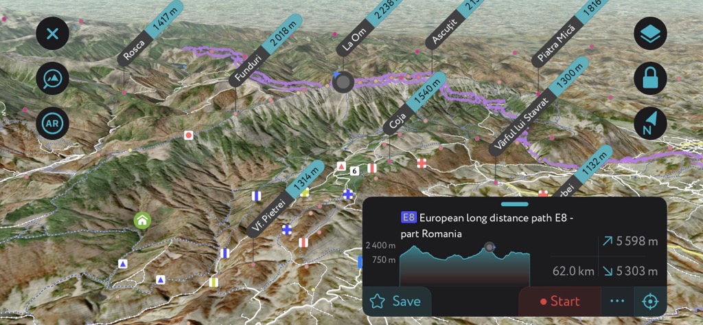
The first section follows the west ascent to the Creasta Nordica from Cabana Plaiul Foii, following the red stripe trail. The climb is complex and lengthy but very rewarding. It passes under La Zaplaz, the impressive limestone arches I mentioned earlier.
After summiting La Om, you’ll turn left and follow the red circle along the Creasta Nordica, taking you to the summit of Ascuțit. From here, head down the east slope of the mountains, following the blue triangle trail.
The blue triangle is one of the least demanding ways down from the ridge. It leads directly to Cabana Curmătura. Most hikers arrive at the cabana in the dark, spend the night, and head down in the morning.
Piatra Craiului is one of the most accessible parks in Romania, even without a car. It sits about an hour southeast of Brașov, which has a major airport and train station.
The two closest towns are Zărnești and Bran, both of which have accommodation readily available. Trains run hourly from Brașov to Zărnești, and buses run on roughly the same schedule to Bran. Taxis can also be helpful to get to the smaller towns and trailheads leading into the park.
Between the two, Zărnești is the better launchpad for getting into the park. There are two major trailheads out of Zărnești, one that leads up the Zărnești Gorges and another that follows a dirt road to Botorog Campground. Both trailheads are just a few kilometers from Cabana Curmătura, the park’s best base camp for hiking.
As I mentioned, Zărnești is in a prime location for seeing the park. It has two trailheads within walking distance and great views of the mountains. There are a few lodging options nearby, most of which are homestays. It’s wise to book somewhere with an on-site kitchen because there aren’t many restaurants nearby. You can get to Zărnești from Brașov by train or car.
Bran is also a decent option for seeing the park. It’s a little further from the trailheads but has more lodging options. If you’re having trouble finding a place to stay in Zărnești, Bran is a good backup. There are hourly buses from Brașov to the center of town. Taxis are also readily available and helpful for getting to/from Brașov or the trailheads.
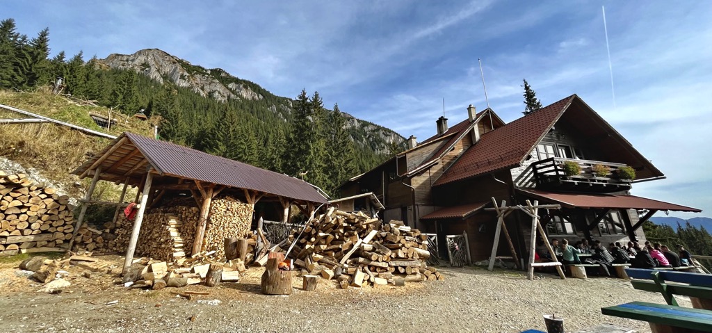
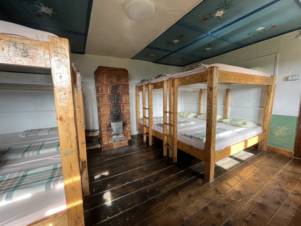
The mountain huts (cabanas) around Piatra Craiului are convenient for overnighting and grabbing a hearty trail lunch. Like most mountain huts in Europe, they offer hot meals and drinks for cash. Most are open all year.
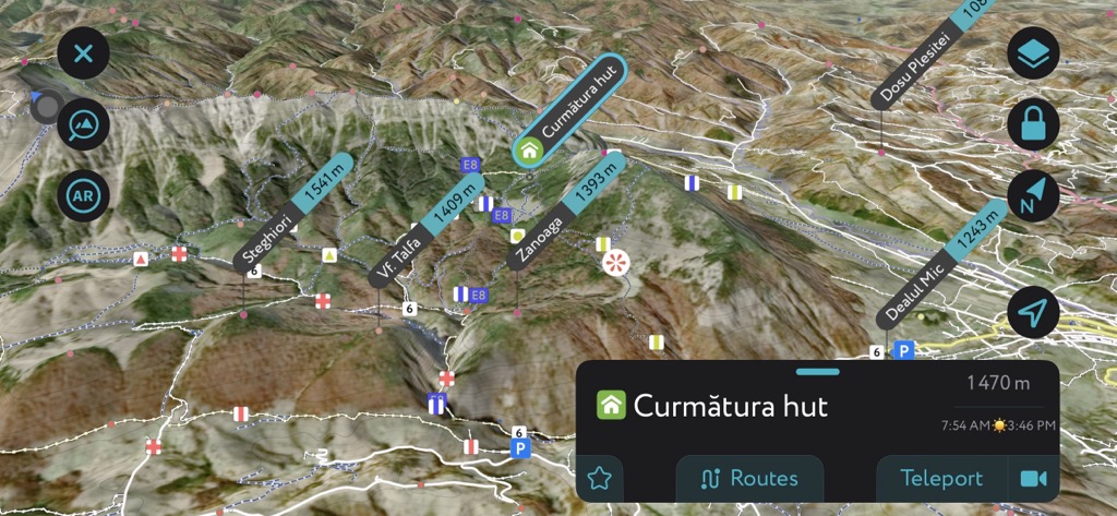
The most strategically located of the huts is Cabana Curmătura, which sits just below the Saua Crapaturii. If you want to do the Creasta Nordica or Piatra Mică, Curmătura is an ideal starting point.
To get a bed, you need to make reservations by phone - which can be tricky as the person on the other line may or may not speak English. The good news is that beds are cheap (50 Lei/10€ per night). Curmătura is very busy in the high season, so book in advance if you can.
If you want to do the entire Piatra ridgeline, Cabana Pietricica is also in a good location. It sits at the south end of the massif, a prime spot for starting or ending the trek over the crest. Like Curmătura, Pietricica is open all year.