Scan the QR code and open PeakVisor on your phone
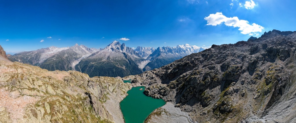
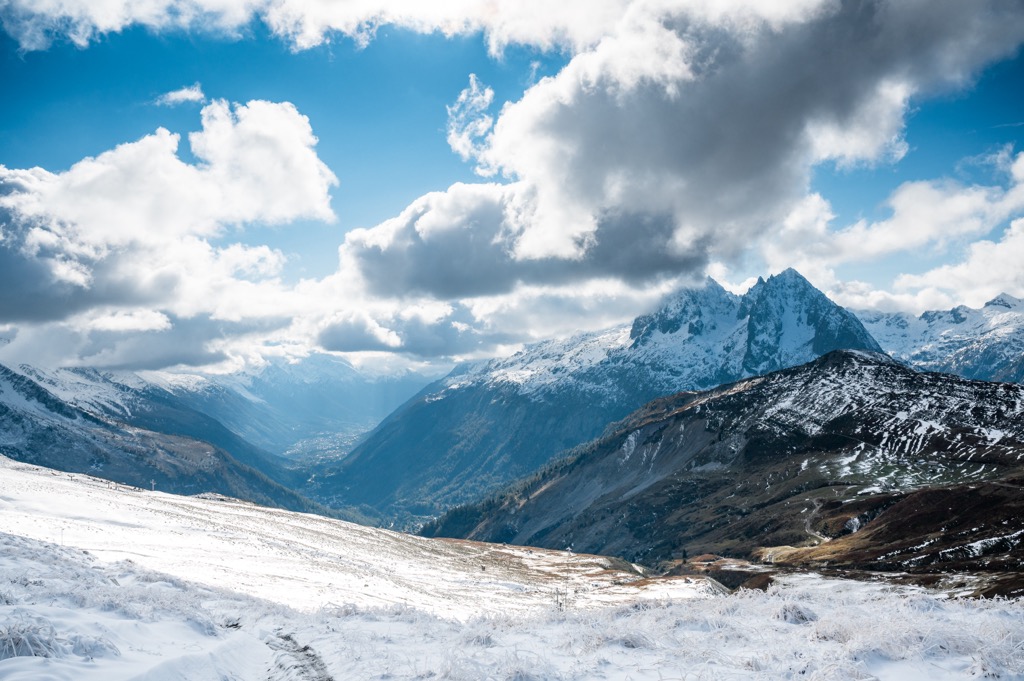
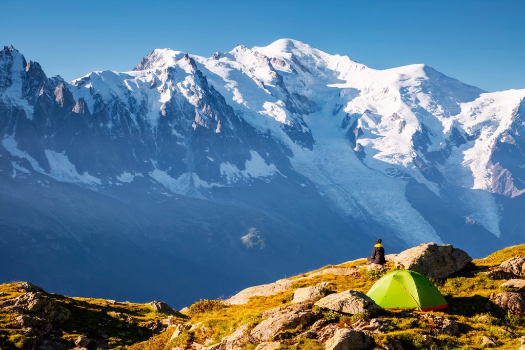
The Aiguilles Rouges Massif forms the northern end of the infamous L’Arve Valley, also known as the Chamonix Valley. While not as imposing as the neighboring Mont Blanc Massif, the Aiguilles Rouges is still formidable. The massif features nearly 2000 m (6600 ft) of prominence from the L’Arve Valley to the top of the Aiguille du Belvédère (2965 m / 9728 ft), the highest peak. Glaciers lurk in the shadowy heights, such as the Glacier de Bérard and Glacier d’Anneuley. Perhaps best of all, these peaks offer an astonishing view of Mont Blanc (4,808 m / 15,774 ft).
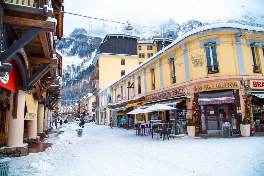
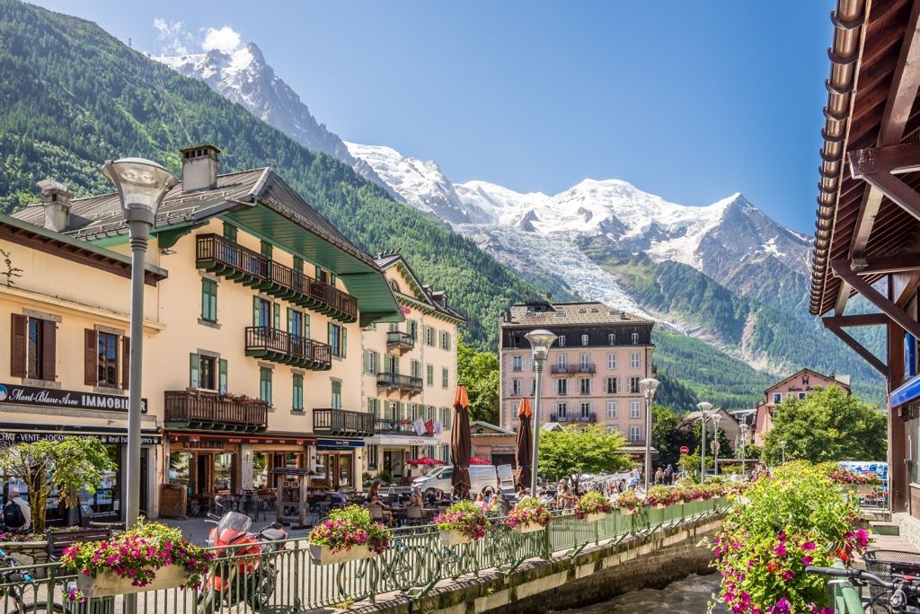
Natural spaces, including mountains, glaciers, ice fields, forests, valleys, and lakes, define the Aiguilles Rouges Massif. Historically, the region’s demographic was subsistence farmers, shepherds, and pastoralists. Tourism and recreation have since become the primary economic driver. Today, the massif forms half of one of the world’s most beautiful and well-equipped vacation destinations - the town of Chamonix, France.
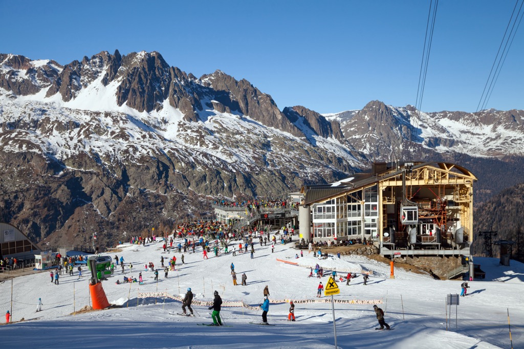
The L'Arve Valley offers five ski areas plus the Aiguille du Midi cable car and is legendary for providing access to off-piste skiers. Two ski resorts - the Brévent and Flégère interconnected areas - sit upon the Aiguilles Rouges Massif, while the others are across the valley on the Mont Blanc Massif.
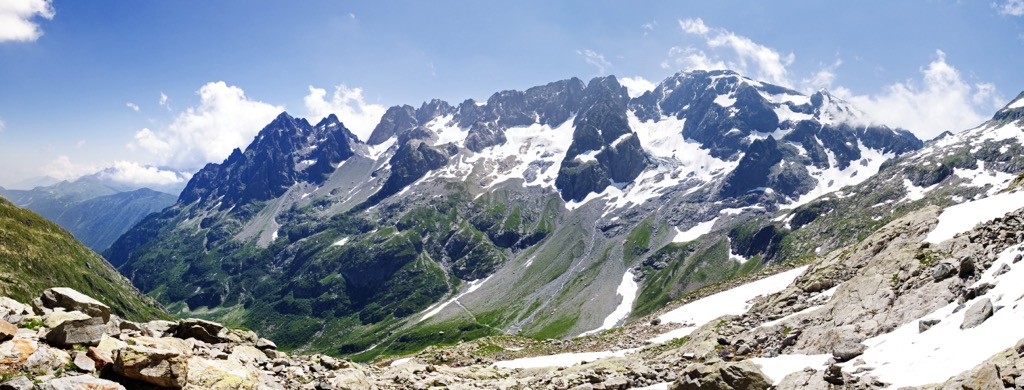
The Réserve Naturelle des Aiguilles Rouges covers most of the massif and features some 250 km (150 mi) of hiking trails.
The Aiguilles Rouges is a bastion of sunshine in a valley that can be shadowy for much of the year. Skiers can hang out and bask in the sun at the Brévent and Flégère even when it's cold and windy on the Mont Blanc Massif.
On the other hand, the relatively low elevation (no peak reaches above 3000 m) and southern exposure mean glaciers are melting quickly. The Aiguille du Belvédère likely no longer features permanent ice on its southern aspect, while the north-facing ice doesn’t make it more than a couple of hundred meters down the mountain.

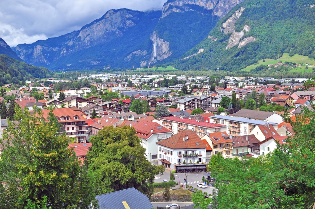
The scale of commerce through the Mont Blanc Tunnel - namely, large cargo trucks or lorries, as the British call them - has contributed to a persistent pollution problem in the L'Arve Valley. The valley is prone to intense temperature inversions during the winter because of the scale of the Mont Blanc Massif and its numerous glaciers, as well as the Aiguilles Rouges on the north side. Cold mountain air sinks into the valley and is locked in place.
Pollutants become stuck, creating a layer of smog. It’s estimated that as much as 50% of the pollution originates from tunnel traffic, and the valley became noticeably cleaner after the 1999 Tunnel Fire closed the tunnel. Other pollution originates from wood-burning stoves, car traffic, and the industrial town of Sallanches in the valley below the L’Arve Valley.
The Alpine Orogeny, which occurred between 64 and 2.5 million years ago, created the entire European Alps. The orogeny results from the African and Indian plates colliding with the Eurasian plate, forcing the crust upwards.
In many places, the orogeny is ongoing - namely, the Himalayas, because the Indian plate has only recently collided with Eurasia and continues to exert force on the crust. Even at a few tens of millions of years old, the Alps are still young, hence the towering, jagged peaks and low valleys. The mountains have not had time to erode, and the valleys have not filled with sediment.
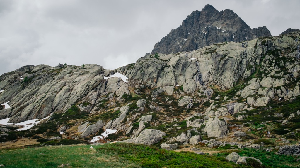
A granite batholith and glacial processes significantly influence the Aiguilles Rouges’ local geology. The batholith developed hundreds of millions of years ago, but the more recent Alpine Orogeny provided enough thrust for the granite to break through the surface. It also forms the base of the nearby Mont Blanc Massif.
The orogeny was completed around the Aiguilles Rouges about 15 million years ago. Some peaks still show an annual rise of up to 2.5 mm, though geologists speculate this is due to the rock rebounding from the weight of melted glaciers.
Since then, successive ice ages have been the primary geological driver of change. At times, an 1000m thick ice sheet has stretched from the L'Arve Valley to Lyon, hundreds of kilometers away. Other times, the highest summits have seen little to no ice. These ice movements have shaped the region’s lower valleys while the ice continues to scour the higher alpine valleys.
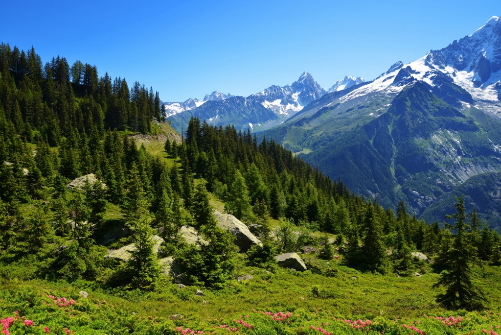
Vast fir, spruce, and larch forests thrive below 2000 meters, with rock and ice fields above 2700 meters.
Of the thousands of plant species, the most famous include edelweiss, blue thistle, and génépi (used to make a type of hard liquor called a ‘digestif’). Wildflowers are rampant throughout the meadows, especially where livestock graze and fertilize the soil.
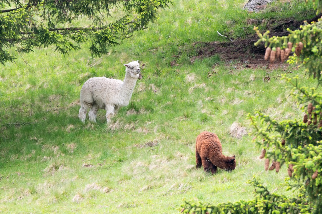
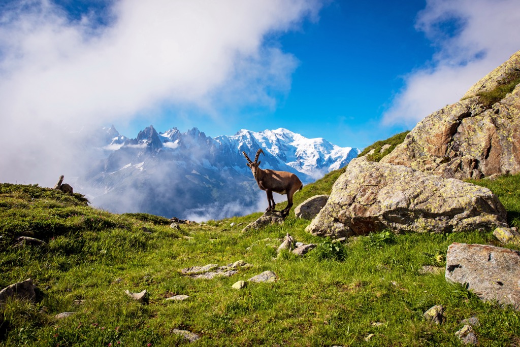
The forests and alpine meadows of the Aiguilles Rouges Massif are enchanted. Here, you will find chamois, ibex, wolves, lynx, golden eagles, bearded vultures, tawny vultures, owls, rock ptarmigan, tetras, ermines, hares, foxes, squirrels, marmots, and many other animals.
Black crows, a.k.a. Alpine Chough, soar amongst the rocky spires and peaks and carry special significance in the L'Arve Valley. It’s said that these black birds flitting amongst the great mountains are the souls of fallen skiers and climbers. Folks respect them and generally appreciate their presence.
On the Aiguilles Rouges, the alpine slopes are the wildest spaces. The surrounding valleys have towns and villages but no pockets of true wilderness. Ski slopes (winter) and livestock (summer) dominate the median altitude. Because it’s near a legendary mountaineering town, even the outer reaches of this massif feature a human presence in the form of ski lifts, refuges, climbers, alpinists, and other recreationists.
Anatomically modern humans probably permanently settled in the region around 40,000 years ago. However, limited evidence of these early pioneers exists.
Celtic tribes, specifically the Gauls, occupied most of pre-Roman France. In the valleys around Mont Blanc, the Romans subdued the Gauls by 125 B.C. After the fall of the Roman empire and throughout the Dark Ages, these valleys passed through the hands of many rulers.
In the 14th century, the House of Savoy began a 500-year rule of the region stretching from the northern Italian plain to Geneva and south to Nice, including the valleys surrounding the Aiguilles Rouges. It became known as the Duchy of Savoy for most of this time and was a formidable state.
In 1563, the House of Savoy moved the capital from Chambery, their ancestral homeland, across the Alps to Turin. More importantly, the Alps proved too potent a geographical barrier for Italy - the region of Savoy west of the Alps increasingly identified with French culture. France invaded during the Revolution and formally annexed the state in 1860.
The Annexation resulted from political maneuvering on both sides of the Alps. Italy needed French support for unification in the face of the waning Holy Roman Empire. Recognizing their tenuous grip on the region of Savoy from across the towering alpine ridge, they offered it to France in exchange for support. Italy maintained control of the land south and east of the Mont Blanc Massif, while the northern side - including the Aiguilles Rouges - became French.
The inhabitants of the region were generally pleased by this arrangement. The French Savoie has its own culture - known as ‘Savoyard,’ in French - but this culture is drastically more French than Italian.
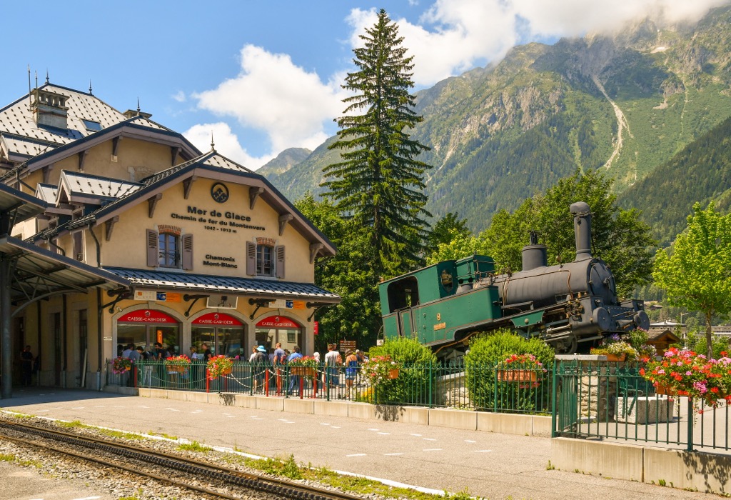
The town of Chamonix was quickly becoming the global center for mountaineering endeavors, although all of the famous ascents took place around Mont Blanc and not the Aiguilles Rouges. In 1786, a duo of Chamonix locals - Jacques Balmat and Dr. Michel Paccard - became immortalized with their ascent of Mont Blanc. This ascent launched the sport of mountaineering. The Aiguille du Midi saw a first ascent in 1818, but climbers did not successfully summit any other major peaks until 1864.
However, by the 20th century, even the most unfathomable summits from earlier generations quickly fell. Years later, teams from Cham conquered 8,000-meter peaks in the Himalayas, like Annapurna. Nowadays, few summits remain unclimbed, and few objectives un-ticked. It all began in Chamonix.
Fittingly, Chamonix hosted the first Winter Olympics in 1924. ‘White Gold’ became an obsession amongst mountain communities across the Alps. Villages rushed to build ski lifts and capitalize on the winter tourism boom.
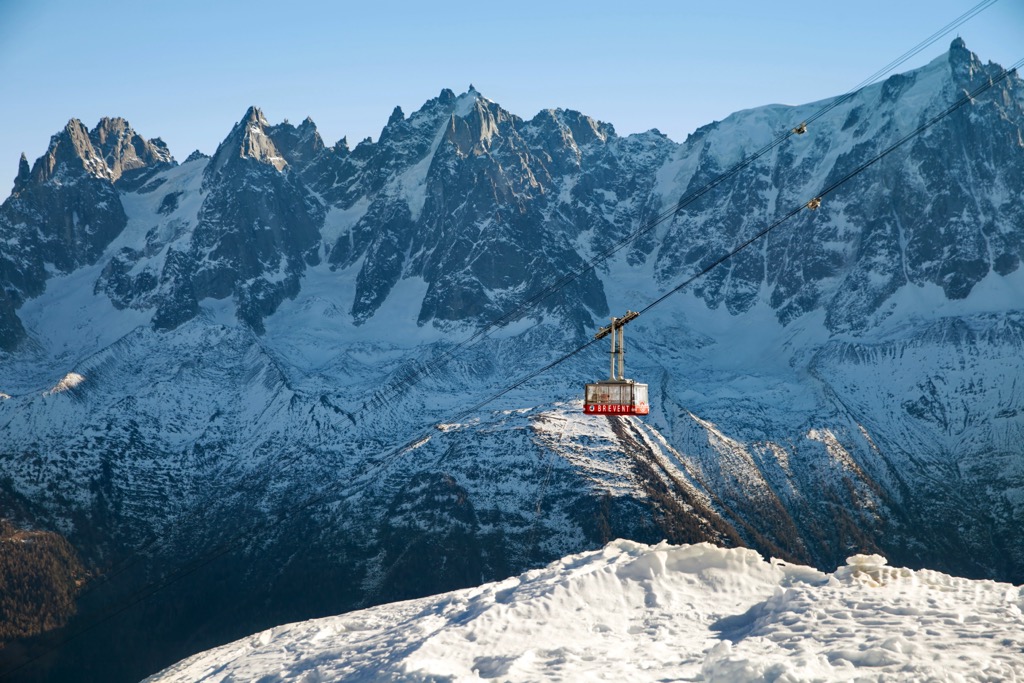
Chamonix offers world-class options for the following hobbyists: skiers, climbers, road cyclists, mountain bikers, hikers, trail runners, fishermen, hunters, paragliders, speed flyers, and even wing-suiters. The Brévent, with its steep cable car to the mid-station, is one of the best places to spot speed flyers and wingsuiters.
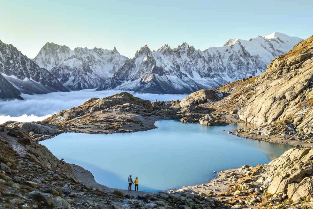
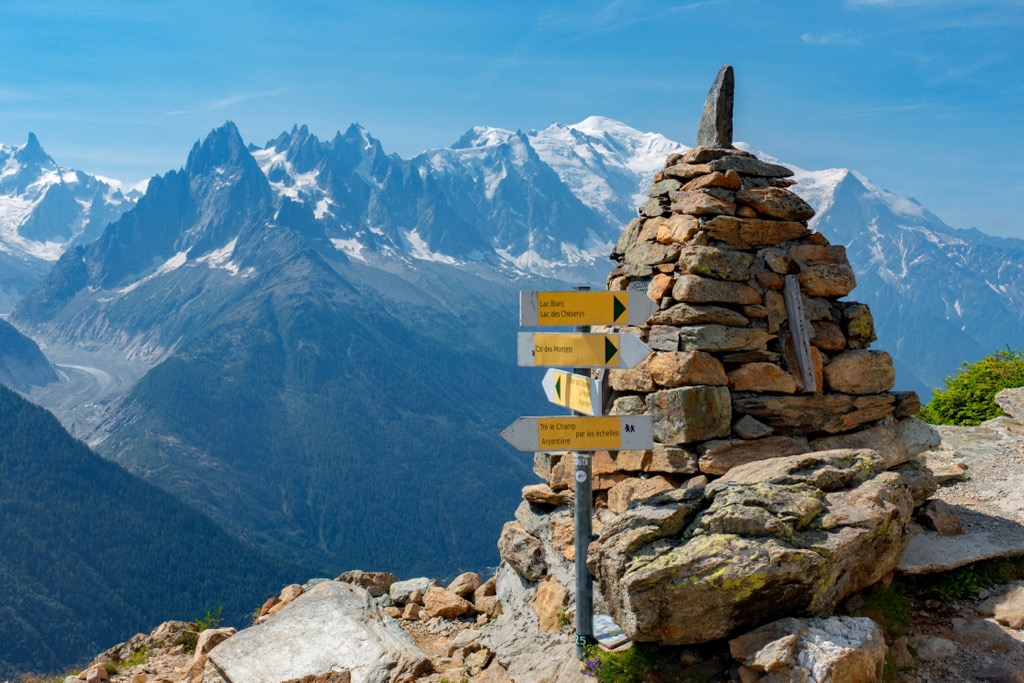
One all-day hike starts from the Col des Montets and heads southwest towards Lac de Chéserys and Lac Blanc. Taking the botanic trail to the left of the information center, follow the path to Gouille de la Remuaz. From here, continue to the first of the lakes - Lac des Chéserys - you should be able to snap a photo of the spectacular Mont Blanc reflected in the ice-cold mountain water.
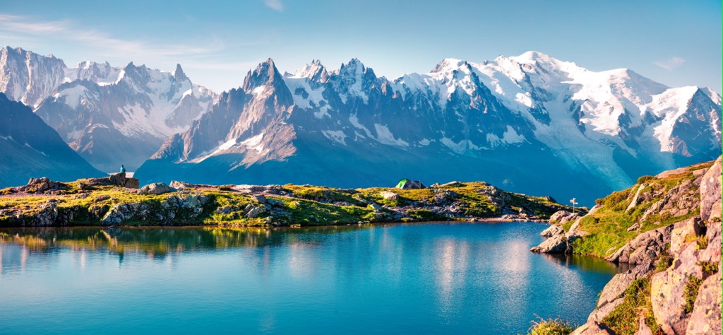
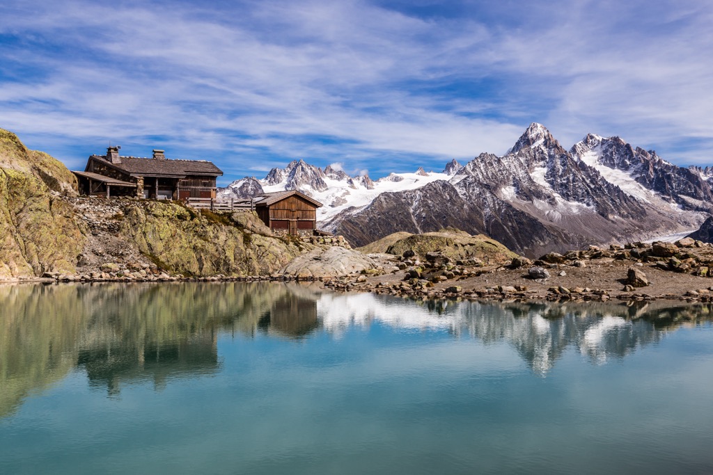
After traversing a rocky section, head towards Lac Blanc, around 20 minutes from the Chéserys. Here will be your first view of the refuge of Lac Blanc - a perfect place for a mid-hike picnic! Once well rested, you can head back on the same trail towards the Col des Montets. This hike is recommended for intermediate to experienced hikers and is ideal in the summer after the winter snows have melted off. The total distance is 11km, with 1000m of vertical elevation up to an altitude of over 2,400m.
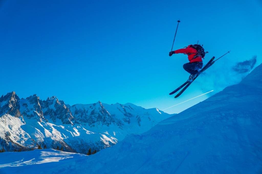
The next time you go skiing - especially if you ski off-piste - you have Chamonix to thank. They hosted the Winter Olympics in 1924 and discovered the power of ‘white gold,’ the idea that skiing could rejuvenate aging, economically depressed mountain villages throughout the country (and the world). Technically speaking, only the Brévent and Flégère sit upon the Aiguilles Rouges side of the valley; the other resorts are on the Mont-Blanc side.
L'Arve Valley boasts five ski resorts plus the Aiguille du Midi lift-access domain. Les Houches, Le Tour, and Flégère are the go-to spots for beginners and intermediates. That’s a lot of skiing for beginners in a valley known for the sport's extreme fringe. It turns out that Cham is one of the best towns for beginners and intermediates, in my opinion. Le Flégère is south-facing and gets wonderfully warm sun during February and March.
Brévent and Grands Montets offer some skiing for intermediates, but advanced skiers will enjoy these resorts more. Both resorts access incredible terrain beyond the ‘boundary’ - I use quotes because the areas here don’t have boundaries like resorts in North America do. Lastly, the Aiguille du Midi accesses the most extreme lift-access terrain in the world, suitable only for the most daring and skilled skiers.
Flégère and Brévent are connected; otherwise, the resorts are separated, and you must take the bus (or train) between them. Word to the wise; don’t drive, as the parking situation is miserable.
Chamonix is where it all started. Here is the original mountain town in all its glory. The valley comprises the town of Chamonix and several small villages with relatively little destructive development. The number of attractions and opportunities is endless, whether summer or winter.
Cham sees 2.5 million visitors annually, so you need to expect crowds. The town’s permanent population of 10,000 swells to 30,000 in the winter and 60,000 in the summer. When I visit Cham, I first think, “How am I going to avoid the crowds today?”
The answer to that question is the mountains. The Mont Blanc Massif and Aiguilles Rouges are so massive that there are not enough fit people to fill their spaces. You’ve got the world’s best access to alpine climbing, extreme skiing, and trail running within the valley - these are incontrovertible facts, not opinions. The access, natural beauty, radical terrain, and extreme sports culture push this valley to the forefront.
You can also just relax at a cafe and stare up at the peaks, safe in the knowledge that, today, you will not be one of the hundreds of people to die up there every year.
The food scene in Cham is particularly good for a ski town. Many French restaurants showcase the Savoyard alpine fare, and you can even find international food, like Annapurna (Indian), in downtown Chamonix. La P'tite Verte - classic Savoyard - is the best restaurant in the Argentière village, and I tried them all (at least in 2015, and things don’t change too fast around here).