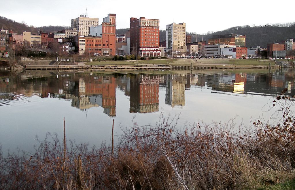
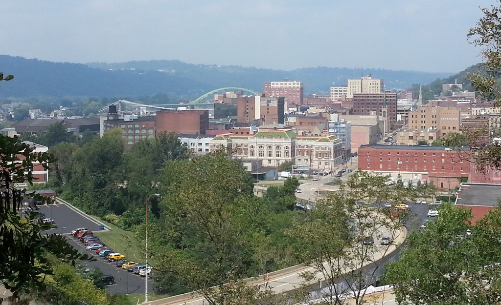
Wheeling is a city in Ohio and Marshall counties in the U.S. state of West Virginia. The county seat of Ohio County, it lies along the Ohio River in the foothills of the Appalachian Mountains within the state's Northern Panhandle. As of the 2020 census, the city had a population of 27,062, making it the fifth-most populous city in West Virginia and the most populous in the Northern Panhandle. The Wheeling metropolitan area had a population of 139,513 in 2020. Wheeling is located about 60 miles (97 km) west of Pittsburgh and 120 miles (190 km) east of Columbus via Interstate 70. Wheeling was settled in 1769 in land contested between colonial Pennsylvania and Virginia, and later grew to become Virginia's largest city west of the Appalachians. During the American Civil War, Wheeling was the host of the Wheeling Conventions that led to the secession of West Virginia and served as the first capital until 1865. It became a manufacturing center in the late nineteenth century due to its location along major transportation routes, including the Ohio River, National Road, and the Baltimore and Ohio Railroad. After the decline of heavy industry and substantial population loss following World War II, Wheeling's major industries now include healthcare, education, law and legal services, entertainment and tourism, and energy.
We use GPS information embedded into the photo when it is available.
3D mountains overlay
Adjust mountain panorama to perfectly match your photos because recorded by camera photo position might be imprecise.
Move tool
Rotate tool
Zoom
More customization
Choose which peak labels should make into the final photo and what photo title should be.
Next
Photo Location
Satellitte
Flat map
Relief map
Latitude
Longitude
Altitude
OR
Latitude
°'''
Longitude
°'''
Apply
Register Peak
Peak Name
Latitude
Longitude
Altitude
Register
Teleport
PeakVisor
This 3D model of Sagarmatha National Park in Nepal was made using the PeakVisor app topographic data. The mobile app features higher precision models worldwide, more topographic details, and works offline. Download PeakVisor maps today.
Download OBJ model
PeakVisor
The download should start shortly. If you find it useful please consider supporting the PeakVisor app.
PeakVisor for iOS and Android
Be a superhero of outdoor navigation with state-of-the-art 3D maps and mountain identification in the palm of your hand!