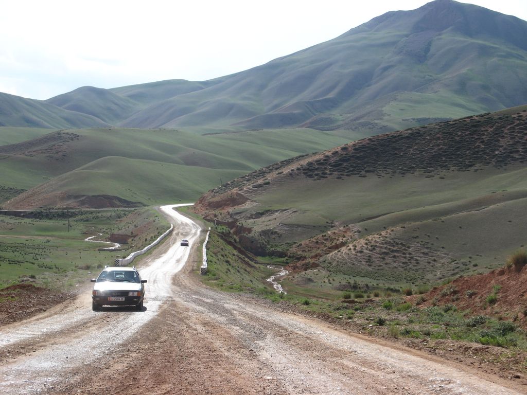
Torugart Pass (Uyghur: تورغات پورتى (Chinese: 吐尔尕特山口; Kyrgyz: Торугарт ашуусу, romanized: Torughart ashuusu; Russian: Перевал Торугарт) is a mountain pass in the Tian Shan mountain range near the border between the Naryn Region of Kyrgyzstan and the Xinjiang Autonomous Region of China. It is one of two border crossings between Kyrgyzstan and China, the other being Erkeshtam, some 165 km (103 mi) to the southwest. The scenic lake Chatyr-Köl lies near the pass on the Kyrgyz side. The road to Naryn and then to Balykchy and Bishkek—stretching for some 400 km (250 mi)—is narrow and in winter often impassable due to heavy snowfall and frequent avalanches. On the Chinese side, the Torugart Port of Entry (吐尔尕特口岸), where travelers must clear for customs, is located about 110 km (68 mi) from the pass itself in Ulugqat County of the Kizilsu Kirghiz Autonomous Prefecture. Distances from the pass to major cities are: 110 km (68 mi) to Ulugqat, 165 km (103 mi) to Kashgar, 170 kilometres (110 mi) to Artux and some 1,630 km (1,010 mi) to Ürümqi. The pass is also terminus of European route E125 and, under the new National Highway plans, the China National Highway 315, but neither are signed in this area by 2020.
We use GPS information embedded into the photo when it is available.
3D mountains overlay
Adjust mountain panorama to perfectly match your photos because recorded by camera photo position might be imprecise.
Move tool
Rotate tool
Zoom
More customization
Choose which peak labels should make into the final photo and what photo title should be.
Next
Photo Location
Satellitte
Flat map
Relief map
Latitude
Longitude
Altitude
OR
Latitude
°'''
Longitude
°'''
Apply
Register Peak
Peak Name
Latitude
Longitude
Altitude
Register
Teleport
PeakVisor
This 3D model of Sagarmatha National Park in Nepal was made using the PeakVisor app topographic data. The mobile app features higher precision models worldwide, more topographic details, and works offline. Download PeakVisor maps today.
Download OBJ model
PeakVisor
The download should start shortly. If you find it useful please consider supporting the PeakVisor app.
PeakVisor for iOS and Android
Be a superhero of outdoor navigation with state-of-the-art 3D maps and mountain identification in the palm of your hand!