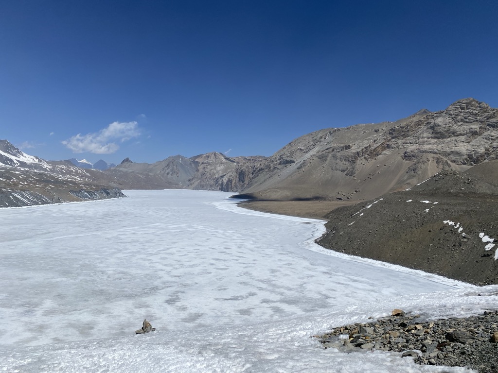
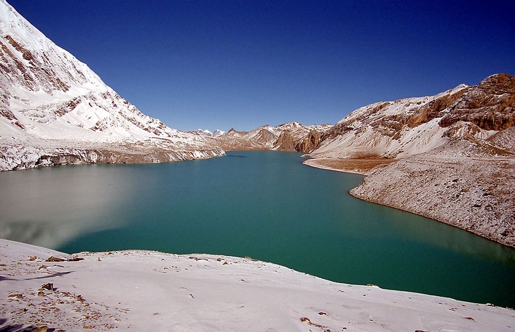
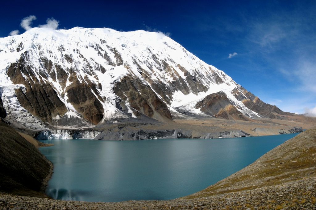
Tilicho Lake (Nepali: तिलिचो ताल; pronounced [tilit͡so]) is a glacial lake located in the Manang district of Nepal, 55 kilometres (34 mi) as the crow flies from the city of Pokhara. It is situated at an altitude of 4,919 metres (16,138 ft) in the Annapurna range of the Himalayas. Another source lists the altitude of Lake Tilicho as being 4,949 metres (16,237 ft) above mean sea level. According to the Nepali Department of Hydrology & Meteorology (2003), no aquatic organism has been recorded in the lake. Tilicho Lake was once known as Nepal’s highest lake, as it is situated at an altitude of 4,919 meters (16,138 ft), but now is overthrown by the Kajin Sara Lake Lake which is situated at 5,200 m, however, Tilicho Lake is still the Lake with longest diameter, lengthening up to 4 km in length and 1.2 km in width. Another interesting fact about Tilicho Lake is that there are neither water sources present, nor is there a designated route for water to follow, so the water stays within the lake. Tilicho Lake is the destination of one of the most popular side hikes of the Annapurna Circuit trek. The hike takes additional 3–4 days. No camping is required, as new lodges have been built between Manang and the lake. The final approach to the lake is done in a day hike from the lodge at Tilicho Base Camp. Trekkers attempting the Annapurna Circuit route usually cross the watershed between Manang and Kali Gandaki valleys over the 5416 meters high Thorong La pass. The alternate route, skirting Tilicho Lake from the north, has been gaining popularity. This route is more demanding and requires at least one night of camping. There are no teahouses or lodges past the Tilicho Base Camp lodge some kilometers east of the lake and the next village of Thini Gaon in the Kali Gandaki valley. Most groups spend two nights between these places. There are two passes leading to Thini Gaon and Jomsom; Mesokanto La and Tilicho North pass known also as Tilicho "Tourist pass". These routes via Tilicho Lake are more often closed by snow than the higher Thorong La. Tilicho Lake was the site of one of the highest ever altitude scuba dives. A Russian diving team, consisting of Andrei Andryushin, Denis Bakin, and Maxim Gresko, conducted a scuba dive in the lake in 2000.
We use GPS information embedded into the photo when it is available.
3D mountains overlay
Adjust mountain panorama to perfectly match your photos because recorded by camera photo position might be imprecise.
Move tool
Rotate tool
Zoom
More customization
Choose which peak labels should make into the final photo and what photo title should be.
Next
Photo Location
Satellitte
Flat map
Relief map
Latitude
Longitude
Altitude
OR
Latitude
°'''
Longitude
°'''
Apply
Register Peak
Peak Name
Latitude
Longitude
Altitude
Register
Teleport
PeakVisor
This 3D model of Sagarmatha National Park in Nepal was made using the PeakVisor app topographic data. The mobile app features higher precision models worldwide, more topographic details, and works offline. Download PeakVisor maps today.
Download OBJ model
PeakVisor
The download should start shortly. If you find it useful please consider supporting the PeakVisor app.
PeakVisor for iOS and Android
Be a superhero of outdoor navigation with state-of-the-art 3D maps and mountain identification in the palm of your hand!