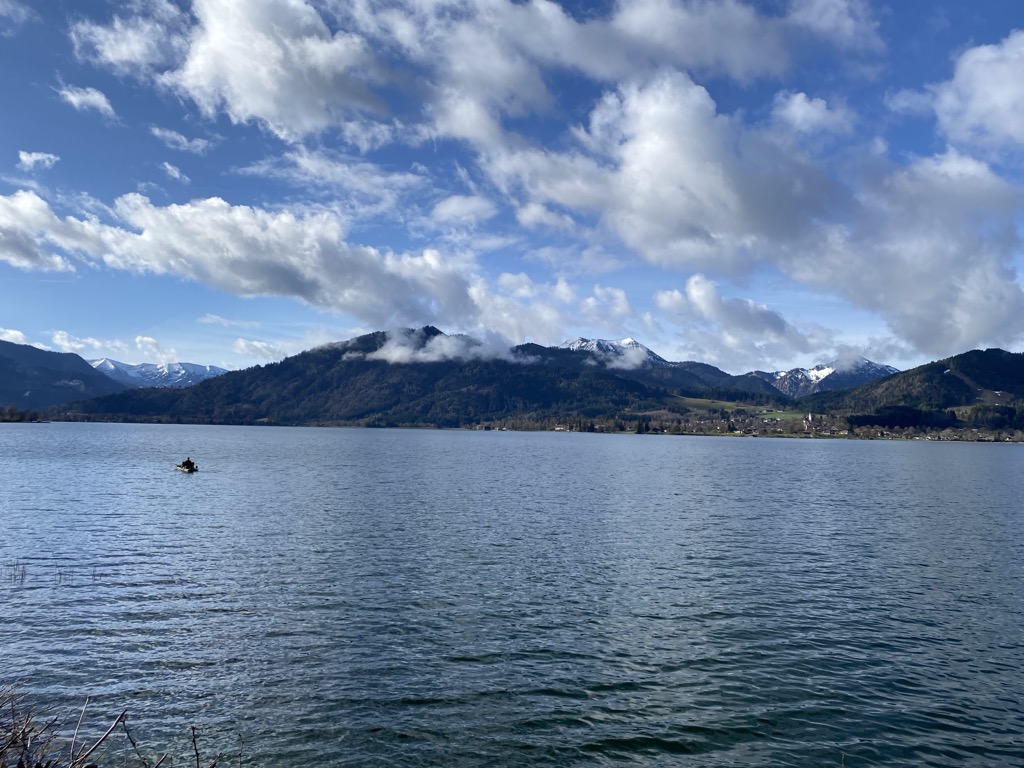
The Tegernsee is a Zungenbecken lake in the Bavarian Alps in southern Germany. The lake is the centre of a popular recreation area 50 kilometres (31 mi) south-east of Munich. Resorts on the lake include the eponymous Tegernsee, as well as Bad Wiessee, Kreuth, Gmund, and Rottach-Egern. The lake is some 6.5 kilometres (4.0 mi) in length, 1.4 kilometres (0.87 mi) across at its widest, and spans an area of 8.934 square kilometres (3.449 sq mi). It reaches a maximum depth of 72.6 metres (238 ft), with an average depth of 36.3 metres (119 ft), and the normal water level is 725.5 metres (2,380 ft) above sea level. The lake flows into the River Mangfall, a tributary of the River Inn and thence the River Danube. The buildings of the former Benedictine monastery of Tegernsee Abbey lie on the banks of the lake. Now in private hands, they are now known as Schloss Tegernsee. The area around the lake is linked to Munich by rail through trains of the Bayerische Oberlandbahn, which, in the final part of their journey, travel over the tracks of the privately owned Tegernsee-Bahn. Pleasure boat services serve several points on the lake, and are operated by boats of the Bayerische Seenschifffahrt company. Adolf Hitler owned a house on the shores of Tegernsee and reclused here following the suicide of his niece and girlfriend, Geli Raubal, in 1931.
We use GPS information embedded into the photo when it is available.
3D mountains overlay
Adjust mountain panorama to perfectly match your photos because recorded by camera photo position might be imprecise.
Move tool
Rotate tool
Zoom
More customization
Choose which peak labels should make into the final photo and what photo title should be.
Next
Photo Location
Satellitte
Flat map
Relief map
Latitude
Longitude
Altitude
OR
Latitude
°'''
Longitude
°'''
Apply
Register Peak
Peak Name
Latitude
Longitude
Altitude
Register
Teleport
PeakVisor
This 3D model of Sagarmatha National Park in Nepal was made using the PeakVisor app topographic data. The mobile app features higher precision models worldwide, more topographic details, and works offline. Download PeakVisor maps today.
Download OBJ model
PeakVisor
The download should start shortly. If you find it useful please consider supporting the PeakVisor app.
PeakVisor for iOS and Android
Be a superhero of outdoor navigation with state-of-the-art 3D maps and mountain identification in the palm of your hand!


.jpg)


