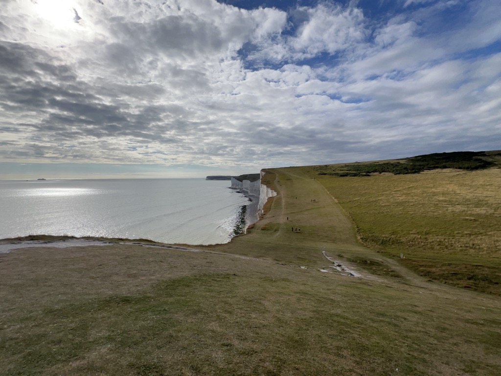
The Seven Sisters are a series of chalk sea cliffs on the English Channel coast, and are a stretch of the sea-eroded section of the South Downs range of hills, in the county of East Sussex, in south-east England. The Seven Sisters cliffs run between the mouth of the River Cuckmere near Seaford, and the chalk headland of Beachy Head outside of Eastbourne. The dips or swales that separate each of the seven crests from the next are the remnants of dry valleys in the chalk South Downs which are being gradually eroded by the sea. Some of the cliffs and adjacent countryside make up the Seven Sisters Country Park, which is bounded on its inland side by the A259 road, and is itself a part of the larger South Downs National Park.
We use GPS information embedded into the photo when it is available.
3D mountains overlay
Adjust mountain panorama to perfectly match your photos because recorded by camera photo position might be imprecise.
Move tool
Rotate tool
Zoom
More customization
Choose which peak labels should make into the final photo and what photo title should be.
Next
Photo Location
Satellitte
Flat map
Relief map
Latitude
Longitude
Altitude
OR
Latitude
°'''
Longitude
°'''
Apply
Register Peak
Peak Name
Latitude
Longitude
Altitude
Register
Teleport
PeakVisor
This 3D model of Sagarmatha National Park in Nepal was made using the PeakVisor app topographic data. The mobile app features higher precision models worldwide, more topographic details, and works offline. Download PeakVisor maps today.
Download OBJ model
PeakVisor
The download should start shortly. If you find it useful please consider supporting the PeakVisor app.
PeakVisor for iOS and Android
Be a superhero of outdoor navigation with state-of-the-art 3D maps and mountain identification in the palm of your hand!