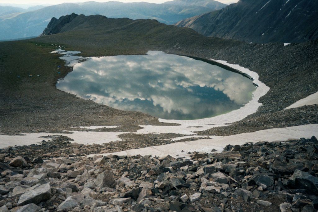
Pacific Tarn is a small lake located in the Colorado Rocky Mountains in the United States. It is notable for its 13,420 foot (4,090 m) elevation, making it the highest lake in the United States whose name is recognized by the United States Board on Geographic Names, surpassing other lakes such as Hawaii's Lake Waiau on Mauna Kea, and California's Tulainyo Lake near Mount Whitney. The lake sits atop the broad eastern ridge of Pacific Peak in the Tenmile Range. Efforts to name the lake were spearheaded by Carl Drews, a Boulder, Colorado resident who organized an expedition to the lake in 2002 to measure the size, depth and water chemistry. The lake remained unnamed until January 8, 2004, when the United States Board of Geographic Names officially approved the name Pacific Tarn for the lake.
We use GPS information embedded into the photo when it is available.
3D mountains overlay
Adjust mountain panorama to perfectly match your photos because recorded by camera photo position might be imprecise.
Move tool
Rotate tool
Zoom
More customization
Choose which peak labels should make into the final photo and what photo title should be.
Next
Photo Location
Satellitte
Flat map
Relief map
Latitude
Longitude
Altitude
OR
Latitude
°'''
Longitude
°'''
Apply
Register Peak
Peak Name
Latitude
Longitude
Altitude
Register
Teleport
PeakVisor
This 3D model of Sagarmatha National Park in Nepal was made using the PeakVisor app topographic data. The mobile app features higher precision models worldwide, more topographic details, and works offline. Download PeakVisor maps today.
Download OBJ model
PeakVisor
The download should start shortly. If you find it useful please consider supporting the PeakVisor app.
PeakVisor for iOS and Android
Be a superhero of outdoor navigation with state-of-the-art 3D maps and mountain identification in the palm of your hand!