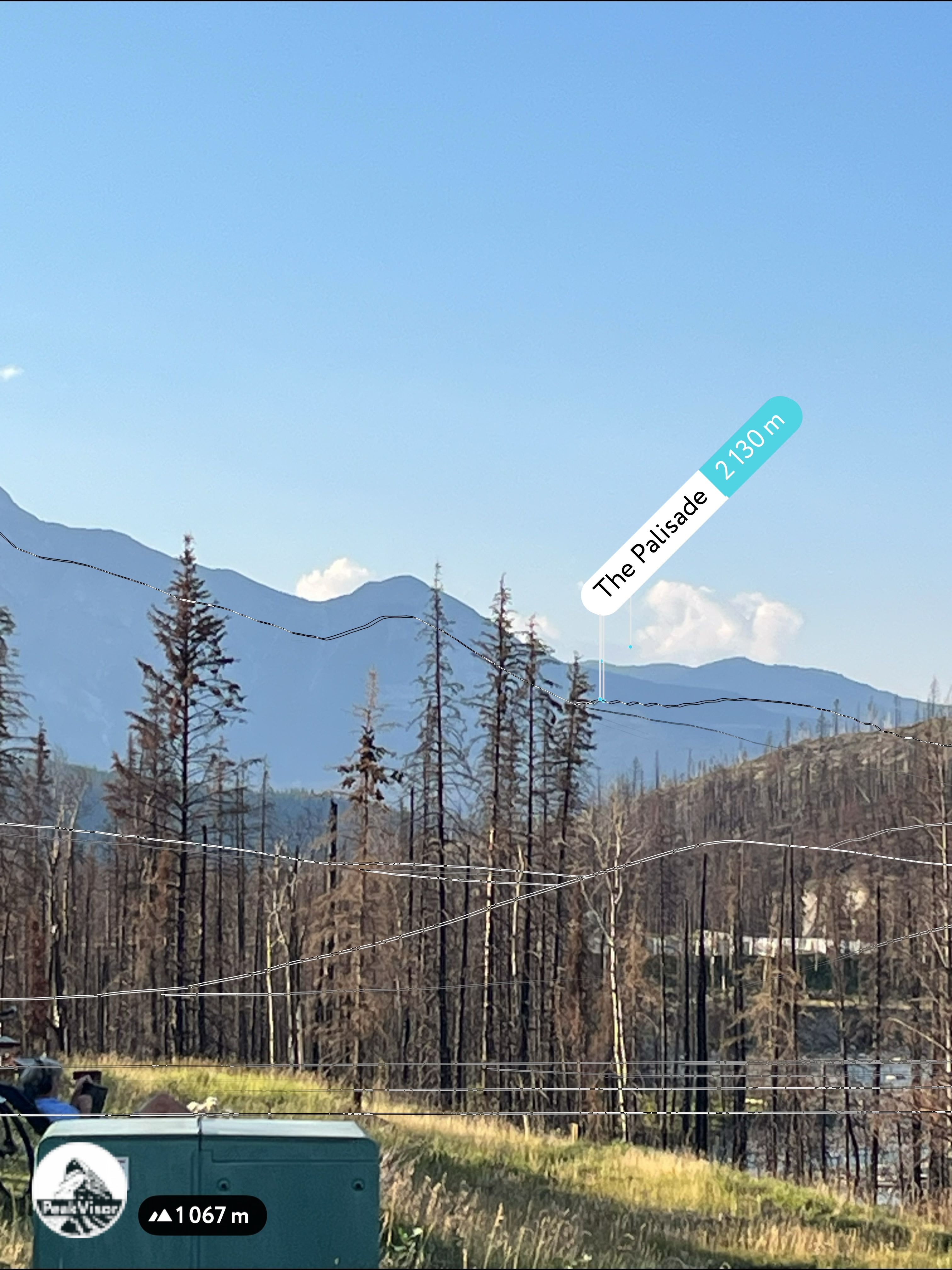
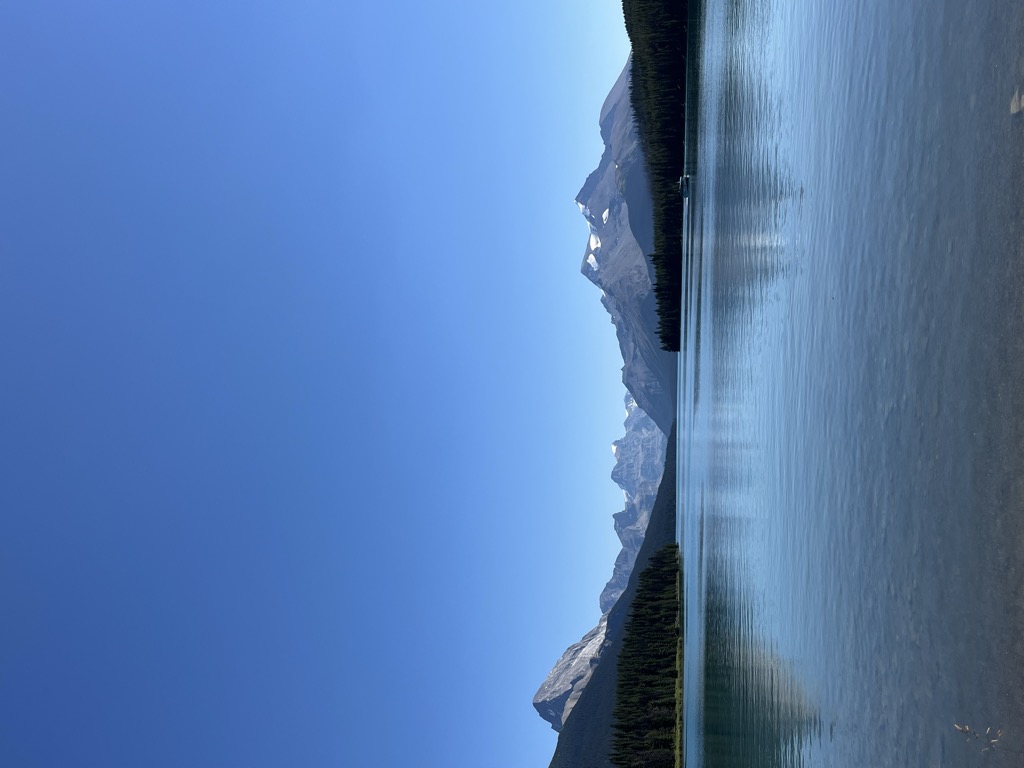
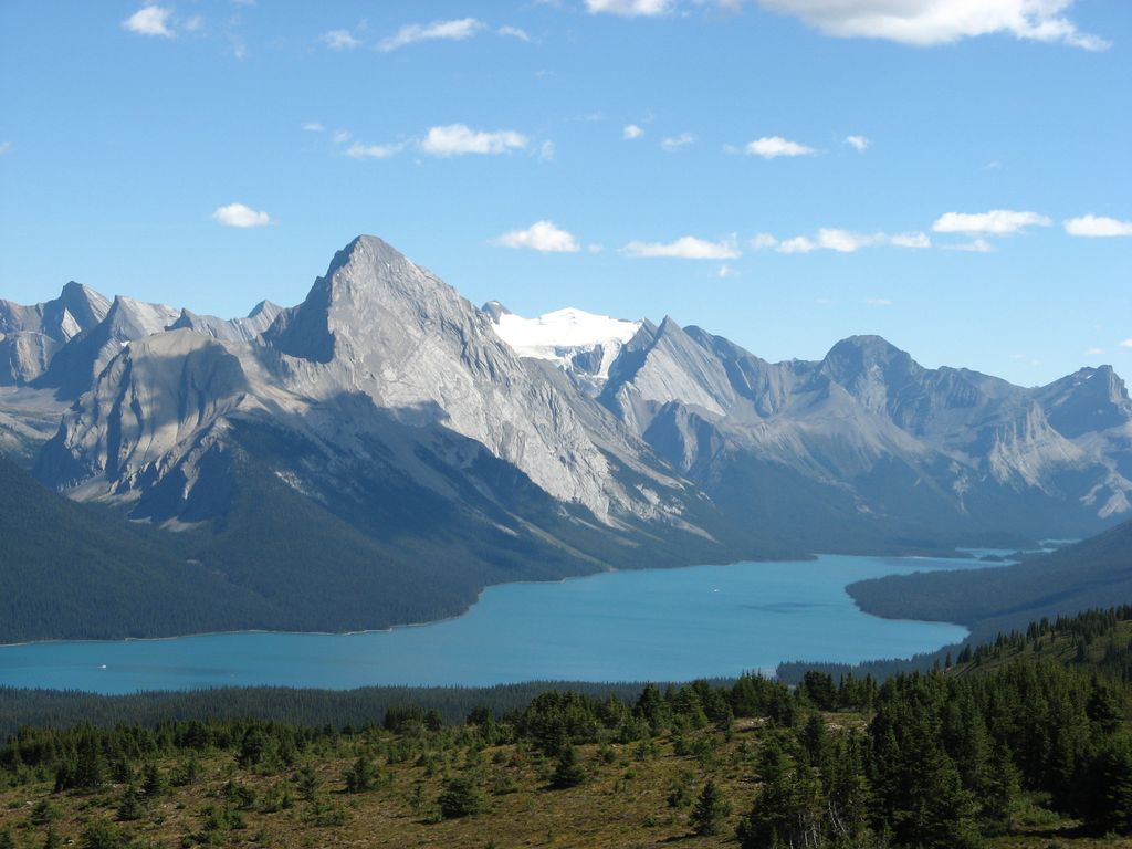
Maligne Lake ( mə-LEEN) is a lake in Jasper National Park, Alberta, Canada. The lake is famed for the colour of its azure water, the surrounding peaks, the three glaciers visible from the lake, and Spirit Island, a frequently and very famously photographed islet. The lake is located 44 km (27 mi) south of Jasper town, and is accessible by motor vehicle, including shuttle buses from Jasper. Boat tours run to Spirit Island in the spring to autumn season. The 44 km Skyline Trail, Jasper's most popular, highest and above treeline, multi-day hike, begins at Maligne Lake and finishes near the town of Jasper. Other popular day hikes include the Opal Hills and Bald Hills loops. Winter activities include cross-country skiing and snowboarding. Maligne Lake is approximately 22.5 km (14.0 mi) long and is 97 m (318 ft) at its deepest point, in the south end of the lake. It averages 35 m (115 ft) in depth. It sits at approximately 1,670 m (5,480 ft) asl. Easily visible from the Maligne Lake Day Lodge are Leah and Samson Peaks and Mount Paul to the east, and Mounts Charlton, Unwin, Mary Vaux and Llysfran Peak to the south and west. The Charlton-Unwin, Maligne, and Coronet glaciers are visible from the lake, which boasts a self-sustaining population of introduced rainbow trout and brook trout. It is a popular spot for sport fishing, kayaking and canoeing. Parks Canada maintains three camping sites, accessible only by canoe, at Hidden Cove, Fisherman's Bay and Coronet Creek. Maligne Lake is fed and drained by the Maligne River, which enters the lake on its south side, near Mount Unwin and drains the lake to the north. Maligne Lake, as well as Maligne River, Maligne Mountain, and Maligne Pass, takes its name from the French word for malignant or wicked. The name was used by Father Pierre-Jean De Smet (1801–1873) to describe the turbulent river that flows from the lake (in the spring), and soon spread to the lake, canyon, pass, mountain and range. It is also possible that early French traders applied the name to the river for its treacherous confluence with the Athabasca River.
We use GPS information embedded into the photo when it is available.
3D mountains overlay
Adjust mountain panorama to perfectly match your photos because recorded by camera photo position might be imprecise.
Move tool
Rotate tool
Zoom
More customization
Choose which peak labels should make into the final photo and what photo title should be.
Next
Photo Location
Satellitte
Flat map
Relief map
Latitude
Longitude
Altitude
OR
Latitude
°'''
Longitude
°'''
Apply
Register Peak
Peak Name
Latitude
Longitude
Altitude
Register
Teleport
PeakVisor
This 3D model of Sagarmatha National Park in Nepal was made using the PeakVisor app topographic data. The mobile app features higher precision models worldwide, more topographic details, and works offline. Download PeakVisor maps today.
Download OBJ model
PeakVisor
The download should start shortly. If you find it useful please consider supporting the PeakVisor app.
PeakVisor for iOS and Android
Be a superhero of outdoor navigation with state-of-the-art 3D maps and mountain identification in the palm of your hand!