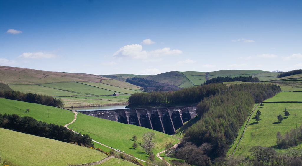
Lamaload Reservoir is a reservoir near Rainow, Cheshire, England (SJ972750). It lies in the South West Peak within the Peak District National Park, to the west of the Goyt Valley, and is fed by the River Dean. The reservoir is 0.93 km × 0.53 km, with a capacity of 1,909,000 m³, impounded by a multiple-arch, round-headed buttress dam in concrete, whose design was innovative at the time. It was built by Richard Costain Ltd in 1959–63 to serve Macclesfield, which lies to its west, and officially opened in 1965. The reservoir and associated water treatment works are owned by United Utilities. The area is a popular tourist spot, forming an access point for walkers to the surrounding moorland.
We use GPS information embedded into the photo when it is available.
3D mountains overlay
Adjust mountain panorama to perfectly match your photos because recorded by camera photo position might be imprecise.
Move tool
Rotate tool
Zoom
More customization
Choose which peak labels should make into the final photo and what photo title should be.
Next
Photo Location
Satellitte
Flat map
Relief map
Latitude
Longitude
Altitude
OR
Latitude
°'''
Longitude
°'''
Apply
Register Peak
Peak Name
Latitude
Longitude
Altitude
Register
Teleport
PeakVisor
This 3D model of Sagarmatha National Park in Nepal was made using the PeakVisor app topographic data. The mobile app features higher precision models worldwide, more topographic details, and works offline. Download PeakVisor maps today.
Download OBJ model
PeakVisor
The download should start shortly. If you find it useful please consider supporting the PeakVisor app.
PeakVisor for iOS and Android
Be a superhero of outdoor navigation with state-of-the-art 3D maps and mountain identification in the palm of your hand!