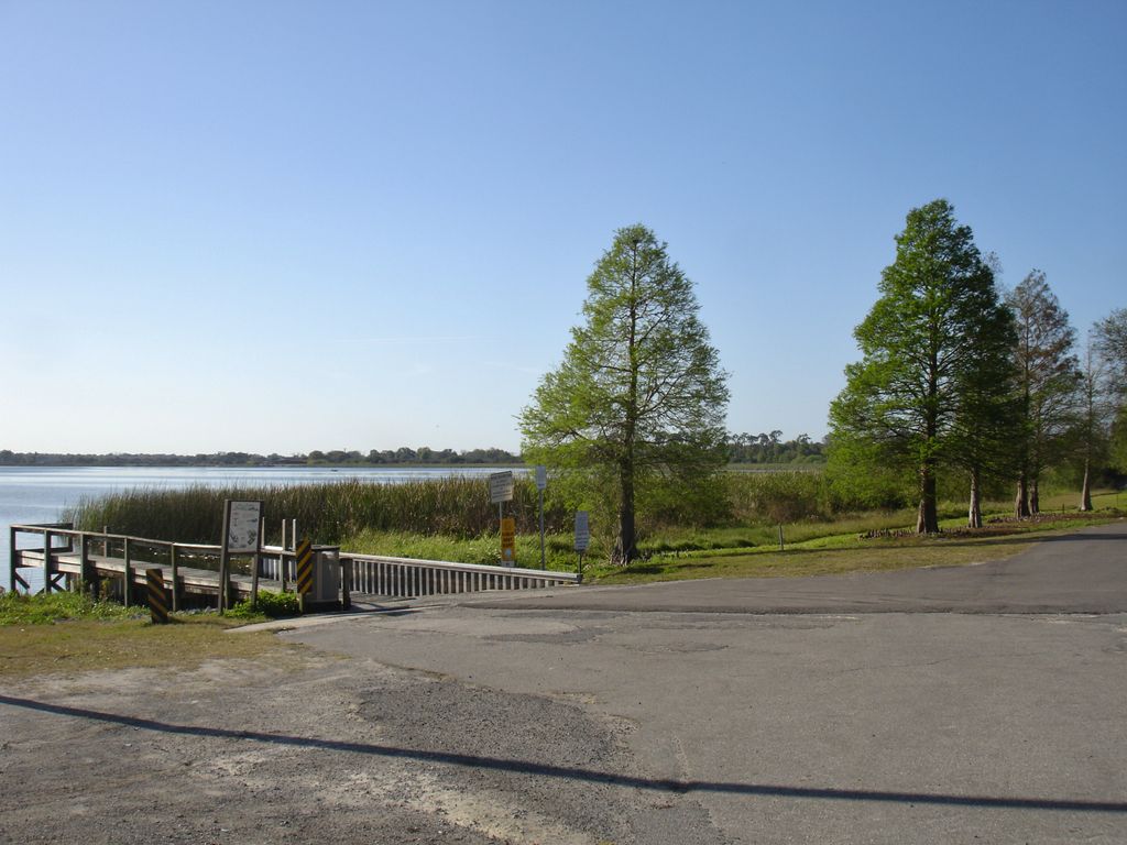
Lake Rochelle, of which the main body is oval-shaped, has a smaller oval-shaped cove on its east end. This lake has a surface area of 580-acre (2,300,000 m2). The lake is located just north of Winter Haven, Florida, but is located entirely within the city limits of Lake Alfred, Florida, the main part of which is on the lake's northwest side. On that side US Highway 92 is just beyond the lake's shore. Most of the north and west sides of Lake Rochelle are bordered by woods. The east and south sides are bordered by residences and grassland. Lake Rochelle has public access on its northwest shore. The Lake Rochelle Park and Boat Ramp, maintained by the city of Lake Alfred, are there; the boat ramp is a part of the 1.8-acre (7,300 m2) park. The park has a shelter house covering a picnic table. On the west side of the lake, the Chain of Lakes Trail, a paved walking and bicycle trail, runs from Joyce B. Davis Park in downtown Winter Haven and stops at US Highway 92. This lake is one of the lakes in the north part of the Winter Haven Chain of Lakes. Boats may enter Lake Rochelle from two canals. One, no the north side, connects to Lake Haines. One on the south side connects to Lake Conine. A small canal on the northeast connects to Lake Echo, but this canal cannot be navigated by boat. There are no public swimming beaches on Lake Rochelle. The Take Me Fishing website says Lake Rochelle contains largemouth bass and bluegill.
We use GPS information embedded into the photo when it is available.
3D mountains overlay
Adjust mountain panorama to perfectly match your photos because recorded by camera photo position might be imprecise.
Move tool
Rotate tool
Zoom
More customization
Choose which peak labels should make into the final photo and what photo title should be.
Next
Photo Location
Satellitte
Flat map
Relief map
Latitude
Longitude
Altitude
OR
Latitude
°'''
Longitude
°'''
Apply
Register Peak
Peak Name
Latitude
Longitude
Altitude
Register
Teleport
PeakVisor
This 3D model of Sagarmatha National Park in Nepal was made using the PeakVisor app topographic data. The mobile app features higher precision models worldwide, more topographic details, and works offline. Download PeakVisor maps today.
Download OBJ model
PeakVisor
The download should start shortly. If you find it useful please consider supporting the PeakVisor app.
PeakVisor for iOS and Android
Be a superhero of outdoor navigation with state-of-the-art 3D maps and mountain identification in the palm of your hand!