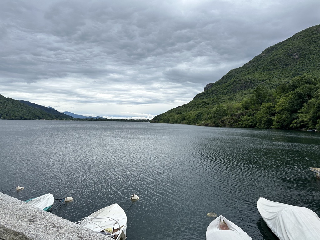
Lago di Mergozzo (En. Lake Mergozzo) is a small sub-alpine lake in northern Italy just to the west of Lago Maggiore and north of Lago d'Orta, at the mouth of the Val d’Ossola in the province of Verbano Cusio Ossola, Piedmont. In ancient times, it was the extreme point of the short northwestern arm of Lago Maggiore, formed by glaciation. However repeated flooding of Maggiore's tributary the Toce deposited sediment which gradually formed a stretch of land which cut off Mergozzo from the larger expanse of water, and from the Toce itself. Today, the settlement of Fondotoce (a frazione of Verbania) stands on this alluvial plain. The small town Mergozzo, which lies at the other end of the lake, gives it its name. The greater part of the lake falls within the commune of Mergozzo, the rest within Verbania. Monte Orfano (790 m) rises from the southwest shore of the lake; the limestone rocks of which it is composed are heavily quarried. On the opposite side of the lake the mountains form the beginning of the Corni di Nibbio chain which divides the Val d'Ossola from the Valgrande and its National Park. The lake is fed by the waters of a number of clean mountain streams, the two most important being the Rio Bracchio and the Rio Rescina. Its sole outlet is the 2.7 kilometres (1.7 mi) canal which links it to Lago Maggiore near Fondotoce. The difference in levels between the two lakes is slight, and when Maggiore is in flood, the flow of water in the canal goes into reverse. This opens up the possibility of pollutants entering Lago Mergozzo. Nevertheless, today the lake, where the use of motorboats has long been forbidden, is one of the least polluted in Italy; it has become a tourist destination particularly popular with people from Germany and the Netherlands.
We use GPS information embedded into the photo when it is available.
3D mountains overlay
Adjust mountain panorama to perfectly match your photos because recorded by camera photo position might be imprecise.
Move tool
Rotate tool
Zoom
More customization
Choose which peak labels should make into the final photo and what photo title should be.
Next
Photo Location
Satellitte
Flat map
Relief map
Latitude
Longitude
Altitude
OR
Latitude
°'''
Longitude
°'''
Apply
Register Peak
Peak Name
Latitude
Longitude
Altitude
Register
Teleport
PeakVisor
This 3D model of Sagarmatha National Park in Nepal was made using the PeakVisor app topographic data. The mobile app features higher precision models worldwide, more topographic details, and works offline. Download PeakVisor maps today.
Download OBJ model
PeakVisor
The download should start shortly. If you find it useful please consider supporting the PeakVisor app.
PeakVisor for iOS and Android
Be a superhero of outdoor navigation with state-of-the-art 3D maps and mountain identification in the palm of your hand!


.jpg)


