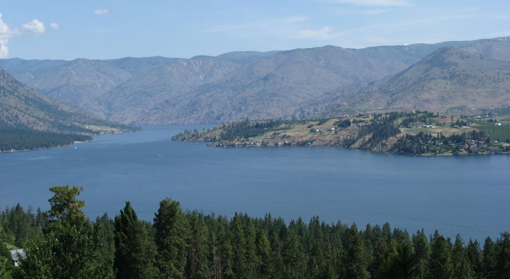
Lake Chelan ( shə-LAN) is a narrow, 50.5 mi (81.3 km) long lake in Chelan County, north-central Washington state, U.S. It is an overdeepened lake and resembles a fjord, with an average width of 1.3 mi (2.1 km). Near its upper end, the lake surface lies more than 6,600 ft (2,000 m) below peaks less than 3 mi (4.8 km) away. Before 1927, Lake Chelan was the largest natural lake in the state in terms of both surface area and water volume. Upon the completion of Lake Chelan Dam in 1927, the elevation of the lake was increased by 21 ft (6.4 m) to its present maximum-capacity elevation of 1,100 ft (340 m). With a maximum depth of 1,486 ft (453 m), Lake Chelan is the third deepest lake in the United States behind Crater Lake, the deepest, and Lake Tahoe, the second deepest. Because of overdeepening, the sides of this lake drop steeply to its bottom. The deepest part of Lake Chelan lies as much as 436 ft (133 m) below sea level. In places, the bedrock floor of the valley occupied by Lake Chelan, which is buried by Pleistocene glacial and lacustrine sediments, lies at least 1,529 ft (466 m) below sea level. Two communities lie on the southern end of the lake, and a third sits at the far north end, providing a gateway to the North Cascades National Park.
We use GPS information embedded into the photo when it is available.
3D mountains overlay
Adjust mountain panorama to perfectly match your photos because recorded by camera photo position might be imprecise.
Move tool
Rotate tool
Zoom
More customization
Choose which peak labels should make into the final photo and what photo title should be.
Next
Photo Location
Satellitte
Flat map
Relief map
Latitude
Longitude
Altitude
OR
Latitude
°'''
Longitude
°'''
Apply
Register Peak
Peak Name
Latitude
Longitude
Altitude
Register
Teleport
PeakVisor
This 3D model of Sagarmatha National Park in Nepal was made using the PeakVisor app topographic data. The mobile app features higher precision models worldwide, more topographic details, and works offline. Download PeakVisor maps today.
Download OBJ model
PeakVisor
The download should start shortly. If you find it useful please consider supporting the PeakVisor app.
PeakVisor for iOS and Android
Be a superhero of outdoor navigation with state-of-the-art 3D maps and mountain identification in the palm of your hand!