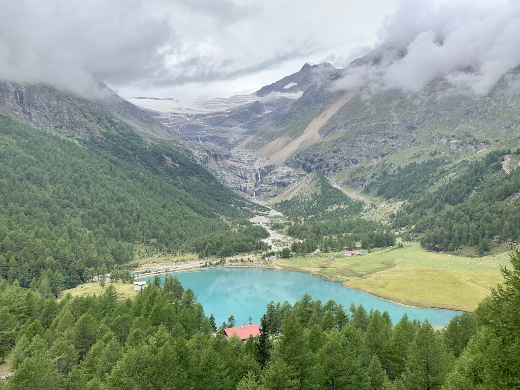
Palü Lake (Italian: Lago Palü, Romansh: Lagh da Palü, German Palüsee) is a lake below Piz Palü in the Swiss canton of Graubünden. It has an elevation of 1,923 m (6,309 ft) and a surface area of 5.2 ha (13 acres). Water from Palü Glacier feeds into the lake. In 1926, a dam was built enabling use of the lake as a reservoir. The nearby Palü hydro-electric power station has an installed capacity of 10 MW and is fed by a pressurised pipe-line from Lago Bianco. The outfall from this plant, along with water from Lago Palü, feeds an underground pipeline to the Cavaglia power station at Cavaglia. The 800-metre (2,600 ft) tunnel connecting the two plants also accommodates a funicular railway that is open to the public during tours of the plants.
We use GPS information embedded into the photo when it is available.
3D mountains overlay
Adjust mountain panorama to perfectly match your photos because recorded by camera photo position might be imprecise.
Move tool
Rotate tool
Zoom
More customization
Choose which peak labels should make into the final photo and what photo title should be.
Next
Photo Location
Satellitte
Flat map
Relief map
Latitude
Longitude
Altitude
OR
Latitude
°'''
Longitude
°'''
Apply
Register Peak
Peak Name
Latitude
Longitude
Altitude
Register
Teleport
PeakVisor
This 3D model of Sagarmatha National Park in Nepal was made using the PeakVisor app topographic data. The mobile app features higher precision models worldwide, more topographic details, and works offline. Download PeakVisor maps today.
Download OBJ model
PeakVisor
The download should start shortly. If you find it useful please consider supporting the PeakVisor app.
PeakVisor for iOS and Android
Be a superhero of outdoor navigation with state-of-the-art 3D maps and mountain identification in the palm of your hand!