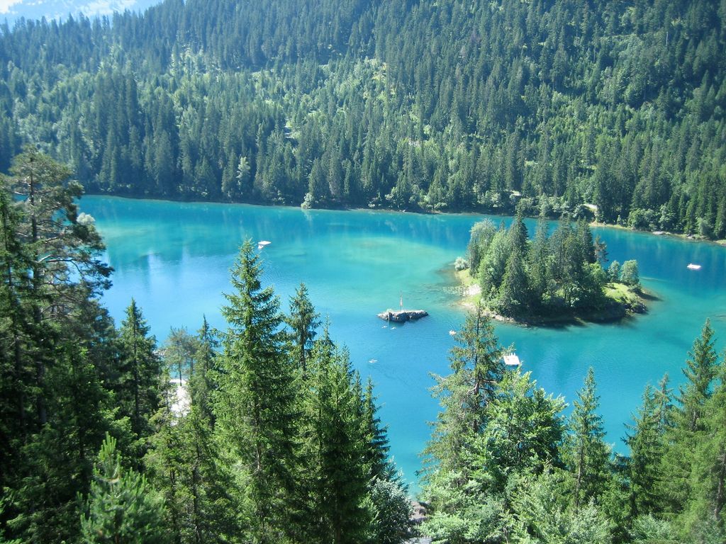
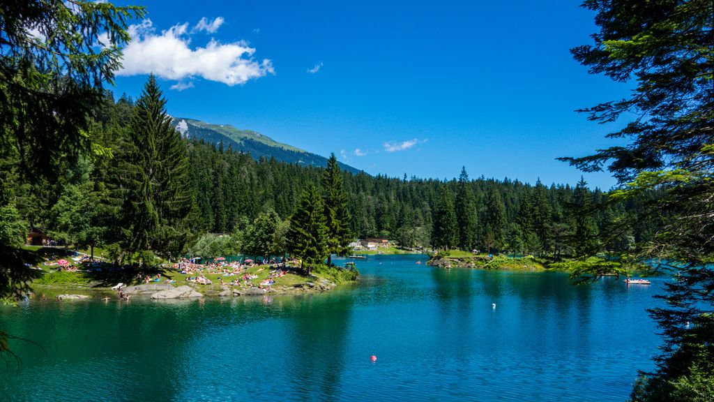
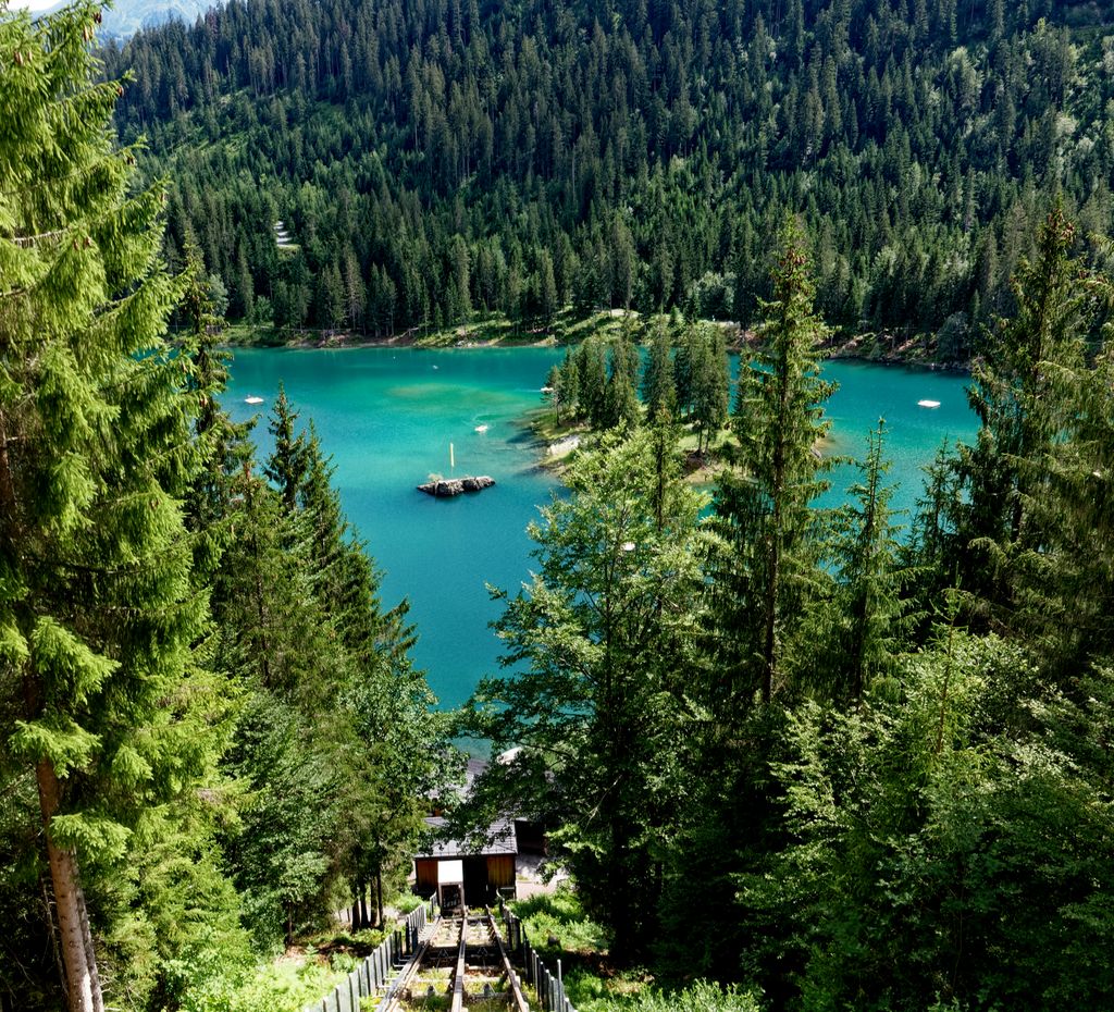
Caumasee (Romansh: Lag la Cauma or Lai da Cauma) is a lake near Flims, in the Grisons, Switzerland. It is one of the lakes on the Flims Rockslide deposits. The lake is fed from underground sources. Its surface area is 10.3194 ha. The level of the lake varies by approximately 4 to 5 meters along with the varying underground water flow during the year, hence reaches its minimum by the end of April when snow melting in the mountains increases. A maximum level is reached by mid July but may be topped in August even after previous falling due to summer rain. The very western bay never freezes in winter, probably showing a maximum water flow in this area. When the lake is at a low level, with a small volume of water, it warms up sooner than most lakes in the region, so people can be seen starting to swim the lake in April while bigger lakes even in lower areas of Switzerland remain rather cool. Water temperature in summer is at an average 21 Celsius, with a maximum around 24 Celsius. The lake is in a huge forest that was allowed to remain on the agriculturally useless debris area of the biggest prehistoric rockslide in the Alps and can only be reached by a footpath (wheelchair accessible), possibly using Caumasee-Lift, a funicular built in 1939, refurbished in 1988 on its original tracks (running May to October only). The walk from the edge of town to the funicular takes about 10 minutes.
We use GPS information embedded into the photo when it is available.
3D mountains overlay
Adjust mountain panorama to perfectly match your photos because recorded by camera photo position might be imprecise.
Move tool
Rotate tool
Zoom
More customization
Choose which peak labels should make into the final photo and what photo title should be.
Next
Photo Location
Satellitte
Flat map
Relief map
Latitude
Longitude
Altitude
OR
Latitude
°'''
Longitude
°'''
Apply
Register Peak
Peak Name
Latitude
Longitude
Altitude
Register
Teleport
PeakVisor
This 3D model of Sagarmatha National Park in Nepal was made using the PeakVisor app topographic data. The mobile app features higher precision models worldwide, more topographic details, and works offline. Download PeakVisor maps today.
Download OBJ model
PeakVisor
The download should start shortly. If you find it useful please consider supporting the PeakVisor app.
PeakVisor for iOS and Android
Be a superhero of outdoor navigation with state-of-the-art 3D maps and mountain identification in the palm of your hand!


_35.jpg)


