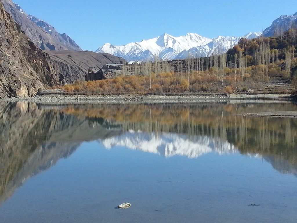
Khalti Lake (Urdu: خلتی جھیل, Khowar: خلتیو چھت) is situated in Gupis-Yasin District, the westernmost part of the Gilgit–Baltistan region and northernmost territory of Pakistan. This lake is an important source of fresh water and has a stock of trout. A PTDC motel is situated nearby with a view of the lake. The water is extremely cold which flows directly from surrounding glaciers. The lake usually freezes in winter season and people can easily walk on it. Khalti Lake is located in Khalti Village of Gupis-Yasin District (Gilgit-Baltistan), Pakistan at about 2,217 metres (7,274 ft) above sea level. The lake is known for its habitat of trout fish. The lake is in a bend of the Ghizer River near the village of Khalti. Khalti Lake is known for its stock of trout. Originally, the trout was put into the River Ghizer near Golaghmuli Village. Those fishes increased in number and reached almost every part of Gupis Valley.
We use GPS information embedded into the photo when it is available.
3D mountains overlay
Adjust mountain panorama to perfectly match your photos because recorded by camera photo position might be imprecise.
Move tool
Rotate tool
Zoom
More customization
Choose which peak labels should make into the final photo and what photo title should be.
Next
Photo Location
Satellitte
Flat map
Relief map
Latitude
Longitude
Altitude
OR
Latitude
°'''
Longitude
°'''
Apply
Register Peak
Peak Name
Latitude
Longitude
Altitude
Register
Teleport
PeakVisor
This 3D model of Sagarmatha National Park in Nepal was made using the PeakVisor app topographic data. The mobile app features higher precision models worldwide, more topographic details, and works offline. Download PeakVisor maps today.
Download OBJ model
PeakVisor
The download should start shortly. If you find it useful please consider supporting the PeakVisor app.
PeakVisor for iOS and Android
Be a superhero of outdoor navigation with state-of-the-art 3D maps and mountain identification in the palm of your hand!