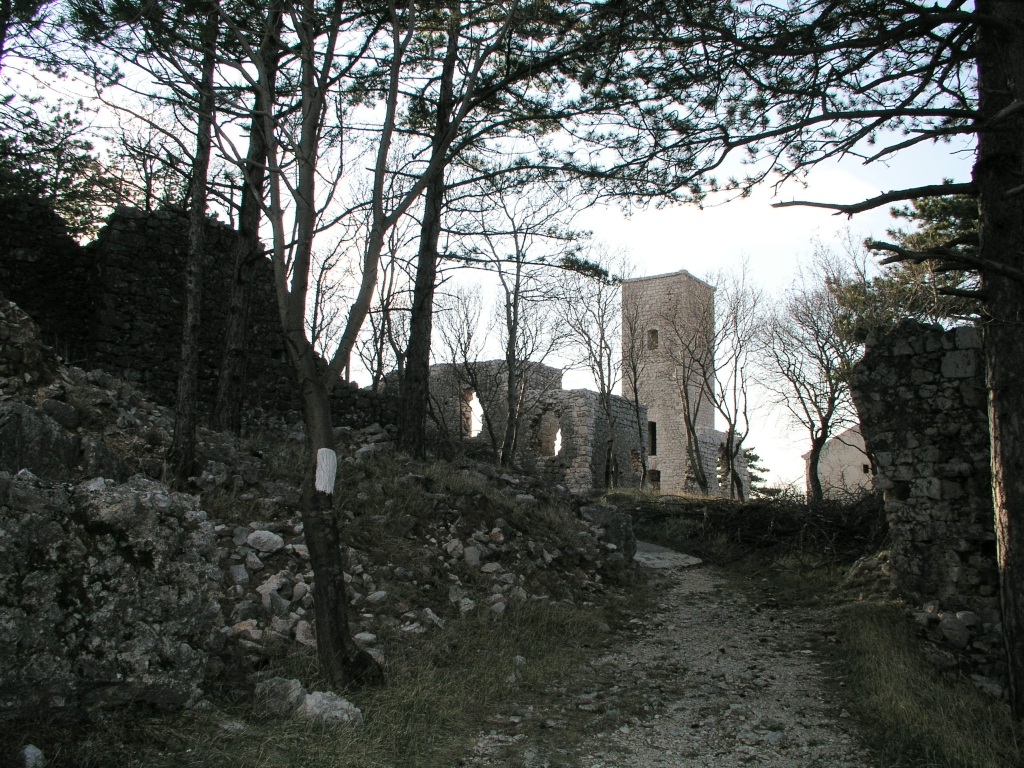
Hreljin Castle (Croatian: Gradina Hreljin) is a fortress and castle near Hreljin, Croatia. It is located in the western part of Vinodol, in the hill above Bakarac, which served as its seaport. Hreljin is first mentioned in historical sources in 1225, when the Frankopan noblemen received it as a gift from the Croatian-Hungarian king Andrew II. It is one of the nine towns that signed the Vinodol Codex, one of the oldest Slavic codes, in 1288. After the Frankopans, it was owned by another noblemen family, the Zrinskis, from 1550 until the execution of Zrinskis and Frankopans in 1671. When Bakar was declared a Royal free city in 1778, Hreljin was under its rule, but already decaying. The last inhabitants were three priests who abandoned it in 1790. The old town of Hreljin was surrounded by defensive walls, which had two towers and two gates. The castle, probably the oldest part of the fortified settlement, was at the highest point of the hill, facing the Bakar Bay. A single-nave church of St. George was in the center of the settlement and had a bell tower attached to it. Next to the ruins of the church stands the Chapel of the Blessed Virgin Mary, dedicated in 1701.
We use GPS information embedded into the photo when it is available.
3D mountains overlay
Adjust mountain panorama to perfectly match your photos because recorded by camera photo position might be imprecise.
Move tool
Rotate tool
Zoom
More customization
Choose which peak labels should make into the final photo and what photo title should be.
Next
Photo Location
Satellitte
Flat map
Relief map
Latitude
Longitude
Altitude
OR
Latitude
°'''
Longitude
°'''
Apply
Register Peak
Peak Name
Latitude
Longitude
Altitude
Register
Teleport
PeakVisor
This 3D model of Sagarmatha National Park in Nepal was made using the PeakVisor app topographic data. The mobile app features higher precision models worldwide, more topographic details, and works offline. Download PeakVisor maps today.
Download OBJ model
PeakVisor
The download should start shortly. If you find it useful please consider supporting the PeakVisor app.
PeakVisor for iOS and Android
Be a superhero of outdoor navigation with state-of-the-art 3D maps and mountain identification in the palm of your hand!