Scan the QR code and open PeakVisor on your phone
Primorje-Gorski Kotar is one of 21 counties of Croatia in the north of the Balkan Peninsula in southern Europe. The two main features of Primorje-Gorski Kotar mountains are several ranges of the Dinaric Alps, which are the main ones in the country. For this reason, they are called "Croatian Switzerland". The second feature is the Kvarner Gulf of the Adriatic Sea with numerous islands, including the two largest in Croatia, forming a significant part of the picturesque Croatian archipelago. In total there are 784 named mountains in Primorje-Gorski Kotar County. Kula (1534 m / 5033 ft) is the highest point. The most prominent mountain is Vojak (1401 m / 4596 ft).
The name of the country, consisting of three words, translates into English as "Seaside-Mountainous District" and refers to its two main natural features: the Adriatic Sea with islands and the foothills of the Dinaric Alps. The name of the region in Croatian language is Primorsko-Goranska županija.
In terms of administrative geography Primorje-Gorski Kotar is located in north-western Croatia, one of the main among 10 countries belonging to the Balkans region, which is the peninsula in southern Europe (others: Montenegro, Albania, Greece… and parts of Turkey).
It is one of the 21 counties of Croatia, including the capital city Zagreb in the namesake country, which borders Istria County in the west, Karlovac County in the north, and Lika-Senj County and Zadar County in the south. On the northern borders is Slovenia, another Balkans state.
The county is part of the larger Croatia Proper, which extends further to the northeast. It is one of the four main historical regions of the country, along with Istria, Dalmatia, and Slavonia.
Internally, the county is divided into 26 municipalities, the largest of which is Rijeka, located on the coast, exactly midway between the islands and the mountains.
The easiest and fastest way to reach Rijeka by land is from the Croatian capital Zagreb, the Slovenian capital Ljubljana, or the nearest major Italian city Trieste. The distance is 70 to 170 km (43 to 106 mi) or 1:30 to 2 hours by car, depending on the city.
If traveling by public transport: There is also a train from Zagreb to Rijeka, and from Italy, via Slovenia, you can get here on the pan-European low-cost bus FlixBus.
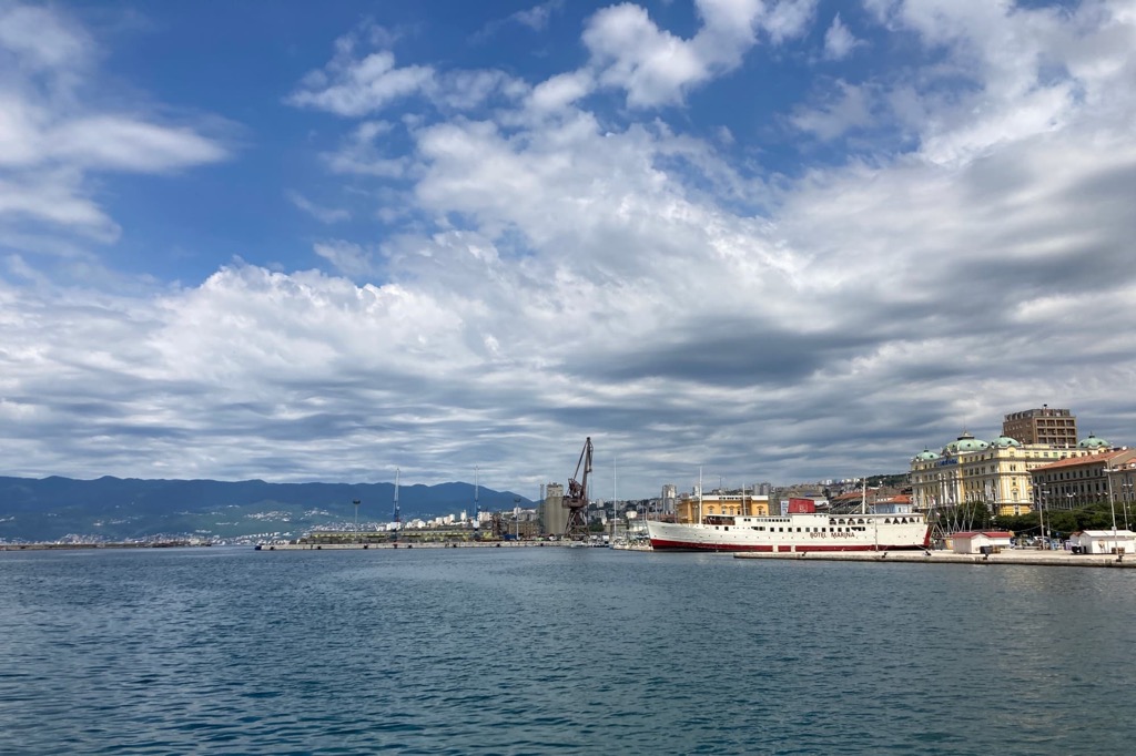
Another option is to come to Croatia by sea from neighboring countries. Kvarner Gulf is more than 100 m (328 ft) deep, which has made Rijeka one of the main ports not only in Croatia but in the entire Adriatic Sea. For example, the headquarters of Jadrolinija, Croatia’s main shipping company, which operates more than 50 car and passenger ferries and cruise ships, is located here.
The landscape of Primorje-Gorski Kotar county has five main features: Gorski Kotar, Rječina River, Croatian Littoral, Kvarner Gulf, and Istria Peninsula. I will briefly describe each of them:
Gorski Kotar is the main mountainous region of Croatia, which occupies at least half of the territory of the country. This is a series of relatively low mountains, which begin as hills of 200 m (656 ft) right in the capital city of Rijeka and stretch northeast reaching a height of 1534 m (5033 ft) on top of Kula. The mountainous region is also a natural boundary between the flat areas of Croatia Proper and the sea coast.
The Rječina River is the main river in the county. It takes its source in Kičej Hill (606 m / 1988 ft) in Gorski Kotar and flows into the Adriatic Sea through the center of Rijeka, literally dividing it into two parts. Because of this, it is one of the natural symbols of the city and the whole region. In fact, the city got its slightly modified name from it, which means “River”. The Rječina is 18 km (11 mi) long, with an average width of 9 to 16 m (30 to 52 ft).
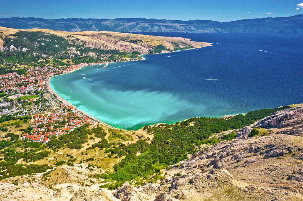
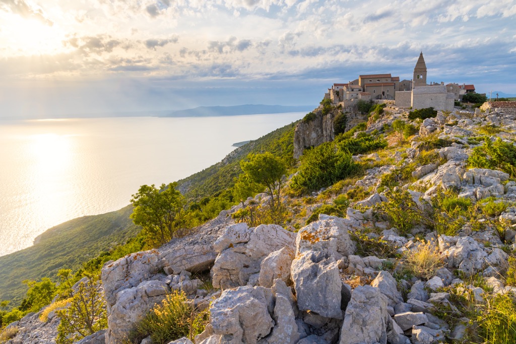
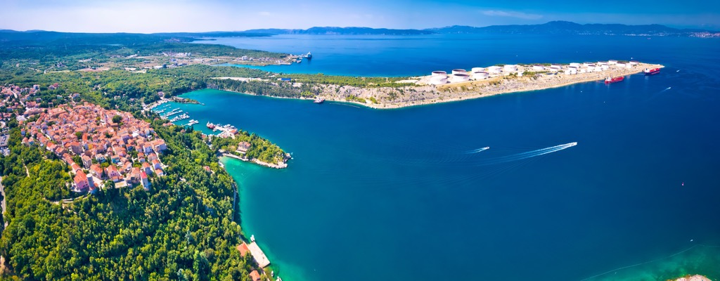
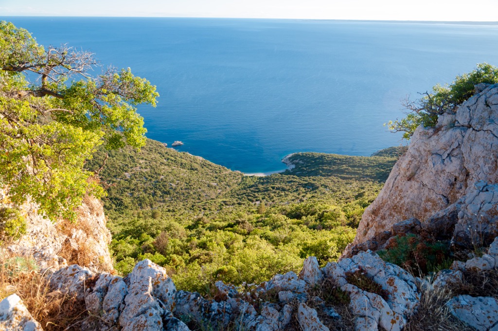
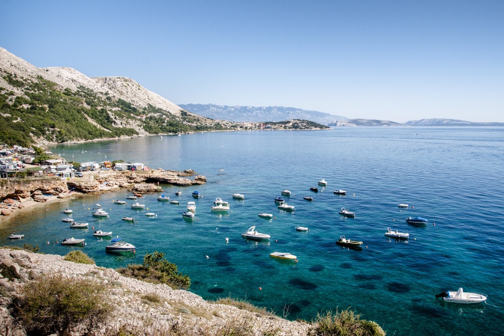
The Croatian Littoral is a long coastal strip of the Adriatic Sea between the Kvarner Gulf and Gorski Kotar. The word Primorje in the name of the county refers to it. It also encompasses the northern part of the Dalmatia region and the island of Krk, one of the two largest in this part of the Croatian Archipelago. The word "Littoral" itself refers to the complex and long history of the region, which has changed many owners: from the Illyrians peoples, a tribe who originally inhabited these territories to the modern Croats, through the Roman Empire, the Lombards, Austria, and Yugoslavia.
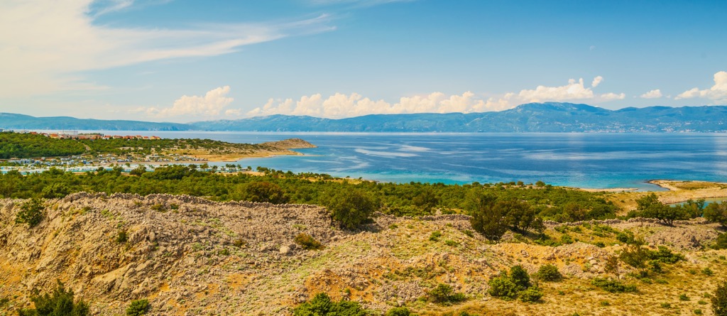
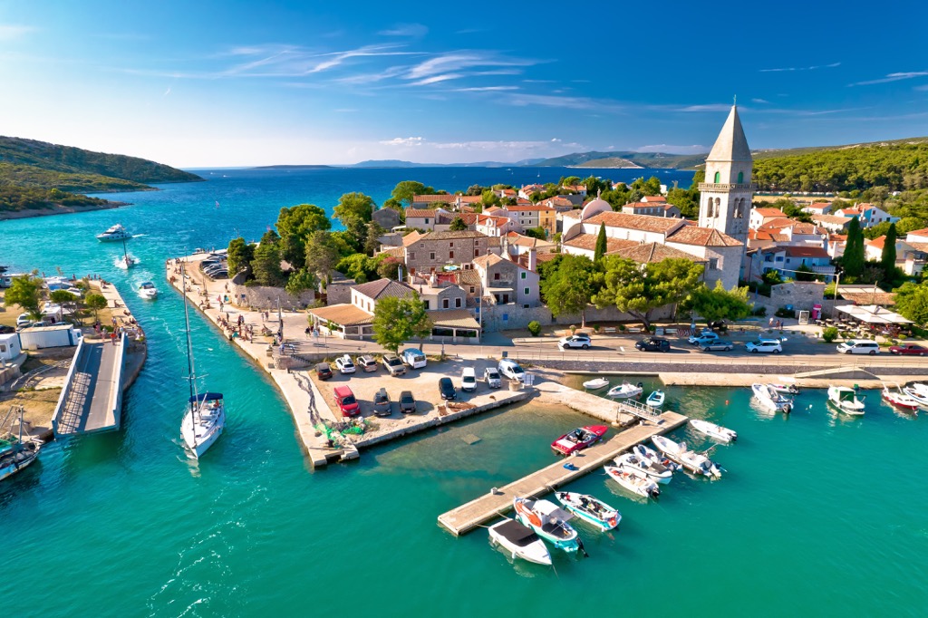
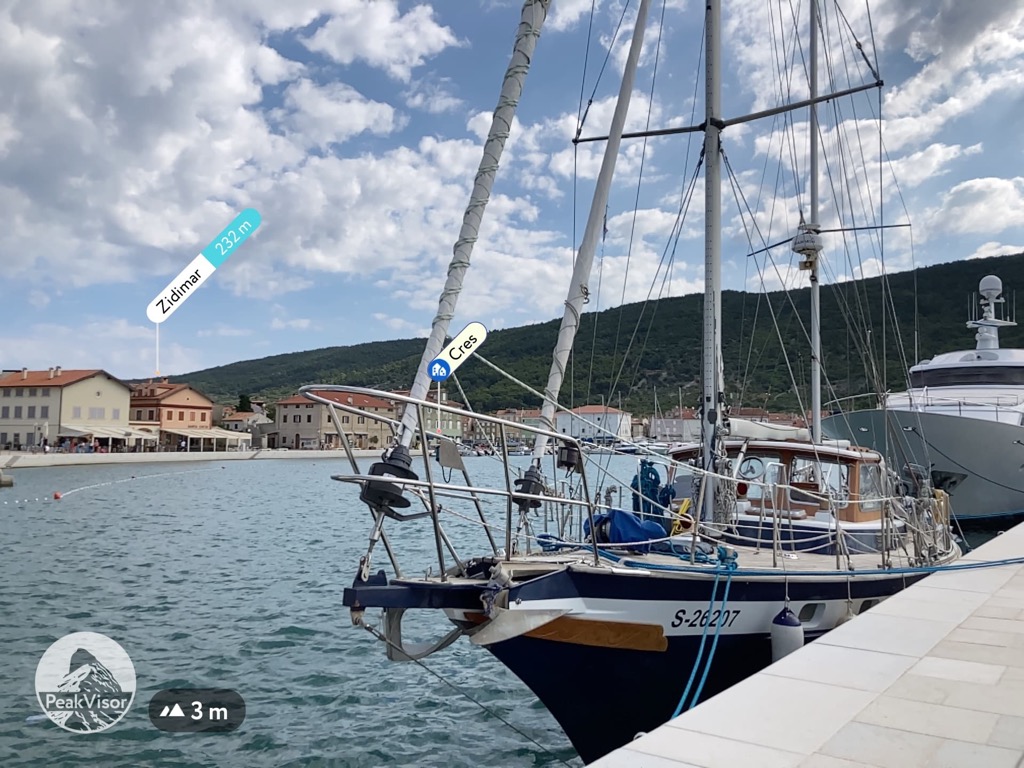
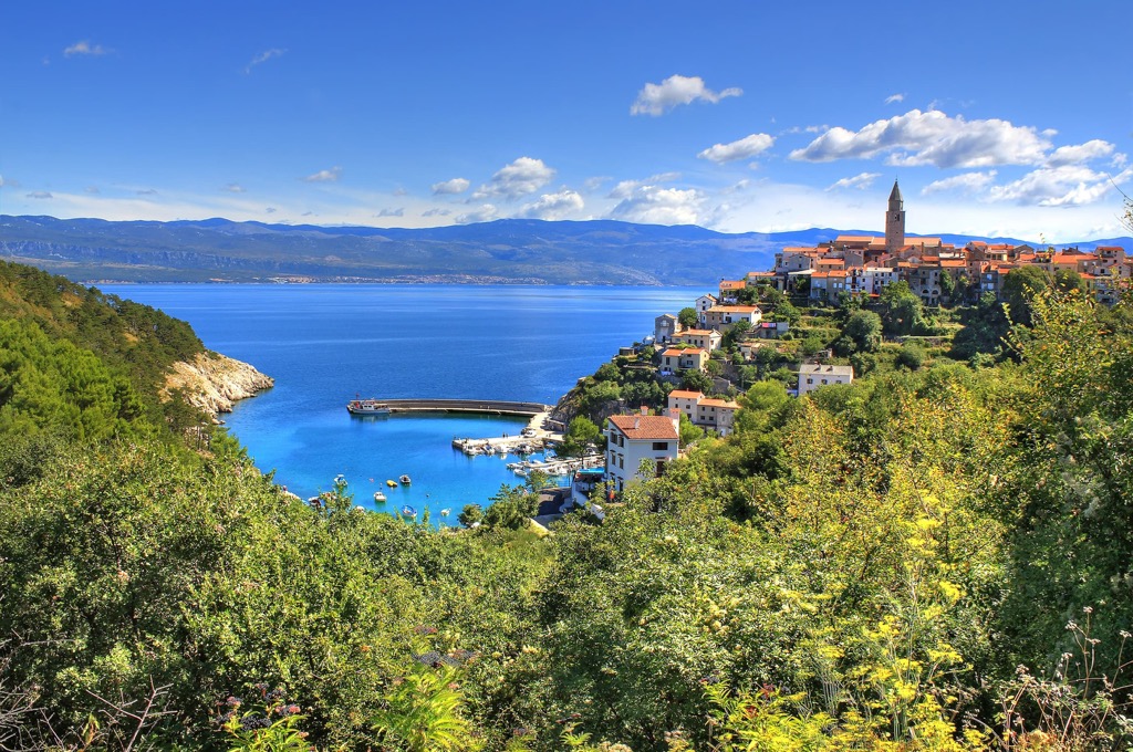
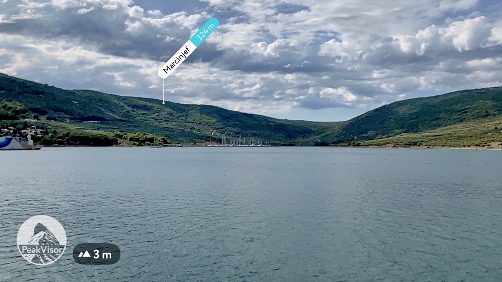
Kvarner Gulf is a bay of the Adriatic Sea between the Croatian Littoral and the Istria Peninsula. It would not be so famous without more than a dozen picturesque rocky islands and islets, including the two largest in Croatia—Cres, and Krk with an equal area of 405 sq km (156 sq mi). The three next largest islands are Pag, Rab, and Lošinj. Krk is connected to the mainland by a road bridge, but to get to Cres you need to take a ferry, from where you can return to Rijeka by direct ferry, making a small loop around the bay, as I did during my trip to the county in July 2022.
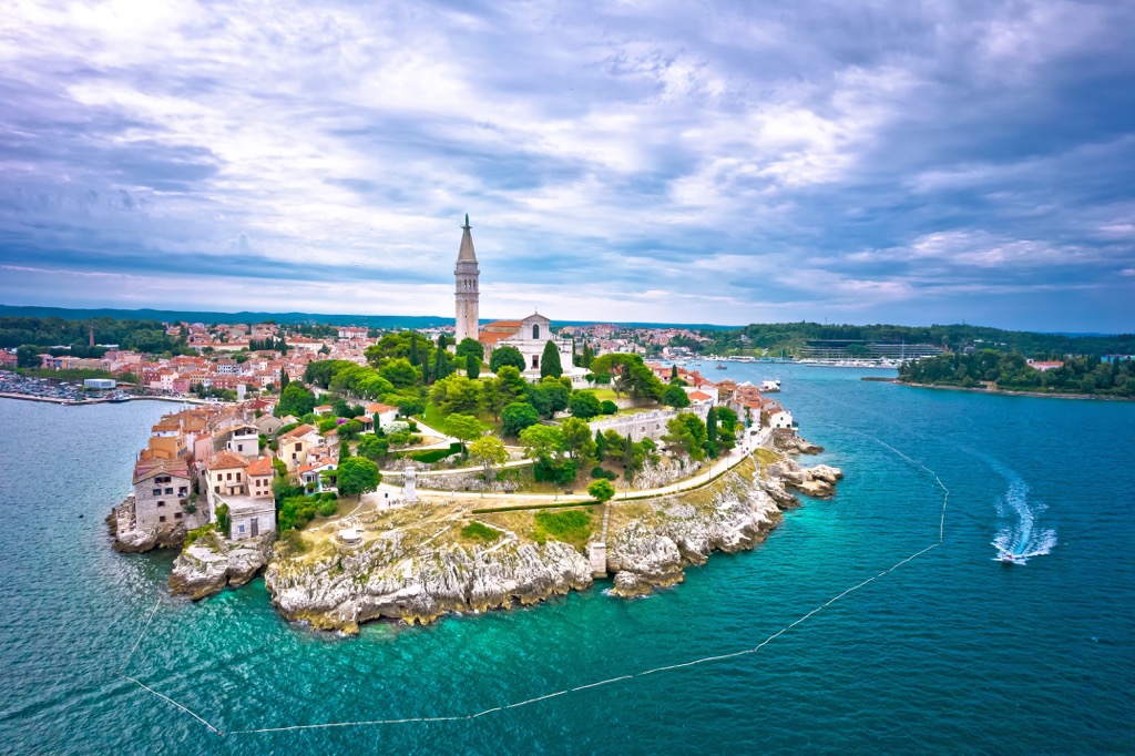
The Istria Peninsula is the largest peninsula of the entire Adriatic Sea and is immediately apparent on the map, located between Venice and Zagreb. It coincides with one of the four main regions of the country. Primorje-Gorski Kotar also occupies a small part of the peninsula on its eastern borders. Like other parts of the country, this is also a mountainous area, which forms an integral part of the landscape of Primorje-Gorski Kotar and the city of Rijeka as the previous four features.
The mountains of the Primorje-Gorski Kotar county belong to the Dinaric Alps, one of many large mountain ranges in Europe. In the territory of Croatia, it stretches along the entire coast of the country, capturing its interior, and all the islands of the Croatian archipelago, which are also part of this mountain system.
Within the Primorje-Gorski Kotar county can be distinguished six mountain ranges and areas of smaller size, including some notable peaks:
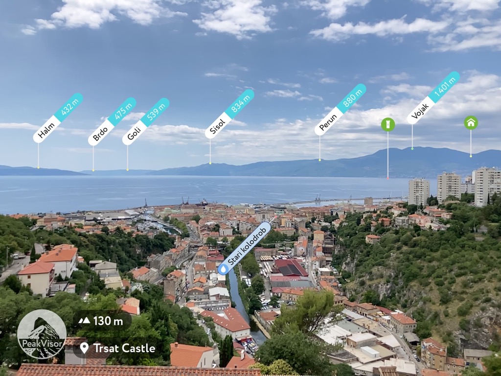
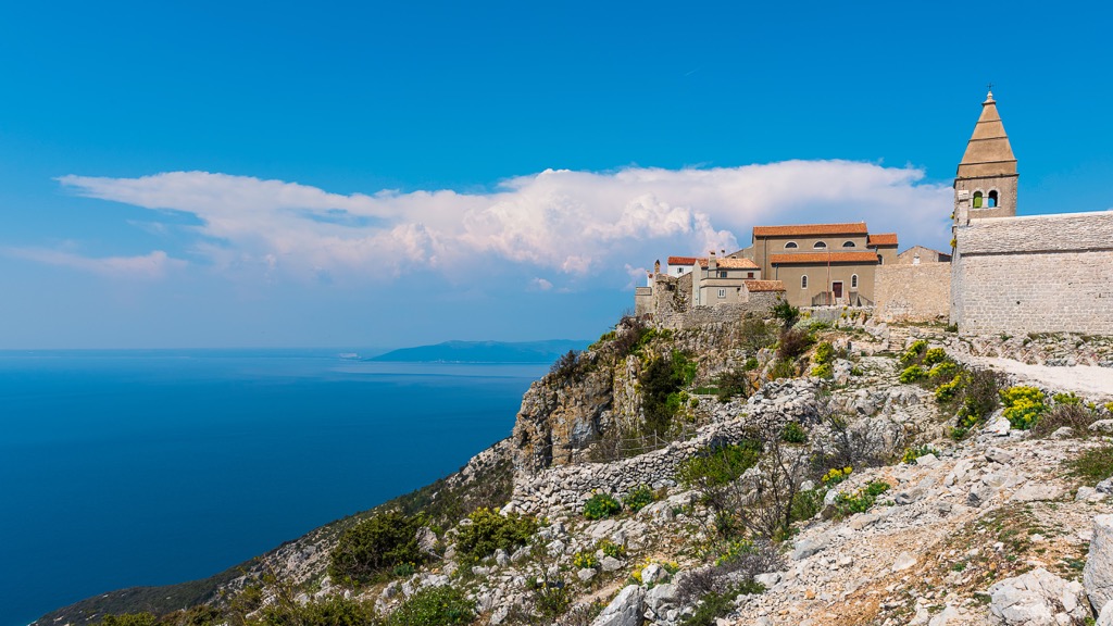
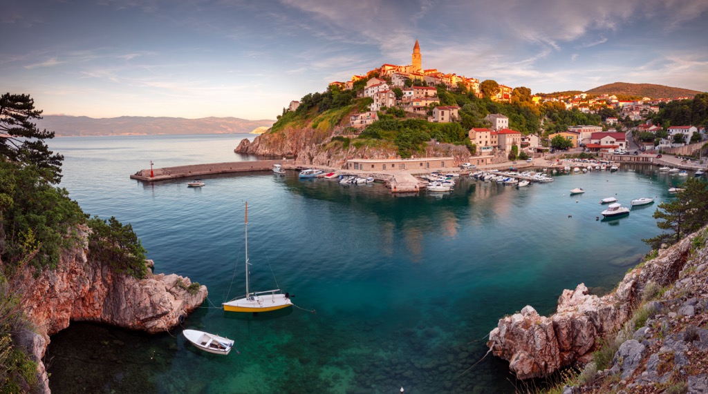
Numerous hills of the Croatian Littoral that begin immediately on the Adriatic coast are the first. The most famous of them is Trsat Hill (161 m / 528 ft)—the highest in the center of Rijeka, on which its main historical and cultural landmark, Trsat Castle, is located. Behind it, there is the Old Town of Rijeka with the same name—Trsat, which, over time, gave way to the lower town.
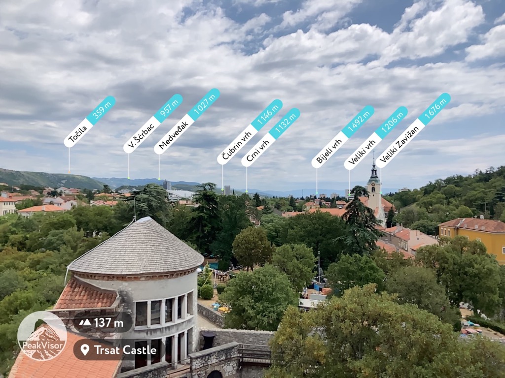
The castle as well as the entire Old Town is notable because it was the home of the Frankopans, the main noble family of Croatia, who were closely involved in life in this part of the Balkan Peninsula for six long centuries from the 11th to the 17th. Today the castle is an open free cultural area with a cafe (not a boring museum as it could be) that I recommend visiting. The castle walls offer magnificent views of the city center and the sea on one side, and the Gorski Kotar peaks on the other: Medvedak (1027 m / 3369 ft), Cubrin vth (1146 m / 3759 ft), Veliki Zavizan (1676 m / 5498 ft), and others.
The long Trsat Stairs of the same name lead to the castle—part of an excellent walking route for a few hours, which is a must-do in the city.
Velika Kapela is the second and the main mainland mountain range of the country, which occupies most of its eastern part. Within it you can distinguish three more neighboring subranges:
Risnjak is the third important mountain range of the county. It is located in the west of the region in the interior of Gorski Kotar. Its highest peak with the same name, Risnjak, or Veliki Risnjak, is 1528 m (5013 ft), which also makes it the second highest after Kula in Bjelolaisisa. Here is also located Snježnik (1505 m / 4937 ft) of the namesake massif, closing the top 3 highest mountains in the region above 1500 m (4921 ft).
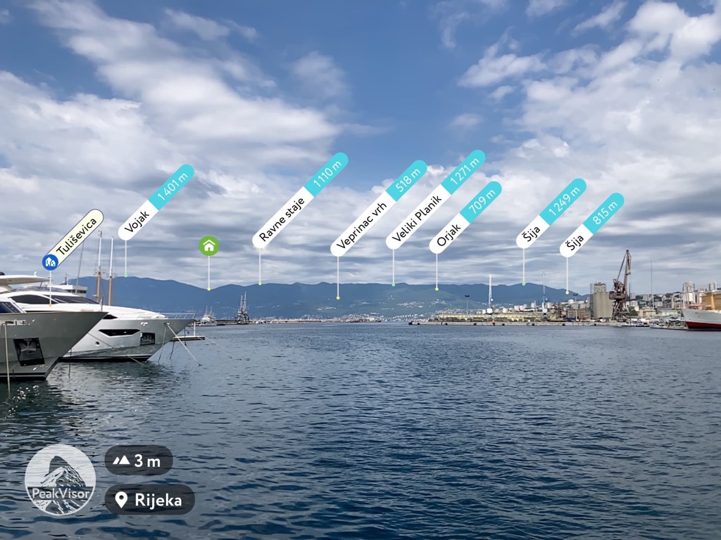
Učka Range and Ćićarija Range are the fourth and fifth on the eastern side of the Istrian Peninsula. The first is 20 km (12 mi) long, the second is twice longer, stretching for 45 km (27.9 mi) from the Bay of Trieste to Rijeka. These are also the largest mountain ranges of the entire peninsula. The highest peaks of both ranges—Vojak (1396 m / 4580 ft) and Veliki Planik (1272 m / 4173 ft)—are perfectly visible from Trsat Hill, as well as from the port of Rijeka. The first is also the most prominent in Primorje-Gorski Kotar.
The rocky islands with rugged coastlines of Kvarner Gulf is the sixth main mountainous area of the Primorje-Gorski Kotar. They are also covered by peaks from a few dozen to more than 500 m (1640 ft). Among the highest are Orline (604 m / 1981 ft) on Cres, Obzova (569 m / 1866 ft) on Krk, and Kamenjak (408 m / 1338 ft) on Rab. You can also see many of these mountains from Rijeka hills.
The bottom line: wherever you go in the region, you'll find mountains and great views on them (as well as on the sea and the cities), thanks to the region's relatively small size and the many natural lookouts formed by its varied topography.
Due to their relatively low altitude, the Primorje-Gorski Kotar mountains are notable for their accessibility. So in all the aforementioned ranges and regions you will find dozens of marked trails of various lengths and levels of difficulty, many of which lead to the peaks.
At the same time, they represent a rich ecological value with many unique and rare species of flora and fauna. About 67% of the county is covered by forest, so it is also called the “Green Lungs of Croatia”. The Gorski Kotar mountains are home to large Alpine animals such as bear, lynx, deer, and others. You can learn more about the nature of the region at the Natural History Museum Rijeka.
The main areas for hiking in Primorje-Gorski Kotar are two of the eight national parks of Croatia: Risnjak National Park (Nacionalni park Risnjak) around the mountain range of the same name in the interior of the region and Učka Nature Park (Park Prirode Učka)—also around the mountain of the same name on the Istria Peninsula. The first, among other things, is known for the fact that in the park begins the Kupa River—one of the longest and largest of the country.
Klek is also a protected nature reserve. The shortest and most common mountain trail to Klek begins in Bjelsko, a village of Musulin Potok municipality at the western foot of the mountain.
The same can be said about White and Samarian Rocks. The most suitable access to them is along the Beg Trail from Mrkopalj and Tuk villages.
On the islands of the archipelago, starting with the two largest, Cres and Krk, it is also harder to find a place without trails than the other way around.
For example, on Cres, I recommend you to take a non-touristy trail from the main town of an island of the same name to the left side of its small picturesque bay. It is covered with pine forest and has lots of wild beaches with not many people. From there you can make a loop through extensive olive groves back to the town to buy a bottle of olive oil from these trees. On the right side of town is a campsite and there are more people there but there are also some trails.
On the islands, you can also find some protected natural areas, in particular Fojiška-Predošcica Nature Reserve on the same Cres, and famous beaches and diving spots like Mali Bok—again on Cres, and “Reef Mala Glavina” in Zavratnica Bay on Krk.
Two of the most famous long hiking trails in Croatia, crossing Primorje-Gorski Kotar are:
The largest of the 11 ski resorts in Croatia are located in Primorje-Gorski Kotar, as well as in the capital Zagreb.
In first place is Platak with 5.5 km (3.4 mi) of slopes and 4 ski lifts in the north of the county. Next comes Sljeme (Medvednica) with 4 km (2.4 mi) of slopes and 4 ski lifts near the Croatian capital. Then we will again return to Gorski Kotar, where there are two more small resorts: Čelimbaša with 2.8 km (1.7 mi) of slopes and 1 ski lift, and Rudnik Tršće with 1.3 km (0.8 mi) of slopes and 1 ski lift.
Learn more about ski resorts in Europe and around the world at World Mountains Lifts on PeakVisor.
Before or after hiking in the mountains and islands of Primorje-Gorski Kotar, visit the official tourist office of the region, located in its capital Rijeka, to learn more information on the spot, get a map, etc.
Rijeka Tourist Information Center
Korzo, 14, Rijeka, Croatia
+38551335882
The official tourist site of the region is Kvarner.hr. There is also its section on all-Croatia's site: Croatia.hr/en-gb/regions/kvarner. You can also find useful sites of two main islands of the region: Visitcres.hr and Visitkrk.com.
As elsewhere in Europe, while hiking in the Primorje-Gorski Kotar mountains you can use three main types of accommodation: paid serviced mountain huts with meals, showers, and some other services; self-catering free huts, shelters and bivouacs, and tents, which can definitely be set up in campsites (check the local rules about wild camping).
Before and after the hike in theory you can find any type of accommodation in the cities of the region. In reality, it is not. For example, in Rijeka in July I couldn't find any inexpensive hotels (in general, there don't seem to be many at all) and I stayed at Apartment Dolac. They have several flats in old partially uninhabited houses, but the accommodation itself is new and comfortable with a kitchen.
Rijeka is the main city of Primorje-Gorski Kotar county with a population of 108,622 (2021).
The main architectural and cultural attractions of the city, besides the large port, are many buildings and objects concentrated on its main shopping street Korzo and in other part of the relatively small town center built in very different eras and styles, including The Croatian National Theatre, Old Gate or Roman Arch, Rijeka Cathedral, Palace Modello, art installation "Balthazartown Beach", University of Rijeka, Centar Zamet Sports Hall, among others.
Rijeka International Airport is also located close to the city and is extremely busy during the peak summer months.