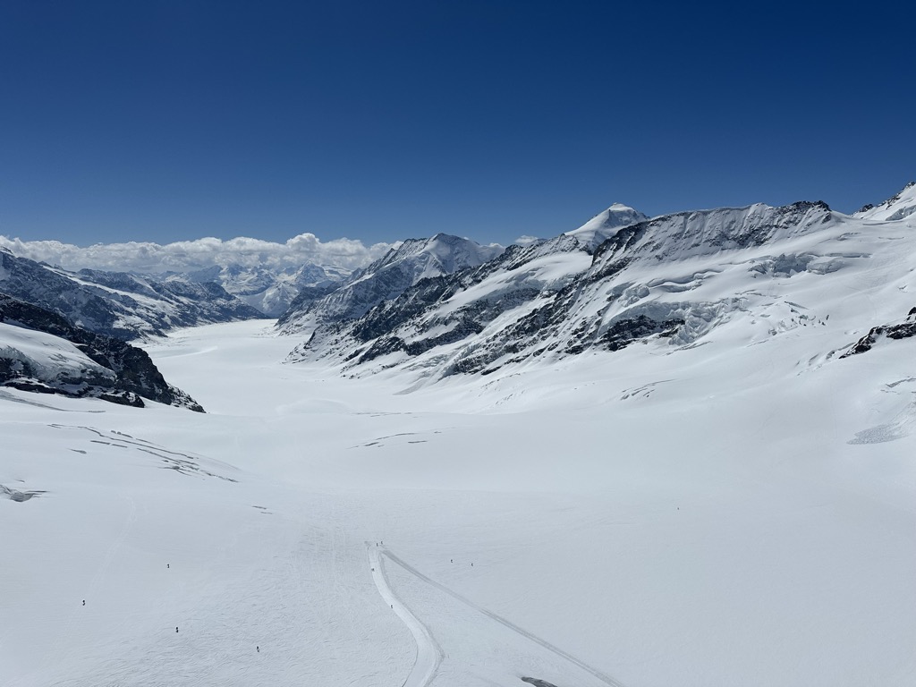
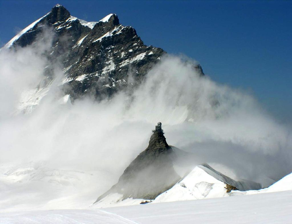
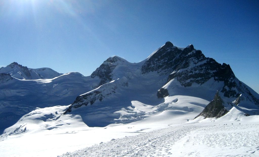
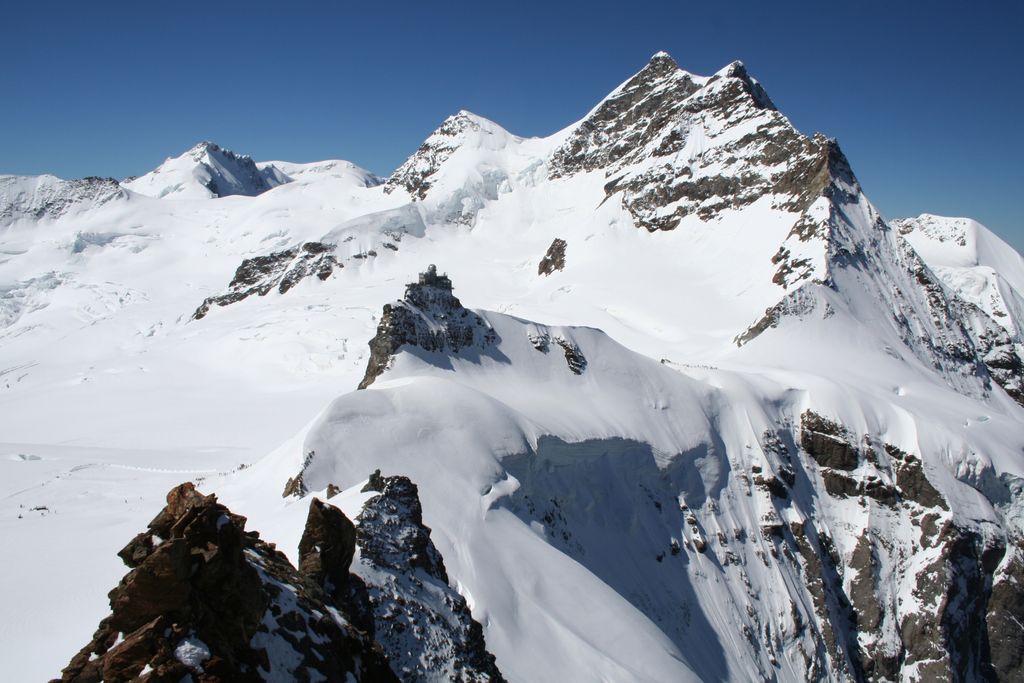
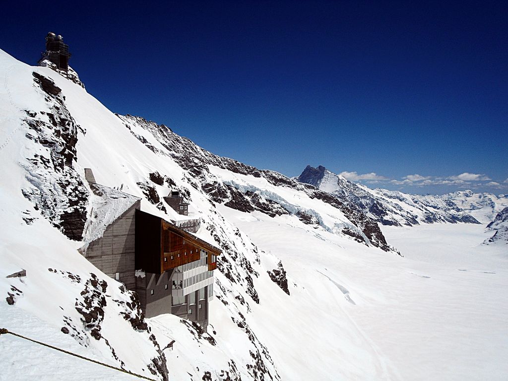
The Jungfraujoch (German: lit. "maiden saddle") is a saddle connecting two major 4000ers of the Bernese Alps: the Jungfrau and the Mönch. It lies at an elevation of 3,463 metres (11,362 ft) above sea level and is directly overlooked by the rocky prominence of the Sphinx. The Jungfraujoch is a glacier saddle, on the upper snows of the Aletsch Glacier, and part of the Jungfrau-Aletsch area, situated on the boundary between the cantons of Bern and Valais, halfway between Interlaken and Fiesch. Since 1912, the Jungfraujoch has been accessible to tourists by the Jungfrau line, a railway from Interlaken and Kleine Scheidegg, running partly underground through a tunnel through the Eiger and Mönch. The Jungfraujoch railway station, at an elevation of 3,454 metres (11,332 ft) is the highest in Europe. It lies east of the saddle, below the Sphinx station, and is connected to the Top of Europe building, which includes several panoramic restaurants, shops, exhibitions, and a post office. Several tunnels lead outside, where secured hiking trails on the crevassed glacier can be followed, in particular to the Mönchsjoch Hut. The normal route to the Jungfrau and Mönch starts from there. The Sphinx Observatory, one of the highest astronomical observatories in the world, provides an additional viewing platform at a height of 3,572 metres (11,719 ft), the second-highest in Switzerland. It can be reached by an elevator from the Jungfraujoch. The observatory houses one of the Global Atmosphere Watch's atmospheric research stations. The Jungfraujoch radio relay station, which is not accessible to the public, is installed west of the Jungfraujoch, on the Jungfrau ridge. It is Europe's highest radio relay station.
We use GPS information embedded into the photo when it is available.
3D mountains overlay
Adjust mountain panorama to perfectly match your photos because recorded by camera photo position might be imprecise.
Move tool
Rotate tool
Zoom
More customization
Choose which peak labels should make into the final photo and what photo title should be.
Next
Photo Location
Satellitte
Flat map
Relief map
Latitude
Longitude
Altitude
OR
Latitude
°'''
Longitude
°'''
Apply
Register Peak
Peak Name
Latitude
Longitude
Altitude
Register
Teleport
PeakVisor
This 3D model of Sagarmatha National Park in Nepal was made using the PeakVisor app topographic data. The mobile app features higher precision models worldwide, more topographic details, and works offline. Download PeakVisor maps today.
Download OBJ model
PeakVisor
The download should start shortly. If you find it useful please consider supporting the PeakVisor app.
PeakVisor for iOS and Android
Be a superhero of outdoor navigation with state-of-the-art 3D maps and mountain identification in the palm of your hand!