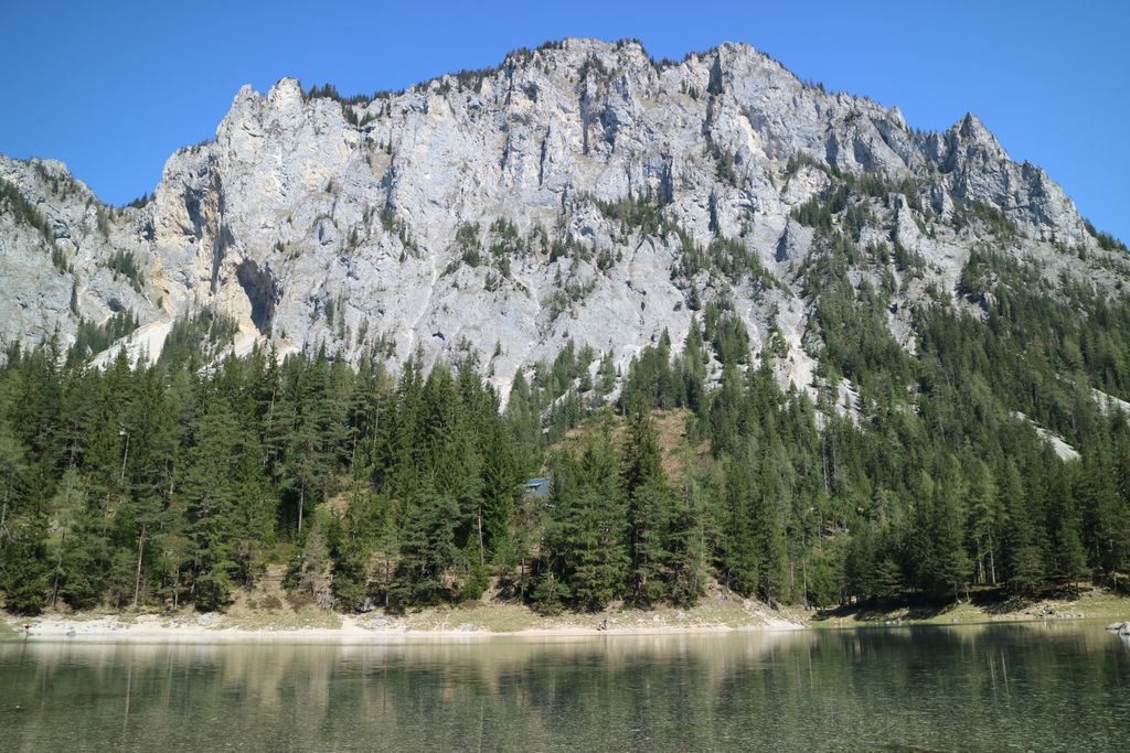
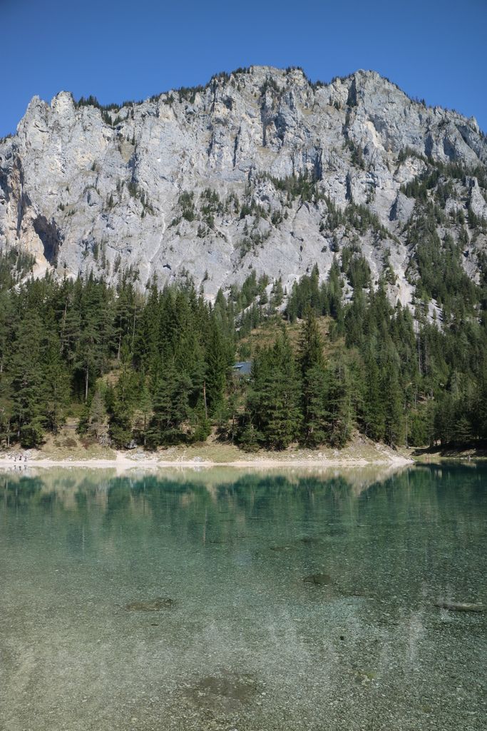
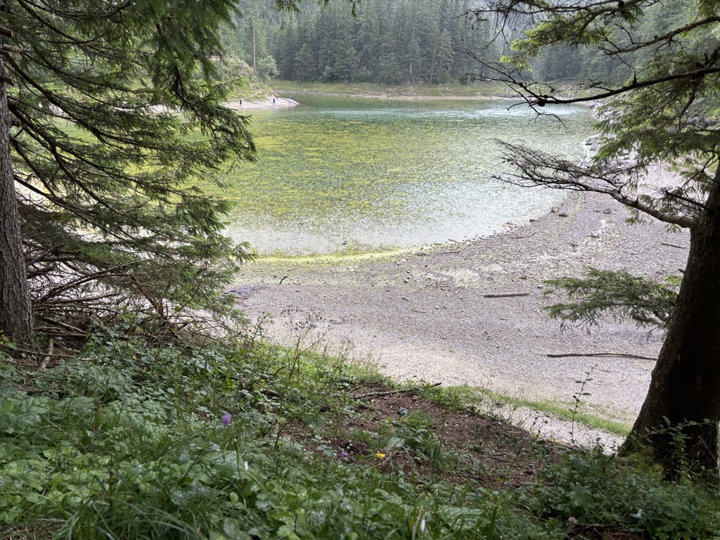
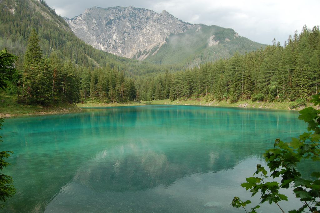
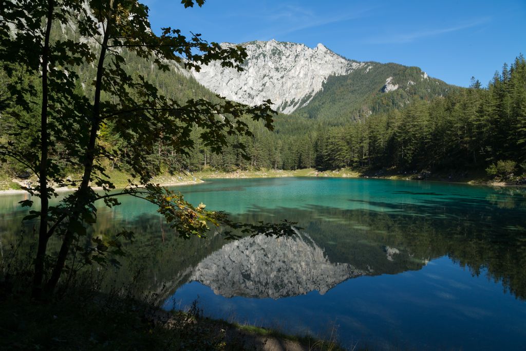
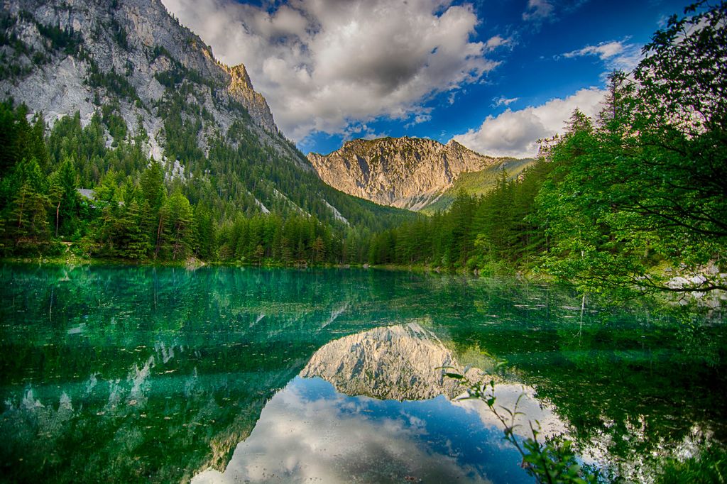
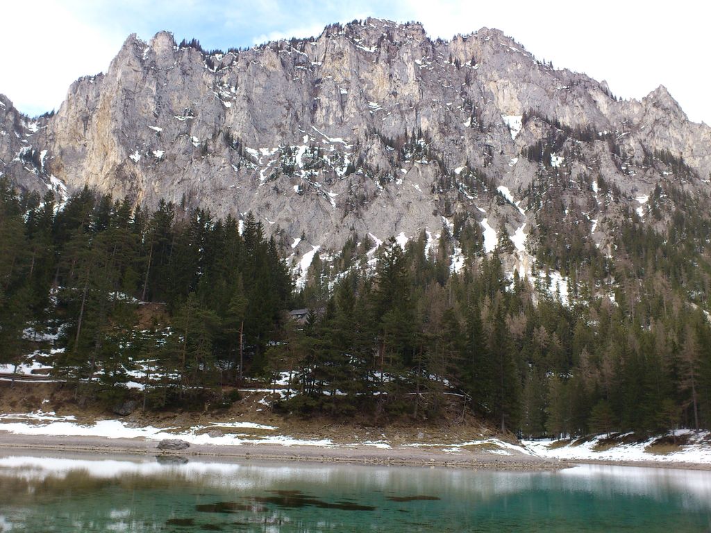
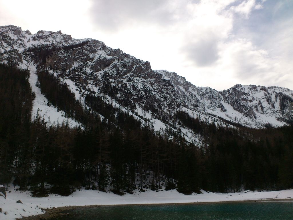
Grüner See (Green Lake) is a lake in Styria, Austria in a village named Tragöß, which is part of the municipality Tragöß-Sankt Katharein. The lake is surrounded by forests and three mountains: Pribitz (1,579 m), Meßnerin (1,835 m) and Trenchtling (Hochturm) (2,081 m), all part of the Hochschwab Mountains. The name "Green Lake" originated because of its emerald-green water. The clean and clear water comes from the snowmelt from the karst mountains and has a temperature of 6–7 °C (43–45 °F). During winter, the lake is only 1–2 m (3–7 ft) deep and the surrounding area is used as a county park. However, in spring, when the temperature rises and snow melts, the basin of land below the mountains fills with water. The lake reaches its maximum depth of around 12 m (39 ft) from mid-May to June and is claimed to look the most beautiful at this time. In July, the water begins to recede. The lake supports a variety of fauna such as snails, water fleas (Daphnia pulex), small crabs, fly larvae, and different species of trout (Salmo). The flora is not abundant because of the rocky bottom of the lake. Furthermore, the lake's depth is variable since its inflow comes from snowmelt. The lake was popular among divers who could observe the green meadows in the edge zone of the lake particularly in June when the water is at its highest. A bridge and a bench could also be found underwater. Furthermore, trails and trees could also be seen underwater. Because of the spike in tourist visits that has occurred and expected damage to this sensitive environment, the use of this lake for all watersports activities has been prohibited since 1 January 2016.
We use GPS information embedded into the photo when it is available.
3D mountains overlay
Adjust mountain panorama to perfectly match your photos because recorded by camera photo position might be imprecise.
Move tool
Rotate tool
Zoom
More customization
Choose which peak labels should make into the final photo and what photo title should be.
Next
Photo Location
Satellitte
Flat map
Relief map
Latitude
Longitude
Altitude
OR
Latitude
°'''
Longitude
°'''
Apply
Register Peak
Peak Name
Latitude
Longitude
Altitude
Register
Teleport
PeakVisor
This 3D model of Sagarmatha National Park in Nepal was made using the PeakVisor app topographic data. The mobile app features higher precision models worldwide, more topographic details, and works offline. Download PeakVisor maps today.
Download OBJ model
PeakVisor
The download should start shortly. If you find it useful please consider supporting the PeakVisor app.
PeakVisor for iOS and Android
Be a superhero of outdoor navigation with state-of-the-art 3D maps and mountain identification in the palm of your hand!


.jpg)
.jpg)