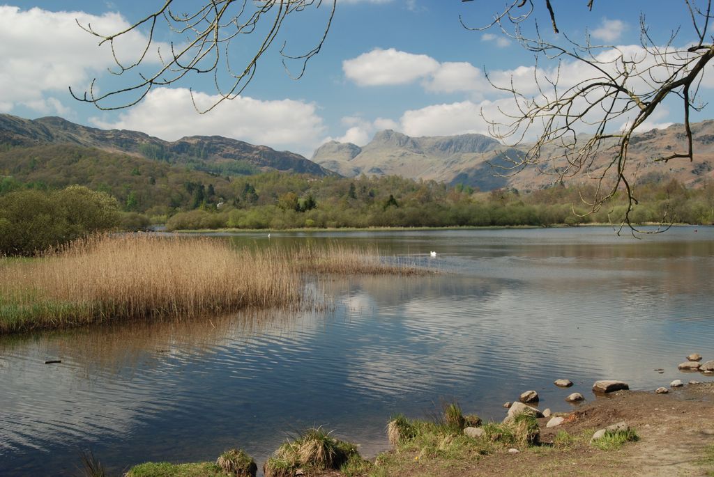
Elter Water is a small lake in the Lake District in North West England, half a mile southeast of the village of the same name. It has a length of 0.62 miles (1.00 km), maximum width of approximately 0.24 miles (0.39 km), a maximum depth of 7 metres (7.7 yd), and an area of 0.16 square kilometres (0.062 sq mi). Its outflow is the River Brathay, which flows south to join Windermere near Ambleside. Windermere is itself drained by the River Leven, which flows into Morecambe Bay. The lake is in the unitary authority of Westmorland and Furness and the ceremonial county of Cumbria. Elter Water forms part of the boundary between the historic counties of Lancashire and Westmorland, and is the northernmost point of the former.
We use GPS information embedded into the photo when it is available.
3D mountains overlay
Adjust mountain panorama to perfectly match your photos because recorded by camera photo position might be imprecise.
Move tool
Rotate tool
Zoom
More customization
Choose which peak labels should make into the final photo and what photo title should be.
Next
Photo Location
Satellitte
Flat map
Relief map
Latitude
Longitude
Altitude
OR
Latitude
°'''
Longitude
°'''
Apply
Register Peak
Peak Name
Latitude
Longitude
Altitude
Register
Teleport
PeakVisor
This 3D model of Sagarmatha National Park in Nepal was made using the PeakVisor app topographic data. The mobile app features higher precision models worldwide, more topographic details, and works offline. Download PeakVisor maps today.
Download OBJ model
PeakVisor
The download should start shortly. If you find it useful please consider supporting the PeakVisor app.
PeakVisor for iOS and Android
Be a superhero of outdoor navigation with state-of-the-art 3D maps and mountain identification in the palm of your hand!