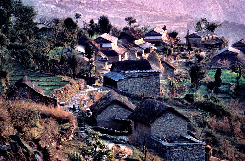
Dhikurpokhari is a suburb and former Village Development Committee in Kaski District in the Gandaki Province of northern-central Nepal. At the 1991 Nepal census, it had a population of 7,392 persons in 1,427 individual households. Dhikurpokhari is surrounded by Machhapuchchhre Rural Municipality on the East, Myagdi district on the West, Manang District on the North and Parbat district, and Pokhara Metropolitan City on the South. It has a total area of 417.74 km2 (161.29 sq mi) and a population of 23,565 individuals, according to Nepal census 2011 (2068 BS). The population density of this Rural Municipality is 56.411/km2 (146.103/sq mi). This Rural Municipality is divided into 8 wards. This rural municipality lies 4528 feet above sea level. The Mid-Hill Highway(Pokhara-Baglung Segment) goes through the Dhikurpokhari. There are views of the Annapurna range. It is the birthplace of current Prime Minister of Nepal, Prachanda.
We use GPS information embedded into the photo when it is available.
3D mountains overlay
Adjust mountain panorama to perfectly match your photos because recorded by camera photo position might be imprecise.
Move tool
Rotate tool
Zoom
More customization
Choose which peak labels should make into the final photo and what photo title should be.
Next
Photo Location
Satellitte
Flat map
Relief map
Latitude
Longitude
Altitude
OR
Latitude
°'''
Longitude
°'''
Apply
Register Peak
Peak Name
Latitude
Longitude
Altitude
Register
Teleport
PeakVisor
This 3D model of Sagarmatha National Park in Nepal was made using the PeakVisor app topographic data. The mobile app features higher precision models worldwide, more topographic details, and works offline. Download PeakVisor maps today.
Download OBJ model
PeakVisor
The download should start shortly. If you find it useful please consider supporting the PeakVisor app.
PeakVisor for iOS and Android
Be a superhero of outdoor navigation with state-of-the-art 3D maps and mountain identification in the palm of your hand!