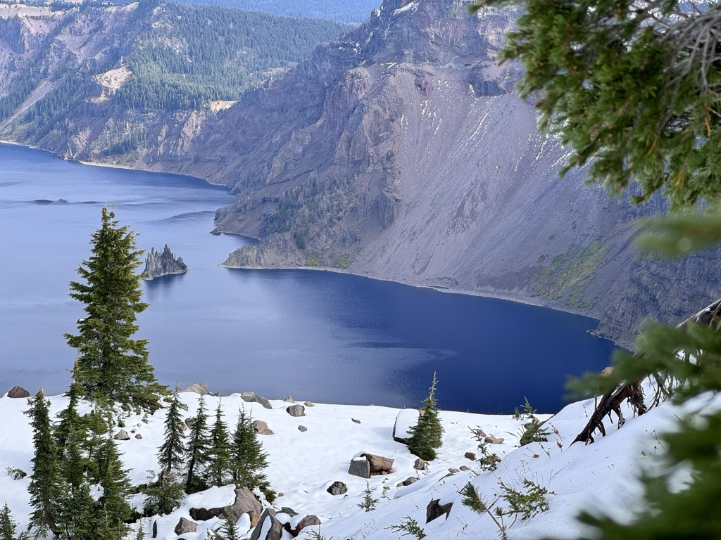
Crater Lake (Klamath: Giiwas) is a volcanic crater lake in south-central Oregon in the Western United States. It is the main feature of Crater Lake National Park and is famous for its deep blue color and water clarity. The lake partly fills a 2,148-foot-deep (655 m) caldera that was formed around 7,700 (± 150) years ago by the collapse of the volcano Mount Mazama. No rivers flow into or out of the lake; the evaporation is compensated for by rain and snowfall at a rate such that the total amount of water is replaced every 250 years. With a depth of 1,949 feet (594 m), the lake is the deepest in the United States. In the world, it ranks tenth for maximum depth, as well as third for mean (average) depth. Crater Lake features two small islands. Wizard Island, located near the western shore of the lake, is a cinder cone about 316 acres (128 hectares) in size. Phantom Ship, a natural rock pillar, is located near the southern shore. Since 2002, one of Oregon's regular-issue license-plate designs has featured Crater Lake and a one-time plate surcharge is used to support the operation of Crater Lake National Park. The commemorative Oregon State Quarter, which was released by the United States Mint in 2005, features an image of Crater Lake on its reverse. The lake and surrounding park areas offer many recreational activities, including hiking, biking, snowshoeing, fishing, and cross-country skiing, and during the summer, campgrounds and lodges at Crater Lake are open to visitors.
We use GPS information embedded into the photo when it is available.
3D mountains overlay
Adjust mountain panorama to perfectly match your photos because recorded by camera photo position might be imprecise.
Move tool
Rotate tool
Zoom
More customization
Choose which peak labels should make into the final photo and what photo title should be.
Next
Photo Location
Satellitte
Flat map
Relief map
Latitude
Longitude
Altitude
OR
Latitude
°'''
Longitude
°'''
Apply
Register Peak
Peak Name
Latitude
Longitude
Altitude
Register
Teleport
PeakVisor
This 3D model of Sagarmatha National Park in Nepal was made using the PeakVisor app topographic data. The mobile app features higher precision models worldwide, more topographic details, and works offline. Download PeakVisor maps today.
Download OBJ model
PeakVisor
The download should start shortly. If you find it useful please consider supporting the PeakVisor app.
PeakVisor for iOS and Android
Be a superhero of outdoor navigation with state-of-the-art 3D maps and mountain identification in the palm of your hand!