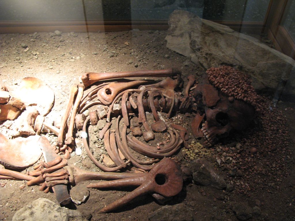
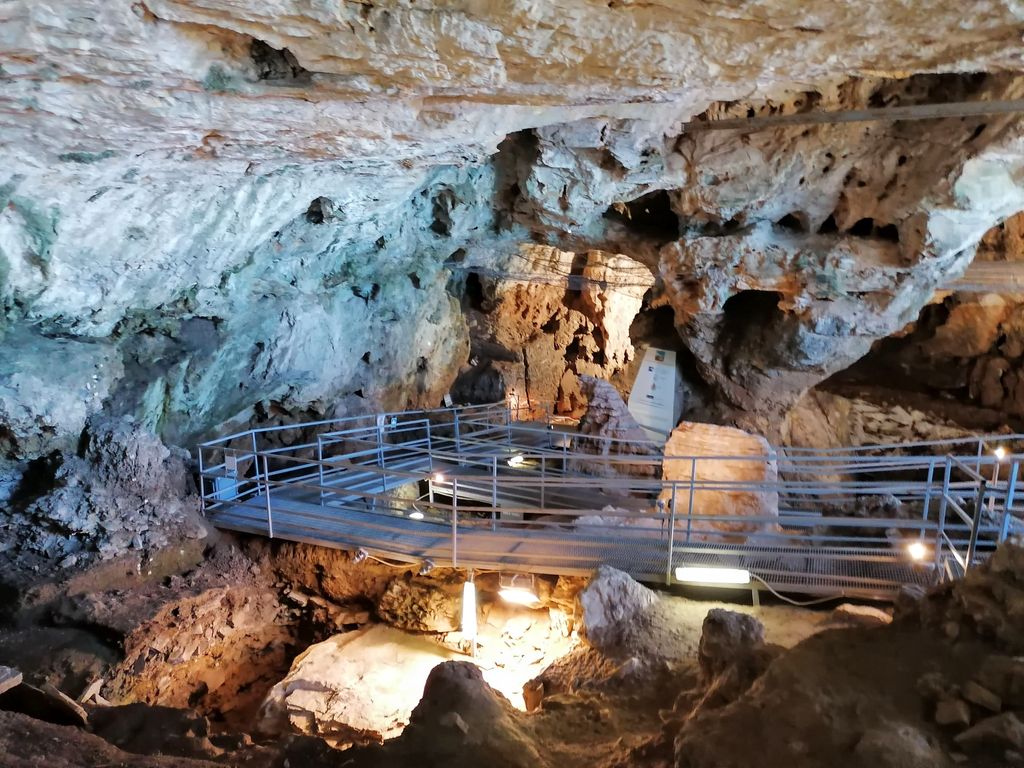
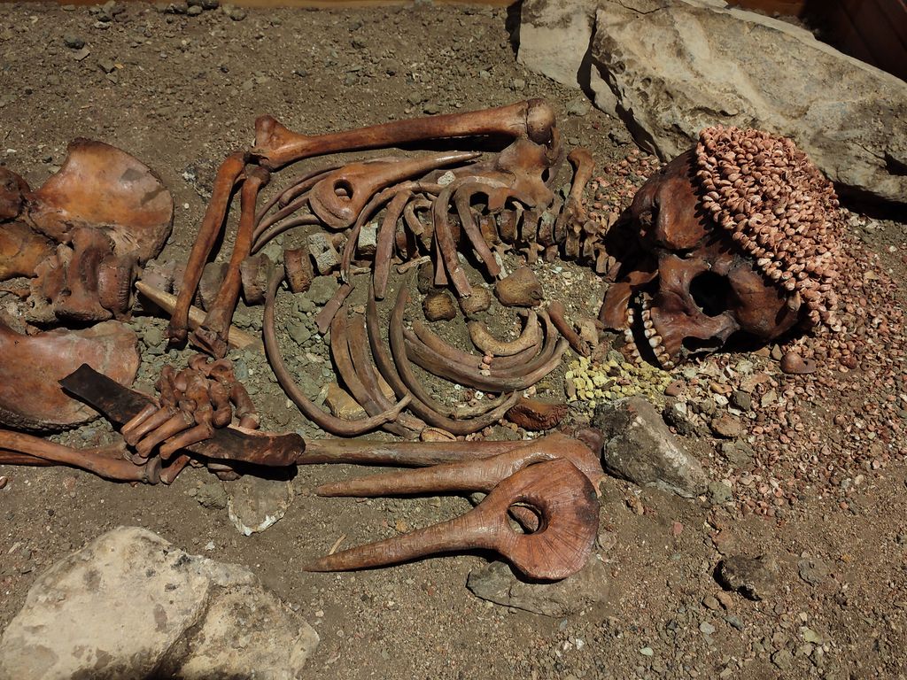
The Arene Candide, (Italian: Caverna delle Arene Candide, Cavern of the White sands) is an archaeological site in Finale Ligure, Liguria, Italy. Its name was derived from the eponymous dune of white (candida) sand (arena) that could be found at the base of the cliff until the 1920s in the Caprazoppa promontory, where the Arene Candide cave is located. The cave is situated at 90 m (300 ft) above sea level on the upper margin of the former Ghigliazza stone quarry and has three wide openings that point towards the sea. Thanks to its position and to those openings the cave is well lit and relatively dry. It can be accessed from above within 30 minutes via a path from Borgio Verezzi.
We use GPS information embedded into the photo when it is available.
3D mountains overlay
Adjust mountain panorama to perfectly match your photos because recorded by camera photo position might be imprecise.
Move tool
Rotate tool
Zoom
More customization
Choose which peak labels should make into the final photo and what photo title should be.
Next
Photo Location
Satellitte
Flat map
Relief map
Latitude
Longitude
Altitude
OR
Latitude
°'''
Longitude
°'''
Apply
Register Peak
Peak Name
Latitude
Longitude
Altitude
Register
Teleport
PeakVisor
This 3D model of Sagarmatha National Park in Nepal was made using the PeakVisor app topographic data. The mobile app features higher precision models worldwide, more topographic details, and works offline. Download PeakVisor maps today.
Download OBJ model
PeakVisor
The download should start shortly. If you find it useful please consider supporting the PeakVisor app.
PeakVisor for iOS and Android
Be a superhero of outdoor navigation with state-of-the-art 3D maps and mountain identification in the palm of your hand!