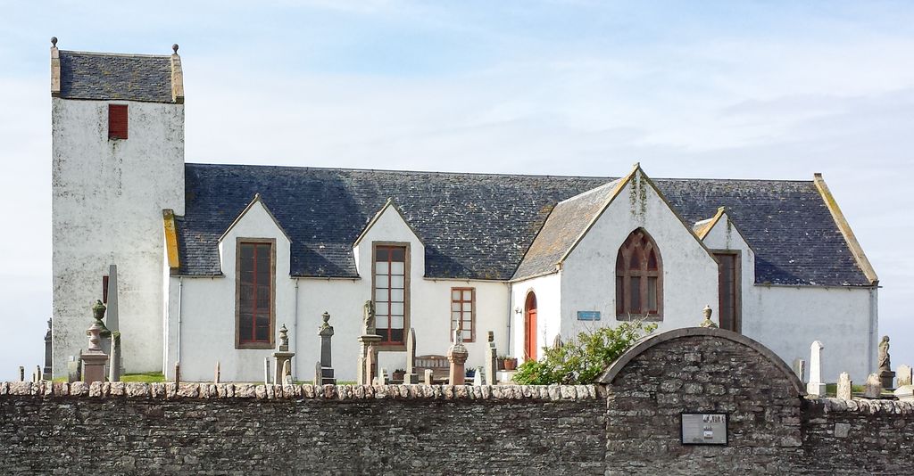
Canisbay is a rural hamlet located about one mile (1.5 kilometres) southwest of Huna and two and a half miles (four kilometres) southwest of John o' Groats in Caithness, Scottish Highlands, and is in the Scottish council area of Highland. It lies on the A836 coast road, which bypasses the hamlet to the north. It is home to Canisbay Primary School, a Village Hall, Medical Practice, and two Churches, one of which was the church used by Charles III. The Church is also the burial place of Jean De Groot, the ferryman after which John o' Groats is named. The Parish of Canisbay includes John o' Groats, Upper and Lower Gills, Huna and Freswick. Canisbay Juniors are the "feeder" team to John o' Groats FC with many of the key first team players having played for the side at one time. They play in the youth development leagues in Caithness where they enter teams at all age groups. It is also home to Canisbay Rifle club, who regularly compete in the Caithness Rifle Leagues. The Canisbay Show is the local agricultural and crafts show held mid-June each year in the park behind the village hall, with the JCB competition, the karate display and mainly the Beer Tent being the big attractions.
Show more
Sun and Moon
Mon
Tue
Wed
Thu
Fri
Sat
Sun
May 2022
Date and time
00:00
06:00
12:00
18:00
Today
--
--
Sunrise
--
Sunset
--
Moonrise
--
Moonset
Phase
🌔 Waxing Gibbous
The perfect light time for beautiful photos:
--
Sunrise
--
Sunset
PeakVisor app
Get the app on your smartphone
New Panorama Tools
Trace location on the map
Measure distances
All the instruments are available in the context menu as well.
We use GPS information embedded into the photo when it is available.
3D mountains overlay
Adjust mountain panorama to perfectly match your photos because recorded by camera photo position might be imprecise.
Move tool
Rotate tool
Zoom
More customization
Choose which peak labels should make into the final photo and what photo title should be.
Next
Photo Location
Satellitte
Flat map
Relief map
Latitude
Longitude
Altitude
OR
Latitude
°'''
Longitude
°'''
Apply
Register Peak
Peak Name
Latitude
Longitude
Altitude
Register
Teleport
PeakVisor
This 3D model of Sagarmatha National Park in Nepal was made using the PeakVisor app topographic data. The mobile app features higher precision models worldwide, more topographic details, and works offline. Download PeakVisor maps today.
Download OBJ model
PeakVisor
The download should start shortly. If you find it useful please consider supporting the PeakVisor app.
PeakVisor for iOS and Android
Be a superhero of outdoor navigation with state-of-the-art 3D maps and mountain identification in the palm of your hand!