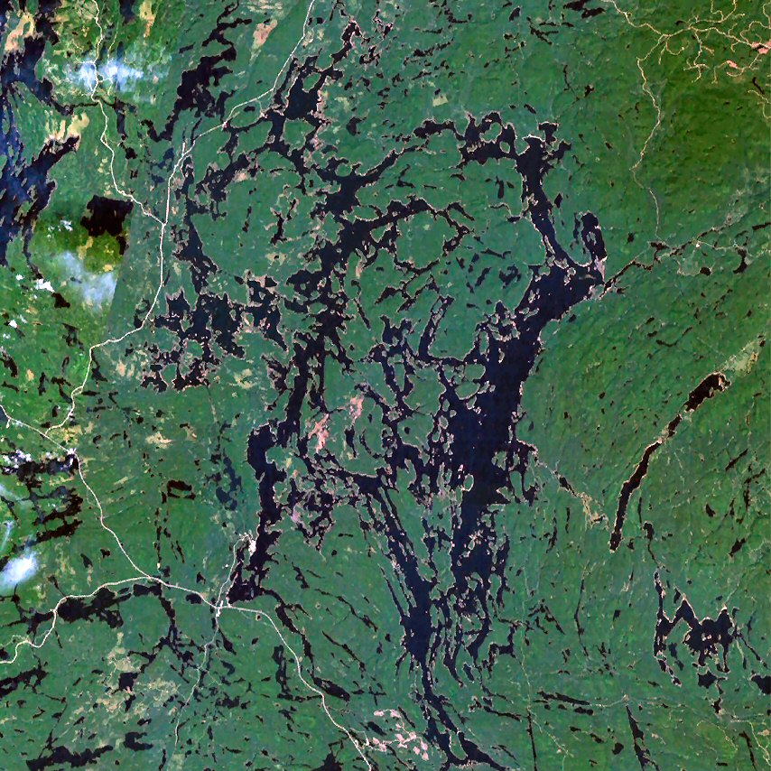
The Cabonga Reservoir (French: Réservoir Cabonga) is a man-made lake in central Quebec, Canada, with a total surface area of 677 square kilometres (261 sq mi) and a net area (water only) of 484 square kilometres (187 sq mi). It is located on the boundary between the unorganized territories of Lac-Pythonga and Réservoir-Dozois, and fully within the La Vérendrye Wildlife Reserve. The First Nations reserve of Rapide Lake is on its western shores. Its name is derived from the Algonquin kakibonga and means "completely blocked by sand." The reservoir has two outlets: the Gens de Terre River flowing to the south-east which is a tributary of the Baskatong Reservoir and Gatineau River; and an outflow to the north-west flowing directly into Barrière Lake which is part of the Ottawa River system. Both outflows are controlled by dams to regulate the flow on the respective rivers. Many fishing magazines and websites consider Cabonga Reservoir one of North America's top 20 walleye and northern pike waters. Also, Outdoor Canada magazine includes it among its "simply the best" hot spots for lake trout fishing.
We use GPS information embedded into the photo when it is available.
3D mountains overlay
Adjust mountain panorama to perfectly match your photos because recorded by camera photo position might be imprecise.
Move tool
Rotate tool
Zoom
More customization
Choose which peak labels should make into the final photo and what photo title should be.
Next
Photo Location
Satellitte
Flat map
Relief map
Latitude
Longitude
Altitude
OR
Latitude
°'''
Longitude
°'''
Apply
Register Peak
Peak Name
Latitude
Longitude
Altitude
Register
Teleport
PeakVisor
This 3D model of Sagarmatha National Park in Nepal was made using the PeakVisor app topographic data. The mobile app features higher precision models worldwide, more topographic details, and works offline. Download PeakVisor maps today.
Download OBJ model
PeakVisor
The download should start shortly. If you find it useful please consider supporting the PeakVisor app.
PeakVisor for iOS and Android
Be a superhero of outdoor navigation with state-of-the-art 3D maps and mountain identification in the palm of your hand!