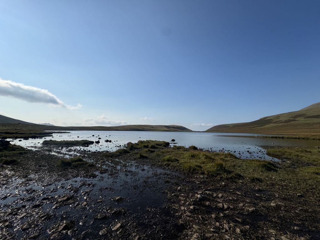
Burnmoor Tarn, on Eskdale Fell in Cumbria, England, is the largest entirely natural tarns in the Lake District. Its waters flow into Whillan Beck at the tarn's north-eastern corner, which immediately turns south and flows into Eskdale, joining the Esk at Beckfoot. Burnmoor Lodge, a former fishing lodge, stands by the southern shore and a mediaeval corpse road runs past the eastern shore where it fords the beck. Eskdale Moor or Boat How lies to the south of the tarn. The tarn is one of the sites in DEFRA's UK Upland Waters Monitoring Network. It occupies 23.9 hectares (59 acres) and lies at an altitude of 253 metres (830 ft) in a moraine hollow on the uplands between Wastwater and Eskdale. The lake has two distinct basins close to the south-eastern shore and a maximum depth of 13 metres (43 ft). There are four main inflow streams to the north and north-west. The outflow at the eastern end joins the Hardrigg Beck which drains the slopes of Scafell and, in times of especially high flow, is partly diverted into the lake across a braided delta.
We use GPS information embedded into the photo when it is available.
3D mountains overlay
Adjust mountain panorama to perfectly match your photos because recorded by camera photo position might be imprecise.
Move tool
Rotate tool
Zoom
More customization
Choose which peak labels should make into the final photo and what photo title should be.
Next
Photo Location
Satellitte
Flat map
Relief map
Latitude
Longitude
Altitude
OR
Latitude
°'''
Longitude
°'''
Apply
Register Peak
Peak Name
Latitude
Longitude
Altitude
Register
Teleport
PeakVisor
This 3D model of Sagarmatha National Park in Nepal was made using the PeakVisor app topographic data. The mobile app features higher precision models worldwide, more topographic details, and works offline. Download PeakVisor maps today.
Download OBJ model
PeakVisor
The download should start shortly. If you find it useful please consider supporting the PeakVisor app.
PeakVisor for iOS and Android
Be a superhero of outdoor navigation with state-of-the-art 3D maps and mountain identification in the palm of your hand!